Malone is a village in, and the county seat of, Franklin County, New York, United States. Its population was 5,911 at the 2010 census. The village is in the town of Malone. It is home to a campus of North Country Community College.
| Name: | Malone village |
|---|---|
| LSAD Code: | 47 |
| LSAD Description: | village (suffix) |
| State: | New York |
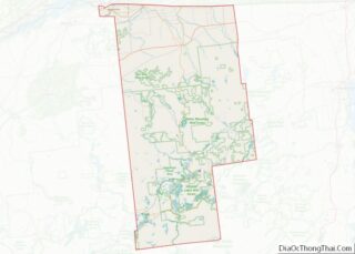
| County: | Franklin County |
| Elevation: | 712 ft (217 m) |
| Total Area: | 3.19 sq mi (8.25 km²) |
| Land Area: | 3.12 sq mi (8.08 km²) |
| Water Area: | 0.07 sq mi (0.17 km²) |
| Total Population: | 5,483 |
| Population Density: | 1,757.94/sq mi (678.68/km²) |
| ZIP code: | 12953 |
| Area code: | 518 |
| FIPS code: | 3644710 |
| GNISfeature ID: | 0956316 |
| Website: | villageofmalone-ny.com |
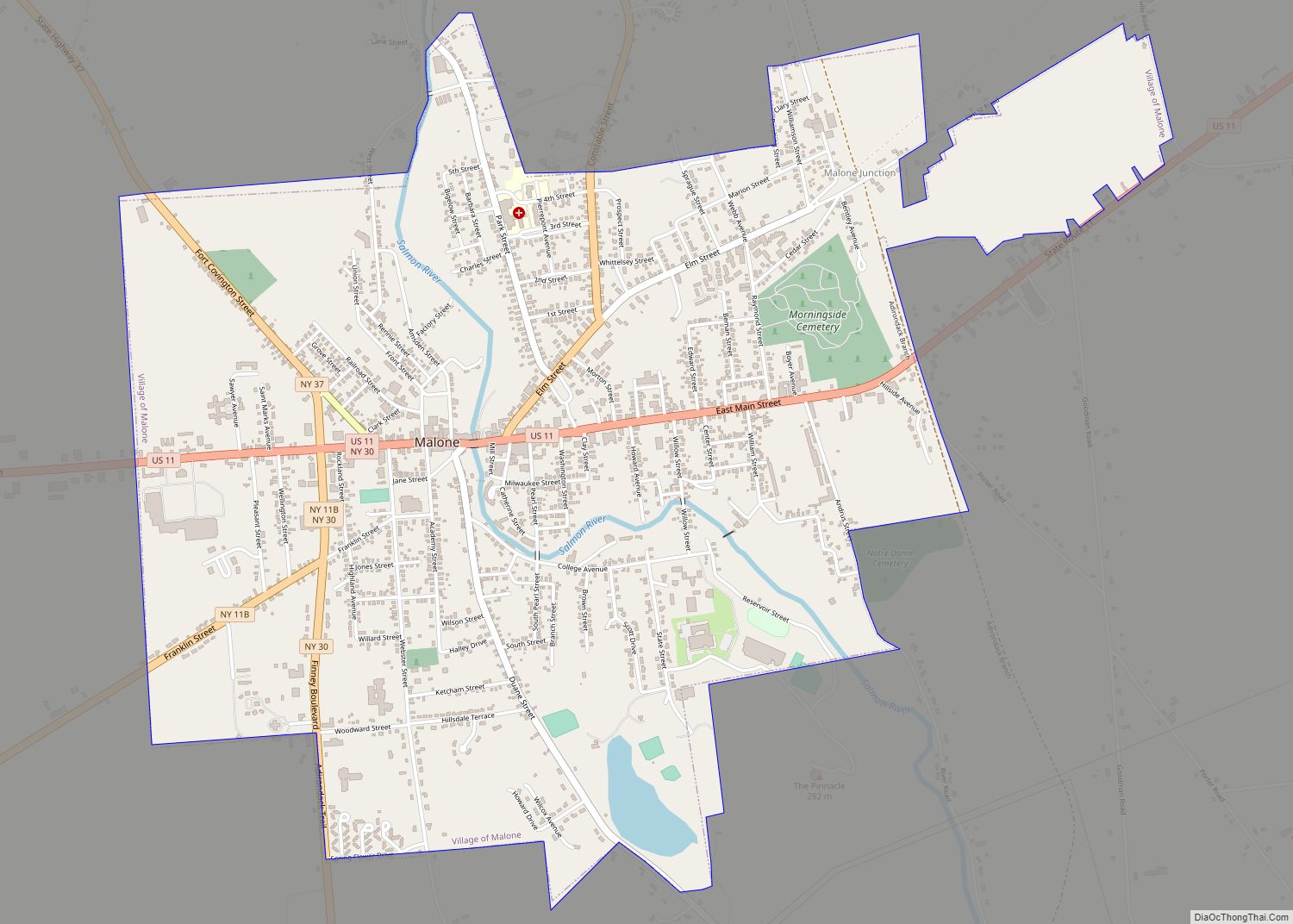
Online Interactive Map
Click on ![]() to view map in "full screen" mode.
to view map in "full screen" mode.
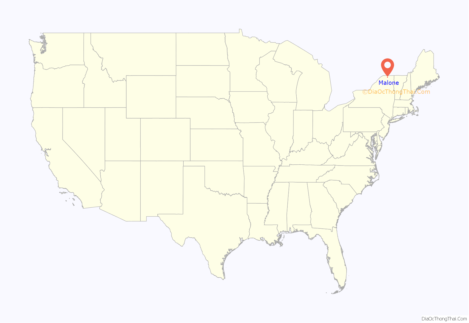
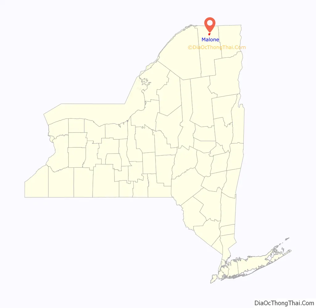
Malone location map. Where is Malone village?
History
The community was first settled around 1802. During the War of 1812, the village was sacked by British troops making incursions from what would become Canada.
Malone was incorporated as a village in 1853. It served as a staging point for one arm of the 1866 and 1870 Fenian raids of Canada, which took place at many points along the Canada–United States border. The Fenian Brotherhood (Fenians) attempted to capture Canada to end British rule of Ireland.
Laura Ingalls Wilder wrote the book Farmer Boy about Almanzo Wilder, who attended Franklin Academy here. The school is now the site of the Malone Middle School, and the Wilder Homestead is a historical site that lies about 5 miles (8 km) east of the village of Malone in the town of Burke. The First Congregational Church, likely the one mentioned in Farmer Boy, was the first Christian congregation founded and the first church building built in Franklin County. There is anecdotal evidence that the second church building (1852–1883) was one of the final stops in the Underground Railroad. A tunnel for the persons seeking freedom can still be found in the church’s basement.
In 1935, Dutch Schultz had his tax evasion trial moved from Manhattan to Malone. After a media-saturated trial before a Malone-area jury, he was acquitted. In 1998, the village suffered a natural disaster as part of the North American Ice Storm of 1998. On November 6, 2012, a proposal to dissolve the village into the surrounding town of Malone was defeated by a 2-to-1 margin, with village residents voting 1,117–562 to keep the village intact.
In addition to the First Congregational Church and Wilder Homestead, the Horton Gristmill, Anselm Lincoln House, Malone Armory, Malone Freight Depot, Paddock Building, and United States Post Office are listed on the National Register of Historic Places.
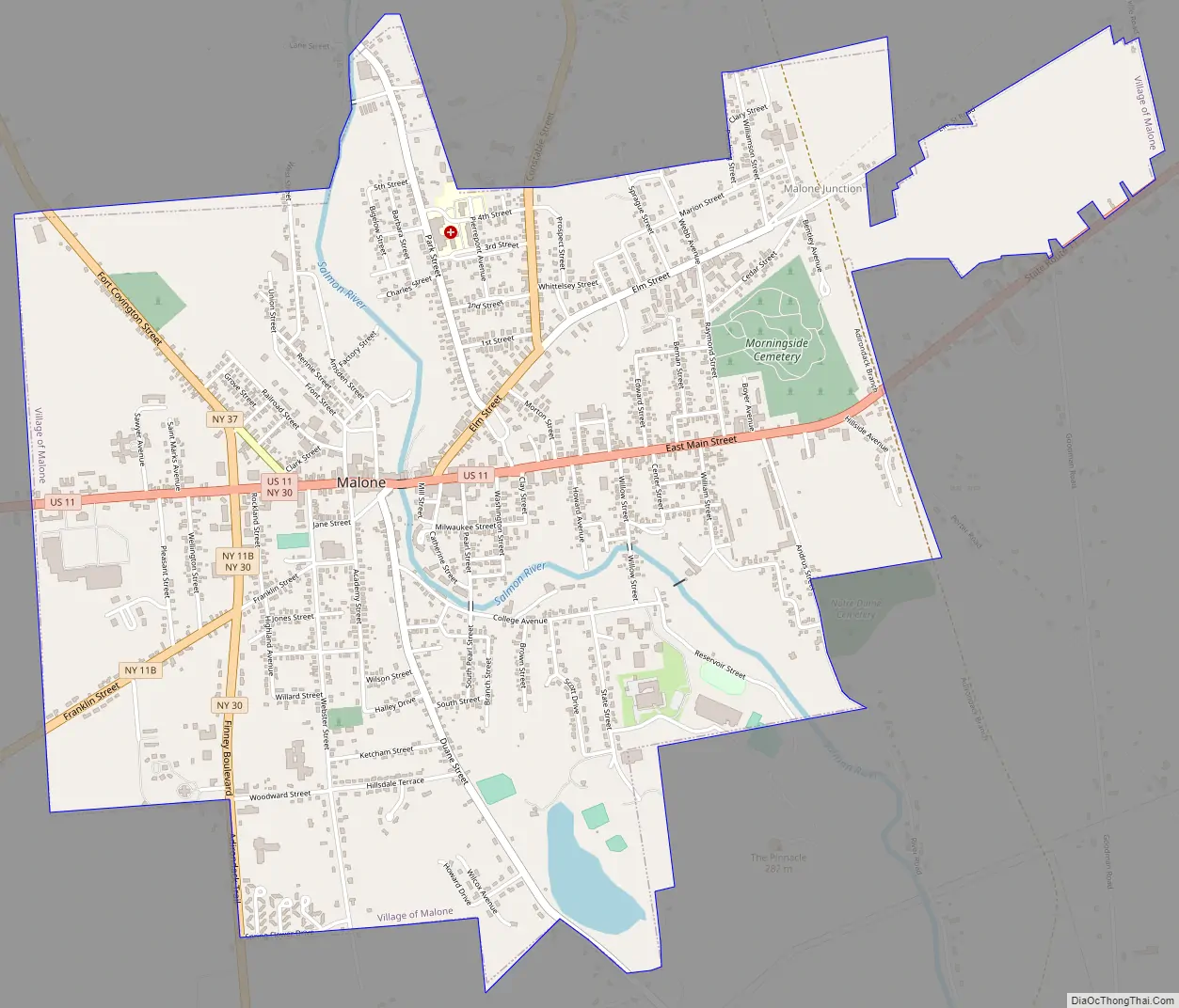
Malone Road Map
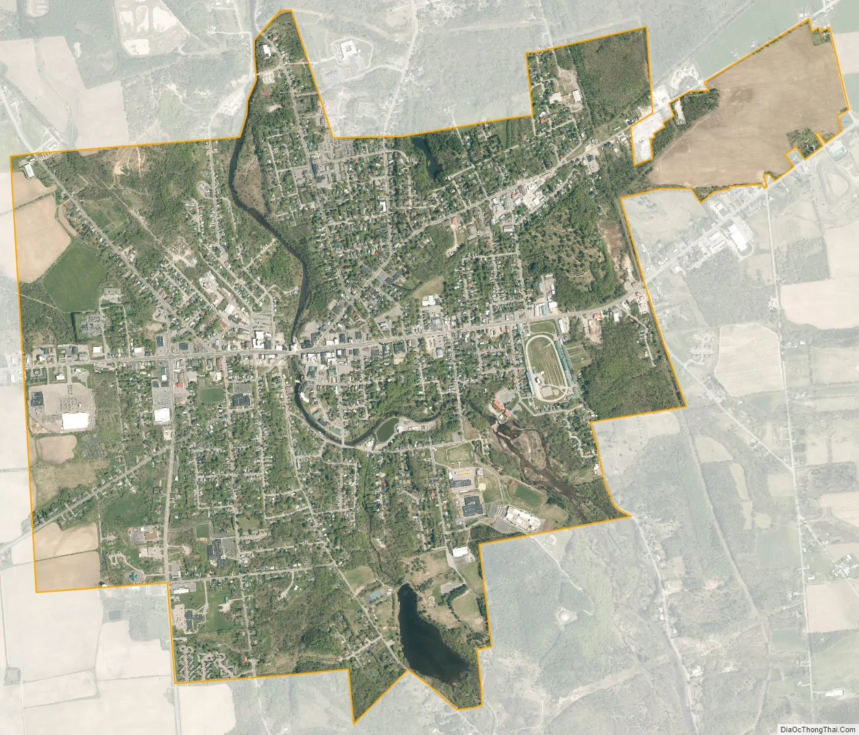
Malone city Satellite Map
Geography
Malone village is located in the northern part of the town of Malone at 44°51′2″N 74°17′20″W / 44.85056°N 74.28889°W / 44.85056; -74.28889 (44.850676, −74.28907), in north-central Franklin County.
According to the United States Census Bureau, the village has a total area of 3.18 square miles (8.23 km), of which 3.11 square miles (8.06 km) is land and 0.066 square miles (0.17 km) 2.08%, is water.
Malone is at the convergence of U.S. Route 11, New York State Route 11B (NY 11B), NY 30, and NY 37. County Road 25 enters the village from the south. US-11 leads east 46 miles (74 km) to Champlain and southwest 37 miles (60 km) to Potsdam. NY-30 leads south 58 miles (93 km) to Tupper Lake in the Adirondacks and north 11 miles (18 km) to Trout River at the Canada–US border. Cornwall, Ontario, is 31 miles (50 km) to the northwest via NY-37.
The Salmon River, a tributary of the St. Lawrence River, flows northward through the village.
Climate
The climate of Malone is hemiboreal (Köppen climate classification “Dfb”).
See also
Map of New York State and its subdivision:- Albany
- Allegany
- Bronx
- Broome
- Cattaraugus
- Cayuga
- Chautauqua
- Chemung
- Chenango
- Clinton
- Columbia
- Cortland
- Delaware
- Dutchess
- Erie
- Essex
- Franklin
- Fulton
- Genesee
- Greene
- Hamilton
- Herkimer
- Jefferson
- Kings
- Lake Ontario
- Lewis
- Livingston
- Madison
- Monroe
- Montgomery
- Nassau
- New York
- Niagara
- Oneida
- Onondaga
- Ontario
- Orange
- Orleans
- Oswego
- Otsego
- Putnam
- Queens
- Rensselaer
- Richmond
- Rockland
- Saint Lawrence
- Saratoga
- Schenectady
- Schoharie
- Schuyler
- Seneca
- Steuben
- Suffolk
- Sullivan
- Tioga
- Tompkins
- Ulster
- Warren
- Washington
- Wayne
- Westchester
- Wyoming
- Yates
- Alabama
- Alaska
- Arizona
- Arkansas
- California
- Colorado
- Connecticut
- Delaware
- District of Columbia
- Florida
- Georgia
- Hawaii
- Idaho
- Illinois
- Indiana
- Iowa
- Kansas
- Kentucky
- Louisiana
- Maine
- Maryland
- Massachusetts
- Michigan
- Minnesota
- Mississippi
- Missouri
- Montana
- Nebraska
- Nevada
- New Hampshire
- New Jersey
- New Mexico
- New York
- North Carolina
- North Dakota
- Ohio
- Oklahoma
- Oregon
- Pennsylvania
- Rhode Island
- South Carolina
- South Dakota
- Tennessee
- Texas
- Utah
- Vermont
- Virginia
- Washington
- West Virginia
- Wisconsin
- Wyoming