Map of Malone village, New York

Map of Malone village, New York

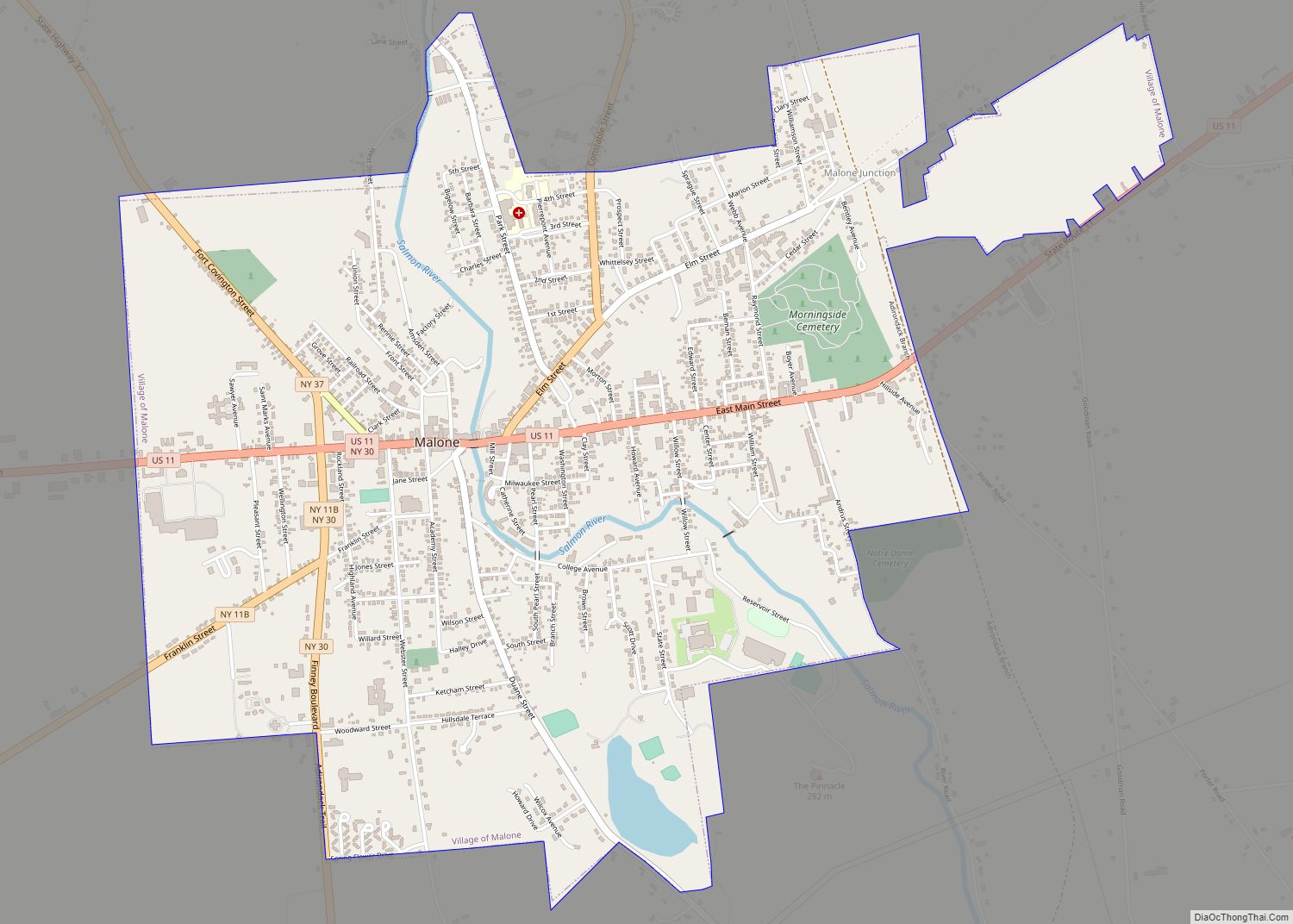
Malone is a village in, and the county seat of, Franklin County, New York, United States. Its population was 5,911 at the 2010 census. The village is in the town of Malone. It is home to a campus of North Country Community College. Malone village overview: Name: Malone village LSAD Code: 47 LSAD Description: village … Read more

Map of Margaretville village

Map of Margaretville village

Margaretville is a village in Delaware County, New York, United States. The population was 596 at the 2010 census. The village is in the town of Middletown, on the border of the Catskill Park. Margaretville village overview: Name: Margaretville village LSAD Code: 47 LSAD Description: village (suffix) State: New York County: Delaware County Incorporated: 1875 … Read more

Map of Marcellus village, New York

Map of Marcellus village, New York

Marcellus is a village in the town of Marcellus in Onondaga County, New York, United States. As of the 2020 census, the population was 1,745. The village is southwest of Syracuse and is in the southern part of the town of Marcellus. Marcellus village overview: Name: Marcellus village LSAD Code: 47 LSAD Description: village (suffix) … Read more

Map of Marathon village, New York

Map of Marathon village, New York

Marathon is a village within the town of Marathon in Cortland County, New York, United States. The population of the village was 919 at the 2010 census, out of 1,967 in the entire town. Marathon village overview: Name: Marathon village LSAD Code: 47 LSAD Description: village (suffix) State: New York County: Cortland County Elevation: 1,024 ft … Read more

Map of Manorville CDP

Map of Manorville CDP, New York

Manorville is a hamlet and census-designated place (CDP) in Suffolk County, New York, United States. The population was 14,314 at the 2010 census. Manorville is mostly in the Town of Brookhaven, but its northeast corner is in the Town of Riverhead. Due to its proximity to The Hamptons, Manorville is nicknamed “The Gateway to the … Read more

Map of Massena village, New York

Map of Massena village, New York

Massena is a village in St. Lawrence County, New York, United States. The village is named after André Masséna, one of Napoleon’s generals. The Village of Massena is at the southwestern town line of the Town of Massena, with a small southeastern section of the community spilling into the Town of Louisville, and a tiny … Read more

Map of Massapequa CDP

Map of Massapequa CDP

Massapequa (/ˌmæsəˈpiːkwə/, mass-ə-PEEK-wə) is a hamlet and census-designated place (CDP) in the Town of Oyster Bay in Nassau County, on the South Shore of Long Island, in New York, United States. It is considered the anchor community of the Greater Massapequa area. The population of the CDP was 21,685 at the time of the 2010 … Read more

Map of Massapequa Park village

Map of Massapequa Park village

Massapequa Park is an incorporated village located within the Town of Oyster Bay in Nassau County, on the South Shore of Long Island, in New York, United States. The population was 17,008 at the 2010 census. Areas south and east of the village borders are considered the hamlet of Massapequa because they are under the … Read more

Map of Marlboro CDP

Map of Marlboro CDP, New York

Marlboro is a hamlet (and census-designated place) in Ulster County, New York, United States. The population was 3,669 at the 2020 census. Marlboro is in the southeastern part of the town of Marlborough, located in the southeastern corner of the county. Marlboro CDP overview: Name: Marlboro CDP LSAD Code: 57 LSAD Description: CDP (suffix) State: … Read more

Map of Marion CDP, New York

Map of Marion CDP, New York

Marion is a hamlet (and census-designated place) located in the Town of Marion, Wayne County, New York, United States. The population was 1,511 at the 2010 census. Government offices for the Town of Marion are located in the hamlet. Marion is home to Seneca Foods, a food processing and distribution company. Marion CDP overview: Name: … Read more

Map of Mariaville Lake CDP

Map of Mariaville Lake CDP

Mariaville Lake is a census-designated place (CDP) in Schenectady County, New York. The population was 722 at the 2010 census. The census-designated place is in the town of Duanesburg and is named after a small lake in the eastern part of the town. Mariaville Lake CDP overview: Name: Mariaville Lake CDP LSAD Code: 57 LSAD … Read more

Map of Mechanicstown CDP

Map of Mechanicstown CDP

Mechanicstown is a hamlet (and census-designated place) in Orange County, New York, United States. The population was 8,065 at the 2020 census. It is part of the Poughkeepsie–Newburgh–Middletown, NY Metropolitan Statistical Area as well as the larger New York–Newark–Bridgeport, NY-NJ–CT–PA Combined Statistical Area. Mechanicstown is in the Town of Walkill, southeast of City of Middletown. … Read more