Map of Plattsburgh West CDP

Map of Plattsburgh West CDP

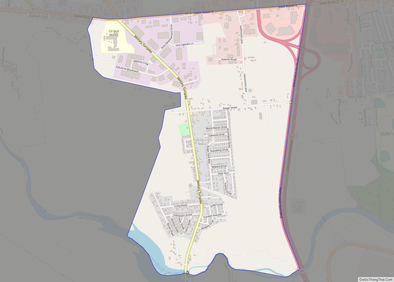
Plattsburgh West is a census-designated place (CDP) and region of the town of Plattsburgh in Clinton County, New York, United States. The population was 1,364 at the 2010 census. The CDP lies to the west of the city of Plattsburgh. Plattsburgh West CDP overview: Name: Plattsburgh West CDP LSAD Code: 57 LSAD Description: CDP (suffix) … Read more

Map of Plattekill CDP

Map of Plattekill CDP

Plattekill is a hamlet (and census-designated place) in Ulster County, New York, United States. The population was 1,296 at the 2020 census. The community, as is the town, is named after a local stream, the Platte Kill. Plattekill is in the southern part of the Town of Plattekill. The community is adjacent to the New … Read more

Map of Plandome village

Map of Plandome village

Plandome is a village in the Town of North Hempstead in Nassau County, on the North Shore of Long Island, in New York, United States. It is considered part of the Greater Manhasset area, which is anchored by Manhasset. The population was 1,349 at the 2010 census. The Incorporated Village of Plandome was ranked fifth … Read more

Map of Pomona village, New York

Map of Pomona village, New York

Pomona is a village partly in the town of Ramapo and partly in the town of Haverstraw in Rockland County, New York, United States. It is located north of New Hempstead, east of Harriman State Park, north of Monsey and west of Mount Ivy. According to the 2020 Census, the population was 3,824, a 23 … Read more

Map of Port Jefferson village

Map of Port Jefferson village, New York

Port Jefferson, also known as Port Jeff, is an incorporated village in the town of Brookhaven in Suffolk County, New York, on the North Shore of Long Island. Officially known as the Incorporated Village of Port Jefferson, the population was 7,962 as of the 2020 United States census. Port Jefferson was first settled in the … Read more

Map of Port Jefferson Station CDP

Map of Port Jefferson Station CDP

Port Jefferson Station is a hamlet and census-designated place (CDP) in the Town of Brookhaven, in Suffolk County, in New York, United States. The population was 7,838 as of the 2010 census. Port Jefferson Station CDP overview: Name: Port Jefferson Station CDP LSAD Code: 57 LSAD Description: CDP (suffix) State: New York County: Suffolk County … Read more

Map of Port Henry CDP

Map of Port Henry CDP

Port Henry is a hamlet (and census-designated place) in Essex County, New York, United States. The population was 1,194 at the 2010 census. Port Henry lies on the eastern side of the town of Moriah and is approximately one hour’s drive (52 miles or 84 km) south of Plattsburgh. It is 44 miles (71 km) by road … Read more

Map of Port Gibson CDP, New York

Map of Port Gibson CDP, New York

Port Gibson is a hamlet and census-designated place (CDP) in the town of Manchester, Ontario County, New York, United States. As of the 2010 census, it had a population of 453. Port Gibson CDP overview: Name: Port Gibson CDP LSAD Code: 57 LSAD Description: CDP (suffix) State: New York County: Ontario County Elevation: 470 ft (140 m) … Read more

Map of Port Ewen CDP

Map of Port Ewen CDP

Port Ewen is a hamlet (and census-designated place) in Ulster County, New York, United States. The population was 3,678 at the 2020 census. Port Ewen is in the Town of Esopus, south of Kingston, along U.S. Route 9W. Port Ewen CDP overview: Name: Port Ewen CDP LSAD Code: 57 LSAD Description: CDP (suffix) State: New … Read more

Map of Port Dickinson village

Map of Port Dickinson village

Port Dickinson is a village in Broome County, New York, United States. The population was 1,641 at the 2010 census. It is part of the Binghamton Metropolitan Statistical Area. The village lies within the town of Dickinson and is north of Binghamton. Port Dickinson village overview: Name: Port Dickinson village LSAD Code: 47 LSAD Description: … Read more

Map of Port Chester village

Map of Port Chester village

Port Chester is a village in the U.S. state of New York and the largest part of the town of Rye in Westchester County by population. At the 2010 U.S. census, the village of Port Chester had a population of 28,967 and was the fifth-most populous village in New York State. In 2019, its population … Read more

Map of Port Byron village, New York

Map of Port Byron village, New York

Port Byron is a village in Cayuga County, New York, United States. The population was 1,290 at the 2010 census. It is in the town of Mentz and is north of Auburn. Port Byron village overview: Name: Port Byron village LSAD Code: 47 LSAD Description: village (suffix) State: New York County: Cayuga County Elevation: 407 ft … Read more