Port Chester is a village in the U.S. state of New York and the largest part of the town of Rye in Westchester County by population. At the 2010 U.S. census, the village of Port Chester had a population of 28,967 and was the fifth-most populous village in New York State. In 2019, its population grew to a census-estimated 29,342 residents. Located in southeast Westchester, Port Chester forms part of the New York City metropolitan statistical area. Port Chester borders the state of Connecticut and the town of Greenwich to the east. Port Chester is one of only 12 villages in New York still incorporated under a charter; other villages either incorporated or reincorporated under the provisions of Village Law.
The village of Port Chester is nicknamed the “Gateway to New England” and serves as a transportation hub between New England states and New York. Its economy is primarily stimulated by small businesses, the local government, and several national chain stores, including Stop & Shop, Marshalls, Target, T-Mobile and Metro by T-Mobile, Verizon, Boost Mobile, Staples, and Walgreens.
| Name: | Port Chester village |
|---|---|
| LSAD Code: | 47 |
| LSAD Description: | village (suffix) |
| State: | New York |
| County: | Westchester County |
| Elevation: | 43 ft (13 m) |
| Total Area: | 2.40 sq mi (6.22 km²) |
| Land Area: | 2.33 sq mi (6.03 km²) |
| Water Area: | 0.07 sq mi (0.19 km²) |
| Total Population: | 31,693 |
| Population Density: | 13,613.83/sq mi (5,255.96/km²) |
| ZIP code: | 10573 |
| Area code: | 914 |
| FIPS code: | 3659223 |
| GNISfeature ID: | 0977392 |
| Website: | portchesterny.com |
Online Interactive Map
Click on ![]() to view map in "full screen" mode.
to view map in "full screen" mode.
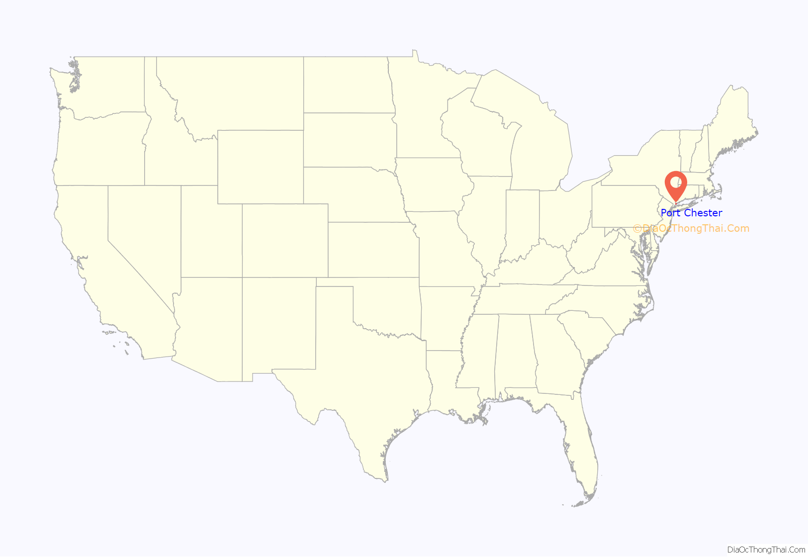
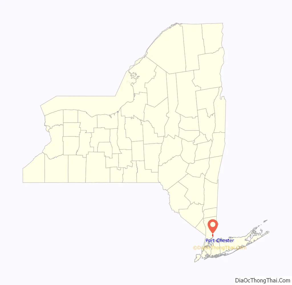
Port Chester location map. Where is Port Chester village?
History
In 1660, three settlers from Greenwidge (now Greenwich, Connecticut) — Thomas Studwell, John Coe, and Peter Disbrow — arranged to buy Manursing Island and the land near the Byram River from the Native Americans. This First Purchase on Peningo Neck comprised the lower part of the present town of Rye, on the east side of Blind Brook. Over the course of the next decade, additional purchases filled in the shoreline from Rye to Greenwich, made via land agreements with the Native Americans in the area at that time. The tribal affiliation of these Native Americans has been a source of considerable debate. They may have been small, independent families or tribes, or they may have been sub-groups of larger tribes in the area. What is known, and documented, is the names of the natives who signed land agreements. Their names were written by the English, using their semi-skilled interpretation of the phonetics. In spite of the English phonetic variations, the land records still existent were clearly signed by the same individuals:
Shawanórõckquot aka Shanarockwell aka Shanarocke (and other variations)
Cockho aka Cokow aka Cokeo (and other variations)
Cockinsecawa aka Cokinseco aka Cockenseco (and other variations)
Kamaque aka Quaraiko aka Rawmanquaie (and other variations)
Mehúmõw aka Maowbert
It is Shanarocke who the others referred to as their leader or “Sachem”. These elder tribe members or “sagamores” made many of the tribal decisions, and there were several instances where agreements could not be signed because he was not present. Shanarocke was a Wiechquaeskeck Native American. Wiechquaskeck settlements were well-documented in shore areas from present-day Pelham to the Byram or “Armonk” river on the Connecticut state line. Indeed, Shanarocke is specifically named a “Wiechquaskeck sachem” or is titled “Sachem of Poningoe” on deeds that included portions of the Bronx and Harlem River area, as well as portions of Queens and Nassau County.
“No Indian name more frequently occurs in the history of the county than that of Wechquaesgeek, nor one the precise location of which there is more difficulty in determining. O’Callaghan says: ‘This tract is described as extending from the Hudson to the East river. The name is from wigwos, birch bark, and keag, country — ‘the country of the birch bark.’ Bolton gives the name to an Indian village which occupied the site of Dobbs’ ferry, which he denominates ‘the place of the bark kettle.’ In Albany Records, III, 379, is this entry: ‘Personally appeared Sauwenare, sachem of Wieckqueskeck, Amenameck his brother, and others, all owners, etc., of lands situated on North river called Wieckquaeskeck, and declared that they had sold the same to Wouter Van Twiller in 1645″ Source: Ruttenber, Edward Manning, History of the Indian Tribes of Hudson’s River: Their Origin, Manners and Customs; Tribal and Sub-Tribal Organizations; Wars, Treaties, Etc., Etc., p. 366 (Albany, NY: J. Munsell, 1872).
Wechqueskeck is not the name of a particular Native American tribe. It was the name applied to the territorial jurisdiction of a clan of Indians in Westchester County, whose principal village was on the headwaters or tributaries of Armonck or Byram’s River. Ruttenber. Indian Geographical Names, pp. 24–25, in ‘Proceedings’ of New York State Hist. Association, vol. 6; Beauchamp. Aboriginal Place Names of New York. Albany, 1907, p. 256.”] It is perhaps the later treaties at West Farms and Hunts Point, where Shanarocke is labeled “Sachem of Rye”, that his tribal affiliation can be surmised. On that agreement are also the sachems of the Reckgawawancs. Recent investigation points to affiliations with the Wappingers, Lenape, Mohawk, Mohegan, and other Westchester County natives. But Native Americans continued to live in Sawpit until their presence was considered a nuisance, a fate that fell on many Native Americans.
Saw Pit area remained largely untouched until Revolutionary times except for a few farms in the hills above the Byram River, and a few taverns along the trail that became the Boston Post Road. Although Rye and Saw Pit were created within Fairfield County, Connecticut, the King of England gifted the Duke of York with large territories west of present-day Connecticut, forming the New York Colony in 1683. The controversy of divided loyalties to the King or the Duke prevailed for 105 years. In 1788, the Legislature of New York ruled that Saw Pit was a part of the town of Rye, New York. Families from Rye and Greenwich began to settle the Saw Pit area just prior to the Revolution but even as late as 1800 there were only a handful of established homesteads.
Early roads in the area grew from native trails. The Boston Post Road, King Street, and Grace Church streets are some of the early migration paths in the Saw Pit/Rye settlement. Water transportation was equally important. The local waterways (the Byram River and Long Island Sound) were a key part of the growth and development of Saw Pit/Port Chester. Early residents took part in farming and fishing. After the Revolution, the harbor area became a shipbuilding site, with the Lyon family operating a considerable shipyard that produced some of the best sloops and ocean-going fishing vessels of the time. By the time the village of Saw Pit was incorporated as Port Chester, it was considered a major seaport. The Byram river provided a decent harbor which would become a factor in the industrialization of Port Chester at the beginning of the 19th century. The arrival of the rail road in 1849 turned Port Chester into a destination for manufacturing and wealthy NYC families, with hotels, theaters, and large estates. These exclusive properties included some of the grandest mansions on the East Coast, but slowly gave way to the crushing need for housing. Successive waves of immigrants from Germany, Ireland, and Italy each brought industry and prosperity as the Village grew.
Steamships regularly sailed from Port Chester to New York City from 1870 until the First World War. The last two decades of the nineteenth century saw public services expand, and roads were widened and paved in the 1920s. From the first and second world wars, over 5,000 men from Port Chester served. After the Second World War, numerous corporations established headquarters or production centers in Port Chester. Examples include Life Savers, whose former factory is now a residential building, which is evidence of Port Chester’s progression from an industrial center to a suburban residential municipality.
On June 30, 1974 an infamous nightclub fire killed 24 young men and women. The fire at Gulliver’s was the deadliest dance club fire in the United States in more than a generation (the Cocoanut Grove fire in Boston, on November 28, 1942, had killed 491, and the Happy Land fire in the Bronx, on March 25, 1990, was to kill 87), and it called attention to the dangers of herding young people into windowless underground rooms without smoke alarms, sprinklers, fire-resistant walls, or limits on occupancy.
Despite the tragedy of Gulliver’s, comprehensive New York State Fire Code reform would not be seen until the 1980s. Fire code enforcement continues to be a top priority in Port Chester to this day.
In 1999, the village of Port Chester established a “redevelopment area” and relegated regulatory authority within that area to private developer Gregory Wasser (from G&S Port Chester, LLC), including power to condemn private property. The decision has spawned several lawsuits, including Brody v. Village of Port Chester, Edward Eways v. Village of Port Chester, and Didden v. Village of Port Chester.
Since the late twentieth and early twenty-first century, Port Chester has undergone several redevelopment proposals and projects. The Port Chester Historical Society is a dedicated group of community members dedicated to learning and teaching the public about Port Chester local history.
Port Chester Road Map

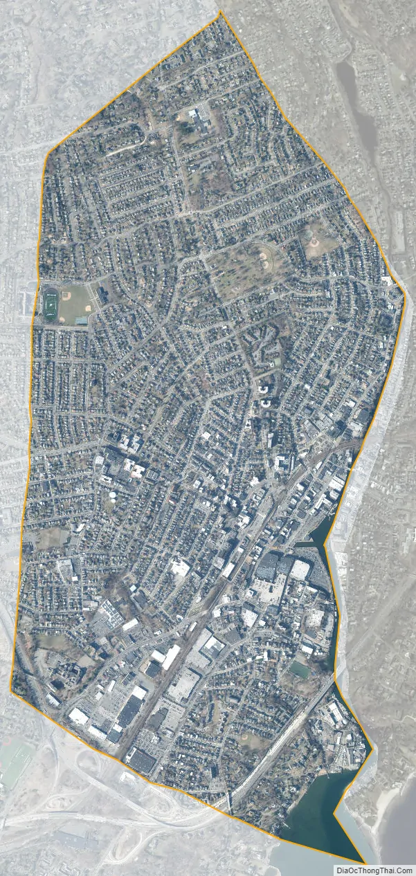
Port Chester city Satellite Map
Geography
According to the United States Census Bureau, the village has a total area of 2.4 square miles (6.2 km), of which 2.33 square miles (6.0 km) is land and 0.7 square miles (1.8 km), is water.
Port Chester has a humid subtropical climate (Cfa). Due to its location on the coast, temperatures are neither extremely cold nor warm, and precipitation is plentiful for the entire year. Winters are usually cool, and powerful nor’easters can occur, sometimes dropping large amounts of rain and snow on the village. Average annual snowfall is 29.8 inches, which is significantly more than New York City’s 25.3 average inches. Snow cover is sporadic as the sea moderates temperatures, which melt snow. During the summer, Port Chester is typically warm, however is far cooler than towns even a few miles inland due to the moderating influence of the sea.
See also
Map of New York State and its subdivision:- Albany
- Allegany
- Bronx
- Broome
- Cattaraugus
- Cayuga
- Chautauqua
- Chemung
- Chenango
- Clinton
- Columbia
- Cortland
- Delaware
- Dutchess
- Erie
- Essex
- Franklin
- Fulton
- Genesee
- Greene
- Hamilton
- Herkimer
- Jefferson
- Kings
- Lake Ontario
- Lewis
- Livingston
- Madison
- Monroe
- Montgomery
- Nassau
- New York
- Niagara
- Oneida
- Onondaga
- Ontario
- Orange
- Orleans
- Oswego
- Otsego
- Putnam
- Queens
- Rensselaer
- Richmond
- Rockland
- Saint Lawrence
- Saratoga
- Schenectady
- Schoharie
- Schuyler
- Seneca
- Steuben
- Suffolk
- Sullivan
- Tioga
- Tompkins
- Ulster
- Warren
- Washington
- Wayne
- Westchester
- Wyoming
- Yates
- Alabama
- Alaska
- Arizona
- Arkansas
- California
- Colorado
- Connecticut
- Delaware
- District of Columbia
- Florida
- Georgia
- Hawaii
- Idaho
- Illinois
- Indiana
- Iowa
- Kansas
- Kentucky
- Louisiana
- Maine
- Maryland
- Massachusetts
- Michigan
- Minnesota
- Mississippi
- Missouri
- Montana
- Nebraska
- Nevada
- New Hampshire
- New Jersey
- New Mexico
- New York
- North Carolina
- North Dakota
- Ohio
- Oklahoma
- Oregon
- Pennsylvania
- Rhode Island
- South Carolina
- South Dakota
- Tennessee
- Texas
- Utah
- Vermont
- Virginia
- Washington
- West Virginia
- Wisconsin
- Wyoming


