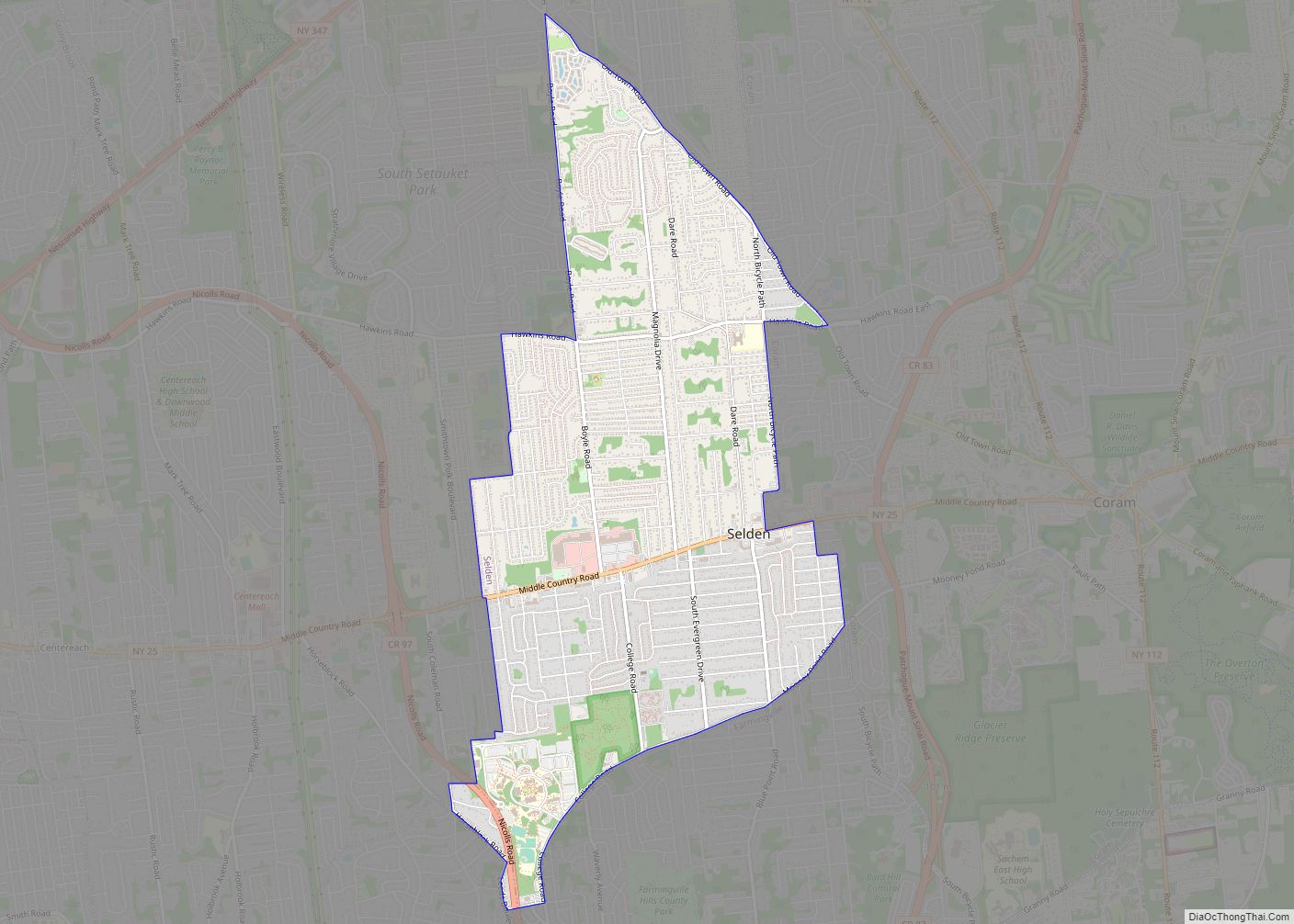
Map of Sharon Springs village, New York
Sharon Springs is a village in Schoharie County, New York, United States. The population was 558 at the 2010 census. Its name derives from the hometown of the first Colonial settlers, Sharon, Connecticut, and the important springs in the village. Sharon Springs, Kansas likewise was settled by former residents of this Upstate New York village. ... Read more
Map of Sharon Springs village, New York
Map of Setauket-East Setauket CDP
Setauket-East Setauket CDP overview: Name: Setauket-East Setauket CDP LSAD Code: 57 LSAD Description: CDP (suffix) State: New York County: Suffolk County FIPS code: 3666481 Online Interactive Map Setauket-East Setauket online map. Source: Basemap layers from Google Map, Open Street Map (OSM), Arcgisonline, Wmflabs. Boundary Data from Database of Global Administrative Areas. Setauket-East Setauket location map. ... Read more
Map of Setauket-East Setauket CDP
Map of Seneca Knolls CDP
Seneca Knolls is a hamlet (and census-designated place) in Onondaga County, New York, United States. The population was 2,011 at the 2010 census. Seneca Knolls is in the eastern part of the town of Van Buren. Seneca Knolls CDP overview: Name: Seneca Knolls CDP LSAD Code: 57 LSAD Description: CDP (suffix) State: New York County: ... Read more
Map of Seneca Knolls CDP
Map of Sidney village, New York
Sidney is a village in Delaware County, New York, United States. The population was 3,900 at the 2010 census. The village is in the western part of the town of Sidney. Sidney village overview: Name: Sidney village LSAD Code: 47 LSAD Description: village (suffix) State: New York County: Delaware County Elevation: 991 ft (302 m) Total Area: ... Read more
Map of Sidney village, New York
Map of Shrub Oak CDP
Shrub Oak is an unincorporated hamlet and census-designated place (CDP) located in the town of Yorktown in Westchester County, New York, United States. The population was 2,011 at the 2010 census. Shrub Oak CDP overview: Name: Shrub Oak CDP LSAD Code: 57 LSAD Description: CDP (suffix) State: New York County: Westchester County Elevation: 440 ft (134 m) ... Read more
Map of Shrub Oak CDP
Map of Shortsville village
Shortsville, officially the Village of Shortsville, is a village in Ontario County, New York, United States. The population was 1,439 at the time of the 2010 U.S. Census. Shortsville encompasses the southwestern part of the Town of Manchester and is located north of the City of Canandaigua. Shortsville village overview: Name: Shortsville village LSAD Code: ... Read more
Map of Shortsville village
Map of Shoreham village, New York
Shoreham is an incorporated village in the Town of Brookhaven, Suffolk County, New York, United States. The population was 531 at the 2010 census. It is officially known as the Incorporated Village of Shoreham. Shoreham village overview: Name: Shoreham village LSAD Code: 47 LSAD Description: village (suffix) State: New York County: Suffolk County Incorporated: 1913 ... Read more
Map of Shoreham village, New York
Map of Shokan CDP
Shokan is a hamlet (and census-designated place) located in the town of Olive in Ulster County, New York, United States, within the Catskill Park. The population was 1,075 at the 2020 census. Shokan CDP overview: Name: Shokan CDP LSAD Code: 57 LSAD Description: CDP (suffix) State: New York County: Ulster County Elevation: 709 ft (216 m) Total ... Read more
Map of Shokan CDP
Map of Shirley CDP, New York
Shirley is a hamlet (and census-designated place) in Suffolk County, New York, United States. At the 2010 census, the population of Shirley was 27,854. Shirley is the western terminus of Atlantic Crossing 1, a major submarine telecommunications cable linking the United States with the UK, Germany, and the Netherlands. Soon, the Emerald Express transatlantic communications ... Read more
Map of Shirley CDP, New York
Map of Shinnecock Hills CDP
Shinnecock Hills is a hamlet (and census-designated place) in Suffolk County, New York, United States. The population was 2,188 at the 2010 census. It is the home of a leading golf club, Shinnecock Hills Golf Club. Ownership of the area has been the subject of a 2005 lawsuit filed by the Shinnecock Indian Nation. Shinnecock ... Read more
Map of Shinnecock Hills CDP
Map of Sherrill city, New York
Sherrill is a city in Oneida County, New York, United States. With a population of 3,071 (2010 census), it is the state’s least populous city. Sherrill is at the western end of the Town of Vernon on Route 5. Sherrill is referred to as The Silver City. Sherrill city overview: Name: Sherrill city LSAD Code: ... Read more
Map of Sherrill city, New York
Map of Sherman village, New York
Sherman is a village in the town of Sherman, Chautauqua County, New York, United States. The village lies in the northern part of the town at intersections of County Routes 15 and 18, NY-76 and NY-430. The population was 681 at the 2020 census. Sherman village overview: Name: Sherman village LSAD Code: 47 LSAD Description: ... Read more
Map of Sherman village, New York