Sherrill is a city in Oneida County, New York, United States. With a population of 3,071 (2010 census), it is the state’s least populous city. Sherrill is at the western end of the Town of Vernon on Route 5. Sherrill is referred to as The Silver City.
| Name: | Sherrill city |
|---|---|
| LSAD Code: | 25 |
| LSAD Description: | city (suffix) |
| State: | New York |
| County: | Oneida County |
| Elevation: | 499 ft (152 m) |
| Total Area: | 2.31 sq mi (5.99 km²) |
| Land Area: | 2.31 sq mi (5.99 km²) |
| Water Area: | 0.00 sq mi (0.00 km²) |
| Total Population: | 3,077 |
| Population Density: | 1,331.46/sq mi (513.97/km²) |
| ZIP code: | 13461 |
| Area code: | 315 |
| FIPS code: | 3666993 |
| GNISfeature ID: | 0965089 |
Online Interactive Map
Click on ![]() to view map in "full screen" mode.
to view map in "full screen" mode.
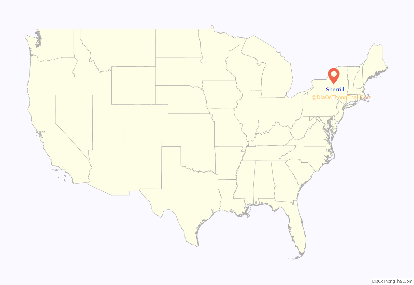
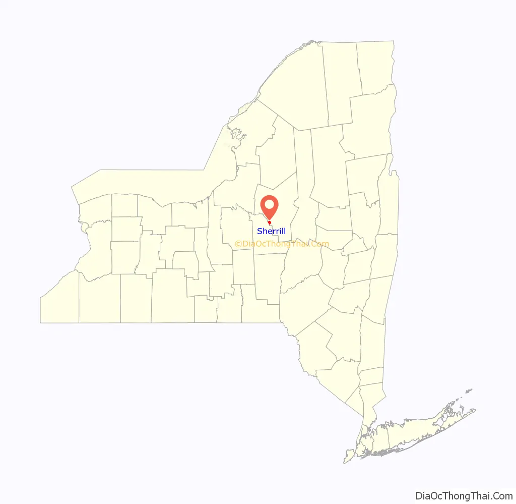
Sherrill location map. Where is Sherrill city?
History
Sherrill was founded in 1916 through a special act of the state legislature and is named in honor of Congressman James S. Sherman’s infant son Sherrill Babcock Sherman. It is unique among cities in New York, because its city charter provides that, for many purposes, it is to be treated as if it were still a village located within the town of Vernon. While other cities in New York are not subject to a town’s jurisdiction, the Vernon town government continues to have jurisdiction over the territory of the city.
In 1997, the Oneida tribe purchased land within the city, eventually initiating a dispute about whether they had to pay taxes.
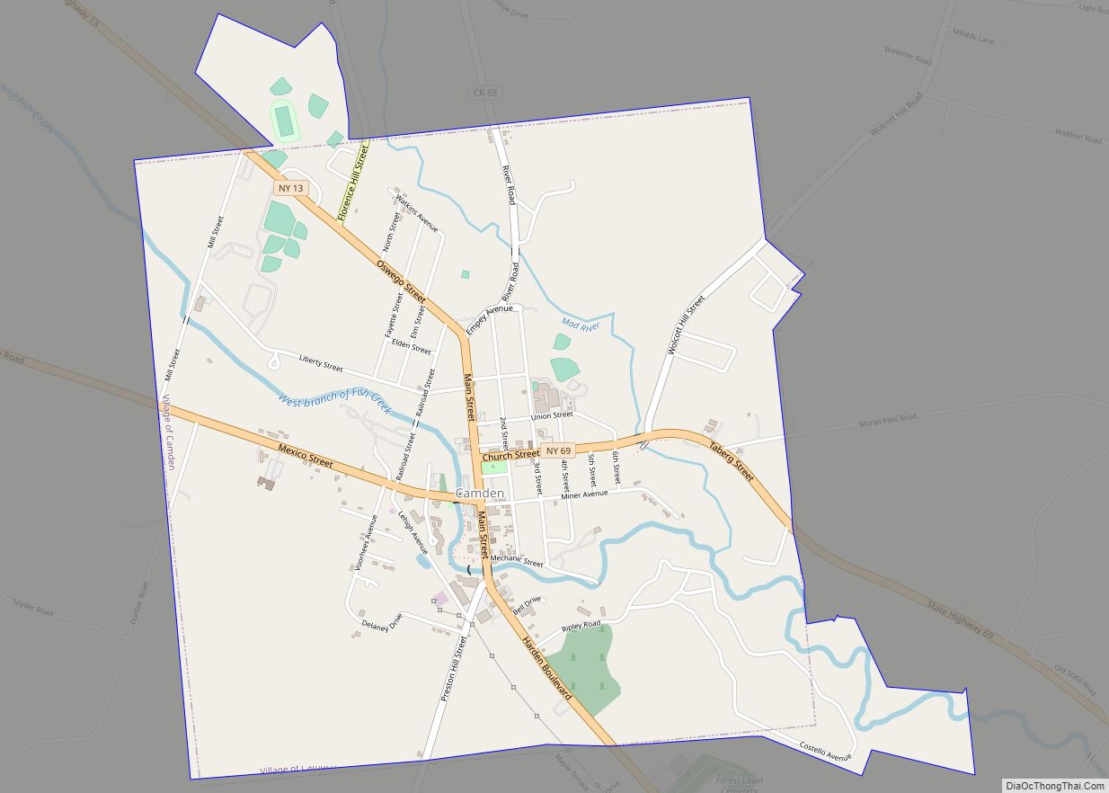
Sherrill Road Map

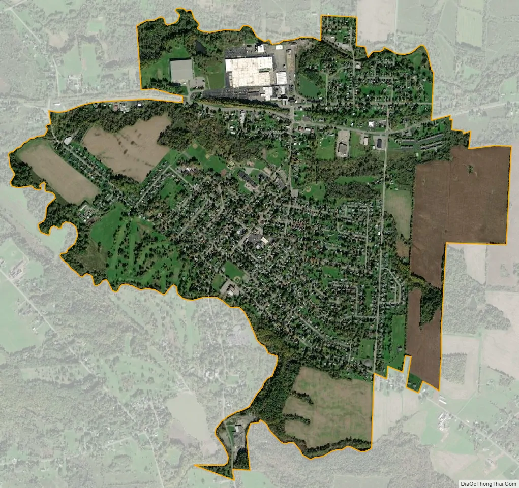
Sherrill city Satellite Map
Geography
Sherrill is located at 43°04′15″N 75°35′57″W / 43.070808°N 75.599124°W / 43.070808; -75.599124, adjacent to the border of Madison County. According to the United States Census Bureau, the city has a total area of 2.0 square miles (5.2 km), all land.
New York State Route 5 passes through the north side of the city.
See also
Map of New York State and its subdivision:- Albany
- Allegany
- Bronx
- Broome
- Cattaraugus
- Cayuga
- Chautauqua
- Chemung
- Chenango
- Clinton
- Columbia
- Cortland
- Delaware
- Dutchess
- Erie
- Essex
- Franklin
- Fulton
- Genesee
- Greene
- Hamilton
- Herkimer
- Jefferson
- Kings
- Lake Ontario
- Lewis
- Livingston
- Madison
- Monroe
- Montgomery
- Nassau
- New York
- Niagara
- Oneida
- Onondaga
- Ontario
- Orange
- Orleans
- Oswego
- Otsego
- Putnam
- Queens
- Rensselaer
- Richmond
- Rockland
- Saint Lawrence
- Saratoga
- Schenectady
- Schoharie
- Schuyler
- Seneca
- Steuben
- Suffolk
- Sullivan
- Tioga
- Tompkins
- Ulster
- Warren
- Washington
- Wayne
- Westchester
- Wyoming
- Yates
- Alabama
- Alaska
- Arizona
- Arkansas
- California
- Colorado
- Connecticut
- Delaware
- District of Columbia
- Florida
- Georgia
- Hawaii
- Idaho
- Illinois
- Indiana
- Iowa
- Kansas
- Kentucky
- Louisiana
- Maine
- Maryland
- Massachusetts
- Michigan
- Minnesota
- Mississippi
- Missouri
- Montana
- Nebraska
- Nevada
- New Hampshire
- New Jersey
- New Mexico
- New York
- North Carolina
- North Dakota
- Ohio
- Oklahoma
- Oregon
- Pennsylvania
- Rhode Island
- South Carolina
- South Dakota
- Tennessee
- Texas
- Utah
- Vermont
- Virginia
- Washington
- West Virginia
- Wisconsin
- Wyoming