Map of China Grove town

Map of China Grove town, North Carolina

China Grove is a town in Rowan County, North Carolina, United States. The population was 4,434 at the 2020 census. The town is located just north of Landis and south of Salisbury. It was one of the first towns in the United States to have Rural Free Mail Delivery. The town was named for a … Read more

Map of Chimney Rock Village village

Map of Chimney Rock Village village

Chimney Rock Village village overview: Name: Chimney Rock Village village LSAD Code: 47 LSAD Description: village (suffix) State: North Carolina County: Rutherford County FIPS code: 3712460 Online Interactive Map Chimney Rock Village online map. Source: Basemap layers from Google Map, Open Street Map (OSM), Arcgisonline, Wmflabs. Boundary Data from Database of Global Administrative Areas. Chimney … Read more

Map of Cherryville city

Map of Cherryville city, North Carolina

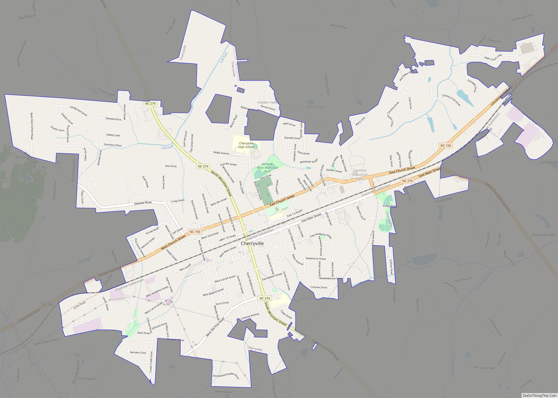
Cherryville is a small city in northwestern Gaston County, North Carolina, United States. The population was 5,760 at the 2010 census. The New Year’s Shooters celebrate the area’s German heritage by beginning each year with a customary chant and the honorary shooting of muskets. Cherryville is located approximately 38 miles (61 km) west of Charlotte and … Read more

Map of Cherokee CDP, North Carolina

Map of Cherokee CDP, North Carolina

Cherokee /ˈtʃɛrəkˌiː/ (Cherokee: ᏣᎳᎩ, romanized: Tsalagi) is a census-designated place (CDP) in Swain and Jackson counties in Western North Carolina, United States, within the Qualla Boundary land trust. Cherokee is located in the Oconaluftee River Valley around the intersection of U.S. Routes 19 and 441. As of the 2020 census, the CDP had a population of … Read more

Map of Chapel Hill town

Map of Chapel Hill town, North Carolina

Chapel Hill is a town in Orange and Durham counties in the U.S. state of North Carolina. Its population was 61,960 in the 2020 census, making Chapel Hill the 17th-largest municipality in the state. Chapel Hill, Durham, and the state capital, Raleigh, make up the corners of the Research Triangle (officially the Raleigh–Durham–Cary, NC Combined … Read more

Map of Clemmons village

Map of Clemmons village

Clemmons is a village in Forsyth County, North Carolina, United States and a suburb of Winston-Salem. The population was 21,177 at the 2020 census, with an estimated population of 21,517 in 2021. Clemmons village overview: Name: Clemmons village LSAD Code: 47 LSAD Description: village (suffix) State: North Carolina County: Forsyth County Elevation: 840 ft (260 m) Total … Read more

Map of Columbus town, North Carolina

Map of Columbus town, North Carolina

Columbus is a town in Polk County, North Carolina, United States. The population was 999 at the 2010 census. It is the county seat of Polk County. Columbus town overview: Name: Columbus town LSAD Code: 43 LSAD Description: town (suffix) State: North Carolina County: Polk County Elevation: 1,102 ft (336 m) Total Area: 3.77 sq mi (9.76 km²) Land Area: … Read more

Map of Columbia town, North Carolina

Map of Columbia town, North Carolina

Columbia is a town in Tyrrell County, North Carolina, United States. The population was 610 at the 2020 census. It is the county seat of Tyrrell County. Columbia town overview: Name: Columbia town LSAD Code: 43 LSAD Description: town (suffix) State: North Carolina County: Tyrrell County Elevation: 3 ft (1 m) Total Area: 1.24 sq mi (3.23 km²) Land Area: … Read more

Map of Colerain town

Map of Colerain town

Colerain is a town in Bertie County, North Carolina, United States. The population was 204 at the 2010 census. Colerain town overview: Name: Colerain town LSAD Code: 43 LSAD Description: town (suffix) State: North Carolina County: Bertie County Elevation: 59 ft (18 m) Total Area: 0.26 sq mi (0.68 km²) Land Area: 0.26 sq mi (0.68 km²) Water Area: 0.00 sq mi (0.00 km²) Total Population: … Read more

Map of Coinjock CDP

Map of Coinjock CDP

Coinjock is an unincorporated community and census-designated place (CDP) in Currituck County, North Carolina, United States. As of the 2010 census it had a population of 335. It is located on U.S. Route 158 between Barco and Grandy, about 20 miles (32 km) south of the Virginia state line, and is at mile marker 50 on … Read more

Map of Cofield village

Map of Cofield village

Cofield is a village in Hertford County, North Carolina, United States. The population was 413 at the 2010 census. Cofield village overview: Name: Cofield village LSAD Code: 47 LSAD Description: village (suffix) State: North Carolina County: Hertford County Elevation: 39 ft (12 m) Total Area: 3.14 sq mi (8.13 km²) Land Area: 3.14 sq mi (8.13 km²) Water Area: 0.00 sq mi (0.00 km²) Total Population: … Read more

Map of Coats town, North Carolina

Map of Coats town, North Carolina

Coats is a town in Harnett County, North Carolina, United States. The population was 2,112 at the 2010 census, and in 2018 the estimated population was 2,464. Coats is a part of the Dunn Micropolitan Area, which is a part of the greater Raleigh–Durham–Cary Combined Statistical Area (CSA) as defined by the United States Census … Read more