Map of Earl town
Earl is a town in Cleveland County, North Carolina, United States. The population was 260 at the 2010 census. Earl town overview: Name: Earl town LSAD Code: 43 LSAD Description: town (suffix) State: North Carolina County: Cleveland County Elevation: 840 ft (256 m) Total Area: 0.86 sq mi (2.23 km²) Land Area: 0.86 sq mi (2.23 km²) Water Area: 0.00 sq mi (0.00 km²) Total Population: ... Read more
Map of Earl town
Map of Dunn city
Dunn is the largest city of Harnett County, North Carolina, United States. The population was 9,263 at the 2010 census, and an estimated 9,718 in 2018. It is the anchor city of the Dunn Micropolitan Area, population 114,678 (2010 census), which consists of Harnett County and is a part of the greater Raleigh–Durham–Cary Combined Statistical ... Read more
Map of Dunn city
Map of Dundarrach CDP
Dundarrach is a census-designated place (CDP) in Hoke County, North Carolina, United States. At the 2010 census, the population was 41. Dundarrach CDP overview: Name: Dundarrach CDP LSAD Code: 57 LSAD Description: CDP (suffix) State: North Carolina County: Hoke County Elevation: 223 ft (68 m) Total Area: 1.32 sq mi (3.41 km²) Land Area: 1.32 sq mi (3.41 km²) Water Area: 0.00 sq mi (0.00 km²) ... Read more
Map of Dundarrach CDP
Map of Duck town
Duck is a town in Dare County, North Carolina, United States. As of the 2020 census, the population was 746. During the peak vacation season, starting after Memorial Day, the population increases to over 20,000. Duck is the northernmost incorporated town in Dare County and the Outer Banks’ newest town, incorporated on May 1, 2002. ... Read more
Map of Duck town
Map of Dublin town, North Carolina
Dublin is a town in Bladen County, North Carolina, United States. As of the 2010 census, the town population was 338. Dublin is located on North Carolina Highway 87 and is known as the “Peanut Capital of North Carolina.” Dublin town overview: Name: Dublin town LSAD Code: 43 LSAD Description: town (suffix) State: North Carolina ... Read more
Map of Dublin town, North Carolina
Map of Drexel town, North Carolina
Drexel is a town in Burke County, North Carolina, United States. The population was 1,858 at the 2010 census. It is part of the Hickory–Lenoir–Morganton Metropolitan Statistical Area. Drexel town overview: Name: Drexel town LSAD Code: 43 LSAD Description: town (suffix) State: North Carolina County: Burke County Elevation: 1,194 ft (364 m) Total Area: 1.38 sq mi (3.58 km²) Land ... Read more
Map of Drexel town, North Carolina
Map of Dover town, North Carolina
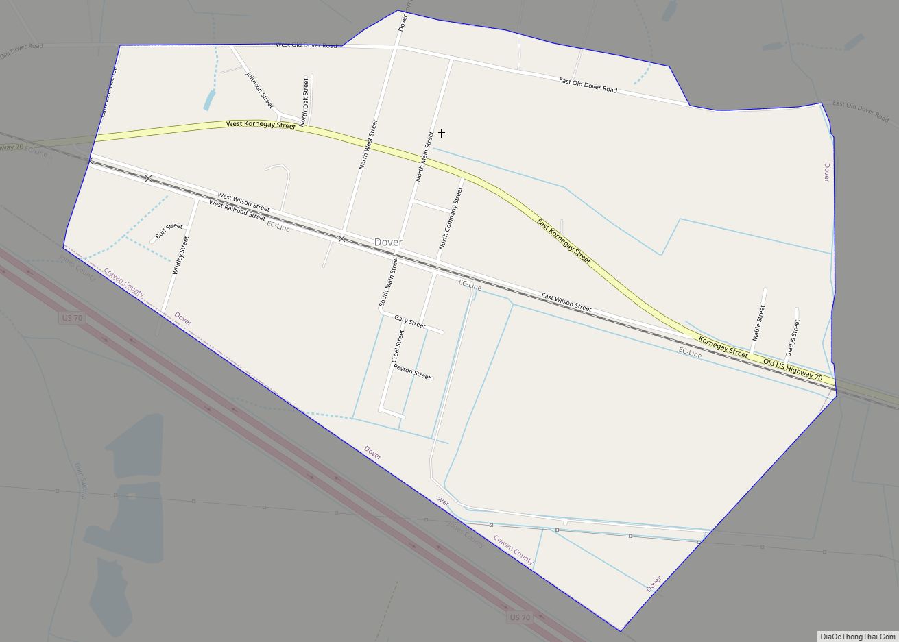
Dover is a town in Craven County, North Carolina, United States. The population was 401 at the 2010 Census.[1] It is part of the New Bern, North Carolina Micropolitan Statistical Area. Dover town overview: Name: Dover town LSAD Code: 43 LSAD Description: town (suffix) State: North Carolina County: Craven County Elevation: 62 ft (19 m) Total Area: ... Read more
Map of Dover town, North Carolina
Map of Dortches town
Dortches is a town in Nash County, North Carolina, United States. It is part of the Rocky Mount, North Carolina Metropolitan Statistical Area. The population was 935 in 2010. Dortches town overview: Name: Dortches town LSAD Code: 43 LSAD Description: town (suffix) State: North Carolina County: Nash County Elevation: 197 ft (60 m) Total Area: 8.09 sq mi (20.95 km²) ... Read more
Map of Dortches town
Map of East Flat Rock CDP
East Flat Rock is an unincorporated area and census-designated place (CDP) in Henderson County, North Carolina, United States. The population was 4,995 at the 2010 census, up from 4,151 at the 2000 census. It is part of the Asheville Metropolitan Statistical Area. East Flat Rock CDP overview: Name: East Flat Rock CDP LSAD Code: 57 ... Read more
Map of East Flat Rock CDP
Map of Elizabeth City
Elizabeth City is a city in Pasquotank County, North Carolina, United States. As of the 2020 census, it had a population of 18,629. Elizabeth City is the county seat and largest city of Pasquotank County. It is the cultural, economic and educational hub of the sixteen-county Historic Albemarle region of northeastern North Carolina. Elizabeth City ... Read more
Map of Elizabeth City
Map of Efland CDP
Efland is a census-designated place in Orange County, North Carolina, United States. As of the 2010 census it had a population of 734. Efland is located along U.S. Route 70, 3 miles (5 km) west of Hillsborough, the Orange County seat, and 5 miles (8 km) east of Mebane. It is served by exit 160 from Interstate ... Read more
Map of Efland CDP
Map of Edneyville CDP
Edneyville is an unincorporated community and census-designated place (CDP) in Henderson County, North Carolina, United States. Its population was 2,367 as of the 2010 census. A post office called Edneyville has been in operation since 1828. Rev. Samuel Edney served as postmaster. He and his brother Asa were the two earliest settlers in the area. ... Read more
Map of Edneyville CDP