Elizabeth City is a city in Pasquotank County, North Carolina, United States. As of the 2020 census, it had a population of 18,629. Elizabeth City is the county seat and largest city of Pasquotank County. It is the cultural, economic and educational hub of the sixteen-county Historic Albemarle region of northeastern North Carolina.
Elizabeth City is the center of the Elizabeth City Micropolitan Statistical Area, with a population of 64,094 as of 2010. It is part of the larger Virginia Beach-Norfolk, VA-NC Combined Statistical Area. The city is the economic center of the region, as well as home to many historic sites and cultural traditions.
Marketed as the “Harbor of Hospitality”, Elizabeth City has had a long history of shipping due to its location at a narrowed bend of the Pasquotank River. Founded in 1794, Elizabeth City prospered early on from the Dismal Swamp Canal as a mercantile city. Later it developed industry and other commercial focus. While Elizabeth City still retains extensive waterfront property, it is linked to neighboring counties and cities by contemporary highways and bridges to support other transportation. It hosts one of the largest United States Coast Guard bases in the nation.
| Name: | Elizabeth City city |
|---|---|
| LSAD Code: | 25 |
| LSAD Description: | city (suffix) |
| State: | North Carolina |
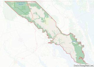
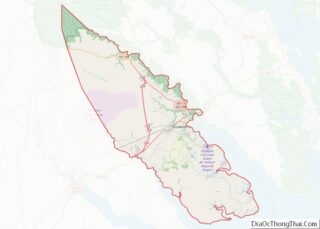
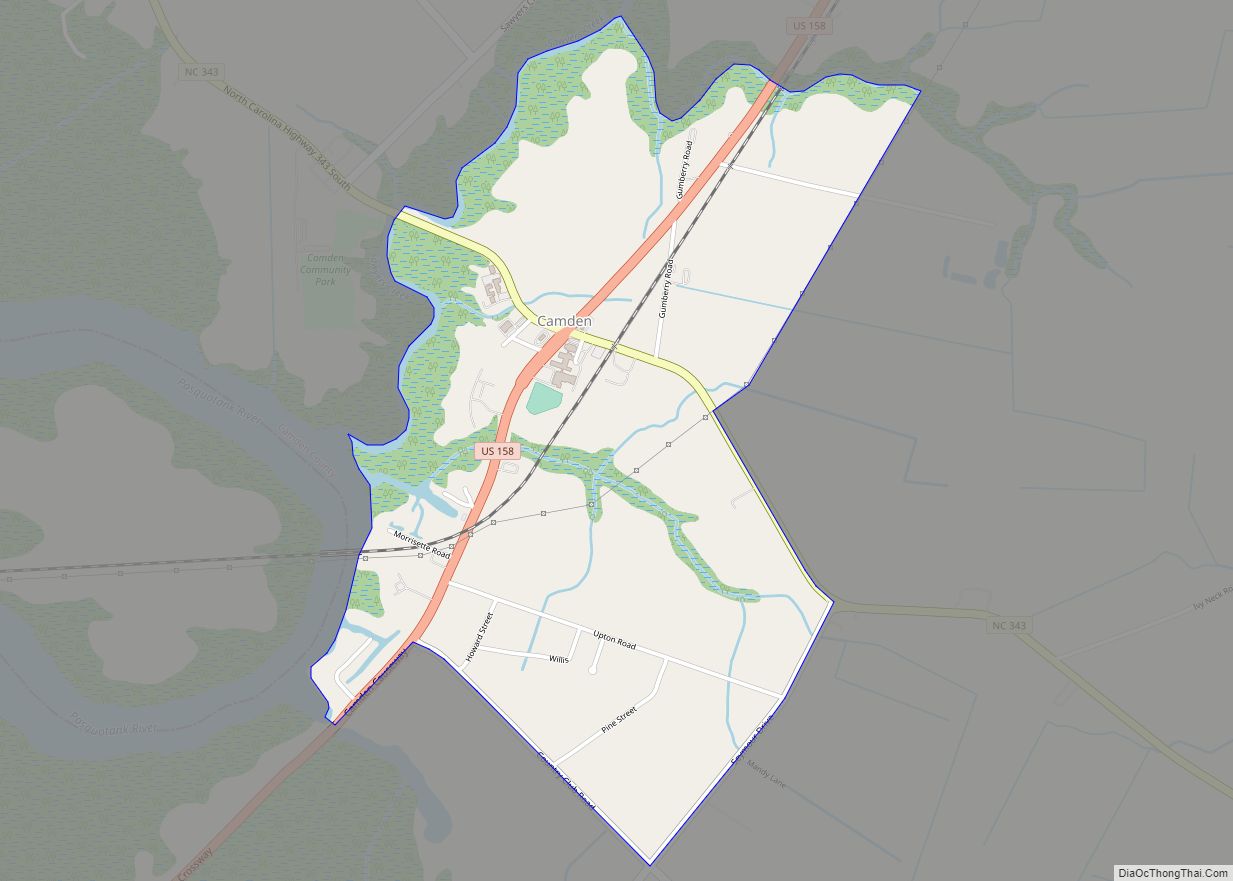
| County: | Camden County, Pasquotank County |
| Elevation: | 12 ft (4 m) |
| Land Area: | 11.71 sq mi (30.32 km²) |
| Water Area: | 0.00 sq mi (0.00 km²) |
| Population Density: | 1,591.58/sq mi (614.50/km²) |
| ZIP code: | 27906, 27907, 27909 |
| Area code: | 252 |
| FIPS code: | 3720580 |
| GNISfeature ID: | 1025307 |
| Website: | www.cityofec.com |
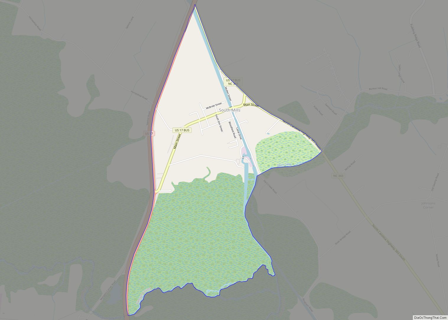
Online Interactive Map
Click on ![]() to view map in "full screen" mode.
to view map in "full screen" mode.
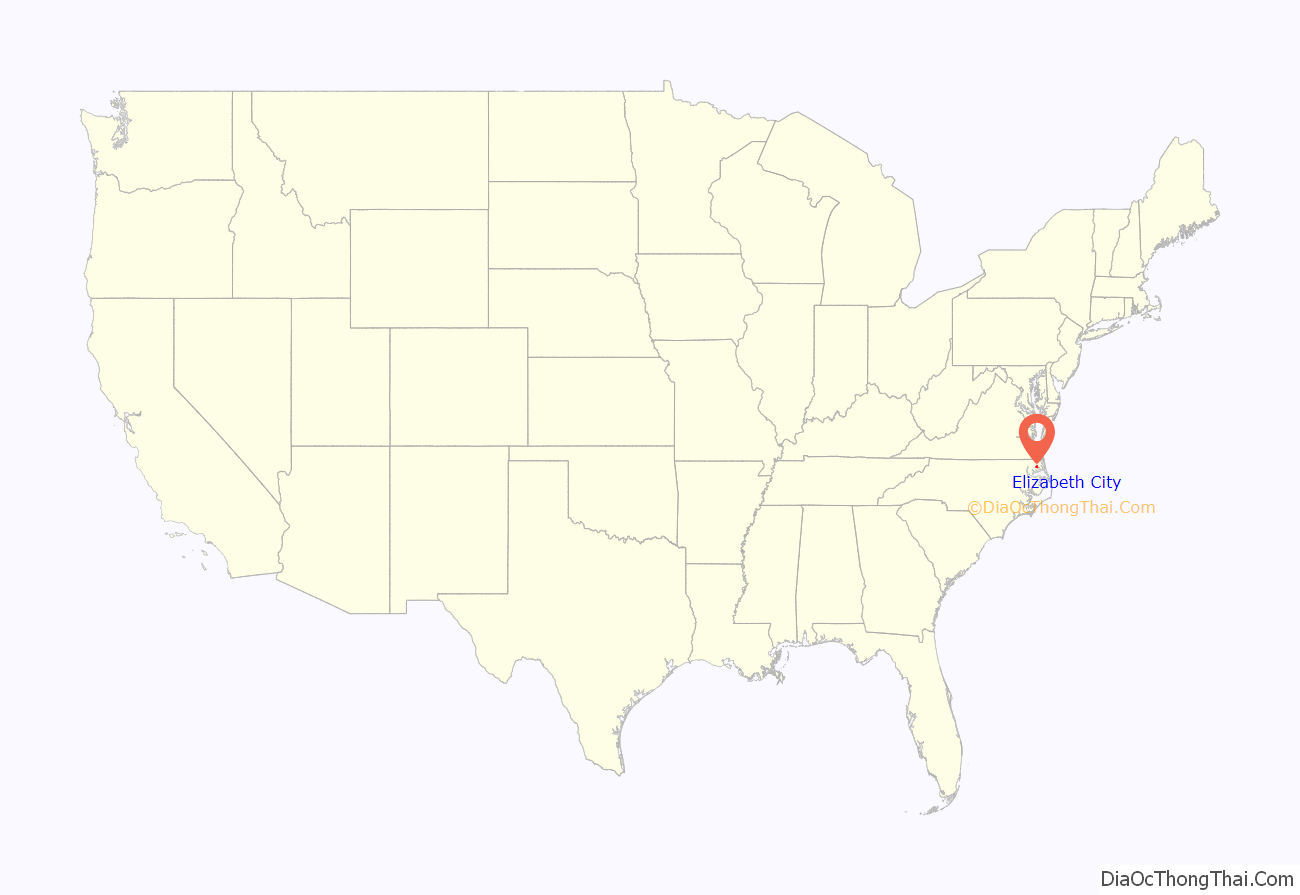
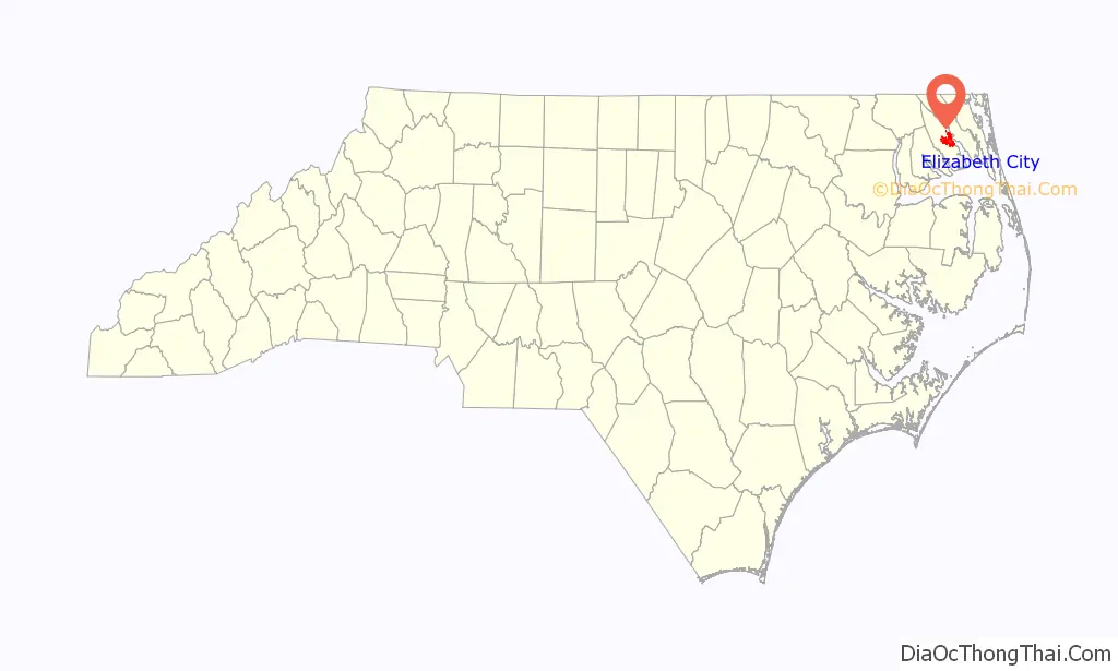
Elizabeth City location map. Where is Elizabeth City city?
History
Located at the narrows of the Pasquotank River, colonists used the area that developed as Elizabeth City as a trading site. As early as the mid 18th century, they established inspection stations and ferries. With the addition of minor roads, a schoolhouse, and soon a church, a small community developed at these narrows.
In 1793, businessmen supported construction of the Dismal Swamp Canal; it was integral to the success of Elizabeth City’s commerce. The North Carolina Assembly incorporated the town as “Redding”, renaming it in 1794 as “Elizabethtown”. Due to resulting confusion with another town of the same name, in 1801, the city was renamed as “Elizabeth City”. The name “Elizabeth” has been attributed to Elizabeth “Betsy” Tooley, a local tavern proprietress who donated much of the land for the new town.
With improvements to the Dismal Swamp Canal, commerce flourished and Elizabeth City became a financial center of trade and commercially successful in the early 19th century. In 1826, the federal government purchased 600 stocks in the canal and, in 1829, additional funds for improvements were raised by the Norfolk lottery. With these funds, the Dismal Swamp Canal was widened and deepened, allowing for larger boats to ship their goods to and from the city.
Further bolstering Elizabeth City’s financial success, the US customs house was relocated in 1827 from Camden County to Elizabeth City. From 1829 to 1832, Elizabeth City’s tolls tripled for commercial shipping.
During the American Civil War, the Confederate States had a small fleet stationed at Elizabeth City. After the Battle of Roanoke Island, Union forces sent a fleet to take the city. A small skirmish resulted in a Union victory. Elizabeth City was under Union control for the remainder of the war, as was most of coastal North Carolina. Confederate irregulars engaged in guerrilla warfare with Union forces in the area for the remainder of the war.
Meanwhile, overland travel slowly improved, enabling greater trade between neighboring counties. The ferry continued to provide transport between Elizabeth City and Camden County. But the completion of competing canals and railroads around Elizabeth City meant that neighboring cities began to draw off some of the traffic. The Portsmouth and Weldon Railroad, completed in the 1830s, allowed for goods to be transported from the Roanoke River directly to Weldon. The Albemarle–Chesapeake Canal, completed in 1859, created a deeper channel for merchants shipping goods from the eastern Albemarle Sound to Norfolk.
Such new opportunities established Elizabeth City as a thriving deep-water port and powerful regional economic center. It was based on such industries as lumbering, shipbuilding, grain export, and fish and oyster processing; it rivaled other ports such as Norfolk, Virginia, and Baltimore, Maryland. But the establishment in 1881 of the Elizabeth City and Norfolk Railroad, later renamed the Norfolk Southern Railway, encouraged a shift of industries from waterfront in Elizabeth City to the growing cities of North Carolina’s Upper Coastal Plain and Piedmont.
The declaration of World War II reinvigorated Elizabeth City’s industries, particularly in shipbuilding, textiles, and aeronautics. Coast Guard Air Station Elizabeth City was established in 1940 and Navy Air Station Weeksville in 1941 to provide valuable surveillance by seaplane and dirigible of German U-boats that were targeting American merchant shipping in East Coast waters.
Additionally from 1942 to 1944, the Elizabeth City Shipyard supported the war effort with much of its production: thirty 111-foot SC-class submarine chasers, four YT-class yard tugboats, and six 104-foot QS-class quick supply boats. The Elizabeth City Shipyard built the most subchasers for the war effort (30 out of 438 total nationally), and set the record construction time for the SC-class, with SC-740 laid down in only thirty days. As of June 2013, the Elizabeth City Shipyard is still in operation.
For two years, 1950 and 1951, Elizabeth City was home to a professional minor league baseball team. The Elizabeth City Albemarles played in the Class D level Virginia League. Previously, the town had fielded a team for several seasons in the semipro Albemarle League.
The conclusion of the war led to a levelled economy. Industry restructuring here and in other areas changed the economy. Since the late 20th century, the service, government, and agriculture sectors have become dominant in the current economy. Starting in the late 1990s, revival efforts in tourism and civic revitalization centered on downtown and the city’s five historic districts have led to increasing economic stability.
The Elizabeth City Historic District, Elizabeth City State Teachers College Historic District, Elizabeth City Water Plant, Episcopal Cemetery, Norfolk Southern Passenger Station, Northside Historic District, Old Brick House, Riverside Historic District, and Shepard Street-South Road Street Historic District are listed on the National Register of Historic Places. They are protected to encourage heritage tourism that stresses the city’s unique qualities.
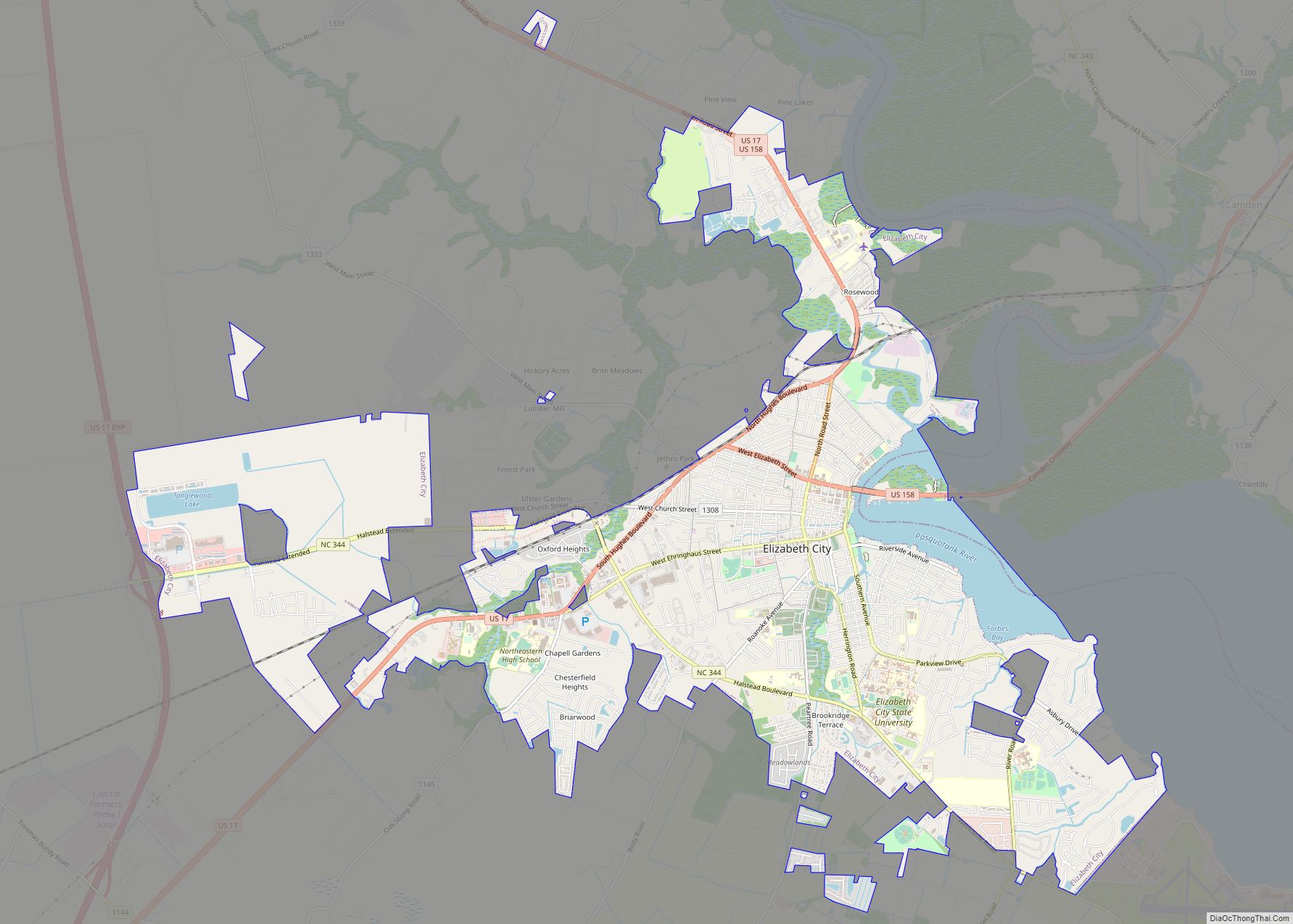
Elizabeth City Road Map
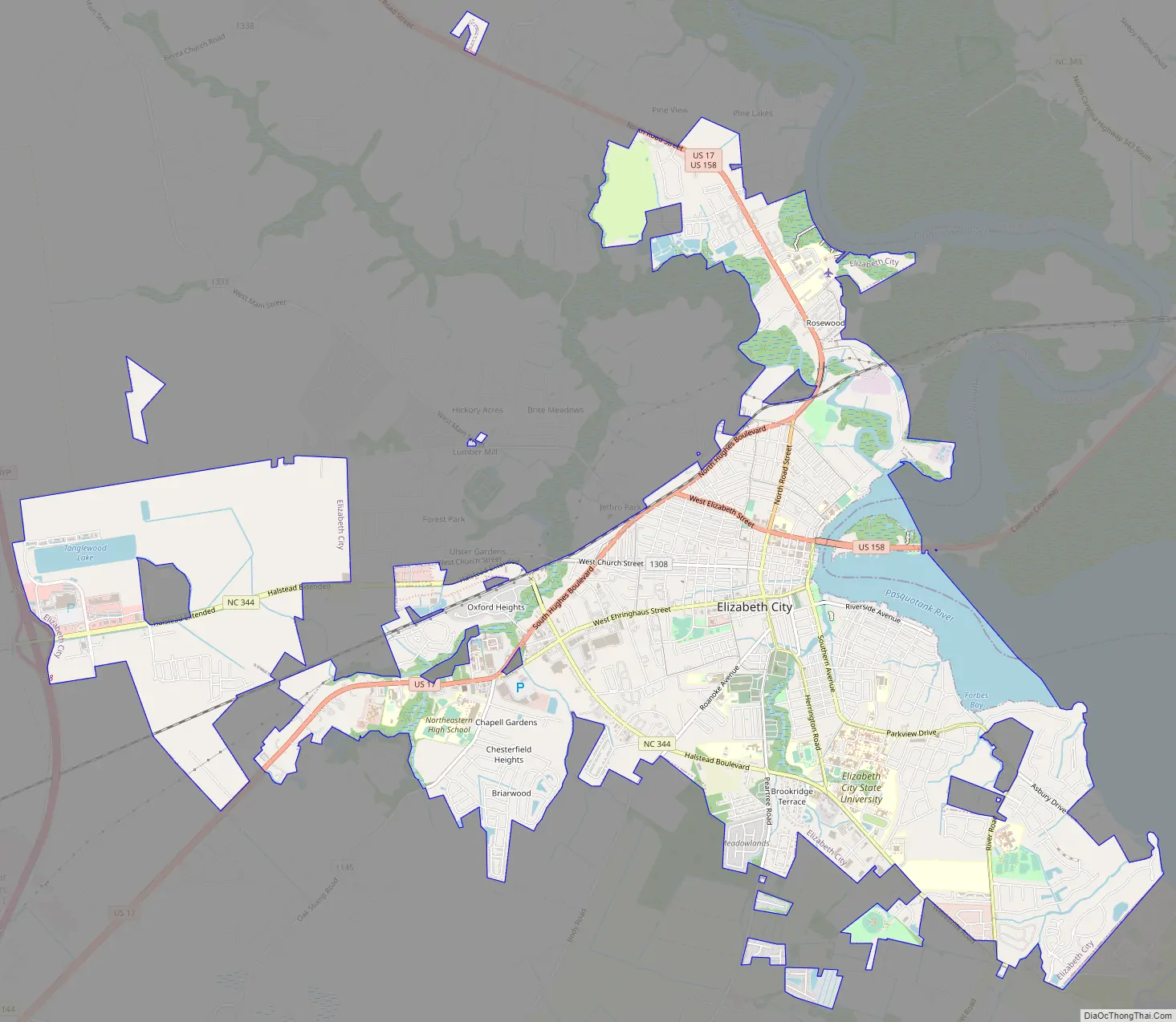
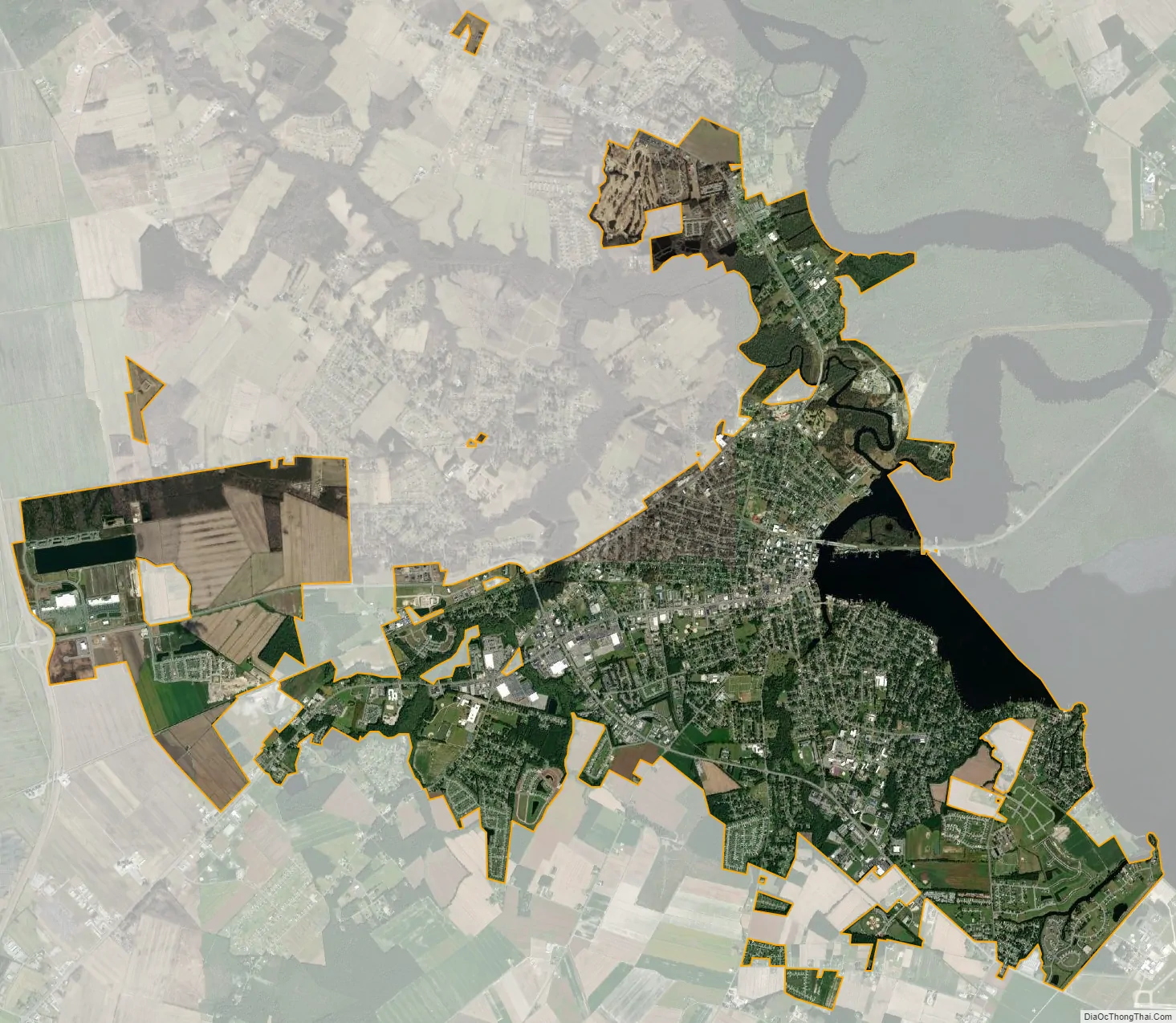
Elizabeth City city Satellite Map
Geography
Elizabeth City is located alongside the Pasquotank River, which connects to Albemarle Sound. Directly across the river lies Camden County.
Elizabeth City is located at 36°17′44″N 76°13′30″W / 36.29556°N 76.22500°W / 36.29556; -76.22500 (36.295585, −76.224954).
According to the United States Census Bureau, Elizabeth City has a total area of 12.2 square miles (31.7 km), of which 11.6 square miles (30.1 km) is land and 0.62 square miles (1.6 km), or 5.09%, is water. Located in the “Inner Banks” region of North Carolina, Elizabeth City is largely flat and marshy with an elevation of only 12 feet (3.7 m) above sea level. The city’s semi-coastal geography has played an important role in its history—Elizabeth City once hosted thriving oyster and timber industries.
Climate
Elizabeth City has a humid subtropical climate, experiencing only modest seasonal variation in temperature and precipitation. Because it is relatively close to the Albemarle Sound and the Atlantic Ocean, the temperature variations in the area are somewhat softened. On average, Elizabeth City has its highest temperature and accumulation of precipitation in July. Elizabeth City commonly experiences thunderstorms during the summer months and has endured many tropical storms and hurricanes due to its proximity to the Atlantic Ocean. This city experiences very little snowfall, however, receiving on average a total of 3.5 inches (89 mm) of snow annually.
- ^ Mean monthly maxima and minima (i.e. the highest and lowest temperature readings during an entire month or year) calculated based on data at said thread from 1991 to 2020
See also
Map of North Carolina State and its subdivision:- Alamance
- Alexander
- Alleghany
- Anson
- Ashe
- Avery
- Beaufort
- Bertie
- Bladen
- Brunswick
- Buncombe
- Burke
- Cabarrus
- Caldwell
- Camden
- Carteret
- Caswell
- Catawba
- Chatham
- Cherokee
- Chowan
- Clay
- Cleveland
- Columbus
- Craven
- Cumberland
- Currituck
- Dare
- Davidson
- Davie
- Duplin
- Durham
- Edgecombe
- Forsyth
- Franklin
- Gaston
- Gates
- Graham
- Granville
- Greene
- Guilford
- Halifax
- Harnett
- Haywood
- Henderson
- Hertford
- Hoke
- Hyde
- Iredell
- Jackson
- Johnston
- Jones
- Lee
- Lenoir
- Lincoln
- Macon
- Madison
- Martin
- McDowell
- Mecklenburg
- Mitchell
- Montgomery
- Moore
- Nash
- New Hanover
- Northampton
- Onslow
- Orange
- Pamlico
- Pasquotank
- Pender
- Perquimans
- Person
- Pitt
- Polk
- Randolph
- Richmond
- Robeson
- Rockingham
- Rowan
- Rutherford
- Sampson
- Scotland
- Stanly
- Stokes
- Surry
- Swain
- Transylvania
- Tyrrell
- Union
- Vance
- Wake
- Warren
- Washington
- Watauga
- Wayne
- Wilkes
- Wilson
- Yadkin
- Yancey
- Alabama
- Alaska
- Arizona
- Arkansas
- California
- Colorado
- Connecticut
- Delaware
- District of Columbia
- Florida
- Georgia
- Hawaii
- Idaho
- Illinois
- Indiana
- Iowa
- Kansas
- Kentucky
- Louisiana
- Maine
- Maryland
- Massachusetts
- Michigan
- Minnesota
- Mississippi
- Missouri
- Montana
- Nebraska
- Nevada
- New Hampshire
- New Jersey
- New Mexico
- New York
- North Carolina
- North Dakota
- Ohio
- Oklahoma
- Oregon
- Pennsylvania
- Rhode Island
- South Carolina
- South Dakota
- Tennessee
- Texas
- Utah
- Vermont
- Virginia
- Washington
- West Virginia
- Wisconsin
- Wyoming