Map of Four Oaks town

Map of Four Oaks town

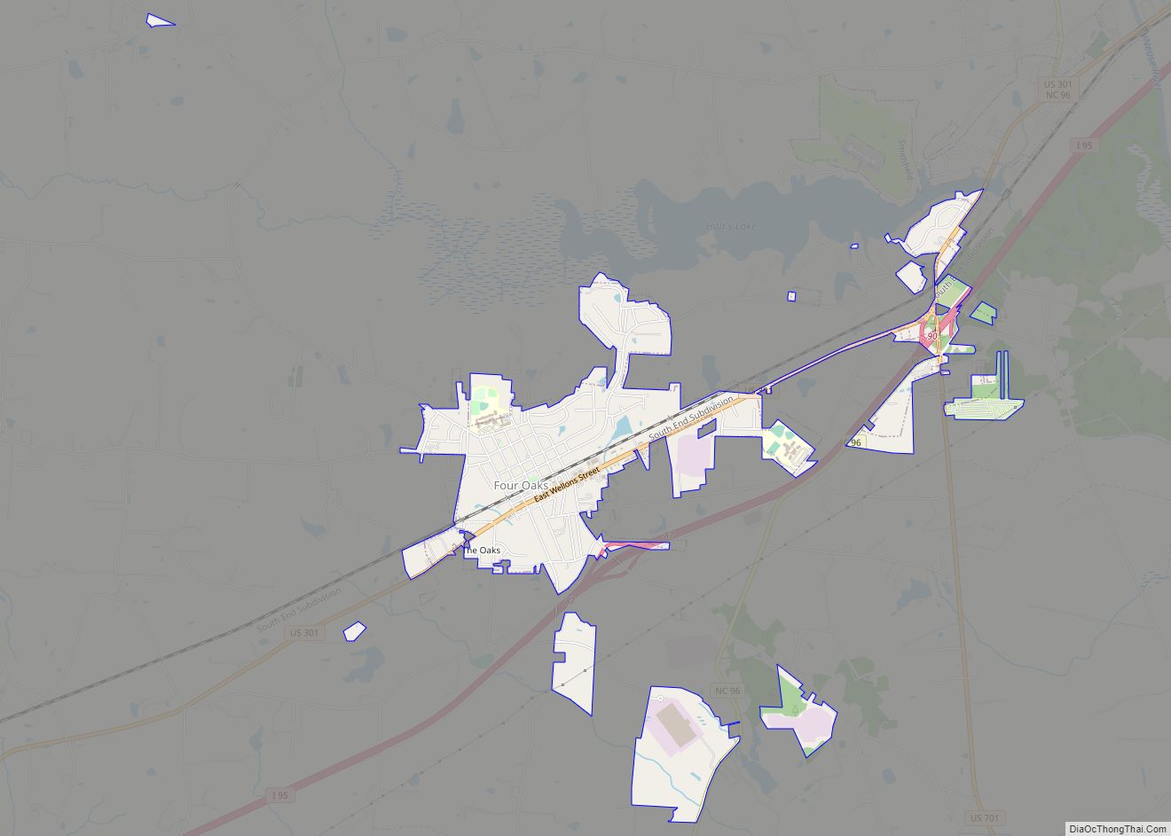
Four Oaks is a town in Johnston County, North Carolina, United States. As of the 2010 census it had a population of 1,921, up from 1,424 in 2000. Four Oaks town overview: Name: Four Oaks town LSAD Code: 43 LSAD Description: town (suffix) State: North Carolina County: Johnston County Elevation: 197 ft (60 m) Total Area: 2.45 sq mi … Read more

Map of Gamewell town

Map of Gamewell town

Gamewell is a town in Caldwell County, North Carolina, United States. The population was 4,051 at the 2010 census. It is part of the Hickory–Lenoir–Morganton Metropolitan Statistical Area. Gamewell town overview: Name: Gamewell town LSAD Code: 43 LSAD Description: town (suffix) State: North Carolina County: Caldwell County Elevation: 1,073 ft (327 m) Total Area: 8.11 sq mi (21.00 km²) Land … Read more

Map of Fuquay-Varina town

Map of Fuquay-Varina town

Fuquay-Varina (/ˈfjuːkweɪ vəˈriːnə/ FYUU-kway və-REE-nə) is a town in southern Wake County, North Carolina, United States, lying south of Holly Springs and southwest of Garner, and north of the Harnett County town of Angier and west of the unincorporated community of Willow Springs. The population was 17,937 at the 2010 census, and estimated at 36,736 … Read more

Map of Fruitland CDP, North Carolina

Map of Fruitland CDP, North Carolina

Fruitland is an unincorporated community and census-designated place (CDP) in Henderson County, North Carolina, United States. Its population was 2,031 as of the 2010 census. Fruitland CDP overview: Name: Fruitland CDP LSAD Code: 57 LSAD Description: CDP (suffix) State: North Carolina County: Henderson County Elevation: 2,215 ft (675 m) Total Area: 8.07 sq mi (20.91 km²) Land Area: 8.04 sq mi (20.83 km²) … Read more

Map of Frisco CDP, North Carolina

Map of Frisco CDP, North Carolina

Frisco is a small unincorporated community and census-designated place (CDP) on the barrier island of Hatteras Island, between the villages of Buxton and Hatteras. It is located in Dare County, North Carolina, United States, and was previously named “Trent”, or “Trent Woods”, but received a new name with the coming of the post office in … Read more

Map of Fremont town, North Carolina

Map of Fremont town, North Carolina

Fremont is a town in Wayne County, North Carolina, United States. The population was 1,255 at the 2010 census. It is included in the Goldsboro, North Carolina Metropolitan Statistical Area. Fremont town overview: Name: Fremont town LSAD Code: 43 LSAD Description: town (suffix) State: North Carolina County: Wayne County Elevation: 148 ft (45 m) Total Area: 1.36 sq mi … Read more

Map of Franklinville town

Map of Franklinville town, North Carolina

Franklinville is a town in Randolph County, North Carolina, United States. The population was 1,164 at the 2010 census. Franklinville town overview: Name: Franklinville town LSAD Code: 43 LSAD Description: town (suffix) State: North Carolina County: Randolph County Elevation: 479 ft (146 m) Total Area: 1.64 sq mi (4.24 km²) Land Area: 1.62 sq mi (4.20 km²) Water Area: 0.02 sq mi (0.04 km²) Total Population: … Read more

Map of Franklinton town, North Carolina

Map of Franklinton town, North Carolina

Franklinton is a town in Franklin County, North Carolina, United States. The population was 2,456 at the 2020 census. Franklinton town overview: Name: Franklinton town LSAD Code: 43 LSAD Description: town (suffix) State: North Carolina County: Franklin County Incorporated: December 20, 1842 Elevation: 410 ft (120 m) Total Area: 2.41 sq mi (4.52 km²) Land Area: 2.40 sq mi (4.50 km²) Water Area: … Read more

Map of Gibson town, North Carolina

Map of Gibson town, North Carolina

Gibson is a town in Scotland County, North Carolina, United States. The population was 540 at the 2010 census. Gibson town overview: Name: Gibson town LSAD Code: 43 LSAD Description: town (suffix) State: North Carolina County: Scotland County Elevation: 249 ft (76 m) Total Area: 0.98 sq mi (2.53 km²) Land Area: 0.98 sq mi (2.53 km²) Water Area: 0.00 sq mi (0.00 km²) Total Population: … Read more

Map of Gerton CDP

Map of Gerton CDP

Gerton is an unincorporated community and census-designated place (CDP) in Henderson County, North Carolina, United States. As of the 2010 census it had a population of 254. It is part of the Asheville Metropolitan Statistical Area. Gerton CDP overview: Name: Gerton CDP LSAD Code: 57 LSAD Description: CDP (suffix) State: North Carolina County: Henderson County … Read more

Map of Germanton CDP

Map of Germanton CDP

Germanton is an unincorporated community and census-designated place (CDP) in Forsyth and Stokes counties in the U.S. state of North Carolina, primarily in Stokes County. As of the 2010 census it had a population of 827. It is located 13 miles (21 km) south of the Stokes County seat of Danbury, on North Carolina State Highways … Read more

Map of Gatesville town

Map of Gatesville town, North Carolina

Gatesville is a town in Gates County, North Carolina, United States. The population was 321 at the 2010 census. It is the county seat of Gates County. Gatesville town overview: Name: Gatesville town LSAD Code: 43 LSAD Description: town (suffix) State: North Carolina County: Gates County Elevation: 23 ft (7 m) Total Area: 0.40 sq mi (1.05 km²) Land Area: … Read more