Map of Rockfish CDP

Map of Rockfish CDP

Rockfish is a census-designated place (CDP) in Hoke County, North Carolina, United States. The population was 3,298 at the 2010 census, up from 2,353 at the 2000 census. Rockfish CDP overview: Name: Rockfish CDP LSAD Code: 57 LSAD Description: CDP (suffix) State: North Carolina County: Hoke County Elevation: 220 ft (67 m) Total Area: 5.07 sq mi (13.14 km²) Land … Read more

Map of Rose Hill town, North Carolina

Map of Rose Hill town, North Carolina

Rose Hill is a town in Duplin County, North Carolina, United States. Its population was 1,626 at the 2010 census. Rose Hill claims to be the home of the world’s largest frying pan. Rose Hill town overview: Name: Rose Hill town LSAD Code: 43 LSAD Description: town (suffix) State: North Carolina County: Duplin County Elevation: … Read more

Map of Roper town

Map of Roper town

Roper is a town in Washington County, North Carolina, United States. The population was 485 at the 2020 Census. It was known as Lee’s Mill (named for Thomas Lee) until 1890, when the John L. Roper Lumber Company was established in the town and its name changed to Roper. Roper town overview: Name: Roper town … Read more

Map of Ronda town

Map of Ronda town

Ronda is a town in Wilkes County, North Carolina, United States. The population was 417 at the 2010 census, and 413 at the 2020 census. Ronda was named after a nearby estate called “Roundabout”, which was the residence of Benjamin Cleveland, a locally prominent planter and a colonel in the North Carolina militia during the … Read more

Map of Rolesville town

Map of Rolesville town

Rolesville is a town in northeastern Wake County, North Carolina, United States, a suburb of the capital city of Raleigh. It is the second oldest town in Wake County and has been one of the fastest-growing towns in the state of North Carolina for the past several years. The population was 9,475 at the 2020 … Read more

Map of Rodanthe CDP

Map of Rodanthe CDP

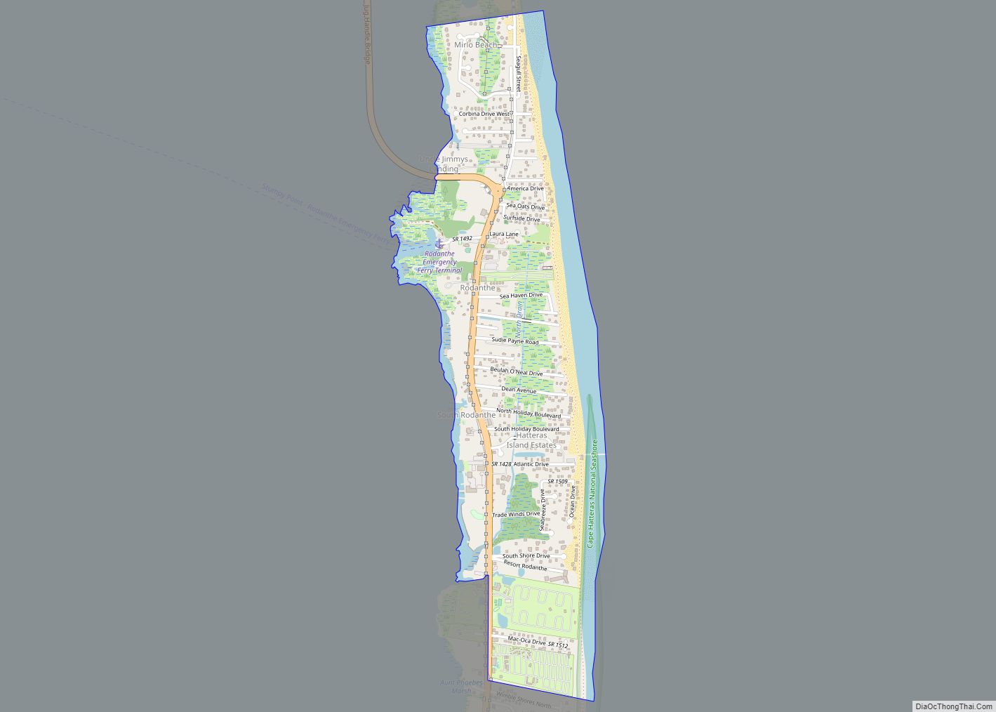
Rodanthe (/roʊˈdænθ/ roh-DAN-th) is an unincorporated community and census-designated place (CDP) located in Dare County, North Carolina, United States, on Hatteras Island, part of North Carolina’s Outer Banks. As of the 2020 census it had a population of 213. Rodanthe, along with Waves and Salvo, are part of the settlement of Chicamacomico. Rodanthe includes the … Read more

Map of Ruth town, North Carolina

Map of Ruth town, North Carolina

Ruth is a town in Rutherford County, North Carolina, United States. The population was 440 at the 2010 census. Ruth town overview: Name: Ruth town LSAD Code: 43 LSAD Description: town (suffix) State: North Carolina County: Rutherford County Elevation: 1,027 ft (313 m) Total Area: 0.42 sq mi (1.10 km²) Land Area: 0.42 sq mi (1.10 km²) Water Area: 0.00 sq mi (0.00 km²) Total Population: … Read more

Map of Rural Hall town

Map of Rural Hall town

Rural Hall is a town in Forsyth County, North Carolina, United States. It is a part of the Piedmont Triad. The population was 3,360 at the 2020 census. The town has one public park: Covington Memorial Park. Rural Hall town overview: Name: Rural Hall town LSAD Code: 43 LSAD Description: town (suffix) State: North Carolina … Read more

Map of Ruffin CDP

Map of Ruffin CDP

Ruffin CDP overview: Name: Ruffin CDP LSAD Code: 57 LSAD Description: CDP (suffix) State: North Carolina County: Rockingham County FIPS code: 3758340 Online Interactive Map Ruffin online map. Source: Basemap layers from Google Map, Open Street Map (OSM), Arcgisonline, Wmflabs. Boundary Data from Database of Global Administrative Areas. Ruffin location map. Where is Ruffin CDP? … Read more

Map of Royal Pines CDP

Map of Royal Pines CDP

Royal Pines is a census-designated place (CDP) in Buncombe County, North Carolina, United States. The population was 4,272 at the 2010 census. It is part of the Asheville Metropolitan Statistical Area. Royal Pines CDP overview: Name: Royal Pines CDP LSAD Code: 57 LSAD Description: CDP (suffix) State: North Carolina County: Buncombe County Elevation: 2,283 ft (696 m) … Read more

Map of Roxobel town

Map of Roxobel town

Roxobel is a town in northwestern Bertie County, North Carolina, United States. It dates to 1724 and was originally known as Cotten’s Cross Roads. After several name changes, it has remained Roxobel since 1849. The population was 240 at the 2010 census. Roxobel town overview: Name: Roxobel town LSAD Code: 43 LSAD Description: town (suffix) … Read more

Map of Roxboro city

Map of Roxboro city

Roxboro is a city and the county seat of Person County in the U.S. state of North Carolina. The population was 8,134 at the 2020 census. The city is 30 miles (48 km) north of Durham and is a part of the four-county Durham–Chapel Hill Metropolitan Statistical Area, which has a population of 649,903 as of … Read more