Roxboro is a city and the county seat of Person County in the U.S. state of North Carolina. The population was 8,134 at the 2020 census. The city is 30 miles (48 km) north of Durham and is a part of the four-county Durham–Chapel Hill Metropolitan Statistical Area, which has a population of 649,903 as of the 2020 Census. The Durham–Chapel Hill MSA is a part of the larger Raleigh–Durham–Cary Combined Statistical Area, which has a population of 2,043,867 as of the 2020 Census.
| Name: | Roxboro city |
|---|---|
| LSAD Code: | 25 |
| LSAD Description: | city (suffix) |
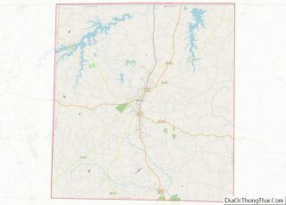
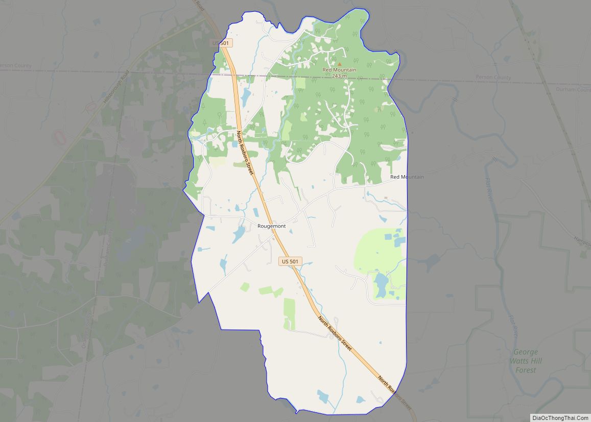
| State: | North Carolina |
| County: | Person County |
| Elevation: | 715 ft (218 m) |
| Total Area: | 7.14 sq mi (18.49 km²) |
| Land Area: | 7.13 sq mi (18.47 km²) |
| Water Area: | 0.01 sq mi (0.02 km²) |
| Total Population: | 8,134 |
| Population Density: | 1,140.33/sq mi (440.28/km²) |
| ZIP code: | 27573, 27574 |
| Area code: | 336, 743, *919 *small portion near Granville Co. |
| FIPS code: | 3758160 |
| GNISfeature ID: | 1024281 |
| Website: | www.cityofroxboro.com |
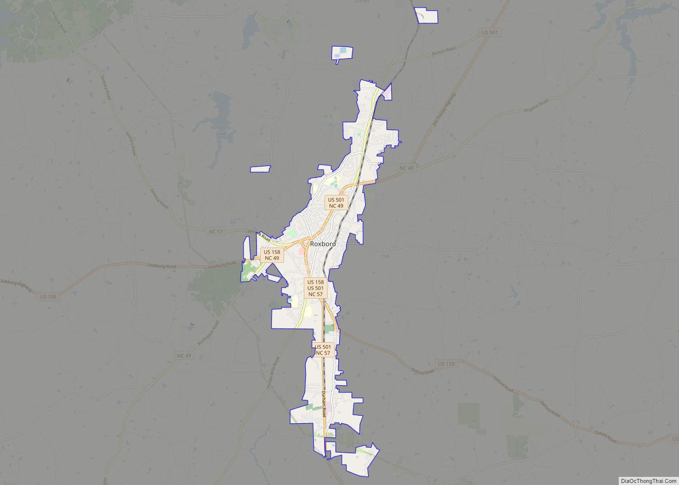
Online Interactive Map
Click on ![]() to view map in "full screen" mode.
to view map in "full screen" mode.
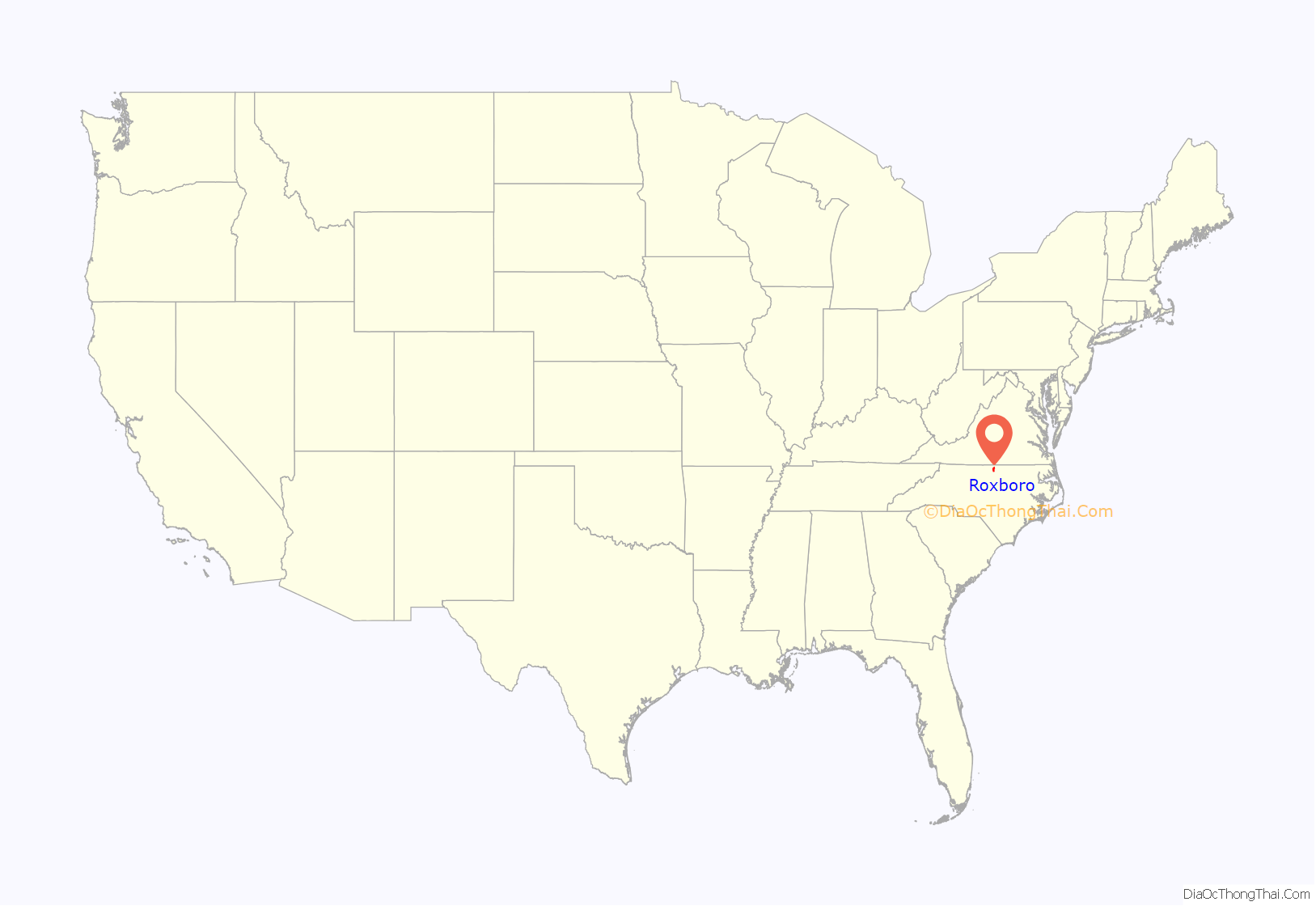
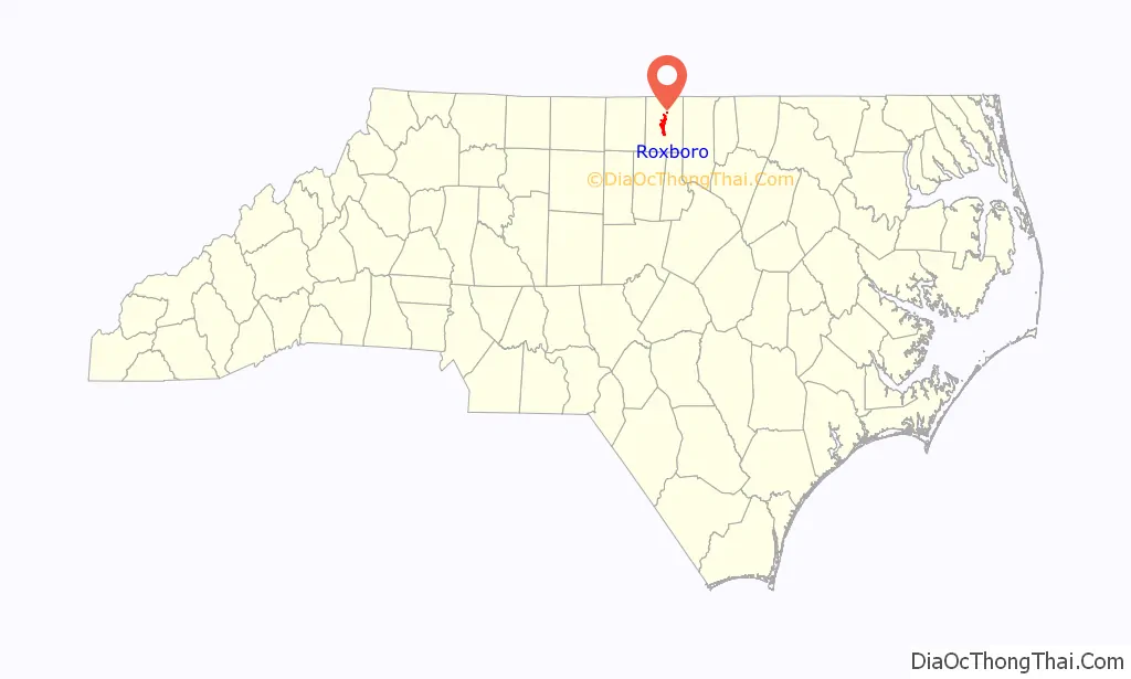
Roxboro location map. Where is Roxboro city?
History
Roxboro is named after a town in Scotland; Roxburgh. Although spelled differently, they are pronounced the same. Prior to the official adoption of the name Roxboro, the community was known as “Mocassin Gap”. The city of Roxboro was incorporated on January 9, 1855, and remains the only municipality in Person County.
The Holloway-Jones-Day House, House on Wagstaff Farm, James A. and Laura Thompson Long House, Merritt-Winstead House, Person County Courthouse, Roxboro Commercial Historic District, Roxboro Cotton Mill, and Roxboro Male Academy and Methodist Parsonage are listed on the National Register of Historic Places.
On July 7, 1920, Red Roach was lynched in downtown Roxboro.
On August 15, 1941, a mob of 500 attempted to lynch Cy Winstead, a 22 year old black man, who was accused of raping a white woman and was being held at the Person county court house. The mob was held off with tear gas by local authorities led by Sheriff M. T. Clayton until Winstead could be safely transferred to the state prison in Raleigh, NC. No injuries were reported. Ten men were indicted for the attempted lynching on October 16, 1941, on misdemeanor charges for “unlawful assembly for unlawful purpose”.
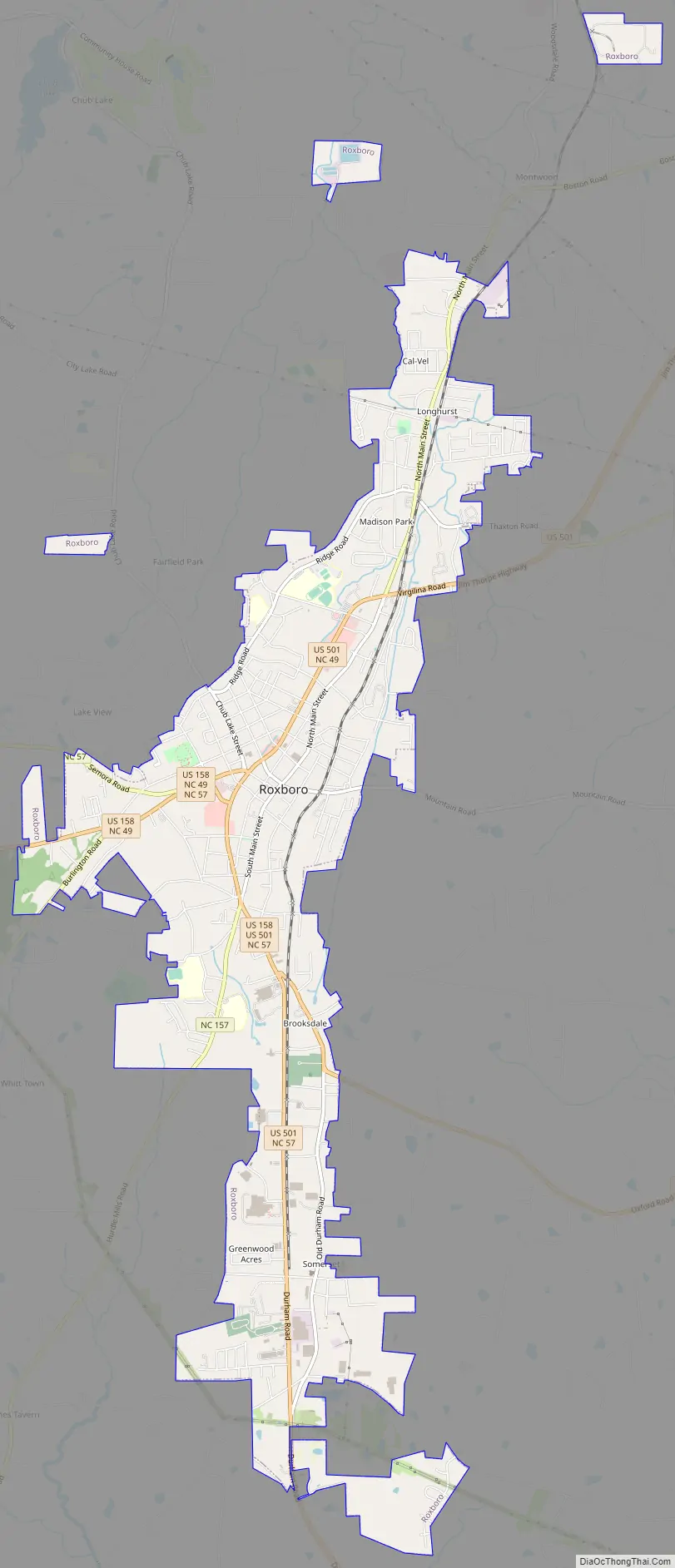
Roxboro Road Map
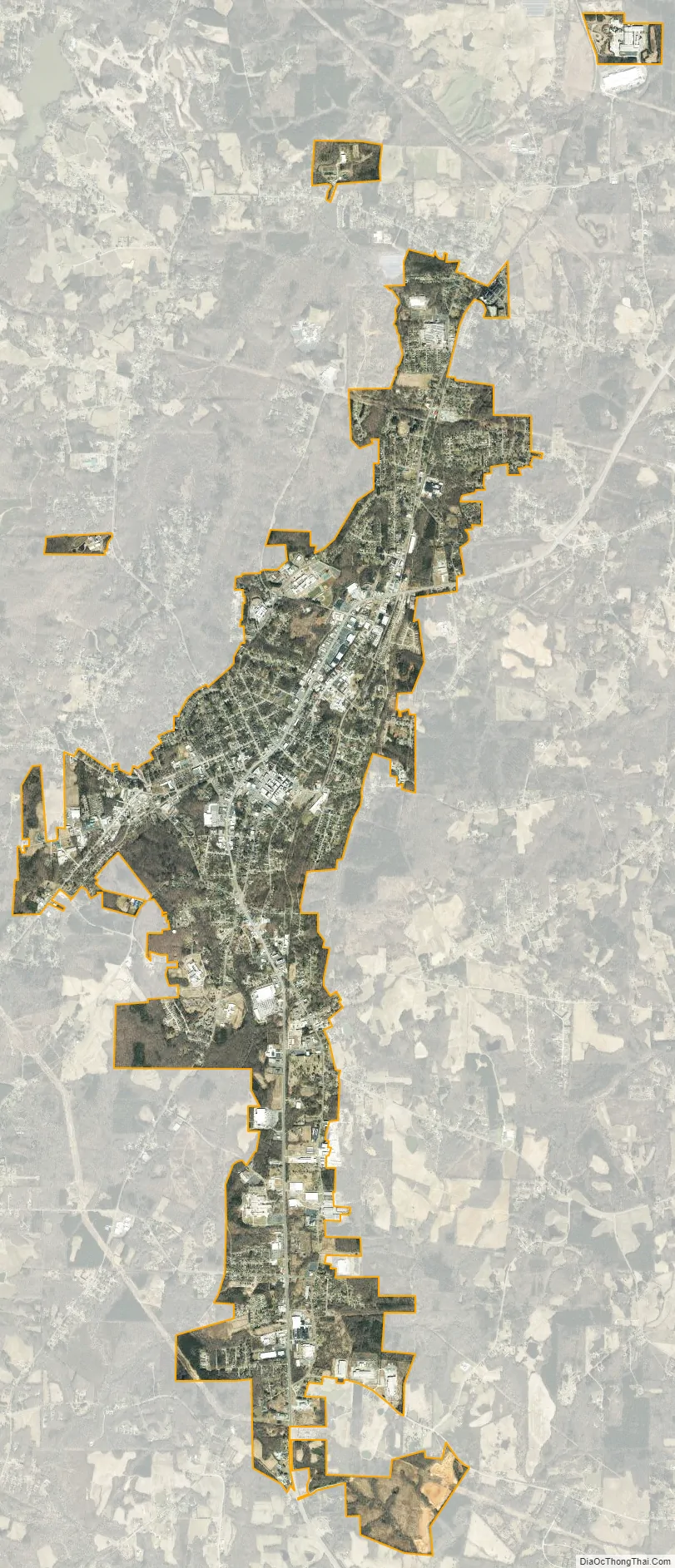
Roxboro city Satellite Map
Geography
Roxboro is located at 36°23′30″N 78°58′55″W / 36.39167°N 78.98194°W / 36.39167; -78.98194 (36.391690, −78.981877).
According to the United States Census Bureau, the city has a total area of 6.3 square miles (16 km), of which 6.3 square miles (16 km) is land and 0.16% is water.
Climate
Roxboro has a moderate subtropical climate, with mild weather in the spring, fall, and winter. However, summers can be hot and humid. Winter temperatures generally range from highs in the low 50s°F (10-13 °C) to lows in the upper 20s-mid 30s°F (-2 to 2 °C), though 60 °F (16 °C) degree weather is not uncommon. The record low was -9 °F in January 1985. Spring and fall days are usually in the low to mid 70s°F (low 20s°C), with nights in the 50s°F (10-14 °C). Summer days are often in the upper 80s and low 90s °F (30-35 °C,) with very high humidity. The record high was 104 °F in July 1966. The rainiest months are July and September.
Roxboro receives an average of 7.2 in (180 mm) of snow per winter. Freezing rain and sleet occur most winters, and occasionally the area experiences a major, damaging ice storm. Roxboro is often dubbed the “Snow Capital of the Triangle” because it often receives the most or close to the most snow during snowstorms in central North Carolina due to its high elevation.
See also
Map of North Carolina State and its subdivision:- Alamance
- Alexander
- Alleghany
- Anson
- Ashe
- Avery
- Beaufort
- Bertie
- Bladen
- Brunswick
- Buncombe
- Burke
- Cabarrus
- Caldwell
- Camden
- Carteret
- Caswell
- Catawba
- Chatham
- Cherokee
- Chowan
- Clay
- Cleveland
- Columbus
- Craven
- Cumberland
- Currituck
- Dare
- Davidson
- Davie
- Duplin
- Durham
- Edgecombe
- Forsyth
- Franklin
- Gaston
- Gates
- Graham
- Granville
- Greene
- Guilford
- Halifax
- Harnett
- Haywood
- Henderson
- Hertford
- Hoke
- Hyde
- Iredell
- Jackson
- Johnston
- Jones
- Lee
- Lenoir
- Lincoln
- Macon
- Madison
- Martin
- McDowell
- Mecklenburg
- Mitchell
- Montgomery
- Moore
- Nash
- New Hanover
- Northampton
- Onslow
- Orange
- Pamlico
- Pasquotank
- Pender
- Perquimans
- Person
- Pitt
- Polk
- Randolph
- Richmond
- Robeson
- Rockingham
- Rowan
- Rutherford
- Sampson
- Scotland
- Stanly
- Stokes
- Surry
- Swain
- Transylvania
- Tyrrell
- Union
- Vance
- Wake
- Warren
- Washington
- Watauga
- Wayne
- Wilkes
- Wilson
- Yadkin
- Yancey
- Alabama
- Alaska
- Arizona
- Arkansas
- California
- Colorado
- Connecticut
- Delaware
- District of Columbia
- Florida
- Georgia
- Hawaii
- Idaho
- Illinois
- Indiana
- Iowa
- Kansas
- Kentucky
- Louisiana
- Maine
- Maryland
- Massachusetts
- Michigan
- Minnesota
- Mississippi
- Missouri
- Montana
- Nebraska
- Nevada
- New Hampshire
- New Jersey
- New Mexico
- New York
- North Carolina
- North Dakota
- Ohio
- Oklahoma
- Oregon
- Pennsylvania
- Rhode Island
- South Carolina
- South Dakota
- Tennessee
- Texas
- Utah
- Vermont
- Virginia
- Washington
- West Virginia
- Wisconsin
- Wyoming