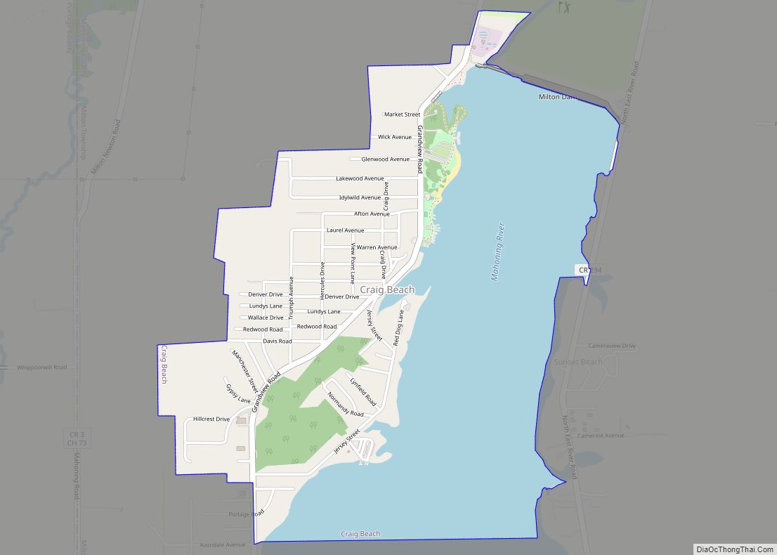
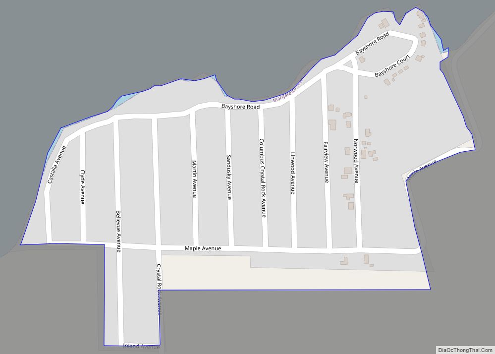
Map of Cortland city, Ohio
Cortland is a city in central Trumbull County, Ohio, United States. It lies on the eastern shore of Mosquito Creek Lake, 19 miles (31 km) north of Youngstown. The population was 7,105 at the 2020 census. It is part of the Youngstown–Warren metropolitan area. Cortland city overview: Name: Cortland city LSAD Code: 25 LSAD Description: city ... Read more
Map of Cortland city, Ohio
Map of Crooksville village
Crooksville is a village in Perry County, Ohio, United States, along Moxahala Creek. The population was 2,418 at the 2020 census. It was the home of Hull pottery, one of the best known Ohio potteries. Crooksville village overview: Name: Crooksville village LSAD Code: 47 LSAD Description: village (suffix) State: Ohio County: Perry County Elevation: 784 ft ... Read more
Map of Crooksville village
Map of Cridersville village
Cridersville /ˈkraɪdərzvɪl/ is a village in Auglaize County, Ohio, United States. The population was 1,852 at the 2010 census. It is included in the Wapakoneta, Ohio Micropolitan Statistical Area. The village is located about halfway between the cities of Lima and Wapakoneta. It is located in Duchouquet Township and is adjacent to Shawnee Township in ... Read more
Map of Cridersville village
Map of Cynthiana CDP, Ohio
Cynthiana is a census-designated place in northwestern Perry Township, Pike County, Ohio, United States. Cynthiana no longer has a post office and the mailing address has been changed to Bainbridge, OH 45612. It lies along State Route 41. Cynthiana CDP overview: Name: Cynthiana CDP LSAD Code: 57 LSAD Description: CDP (suffix) State: Ohio County: Pike ... Read more
Map of Cynthiana CDP, Ohio
Map of Cygnet village
Cygnet is a village in Wood County, Ohio, United States. The population was 597 at the 2010 census. Cygnet village overview: Name: Cygnet village LSAD Code: 47 LSAD Description: village (suffix) State: Ohio County: Wood County Elevation: 705 ft (215 m) Total Area: 0.33 sq mi (0.86 km²) Land Area: 0.33 sq mi (0.86 km²) Water Area: 0.00 sq mi (0.00 km²) Total Population: 543 Population ... Read more
Map of Cygnet village
Map of Cuyahoga Heights village
Cuyahoga Heights is a village in Cuyahoga County, Ohio, United States. The population was 638 at the 2010 census. Cuyahoga Heights village overview: Name: Cuyahoga Heights village LSAD Code: 47 LSAD Description: village (suffix) State: Ohio County: Cuyahoga County Elevation: 715 ft (218 m) Total Area: 3.21 sq mi (8.31 km²) Land Area: 3.07 sq mi (7.95 km²) Water Area: 0.14 sq mi (0.36 km²) Total ... Read more
Map of Cuyahoga Heights village
Map of Cuyahoga Falls city
Cuyahoga Falls (/ˌkaɪəˈhoʊɡə/ KY-ə-HOH-gə or /ˌkaɪəˈhɒɡə/ KY-ə-HOG-ə) is a city in Summit County, Ohio, United States. As of the 2020 census, the city population was 51,114. The second-largest city in Summit County, it is located directly north of Akron and is a suburb of the Akron metropolitan area. The city was founded in 1812 by ... Read more
Map of Cuyahoga Falls city
Map of Custar village
Custar is a village in Wood County, Ohio, United States. The population was 179 at the 2010 census. Custar village overview: Name: Custar village LSAD Code: 47 LSAD Description: village (suffix) State: Ohio County: Wood County Elevation: 692 ft (211 m) Total Area: 0.25 sq mi (0.65 km²) Land Area: 0.25 sq mi (0.65 km²) Water Area: 0.00 sq mi (0.00 km²) Total Population: 178 Population ... Read more
Map of Custar village
Map of Curtice CDP
Curtice is a census-designated place in northern Allen Township, Ottawa County, and southwestern Jerusalem Township, Lucas County, Ohio, United States. As of the 2010 census it had a population of 1,526. It has a post office, with the ZIP code of 43412. Curtice CDP overview: Name: Curtice CDP LSAD Code: 57 LSAD Description: CDP (suffix) ... Read more
Map of Curtice CDP
Map of Cumberland village, Ohio
Cumberland is a village in Guernsey County, Ohio, United States. It is seventy miles east of Columbus. The population was 367 at the 2010 census. Cumberland village overview: Name: Cumberland village LSAD Code: 47 LSAD Description: village (suffix) State: Ohio County: Guernsey County Elevation: 843 ft (257 m) Total Area: 0.49 sq mi (1.26 km²) Land Area: 0.49 sq mi (1.26 km²) Water ... Read more
Map of Cumberland village, Ohio
Map of Crystal Rock CDP
Crystal Rock is an unincorporated community and census-designated place in Erie County, Ohio, United States. As of the 2010 census it had a population of 176. It is located within Margaretta Township. Crystal Rock CDP overview: Name: Crystal Rock CDP LSAD Code: 57 LSAD Description: CDP (suffix) State: Ohio County: Erie County Elevation: 581 ft (177 m) ... Read more
Map of Crystal Rock CDP
Map of Crystal Lakes CDP, Ohio
Crystal Lakes is a census-designated place (CDP) in Clark County, Ohio, United States. The population was 1,483 at the 2010 census. It is part of the Springfield, Ohio Metropolitan Statistical Area. Crystal Lakes CDP overview: Name: Crystal Lakes CDP LSAD Code: 57 LSAD Description: CDP (suffix) State: Ohio County: Clark County Elevation: 850 ft (259 m) Total ... Read more
Map of Crystal Lakes CDP, Ohio