Cuyahoga Falls (/ˌkaɪəˈhoʊɡə/ KY-ə-HOH-gə or /ˌkaɪəˈhɒɡə/ KY-ə-HOG-ə) is a city in Summit County, Ohio, United States. As of the 2020 census, the city population was 51,114. The second-largest city in Summit County, it is located directly north of Akron and is a suburb of the Akron metropolitan area. The city was founded in 1812 by William Wetmore and was originally named Manchester, but renamed for the Cuyahoga River and the series of waterfalls that run along the southern boundary of the city.
| Name: | Cuyahoga Falls city |
|---|---|
| LSAD Code: | 25 |
| LSAD Description: | city (suffix) |
| State: | Ohio |
| County: | Summit County |
| Elevation: | 1,024 ft (312 m) |
| Total Area: | 25.92 sq mi (67.14 km²) |
| Land Area: | 25.80 sq mi (66.81 km²) |
| Water Area: | 0.13 sq mi (0.33 km²) |
| Total Population: | 51,114 |
| Population Density: | 1,981.47/sq mi (765.05/km²) |
| ZIP code: | 44221 and 44223 |
| Area code: | 330 and 234 |
| FIPS code: | 3919778 |
| GNISfeature ID: | 1048646 |
| Website: | https://www.cityofcf.com/ |
Online Interactive Map
Click on ![]() to view map in "full screen" mode.
to view map in "full screen" mode.
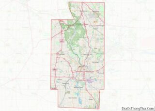
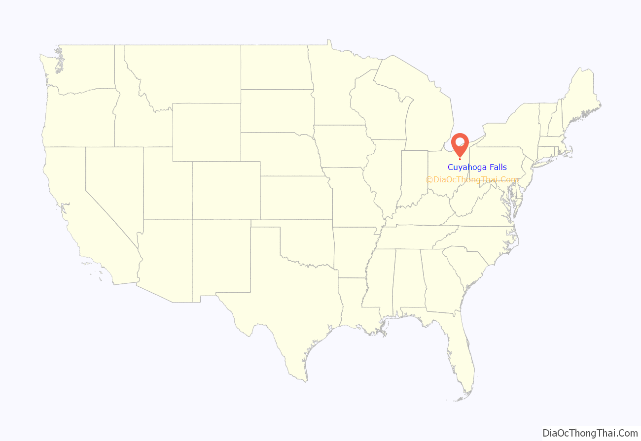
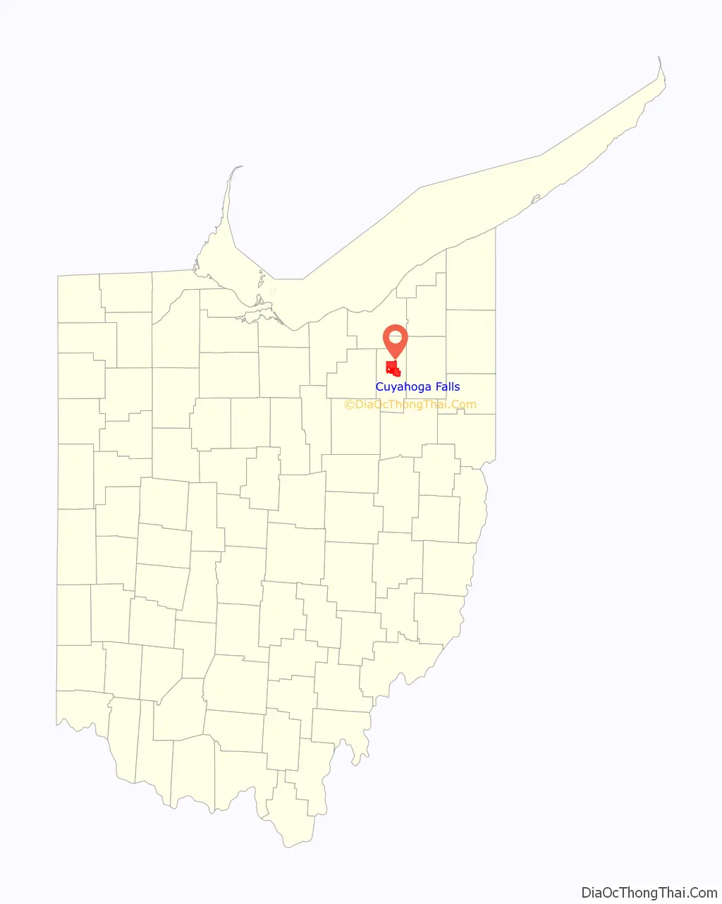
Cuyahoga Falls location map. Where is Cuyahoga Falls city?
History
Cuyahoga Falls was formed in 1812 near the junction of what was then Northampton, Stow, Tallmadge, and Portage townships. The focus was the series of Cuyahoga River waterfalls that provided power for manufacturing.
In 1812, Kelsey and Wilcox built a dam on the Cuyahoga River at a place where a railroad bridge crossed it in 1876. They then built a flour mill, an oil mill, and a saw mill. This led to the construction of a number of houses. This area was known as the old village. Development moved downstream, though, when the power was discovered to be better there. The old village was eventually destroyed in 1826, when a dam built by William Wetmore flooded the dam at the old village and its mills were torn down.
The earliest settlers of Cuyahoga Falls included Joshua Stow and William Wetmore. In 1815, a saw mill was operating near Gaylord’s Grove, using power generated by a dam on the Cuyahoga River there.
The town was initially called Manchester, but was renamed Cuyahoga Falls at the request of the Post Office since several other Manchesters were already in Ohio.
The village proper was first laid out in 1826 by Judge Richardson.
The town was incorporated in 1836, occupying 240 rods from Stow and Tallmadge townships. In 1853, seeing that the village and township of Cuyahoga Falls occupied the same territory, the village council disbanded and the community was only a township until 1868.
In 1841, the Summit County Board of Commissioners named Cuyahoga Falls the county seat. The state legislature then intervened and put the location of the county seat up to a popular vote. Akron won and has been the county seat ever since. In spite of being named the county seat, Cuyahoga Falls never really functioned as such.
In March 1851, the township of Cuyahoga Falls was created out of the village limits. They covered the same territory, so the village council voted to adjourn sine die, letting the village be run under township jurisdiction until June 3, 1868, when the municipal government returned.
In 1939 the first Lawson Convenience Store was established in Cuyahoga Falls.
On July 3, 1940, the Doodlebug Disaster train wreck killed 43 people, the worst disaster in the history of the city.
In 1985, a referendum of merger between the city and neighboring Northampton Township was approved by local voters. In 1986, Cuyahoga Falls merged with Northampton Township, the first merger of a city and township in Ohio.
Cuyahoga Falls had been founded as an industrial city, taking advantage of the river power. By the middle of the twentieth century, it had become largely residential. Don Robart, mayor from 1986 to 2013, promoted the merger with Northampton Township because of the additional land that could be used for development. Parts of that area have since been used for industrial development. Commercial development has also picked up, especially in the Howe Avenue area at the southern border of the city.
The city had one professional sports team, the Cuyahoga Falls Cougars, of the International Basketball League. They moved to Akron in 2006 and became the Akron Cougars.
The Cathedral of Tomorrow, founded by televangelist Rex Humbard in 1958, was in Cuyahoga Falls. It is now the church of pastor/evangelist Ernest Angley and was renamed Grace Cathedral.
Blossom Music Center, an outdoor concert venue and the summer home of the Cleveland Orchestra since 1968, is situated on 800 acres of the Cuyahoga Valley National Park in Cuyahoga Falls.
Cuyahoga Falls Road Map

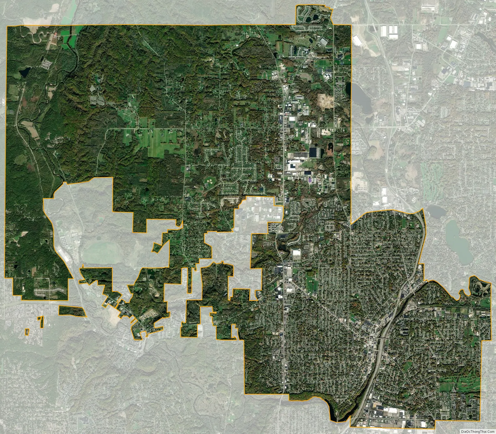
Cuyahoga Falls city Satellite Map
Geography
According to the United States Census Bureau, the city has an area of 25.75 square miles (66.69 km), of which 25.65 square miles (66.43 km) is land and 0.10 square miles (0.26 km) is water.
Cuyahoga Falls is bordered by Akron to the south and the Cuyahoga Valley National Park to the northwest.
See also
Map of Ohio State and its subdivision:- Adams
- Allen
- Ashland
- Ashtabula
- Athens
- Auglaize
- Belmont
- Brown
- Butler
- Carroll
- Champaign
- Clark
- Clermont
- Clinton
- Columbiana
- Coshocton
- Crawford
- Cuyahoga
- Darke
- Defiance
- Delaware
- Erie
- Fairfield
- Fayette
- Franklin
- Fulton
- Gallia
- Geauga
- Greene
- Guernsey
- Hamilton
- Hancock
- Hardin
- Harrison
- Henry
- Highland
- Hocking
- Holmes
- Huron
- Jackson
- Jefferson
- Knox
- Lake
- Lake Erie
- Lawrence
- Licking
- Logan
- Lorain
- Lucas
- Madison
- Mahoning
- Marion
- Medina
- Meigs
- Mercer
- Miami
- Monroe
- Montgomery
- Morgan
- Morrow
- Muskingum
- Noble
- Ottawa
- Paulding
- Perry
- Pickaway
- Pike
- Portage
- Preble
- Putnam
- Richland
- Ross
- Sandusky
- Scioto
- Seneca
- Shelby
- Stark
- Summit
- Trumbull
- Tuscarawas
- Union
- Van Wert
- Vinton
- Warren
- Washington
- Wayne
- Williams
- Wood
- Wyandot
- Alabama
- Alaska
- Arizona
- Arkansas
- California
- Colorado
- Connecticut
- Delaware
- District of Columbia
- Florida
- Georgia
- Hawaii
- Idaho
- Illinois
- Indiana
- Iowa
- Kansas
- Kentucky
- Louisiana
- Maine
- Maryland
- Massachusetts
- Michigan
- Minnesota
- Mississippi
- Missouri
- Montana
- Nebraska
- Nevada
- New Hampshire
- New Jersey
- New Mexico
- New York
- North Carolina
- North Dakota
- Ohio
- Oklahoma
- Oregon
- Pennsylvania
- Rhode Island
- South Carolina
- South Dakota
- Tennessee
- Texas
- Utah
- Vermont
- Virginia
- Washington
- West Virginia
- Wisconsin
- Wyoming