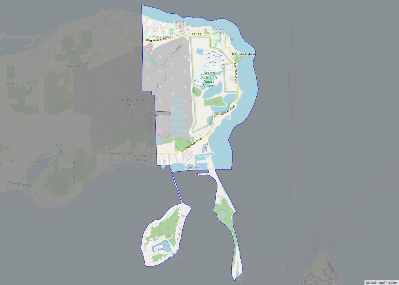
Map of Marion city, Ohio

Map of Marion city, Ohio

Marion is a city in and the county seat of Marion County, Ohio, United States. It is located in north-central Ohio, approximately 50 miles (80 km) north of Columbus. The population was 35,999 at the 2020 census, slightly down from 36,837 at the 2010 census. It is the largest city in Marion County and the principal … Read more

Map of Massillon city

Map of Massillon city

Massillon is a city in Stark County, Ohio, United States, approximately 8 miles (13 km) west of Canton, 20 miles (32 km) south of Akron, and 50 miles (80 km) south of Cleveland. The population was 32,146 at the 2020 census. Massillon is the second largest city within the Canton–Massillon metropolitan area, which includes all of Stark and … Read more

Map of Mason city, Ohio

Map of Mason city, Ohio

Mason is a city in southwestern Warren County, Ohio, United States, approximately 22 miles (35 km) north of downtown Cincinnati. As of the 2020 census, Mason’s population was 34,792. It is home to Kings Island amusement park and one of the largest tennis stadiums in the world, the Lindner Family Tennis Center, home of the Western … Read more

Map of Marysville city, Ohio

Map of Marysville city, Ohio

Marysville is a city in and the county seat of Union County, Ohio, United States, approximately 27 miles (44 km) northwest of Columbus. The population was 22,094 at the 2010 census, a 38.59% increase from 2000. Marysville’s longtime slogan is “Where the Grass is Greener”. In December 2008, the city was designated as a “Preserve America … Read more

Map of Martinsville village, Ohio

Map of Martinsville village, Ohio

Martinsville is a village in Clinton County, Ohio, United States. The population was 463 at the 2010 census. Martinsville village overview: Name: Martinsville village LSAD Code: 47 LSAD Description: village (suffix) State: Ohio County: Clinton County Elevation: 1,086 ft (331 m) Total Area: 0.37 sq mi (0.96 km²) Land Area: 0.37 sq mi (0.95 km²) Water Area: 0.00 sq mi (0.00 km²) Total Population: 416 Population … Read more

Map of Martinsburg village, Ohio

Map of Martinsburg village, Ohio

Martinsburg is a village in Knox County, Ohio, United States. The population was 237 at the 2010 census. Martinsburg village overview: Name: Martinsburg village LSAD Code: 47 LSAD Description: village (suffix) State: Ohio County: Knox County Elevation: 1,175 ft (358 m) Total Area: 0.18 sq mi (0.46 km²) Land Area: 0.18 sq mi (0.46 km²) Water Area: 0.00 sq mi (0.00 km²) Total Population: 222 Population … Read more

Map of Martins Ferry city

Map of Martins Ferry city

Martins Ferry is the largest city in Belmont County, Ohio, United States, along the Ohio River across from Wheeling, West Virginia. The population was 6,260 as of the 2020 census. It is part of the Wheeling metropolitan area. Martins Ferry city overview: Name: Martins Ferry city LSAD Code: 25 LSAD Description: city (suffix) State: Ohio … Read more

Map of Marshallville village, Ohio

Map of Marshallville village, Ohio

Marshallville is a village in Wayne County, Ohio. The population was 756 at the time of the 2010 census. Marshallville was originally called Bristol, and under the latter name was laid out in 1817. Marshallville village overview: Name: Marshallville village LSAD Code: 47 LSAD Description: village (suffix) State: Ohio County: Wayne County Elevation: 1,119 ft (341 m) … Read more

Map of Marseilles village, Ohio

Map of Marseilles village, Ohio

Marseilles is a village in Wyandot County, Ohio, United States, located at the western edge of the Killdeer Plains Wildlife Area. The population was 112 at the 2010 census. Marseilles village overview: Name: Marseilles village LSAD Code: 47 LSAD Description: village (suffix) State: Ohio County: Wyandot County Elevation: 876 ft (267 m) Total Area: 0.10 sq mi (0.25 km²) Land … Read more

Map of Marne CDP, Ohio

Map of Marne CDP, Ohio

Marne is an unincorporated community and census-designated place (CDP) in Licking County, Ohio, United States. As of the 2010 census it had a population of 783. Marne CDP overview: Name: Marne CDP LSAD Code: 57 LSAD Description: CDP (suffix) State: Ohio County: Licking County Elevation: 801 ft (244 m) Total Area: 0.88 sq mi (2.27 km²) Land Area: 0.88 sq mi (2.27 km²) … Read more

Map of Marlboro CDP, Ohio

Map of Marlboro CDP, Ohio

Marlboro is an unincorporated community in Stark County, Ohio, United States. Marlboro CDP overview: Name: Marlboro CDP LSAD Code: 57 LSAD Description: CDP (suffix) State: Ohio County: Stark County Elevation: 1,168 ft (356 m) Total Area: 0.43 sq mi (1.12 km²) Land Area: 0.43 sq mi (1.11 km²) Water Area: 0.00 sq mi (0.01 km²) Total Population: 247 Population Density: 574.42/sq mi (221.90/km²) Area code: 234 and … Read more

Map of Mayfield village, Ohio

Map of Mayfield village, Ohio

Mayfield (sometimes referred to as Mayfield Village) is a village in eastern Cuyahoga County, Ohio, United States. A suburb of Cleveland, it is part of the Cleveland metropolitan area. The population was 3,356 at the 2020 census. Mayfield village overview: Name: Mayfield village LSAD Code: 47 LSAD Description: village (suffix) State: Ohio County: Cuyahoga County … Read more