Martins Ferry is the largest city in Belmont County, Ohio, United States, along the Ohio River across from Wheeling, West Virginia. The population was 6,260 as of the 2020 census. It is part of the Wheeling metropolitan area.
| Name: | Martins Ferry city |
|---|---|
| LSAD Code: | 25 |
| LSAD Description: | city (suffix) |
| State: | Ohio |
| County: | Belmont County |
| Elevation: | 709 ft (216 m) |
| Total Area: | 2.33 sq mi (6.04 km²) |
| Land Area: | 2.33 sq mi (6.03 km²) |
| Water Area: | 0.00 sq mi (0.00 km²) |
| Total Population: | 6,260 |
| Population Density: | 2,689.00/sq mi (1,038.02/km²) |
| ZIP code: | 43935 |
| Area code: | 740 |
| FIPS code: | 3948104 |
| GNISfeature ID: | 1061478 |
| Website: | http://www.martinsferry.org/ |
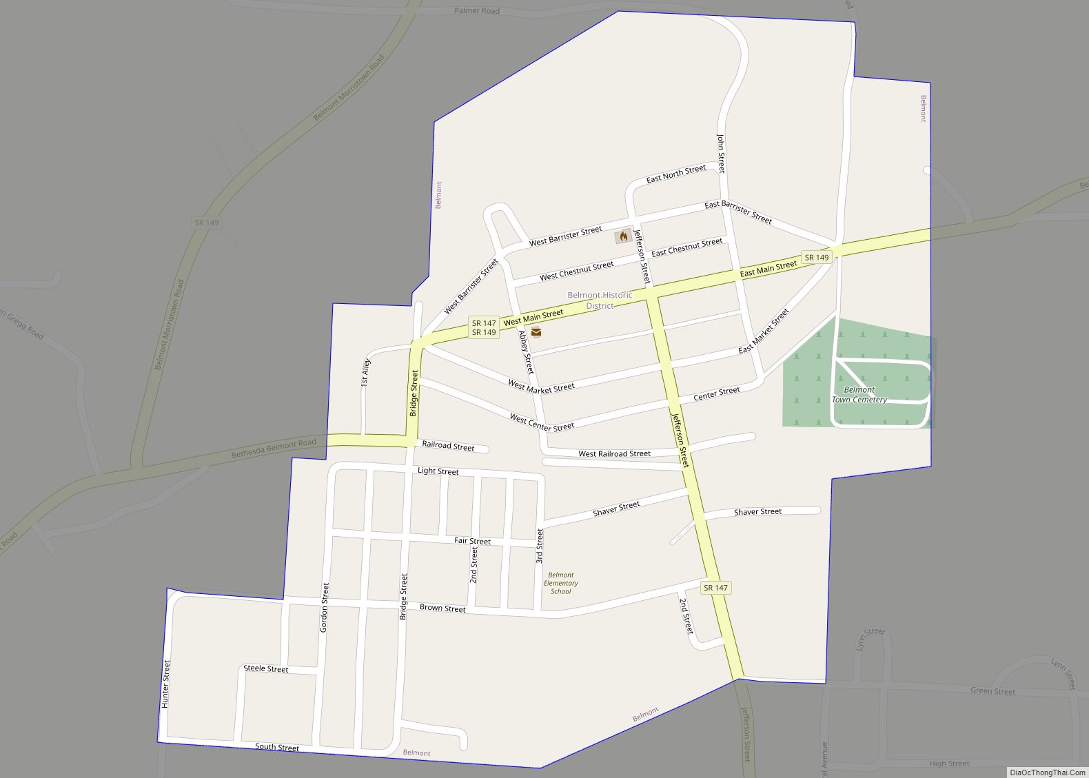
Online Interactive Map
Click on ![]() to view map in "full screen" mode.
to view map in "full screen" mode.
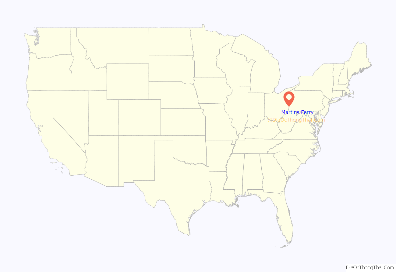
Martins Ferry location map. Where is Martins Ferry city?

History
Martins Ferry is the oldest European settlement in the state of Ohio, having been settled at least as early as 1779, almost a decade before Marietta. The settlement got its start as a consequence of a land grant to George Mercer of the Ohio Company in 1748 from the British Crown for 200,000 acres in the Ohio Country, a colloquial term for what is now much of Ohio, and western West Virginia and Pennsylvania. The grant called for among other things, establishment of a fort. The grant was for land south of the Ohio River in West Virginia (then Virginia). Settlement was hampered by the outbreak of the French and Indian War. The settlement was named Zanesburg (renamed Wheeling in 1795). The Ohio Company was dissolved in 1779, and claims issued by the Crown became moot after the Revolutionary War. The community across the river was a westward extension of Zanesburg, but at that time, settlement on the west bank of the Ohio River was prohibited by the Treaty of Fort Stanwix, 1768. Through the years, it has been known as Hoglinstown, Mercertown, Norristown (1785), Jefferson (1795), Martinsville (1835), and Martin’s Ferry (1865).
Squatters from across the Ohio were the earliest settlers. The settlement formed in the shadow of Virginia’s Fort Fincastle, later renamed Fort Henry on the Virginia side of the Ohio, built in 1774. The town was disbanded a couple of times before becoming established as Norristown in 1785. In 1795, the town of Jefferson was platted by Absalom Martin, one of the city’s earliest settlers, who operated a ferry there. In 1801, he abandoned his plat when St. Clairsville was selected as the county seat of the newly organized county of Belmont, one of the founding territories of the Northwest Territory.
In 1835, Ebenezer Martin, the son of Absalom Martin, redesigned the town, which he called “Martinsville”, with a grid system of streets, much of which survives to this day. Martinsville remained an unincorporated settlement for a relatively long time. It was eventually incorporated as a village in 1865 and renamed Martin’s Ferry for Ebenezer’s father’s ferry. It was chartered as a city in 1885, and sometime later the apostrophe was dropped from the city’s name.
The city developed as an important industrial center during the late 19th century and early 20th century. It became an important rail hub and river port. Over the past 50 years, the town’s population has decreased significantly as industries have closed or moved elsewhere. Today, the city’s population is less than half of what it once was.
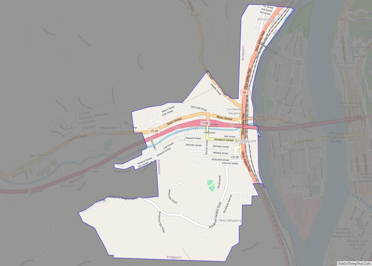
Martins Ferry Road Map
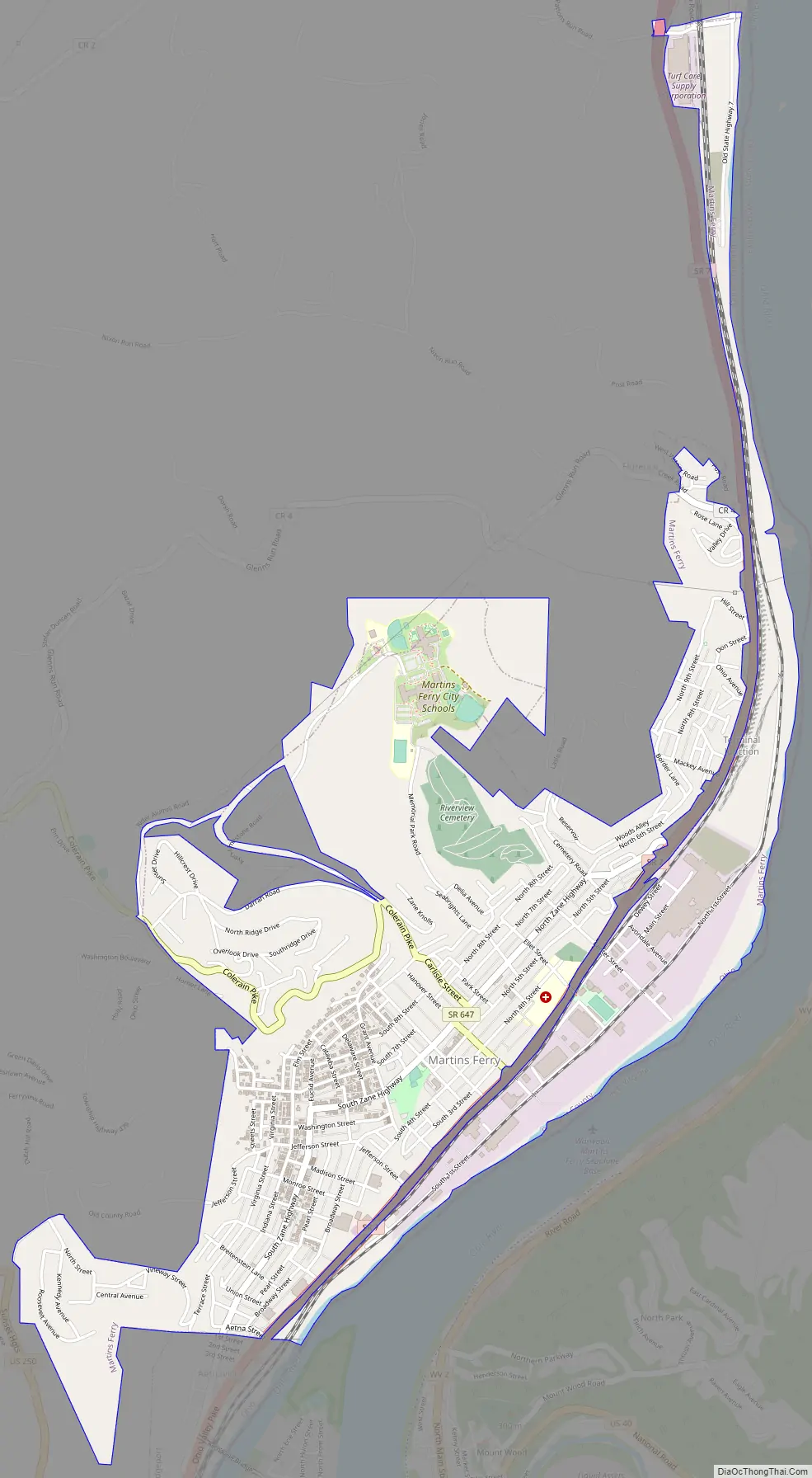
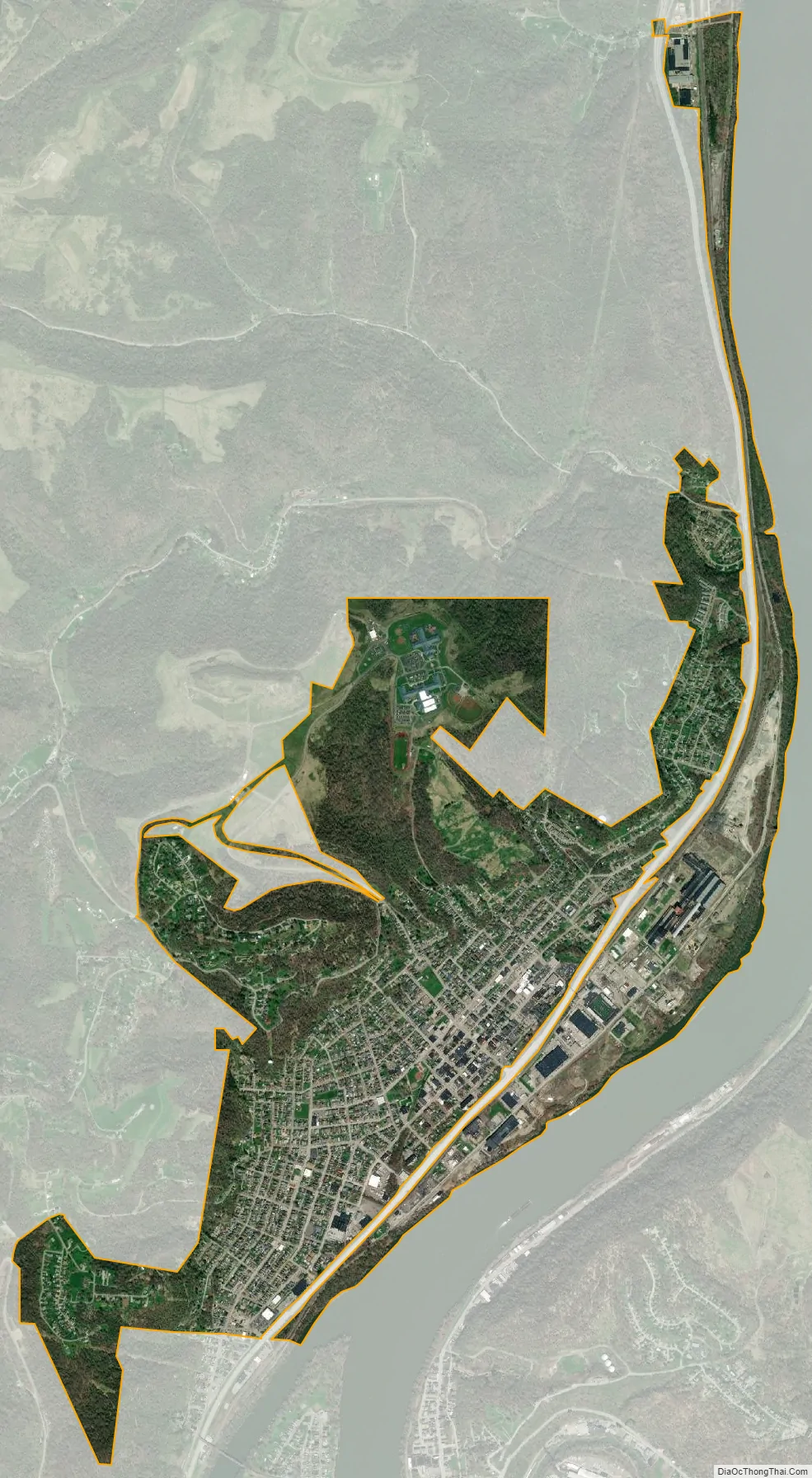
Martins Ferry city Satellite Map
Geography
Martins Ferry is at 40°5′57″N 80°43′31″W / 40.09917°N 80.72528°W / 40.09917; -80.72528 (40.099122, -80.725154).
According to the United States Census Bureau, the city has a total area of 2.33 square miles (6.03 km), all land.
The town is built on two basic plateaus between a hill and the Ohio River. The lower plateau, along the river, is dominated by a large industrial park, the Martins Ferry Football Stadium, and Ohio State Route 7 (a four-lane traffic artery that runs from north to south across eastern Ohio). The higher plateau, which is the larger of the two, is predominantly residential and commercial, and is home to most of the city’s residents. It gradually rises to a steep hillside in the west that forms a natural wall.
Directly across the river lies the city of Wheeling, West Virginia, and to the east is the Pennsylvania state line. The city of Columbus is 125 miles (201 km) to the west, and Pittsburgh is 59 miles (95 km) northeast of the city. On the southern end of town, Martins Ferry is directly connected to the village of Bridgeport.
See also
Map of Ohio State and its subdivision:- Adams
- Allen
- Ashland
- Ashtabula
- Athens
- Auglaize
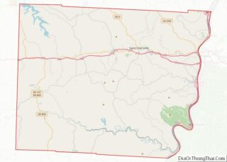
- Belmont
- Brown
- Butler
- Carroll
- Champaign
- Clark
- Clermont
- Clinton
- Columbiana
- Coshocton
- Crawford
- Cuyahoga
- Darke
- Defiance
- Delaware
- Erie
- Fairfield
- Fayette
- Franklin
- Fulton
- Gallia
- Geauga
- Greene
- Guernsey
- Hamilton
- Hancock
- Hardin
- Harrison
- Henry
- Highland
- Hocking
- Holmes
- Huron
- Jackson
- Jefferson
- Knox
- Lake
- Lake Erie
- Lawrence
- Licking
- Logan
- Lorain
- Lucas
- Madison
- Mahoning
- Marion
- Medina
- Meigs
- Mercer
- Miami
- Monroe
- Montgomery
- Morgan
- Morrow
- Muskingum
- Noble
- Ottawa
- Paulding
- Perry
- Pickaway
- Pike
- Portage
- Preble
- Putnam
- Richland
- Ross
- Sandusky
- Scioto
- Seneca
- Shelby
- Stark
- Summit
- Trumbull
- Tuscarawas
- Union
- Van Wert
- Vinton
- Warren
- Washington
- Wayne
- Williams
- Wood
- Wyandot
- Alabama
- Alaska
- Arizona
- Arkansas
- California
- Colorado
- Connecticut
- Delaware
- District of Columbia
- Florida
- Georgia
- Hawaii
- Idaho
- Illinois
- Indiana
- Iowa
- Kansas
- Kentucky
- Louisiana
- Maine
- Maryland
- Massachusetts
- Michigan
- Minnesota
- Mississippi
- Missouri
- Montana
- Nebraska
- Nevada
- New Hampshire
- New Jersey
- New Mexico
- New York
- North Carolina
- North Dakota
- Ohio
- Oklahoma
- Oregon
- Pennsylvania
- Rhode Island
- South Carolina
- South Dakota
- Tennessee
- Texas
- Utah
- Vermont
- Virginia
- Washington
- West Virginia
- Wisconsin
- Wyoming