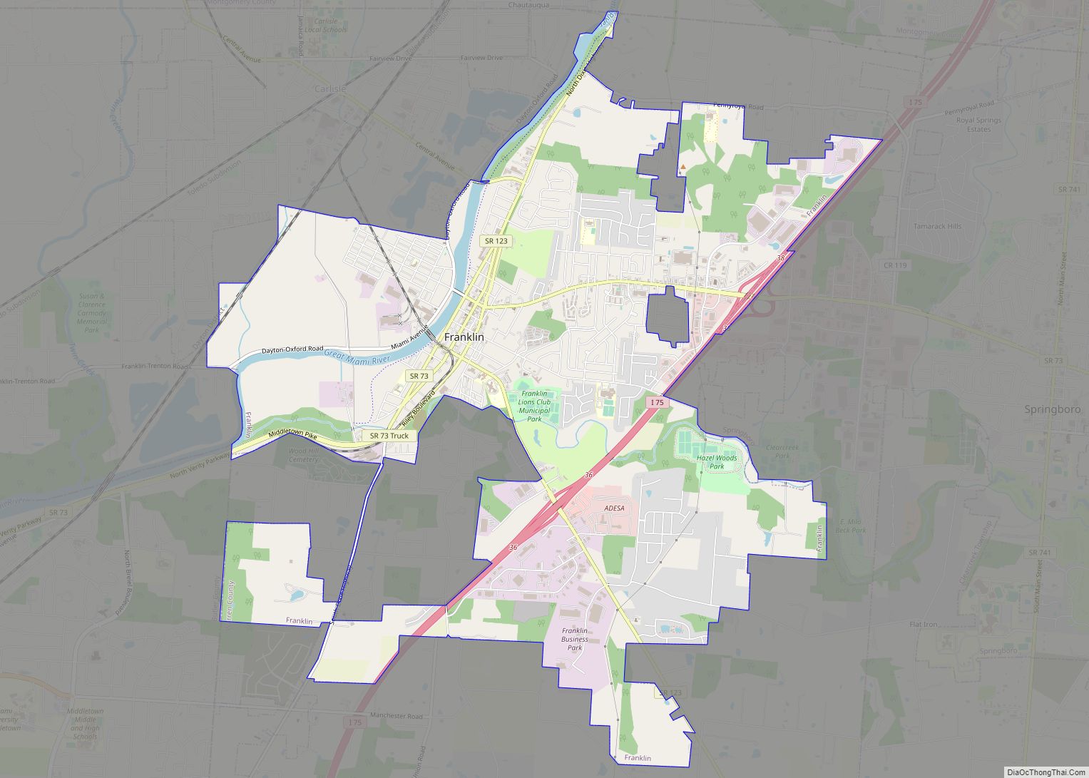
Mason is a city in southwestern Warren County, Ohio, United States, approximately 22 miles (35 km) north of downtown Cincinnati. As of the 2020 census, Mason’s population was 34,792. It is home to Kings Island amusement park and one of the largest tennis stadiums in the world, the Lindner Family Tennis Center, home of the Western & Southern Open, one of the world’s top tennis tournaments for both men and women.
| Name: | Mason city |
|---|---|
| LSAD Code: | 25 |
| LSAD Description: | city (suffix) |
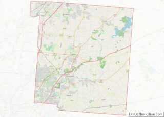
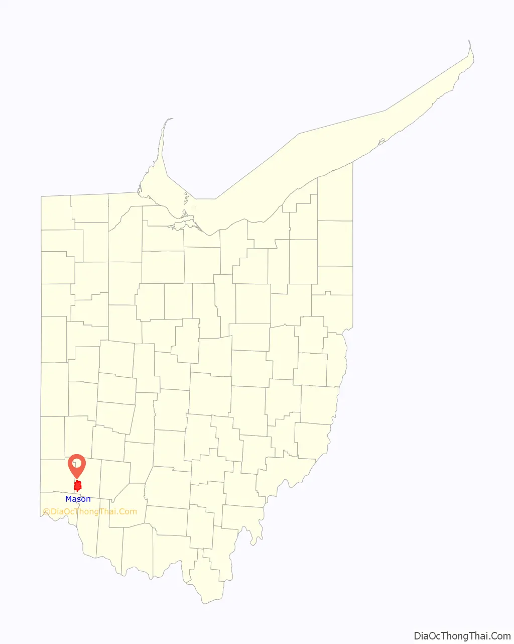
| State: | Ohio |
| County: | Warren County |
| Elevation: | 810 ft (247 m) |
| Total Area: | 19.28 sq mi (49.93 km²) |
| Land Area: | 19.26 sq mi (49.89 km²) |
| Water Area: | 0.02 sq mi (0.04 km²) |
| Total Population: | 34,792 |
| Population Density: | 1,806.25/sq mi (697.41/km²) |
| ZIP code: | 45040 |
| Area code: | 513 |
| FIPS code: | 3948188 |
| GNISfeature ID: | 1061481 |
| Website: | imaginemason.org |
Online Interactive Map
Click on ![]() to view map in "full screen" mode.
to view map in "full screen" mode.
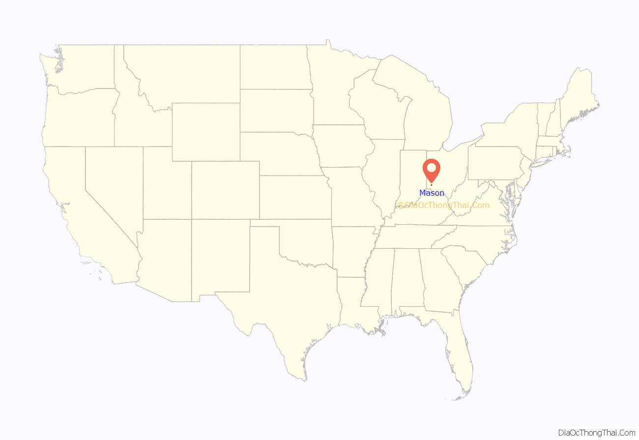
Mason location map. Where is Mason city?
History
On June 1, 1803, Revolutionary War veteran William Mason paid $1,700 at auction to purchase 640 acres (2.6 km) of land in what is now downtown Mason. In 1815, he platted 16 lots on this land and named the village “Narnia.” In 1832, two years after the death of William Mason, more than 40 additional lots were platted on the north, south, and west of Narnia, according to his will. When the plat was officially recorded, the name of the village was listed as “Palmyra.”
In 1835, a petition was sent to the federal post office to correct the name of the town. The town had been listed as Kirkwood, possibly an error because the postmaster at the time was named William Kirkwood. When village officials were informed that there was another Palmyra in Ohio, the name was officially changed to “Mason.”
Mason remained a small farming community for another 125 years. In 1970, a year before the town was incorporated to become a city, there were fewer than 5,700 residents.
In February 1997, Mason withdrew from surrounding Deerfield Township by forming a paper township called Mason Township.
On October 25, 2021, Mason City Council passed an ordinance to criminalize abortions within the city limits by a vote of 4 to 3. No abortion providers currently operate within the city limits. The ordinance was later repealed.
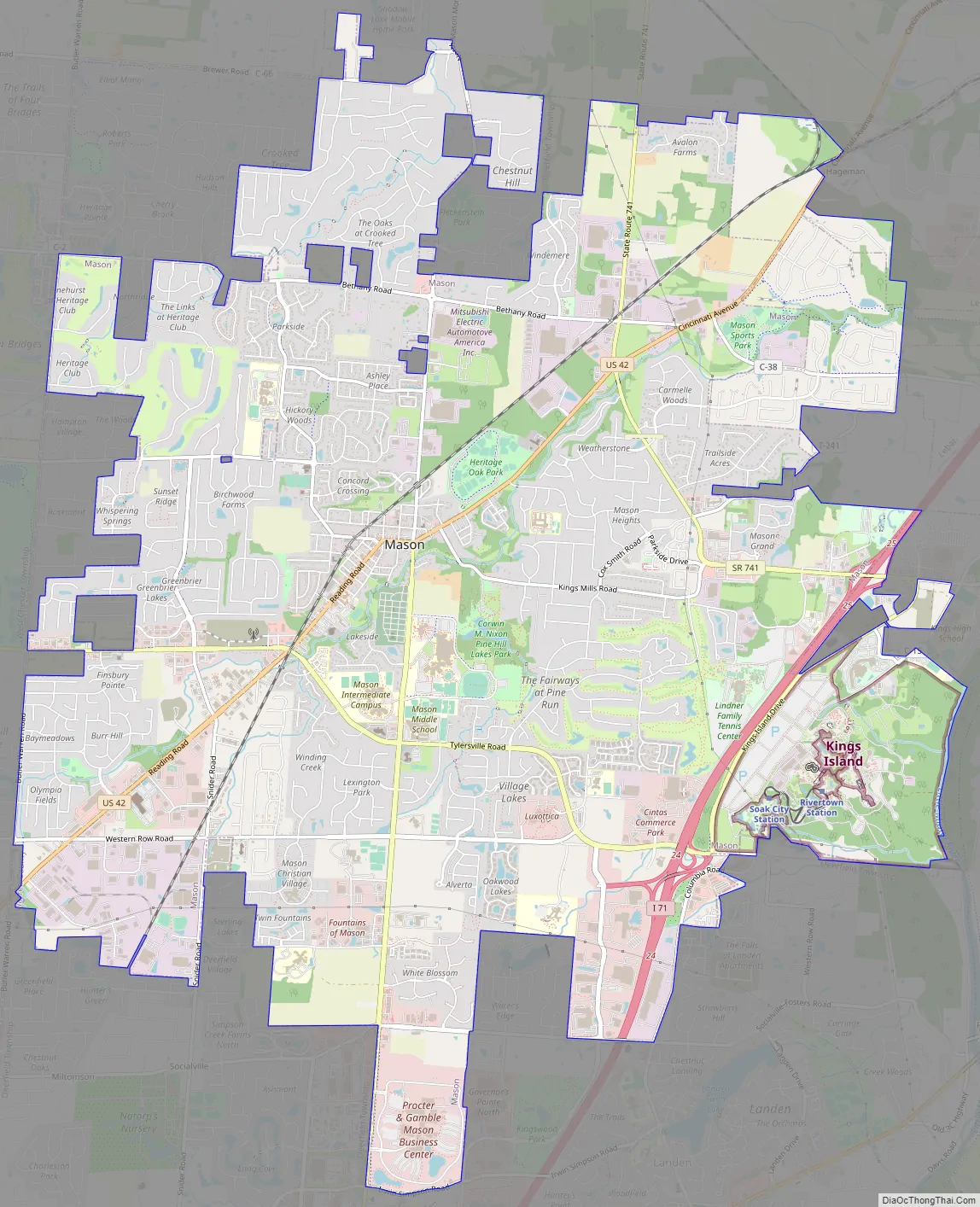
Mason Road Map
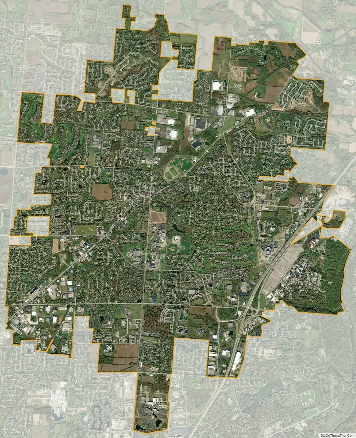
Mason city Satellite Map
Geography
According to the United States Census Bureau, the city has a total area of 18.67 square miles (48.36 km), of which 18.63 square miles (48.25 km) is land and 0.04 square miles (0.10 km) is water.
Climate
See also
Map of Ohio State and its subdivision:- Adams
- Allen
- Ashland
- Ashtabula
- Athens
- Auglaize
- Belmont
- Brown
- Butler
- Carroll
- Champaign
- Clark
- Clermont
- Clinton
- Columbiana
- Coshocton
- Crawford
- Cuyahoga
- Darke
- Defiance
- Delaware
- Erie
- Fairfield
- Fayette
- Franklin
- Fulton
- Gallia
- Geauga
- Greene
- Guernsey
- Hamilton
- Hancock
- Hardin
- Harrison
- Henry
- Highland
- Hocking
- Holmes
- Huron
- Jackson
- Jefferson
- Knox
- Lake
- Lake Erie
- Lawrence
- Licking
- Logan
- Lorain
- Lucas
- Madison
- Mahoning
- Marion
- Medina
- Meigs
- Mercer
- Miami
- Monroe
- Montgomery
- Morgan
- Morrow
- Muskingum
- Noble
- Ottawa
- Paulding
- Perry
- Pickaway
- Pike
- Portage
- Preble
- Putnam
- Richland
- Ross
- Sandusky
- Scioto
- Seneca
- Shelby
- Stark
- Summit
- Trumbull
- Tuscarawas
- Union
- Van Wert
- Vinton
- Warren
- Washington
- Wayne
- Williams
- Wood
- Wyandot
- Alabama
- Alaska
- Arizona
- Arkansas
- California
- Colorado
- Connecticut
- Delaware
- District of Columbia
- Florida
- Georgia
- Hawaii
- Idaho
- Illinois
- Indiana
- Iowa
- Kansas
- Kentucky
- Louisiana
- Maine
- Maryland
- Massachusetts
- Michigan
- Minnesota
- Mississippi
- Missouri
- Montana
- Nebraska
- Nevada
- New Hampshire
- New Jersey
- New Mexico
- New York
- North Carolina
- North Dakota
- Ohio
- Oklahoma
- Oregon
- Pennsylvania
- Rhode Island
- South Carolina
- South Dakota
- Tennessee
- Texas
- Utah
- Vermont
- Virginia
- Washington
- West Virginia
- Wisconsin
- Wyoming