Map of Masury CDP

Map of Masury CDP

Masury is an unincorporated community and census-designated place in eastern Trumbull County, Ohio, United States. The population was 2,001 at the 2020 census. It is part of the Youngstown–Warren metropolitan area. Masury CDP overview: Name: Masury CDP LSAD Code: 57 LSAD Description: CDP (suffix) State: Ohio County: Trumbull County Elevation: 919 ft (280 m) Total Area: 3.48 sq mi … Read more

Map of McCutchenville CDP

Map of McCutchenville CDP

McCutchenville is a census-designated place (CDP) in northern Tymochtee Township, Wyandot County, Ohio, United States. It has a post office with the ZIP code 44844. It lies at the intersection of State Routes 53 and 587. McCutchenville CDP overview: Name: McCutchenville CDP LSAD Code: 57 LSAD Description: CDP (suffix) State: Ohio County: Seneca County, Wyandot … Read more

Map of McConnelsville village

Map of McConnelsville village

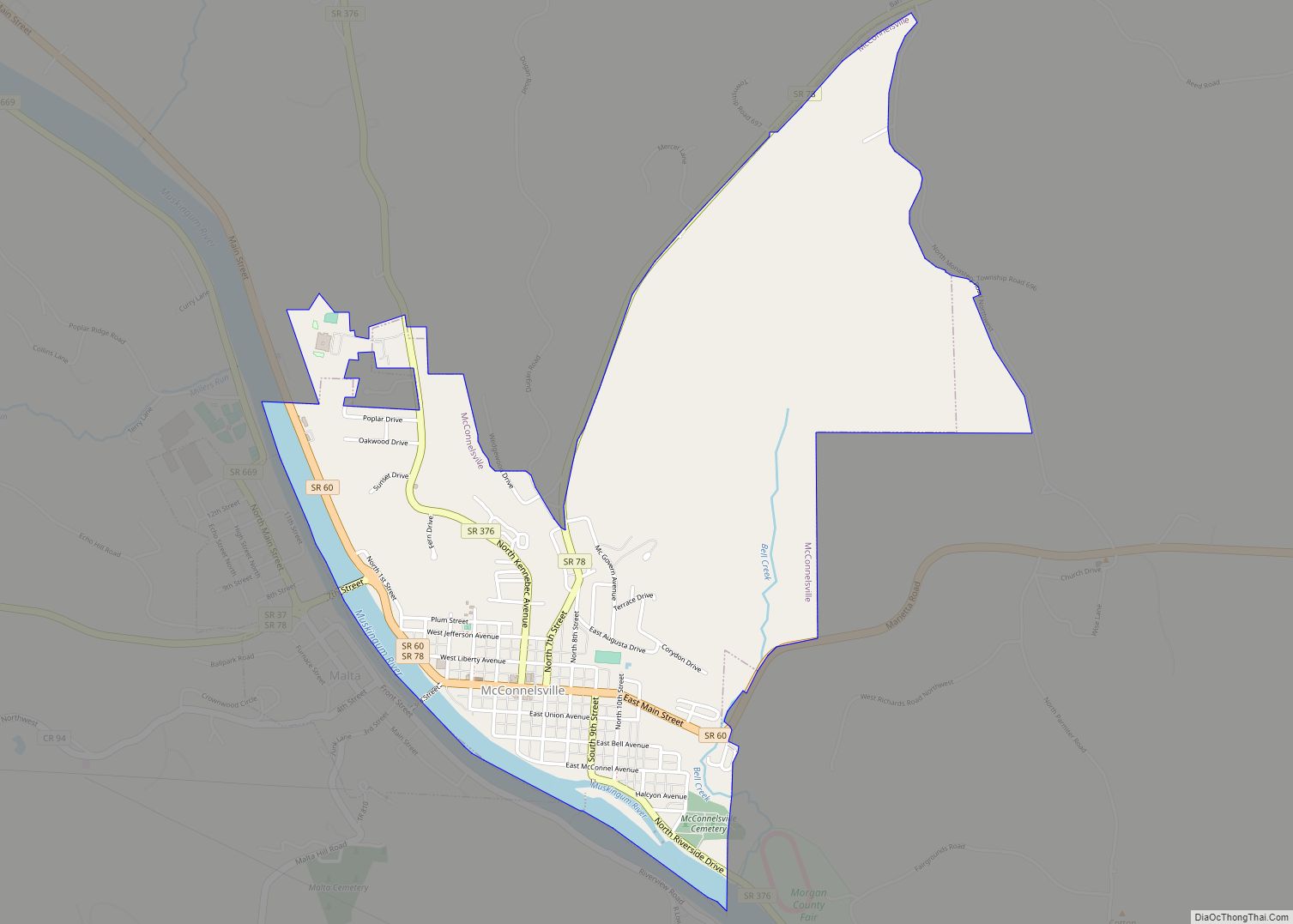
McConnelsville is a village in and the county seat of Morgan County, Ohio, United States, on the east bank of the Muskingum River. Located 21 miles (34 km) southeast of Zanesville and 26 miles (42 km) northwest of Marietta, the population was 1,667 at the 2020 census. McConnelsville village overview: Name: McConnelsville village LSAD Code: 47 LSAD … Read more

Map of McComb village, Ohio

Map of McComb village, Ohio

McComb is a village in Hancock County, Ohio, United States. The population was 1,648 at the time of the 2010 census. The village holds one school district, McComb Local School District and is the largest village in Hancock County. McComb village overview: Name: McComb village LSAD Code: 47 LSAD Description: village (suffix) State: Ohio County: … Read more

Map of McClure village, Ohio

Map of McClure village, Ohio

McClure is a village in Henry County, Ohio, United States. The population was 725 at the 2010 census. McClure village overview: Name: McClure village LSAD Code: 47 LSAD Description: village (suffix) State: Ohio County: Henry County Elevation: 676 ft (206 m) Total Area: 0.50 sq mi (1.29 km²) Land Area: 0.50 sq mi (1.29 km²) Water Area: 0.00 sq mi (0.00 km²) Total Population: 700 Population … Read more

Map of McArthur village, Ohio

Map of McArthur village, Ohio

McArthur is a village in Vinton County, Ohio, United States. It is located 27 miles southeast of Chillicothe. The population was 1,701 at the 2010 census. It is the county seat of Vinton County. McArthur village overview: Name: McArthur village LSAD Code: 47 LSAD Description: village (suffix) State: Ohio County: Vinton County Elevation: 764 ft (233 m) … Read more

Map of Mayfield village, Ohio

Map of Mayfield village, Ohio

Mayfield (sometimes referred to as Mayfield Village) is a village in eastern Cuyahoga County, Ohio, United States. A suburb of Cleveland, it is part of the Cleveland metropolitan area. The population was 3,356 at the 2020 census. Mayfield village overview: Name: Mayfield village LSAD Code: 47 LSAD Description: village (suffix) State: Ohio County: Cuyahoga County … Read more

Map of Mayfield Heights city

Map of Mayfield Heights city

Mayfield Heights is a city in Cuyahoga County, Ohio, United States. It is an eastern suburb of Cleveland. The population was 20,351 at the 2020 census. Mayfield Heights city overview: Name: Mayfield Heights city LSAD Code: 25 LSAD Description: city (suffix) State: Ohio County: Cuyahoga County Founded: 1920 Incorporated: 1950 Elevation: 1,086 ft (331 m) Total Area: … Read more

Map of Maumee city

Map of Maumee city

Maumee (/mɔːˈmiː/ maw-MEE) is a city in Lucas County, Ohio, United States. Located along the Maumee River, it is about 10 miles southwest of Toledo. The population was 14,286 at the 2010 census. Maumee was declared an All-America City by the National Civic League in June 2006. Maumee city overview: Name: Maumee city LSAD Code: … Read more

Map of Melrose village, Ohio

Map of Melrose village, Ohio

Melrose is a village in Paulding County, Ohio, United States. The population was 275 at the 2010 census. Melrose village overview: Name: Melrose village LSAD Code: 47 LSAD Description: village (suffix) State: Ohio County: Paulding County Elevation: 709 ft (216 m) Total Area: 0.86 sq mi (2.22 km²) Land Area: 0.86 sq mi (2.22 km²) Water Area: 0.00 sq mi (0.00 km²) Total Population: 233 Population … Read more

Map of Melmore CDP

Map of Melmore CDP

Melmore is a census-designated place in central Eden Township, Seneca County, Ohio, United States. It has a post office with the ZIP code 44845. It is located at the intersection of State Routes 67 and 100. Melmore CDP overview: Name: Melmore CDP LSAD Code: 57 LSAD Description: CDP (suffix) State: Ohio County: Seneca County Total … Read more

Map of Medina city, Ohio

Map of Medina city, Ohio

Medina (/mɪˈdaɪnə/ mih-DY-nə) is a city in and the county seat of Medina County, Ohio, United States. The population was 26,094 at the 2020 census. It lies about 33 miles (53 km) south of Cleveland and 23 miles (37 km) west of Akron within the Cleveland metropolitan area. Medina city overview: Name: Medina city LSAD Code: 25 … Read more