Map of McDonald village, Ohio

Map of McDonald village, Ohio

McDonald is a village in southern Trumbull County, Ohio, United States, along the Mahoning River. The population was 3,172 at the 2020 census. It is a suburb of the Youngstown–Warren metropolitan area. McDonald village overview: Name: McDonald village LSAD Code: 47 LSAD Description: village (suffix) State: Ohio County: Trumbull County Elevation: 961 ft (293 m) Total Area: … Read more

Map of McDermott CDP

Map of McDermott CDP

McDermott is a census-designated place in western Rush Township, Scioto County, Ohio, United States. As of the 2010 census it had a population of 434. It has a post office with the ZIP code 45652. McDermott CDP overview: Name: McDermott CDP LSAD Code: 57 LSAD Description: CDP (suffix) State: Ohio County: Scioto County FIPS code: … Read more

Map of Mentor-on-the-Lake city

Map of Mentor-on-the-Lake city

Mentor-on-the-Lake is a city in Lake County, Ohio, United States. The population was 7,131 at the 2020 census. Mentor-on-the-Lake city overview: Name: Mentor-on-the-Lake city LSAD Code: 25 LSAD Description: city (suffix) State: Ohio County: Lake County Elevation: 620 ft (189 m) Total Area: 1.65 sq mi (4.28 km²) Land Area: 1.61 sq mi (4.18 km²) Water Area: 0.04 sq mi (0.10 km²) Total Population: 7,131 Population … Read more

Map of Mendon village, Ohio

Map of Mendon village, Ohio

Mendon is a village in Mercer County, Ohio, United States. The population was 662 at the 2010 census. Mendon village overview: Name: Mendon village LSAD Code: 47 LSAD Description: village (suffix) State: Ohio County: Mercer County Elevation: 820 ft (250 m) Total Area: 0.56 sq mi (1.44 km²) Land Area: 0.55 sq mi (1.41 km²) Water Area: 0.01 sq mi (0.03 km²) Total Population: 628 Population … Read more

Map of Melrose village, Ohio

Map of Melrose village, Ohio

Melrose is a village in Paulding County, Ohio, United States. The population was 275 at the 2010 census. Melrose village overview: Name: Melrose village LSAD Code: 47 LSAD Description: village (suffix) State: Ohio County: Paulding County Elevation: 709 ft (216 m) Total Area: 0.86 sq mi (2.22 km²) Land Area: 0.86 sq mi (2.22 km²) Water Area: 0.00 sq mi (0.00 km²) Total Population: 233 Population … Read more

Map of Melmore CDP

Map of Melmore CDP

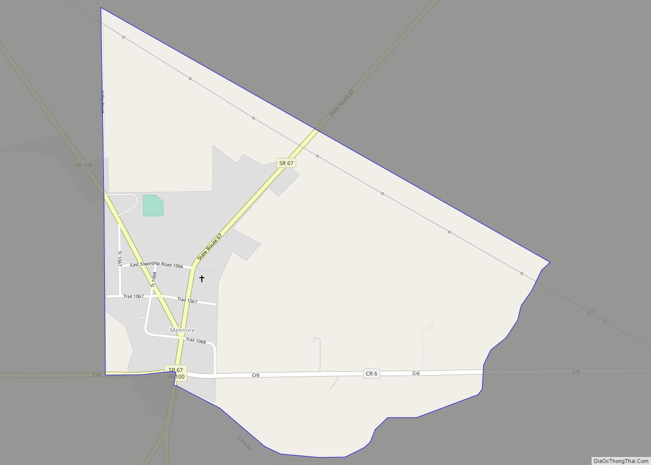
Melmore is a census-designated place in central Eden Township, Seneca County, Ohio, United States. It has a post office with the ZIP code 44845. It is located at the intersection of State Routes 67 and 100. Melmore CDP overview: Name: Melmore CDP LSAD Code: 57 LSAD Description: CDP (suffix) State: Ohio County: Seneca County Total … Read more

Map of Medina city, Ohio

Map of Medina city, Ohio

Medina (/mɪˈdaɪnə/ mih-DY-nə) is a city in and the county seat of Medina County, Ohio, United States. The population was 26,094 at the 2020 census. It lies about 33 miles (53 km) south of Cleveland and 23 miles (37 km) west of Akron within the Cleveland metropolitan area. Medina city overview: Name: Medina city LSAD Code: 25 … Read more

Map of Middlefield village

Map of Middlefield village

Middlefield is a village in Geauga County, Ohio, United States. The population was 2,748 at the 2020 census. It is part of the Cleveland metropolitan area. Middlefield is known for being the center of the world’s fourth largest Amish settlement, and its significant manufacturing base, which includes Gold Key Processing, Inc., Duncan Toys and KraftMaid. … Read more

Map of Middleburg Heights city

Map of Middleburg Heights city

Middleburg Heights is a city and a suburb of Cleveland in Cuyahoga County, Ohio, United States. It is a suburb about 11 miles (18 km) southwest of downtown Cleveland. The population was 16,004 at the 2020 census. Middleburg Heights city overview: Name: Middleburg Heights city LSAD Code: 25 LSAD Description: city (suffix) State: Ohio County: Cuyahoga … Read more

Map of Middle Point village

Map of Middle Point village

Middle Point is a village in Van Wert County, Ohio, United States. The population was 576 at the 2010 census. It is included within the Van Wert, Ohio Micropolitan Statistical Area. Middle Point village overview: Name: Middle Point village LSAD Code: 47 LSAD Description: village (suffix) State: Ohio County: Van Wert County Elevation: 781 ft (238 m) … Read more

Map of Miamiville CDP

Map of Miamiville CDP

Miamiville is an unincorporated community and census-designated place (CDP) in western Miami Township, Clermont County, Ohio, United States, along the Little Miami River and the Loveland Bike Trail. It had a population of 205 at the 2020 census. It has a post office with the ZIP code 45147. Miamiville CDP overview: Name: Miamiville CDP LSAD … Read more

Map of Miamitown CDP

Map of Miamitown CDP

Miamitown is a census-designated place (CDP) in western Whitewater Township, Hamilton County, Ohio, United States. The population was 1,256 at the 2020 census. It has a post office with the ZIP code 45041. Miamitown CDP overview: Name: Miamitown CDP LSAD Code: 57 LSAD Description: CDP (suffix) State: Ohio County: Hamilton County Elevation: 525 ft (160 m) Total … Read more