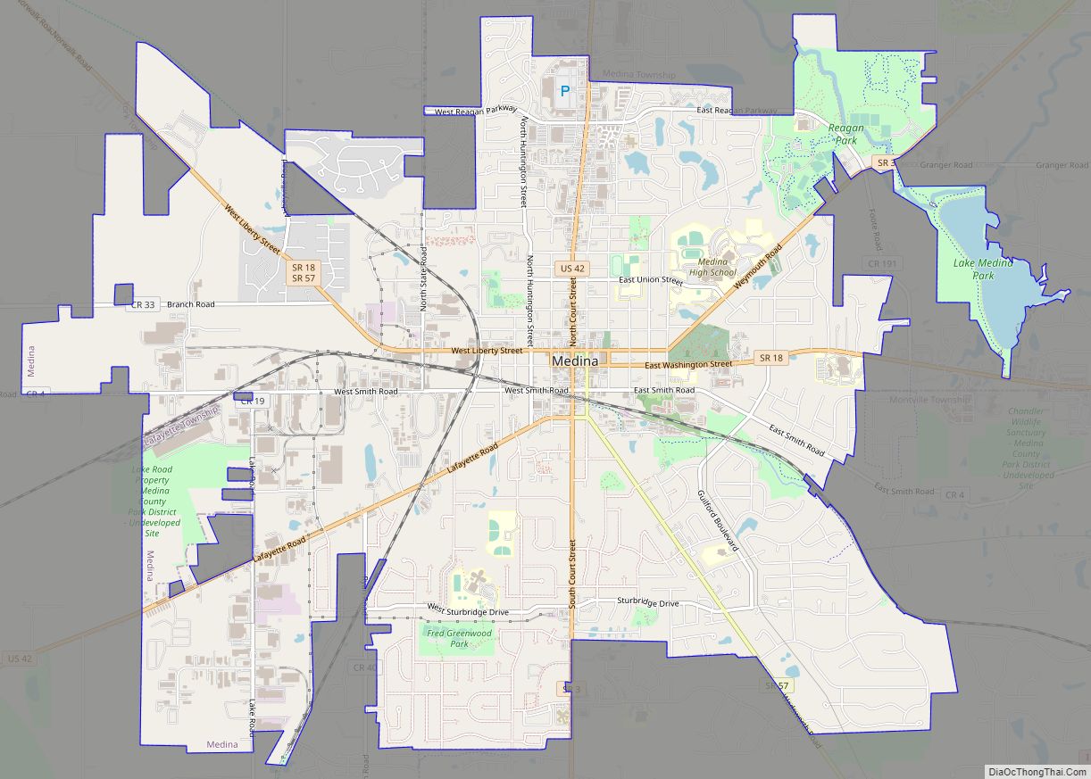
Medina (/mɪˈdaɪnə/ mih-DY-nə) is a city in and the county seat of Medina County, Ohio, United States. The population was 26,094 at the 2020 census. It lies about 33 miles (53 km) south of Cleveland and 23 miles (37 km) west of Akron within the Cleveland metropolitan area.
| Name: | Medina city |
|---|---|
| LSAD Code: | 25 |
| LSAD Description: | city (suffix) |
| State: | Ohio |
| County: | Medina County |
| Founded: | November 30, 1818; 204 years ago (1818-11-30) |
| Incorporated: | January 31, 1835; 188 years ago (1835-01-31) (village) |
| Elevation: | 1,092 ft (333 m) |
| Total Area: | 12.00 sq mi (31.08 km²) |
| Land Area: | 11.79 sq mi (30.54 km²) |
| Water Area: | 0.21 sq mi (0.54 km²) |
| Population Density: | 2,174.50/sq mi (839.575/km²) |
| ZIP code: | 44256, 44258 |
| Area code: | 234, 330 |
| FIPS code: | 3948790 |
| GNISfeature ID: | 1061504 |
| Website: | http://www.medinaoh.org |
Online Interactive Map
Click on ![]() to view map in "full screen" mode.
to view map in "full screen" mode.
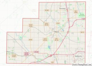
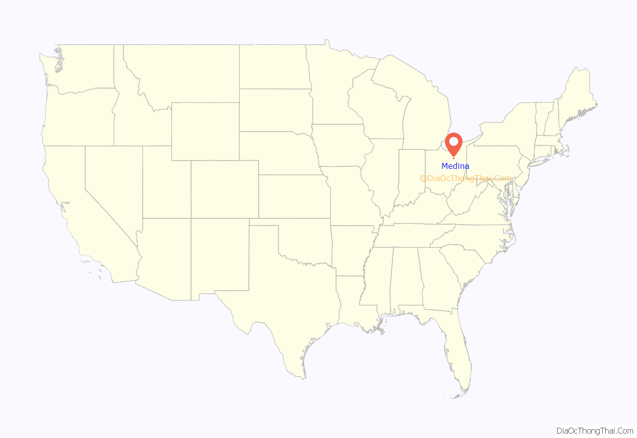
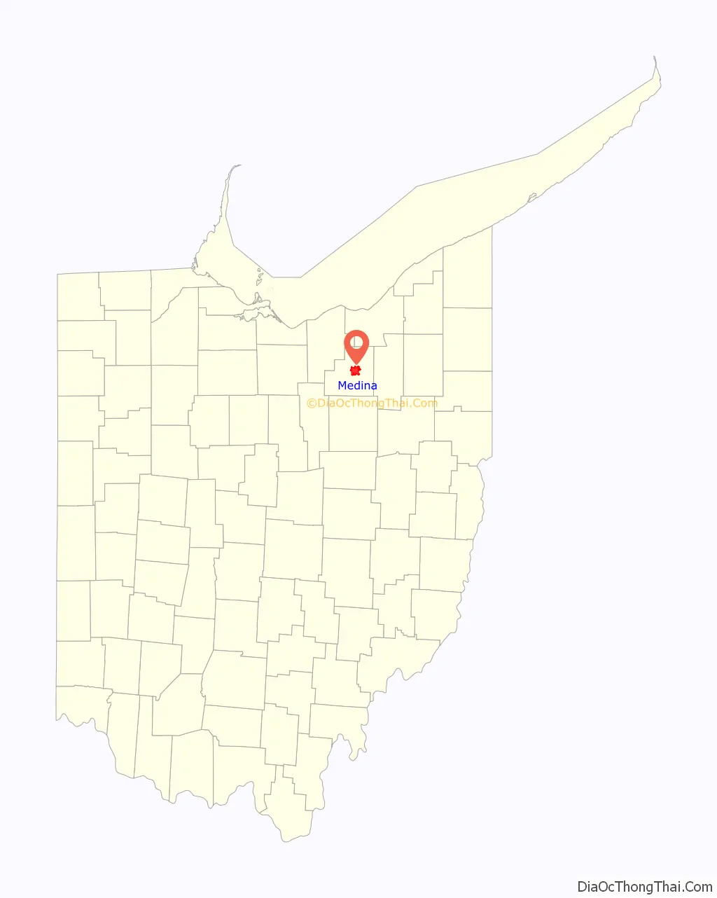
Medina location map. Where is Medina city?
History
Medina was founded on November 30, 1818, as part of the Connecticut Western Reserve. It was originally named Mecca, but an unincorporated community in Ohio already had that name, so the name was changed. Both Mecca and Medina are Saudi Arabian cities particularly significant in Islam.
Most early residents were farmers. In the 1830s, the community’s growth was aided by the completion of the Ohio and Erie Canal, which helped transport agricultural products to markets. On January 31, 1835, Medina was incorporated as a village and as the county seat of Medina County. By 1855, the town’s quarries were producing over $200,000 worth of stone per year. In 1857, many of the canal workers started a strike for higher wages; the striking workers were fired, and the four workers who started it were jailed in Albion, Ohio.
In 1835, two enslaved women and two Native Americans arrived in Medina by stagecoach. One of the enslaved women was the child of then-Vice Presidential candidate Richard Mentor Johnson and Julia Chinn. The next day, Johnson’s nephew arrived, in pursuit of the women, saying that he owned them both, they had escaped, and they had stolen a $1,000 bank check. The women were arrested and charged with stealing. Three local attorneys volunteered to represent them in court. The women were then released to Johnson’s nephew to stand trial in Kentucky. Afterward, one of the Native Americans said that the women had asked for help escaping enslavement and their terrible treatment by their owners. It was later found that the alleged theft was a lie in order to make sure the Ohio court returned them to their owners.
Medina attorney Charles Olcott invented self-ballasting iron ships, and received a patent in 1835. Olcott was originally from Connecticut and had been a student at Yale College when he came up with the early prototypes for his invention. He was later a proponent of building long-distance railroad lines across Ohio.
In 1869, Amos Root founded the A.I. Root Company in Medina as a manufacturer of beehives and beekeeping equipment, and the town became a center for beehive manufacturing. The Root Company had 97 workers in 1886, making it the town’s largest employer.
In the mid-1800s, two disastrous fires hit the village. One, in 1848, destroyed the entire business district. With no facilities for extinguishing fires, the residents attempted to put out the fire using a bucket brigade, but to no avail, as the fire burned for four hours. None of the town’s 1,159 residents died in the fire, but the townspeople failed to budget for the needed firefighting equipment. In 1870, another large fire, which started in a wooden building with a barbershop, destroyed 45 buildings (all but two blocks of the business district) and nearly wiped out the town. Despite the second calamitous fire, the town still had not organized a fire department beyond a bucket brigade. In 1877, after repeated dire warnings, the Council finally authorized the issuance of $3,000 worth of bonds to purchase a fire engine.
After the disastrous 1870 fire, the town literally rose from the ashes. Much of the Medina Square, including the Town Hall and Engine House, was rebuilt under the supervision of onetime mayor and banker Harrison Gray Blake, who owned the Phoenix Building in the same city block. Buildings like the H. G. Blake’s Phoenix Block and the Town Hall and Engine House indicate the community’s resilient spirit.
After the 1870 fire, it took almost ten years to replace the buildings on the Square, hence their common Victorian style. Even today, the architectural unity and historic flavor of the Town Square make Medina an appealing destination for residents, visitors and tourists. This character is what makes the Square a recognized Historic District and spurs the efforts of the Community Design Committee and the Historic Preservation Board to preserve the city’s historic look and feel.
Today, Medina’s Historic District is a nine-block area surrounding Uptown Park and hosts Candlelight Walk, the International Festival, and Art in the Park. It also draws visitors for many other events.
In 1950, Medina had over 5,000 residents, and on May 6, 1952, it was chartered as a city.
Medina Road Map

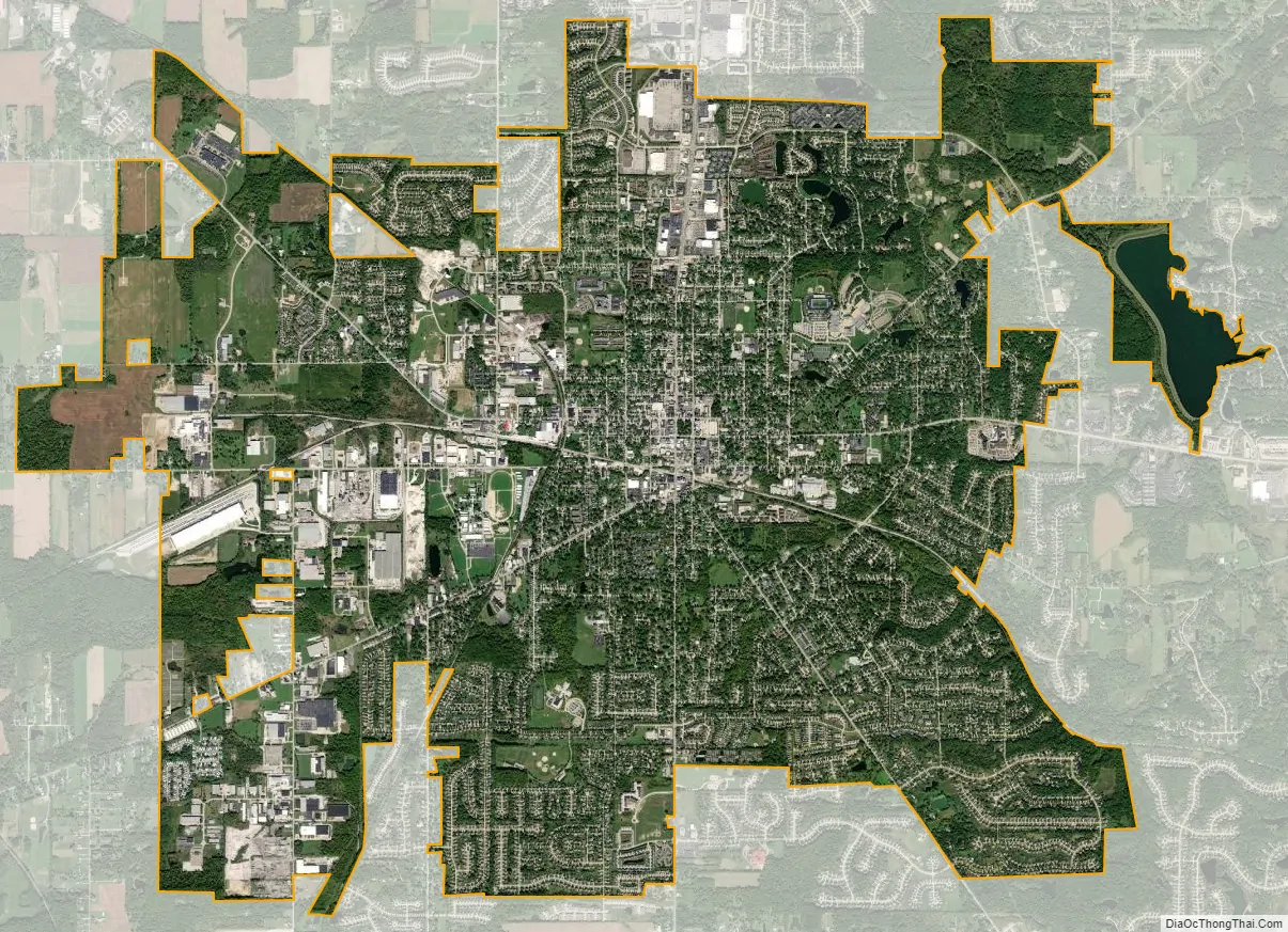
Medina city Satellite Map
Geography
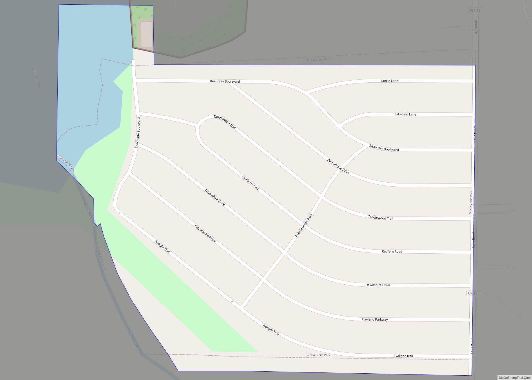
Medina is located at 41°8′9″N 81°51′51″W / 41.13583°N 81.86417°W / 41.13583; -81.86417 (41.135899, -81.864069). and includes parts of Lafayette Township, Medina Township, Montville Township and York Township in Medina County.
According to the United States Census Bureau, the city has an area of 12 square miles (31.08 km), of which 11.8 square miles (30.56 km) is land and 0.2 square miles (0.52 km) is water.
See also
Map of Ohio State and its subdivision:- Adams
- Allen
- Ashland
- Ashtabula
- Athens
- Auglaize
- Belmont
- Brown
- Butler
- Carroll
- Champaign
- Clark
- Clermont
- Clinton
- Columbiana
- Coshocton
- Crawford
- Cuyahoga
- Darke
- Defiance
- Delaware
- Erie
- Fairfield
- Fayette
- Franklin
- Fulton
- Gallia
- Geauga
- Greene
- Guernsey
- Hamilton
- Hancock
- Hardin
- Harrison
- Henry
- Highland
- Hocking
- Holmes
- Huron
- Jackson
- Jefferson
- Knox
- Lake
- Lake Erie
- Lawrence
- Licking
- Logan
- Lorain
- Lucas
- Madison
- Mahoning
- Marion
- Medina
- Meigs
- Mercer
- Miami
- Monroe
- Montgomery
- Morgan
- Morrow
- Muskingum
- Noble
- Ottawa
- Paulding
- Perry
- Pickaway
- Pike
- Portage
- Preble
- Putnam
- Richland
- Ross
- Sandusky
- Scioto
- Seneca
- Shelby
- Stark
- Summit
- Trumbull
- Tuscarawas
- Union
- Van Wert
- Vinton
- Warren
- Washington
- Wayne
- Williams
- Wood
- Wyandot
- Alabama
- Alaska
- Arizona
- Arkansas
- California
- Colorado
- Connecticut
- Delaware
- District of Columbia
- Florida
- Georgia
- Hawaii
- Idaho
- Illinois
- Indiana
- Iowa
- Kansas
- Kentucky
- Louisiana
- Maine
- Maryland
- Massachusetts
- Michigan
- Minnesota
- Mississippi
- Missouri
- Montana
- Nebraska
- Nevada
- New Hampshire
- New Jersey
- New Mexico
- New York
- North Carolina
- North Dakota
- Ohio
- Oklahoma
- Oregon
- Pennsylvania
- Rhode Island
- South Carolina
- South Dakota
- Tennessee
- Texas
- Utah
- Vermont
- Virginia
- Washington
- West Virginia
- Wisconsin
- Wyoming