Parma is a city in Cuyahoga County, Ohio, United States, located on the southern edge of Cleveland. As of the 2020 census, its population was 81,146. Parma is the seventh largest city in the state of Ohio, the largest suburb in the state, and the second largest city in Cuyahoga County after Cleveland. Parma city ... Read more
Ohio Cities and Places
Parma Heights is a city in Cuyahoga County, Ohio, United States and a western suburb of Cleveland. Parma Heights is surrounded on the north, east and south by the larger city of Parma. The cities of Brook Park and Middleburg Heights form most of the western border. The city’s population is 20,718 as of the ... Read more
Parkman is a census-designated place in southern Parkman Township, Geauga County, Ohio, United States. It has a post office with the ZIP code 44080. It lies along U.S. Route 422 at its intersection with State Routes 88, 168, and 528. Parkman CDP overview: Name: Parkman CDP LSAD Code: 57 LSAD Description: CDP (suffix) State: Ohio ... Read more
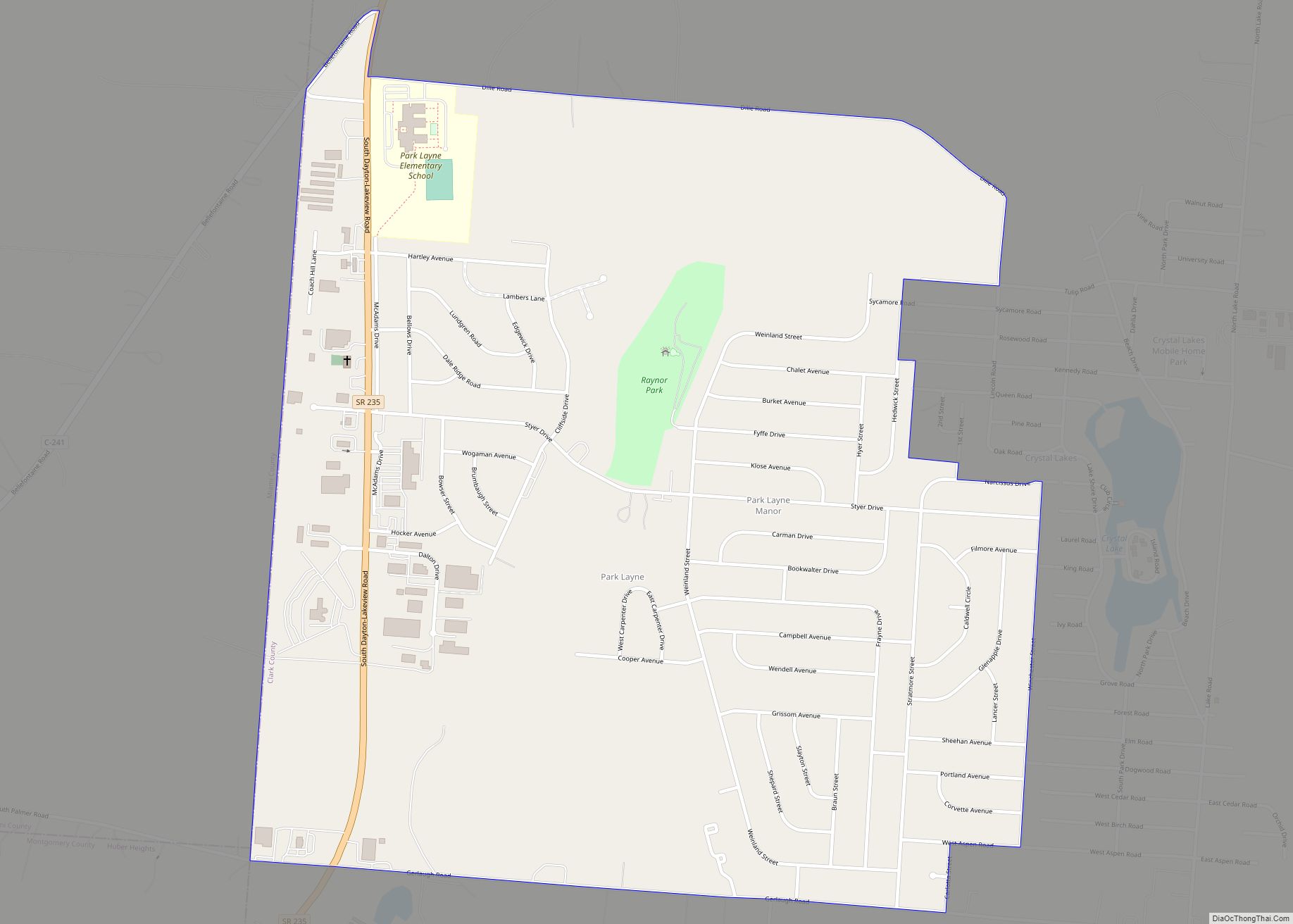
Park Layne is a census-designated place (CDP) in Clark County, Ohio, United States. The area is also referred to as Park Layne Manor. The population of the CDP was 4,343 at the 2010 census. It is part of the Springfield, Ohio Metropolitan Statistical Area. At 9:17 pm on May 24, 2017, an EF1 tornado touched ... Read more
Pandora is a village in Putnam County, Ohio, United States, located on the Riley Creek. The population was 1,153 at the 2010 census. Pandora village overview: Name: Pandora village LSAD Code: 47 LSAD Description: village (suffix) State: Ohio County: Putnam County Elevation: 774 ft (236 m) Total Area: 1.08 sq mi (2.81 km²) Land Area: 1.07 sq mi (2.76 km²) Water Area: 0.02 sq mi ... Read more
Perry is a village in Lake County, Ohio, United States. The population was 1,663 at the 2010 census. Perry village overview: Name: Perry village LSAD Code: 47 LSAD Description: village (suffix) State: Ohio County: Lake County Elevation: 699 ft (213 m) Total Area: 2.27 sq mi (5.88 km²) Land Area: 2.27 sq mi (5.88 km²) Water Area: 0.00 sq mi (0.00 km²) Total Population: 1,602 Population ... Read more
Perry Heights is a census-designated place (CDP) in Stark County, Ohio, United States. The population was 8,900 at the 2000 census. It is part of the Canton-Massillon, OH Metropolitan Statistical Area. It was originally known as Genoa. Perry Heights CDP overview: Name: Perry Heights CDP LSAD Code: 57 LSAD Description: CDP (suffix) State: Ohio County: ... Read more
Pepper Pike is a city in eastern Cuyahoga County, Ohio, United States. It is a suburb of Cleveland. The population was 6,796 as of the 2020 census. Pepper Pike city overview: Name: Pepper Pike city LSAD Code: 25 LSAD Description: city (suffix) State: Ohio County: Cuyahoga County Elevation: 1,056 ft (322 m) Total Area: 7.15 sq mi (18.53 km²) Land ... Read more
Peninsula is a village in Summit County, Ohio, United States. The population was 565 at the 2010 census. It is part of the Akron Metropolitan Statistical Area. Peninsula is in the middle of the Cuyahoga Valley National Park, which provides a source of tourism to the village. Blossom Music Center is located on its outskirts. ... Read more
Pemberville is a village located on the banks of the Portage River in Wood County, Ohio, United States. The population was 1,371 at the 2010 census. Pemberville village overview: Name: Pemberville village LSAD Code: 47 LSAD Description: village (suffix) State: Ohio County: Wood County Elevation: 650 ft (198 m) Total Area: 1.20 sq mi (3.10 km²) Land Area: 1.20 sq mi (3.10 km²) ... Read more
Peebles is a village in Meigs Township, Adams County, Ohio, United States. It is sixty-four miles east of Cincinnati. The population was 1,774 at the 2020 census. Peebles village overview: Name: Peebles village LSAD Code: 47 LSAD Description: village (suffix) State: Ohio County: Adams County Elevation: 827 ft (252 m) Total Area: 1.21 sq mi (3.14 km²) Land Area: 1.21 sq mi ... Read more
Pheasant Run is an unincorporated community and census-designated place in Lorain County, Ohio, United States. Its population was 1,397 as of the 2010 census. Pheasant Run CDP overview: Name: Pheasant Run CDP LSAD Code: 57 LSAD Description: CDP (suffix) State: Ohio County: Lorain County Elevation: 833 ft (254 m) Total Area: 0.97 sq mi (2.51 km²) Land Area: 0.93 sq mi (2.42 km²) ... Read more