Map of Plymouth village, Ohio
Plymouth is a village in Huron and Richland counties in the U.S. state of Ohio. The population was 1,857 at the 2010 census. The Richland County portion of Plymouth is part of the Mansfield Metropolitan Statistical Area, while the Huron County portion is part of the Norwalk Micropolitan Statistical Area. Plymouth village overview: Name: Plymouth ... Read more
Map of Plymouth village, Ohio
Map of Portage village, Ohio
Portage is a village in Wood County, Ohio, United States. The population was 438 at the 2010 census. Portage village overview: Name: Portage village LSAD Code: 47 LSAD Description: village (suffix) State: Ohio County: Wood County Elevation: 686 ft (209 m) Total Area: 1.49 sq mi (3.85 km²) Land Area: 1.49 sq mi (3.85 km²) Water Area: 0.00 sq mi (0.00 km²) Total Population: 398 Population ... Read more
Map of Portage village, Ohio
Map of Portage Lakes CDP
Portage Lakes is a census-designated place (CDP) in Summit County, Ohio, United States. The population was 9,870 at the 2000 census. The city of Green is adjacent to the southeast and Akron on the north. The nearby Portage Lakes of the area include but are not limited to Turkeyfoot Lake, Nimisila Reservoir, Mud Lake, and ... Read more
Map of Portage Lakes CDP
Map of Port William village
Port William is a village in Clinton County, Ohio, United States. The population was 254 at the 2010 census. Port William village overview: Name: Port William village LSAD Code: 47 LSAD Description: village (suffix) State: Ohio County: Clinton County Elevation: 1,020 ft (310 m) Total Area: 0.11 sq mi (0.29 km²) Land Area: 0.11 sq mi (0.28 km²) Water Area: 0.00 sq mi (0.01 km²) Total ... Read more
Map of Port William village
Map of Port Washington village, Ohio
Port Washington is a village in Tuscarawas County, Ohio, United States. The population was 569 at the 2010 census. Port Washington village overview: Name: Port Washington village LSAD Code: 47 LSAD Description: village (suffix) State: Ohio County: Tuscarawas County Elevation: 820 ft (250 m) Total Area: 0.56 sq mi (1.45 km²) Land Area: 0.55 sq mi (1.41 km²) Water Area: 0.01 sq mi (0.04 km²) Total ... Read more
Map of Port Washington village, Ohio
Map of Port Jefferson village, Ohio
Port Jefferson is a village in Salem Township, Shelby County, Ohio, United States. The population was 371 at the 2010 census. Port Jefferson village overview: Name: Port Jefferson village LSAD Code: 47 LSAD Description: village (suffix) State: Ohio County: Shelby County Elevation: 971 ft (296 m) Total Area: 0.15 sq mi (0.40 km²) Land Area: 0.15 sq mi (0.39 km²) Water Area: 0.00 sq mi ... Read more
Map of Port Jefferson village, Ohio
Map of Port Clinton city, Ohio
Port Clinton is a city in and the county seat of Ottawa County, located at the mouth of the Portage River on Lake Erie, about 44 miles east of Toledo. The population was 6,025 at the 2020 census. The city has been nicknamed the “Walleye Capital of the World”, due to the productive fishing waters ... Read more
Map of Port Clinton city, Ohio
Map of Pomeroy village, Ohio
Pomeroy (/ˈpʌmrɔɪ/ PUM-roy) is a village in and the county seat of Meigs County, Ohio, United States, along the Ohio River about 21 miles (34 km) south of Athens. The population was 1,573 at the 2020 census. Pomeroy village overview: Name: Pomeroy village LSAD Code: 47 LSAD Description: village (suffix) State: Ohio County: Meigs County Elevation: ... Read more
Map of Pomeroy village, Ohio
Map of Polk village, Ohio
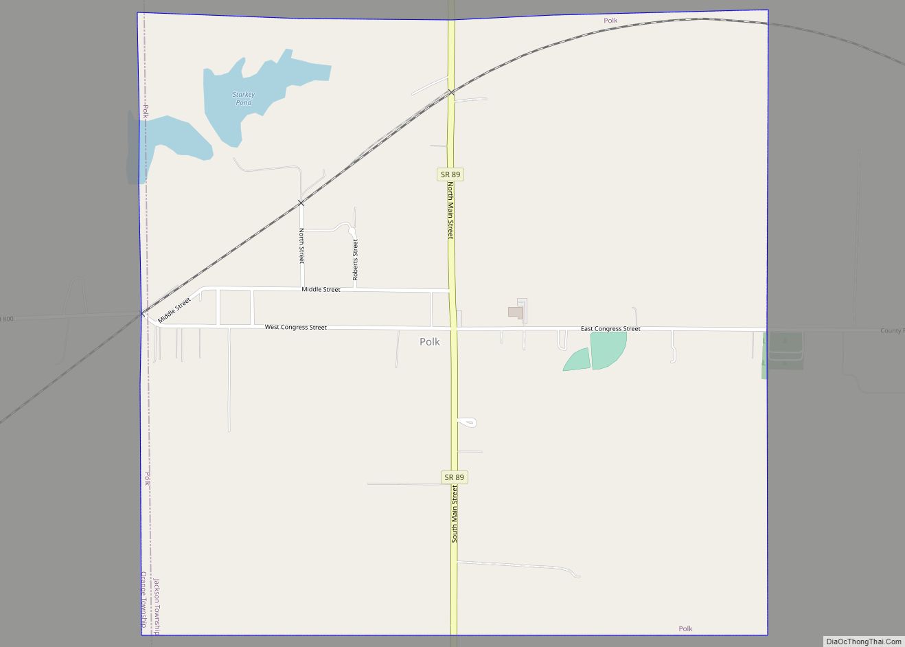
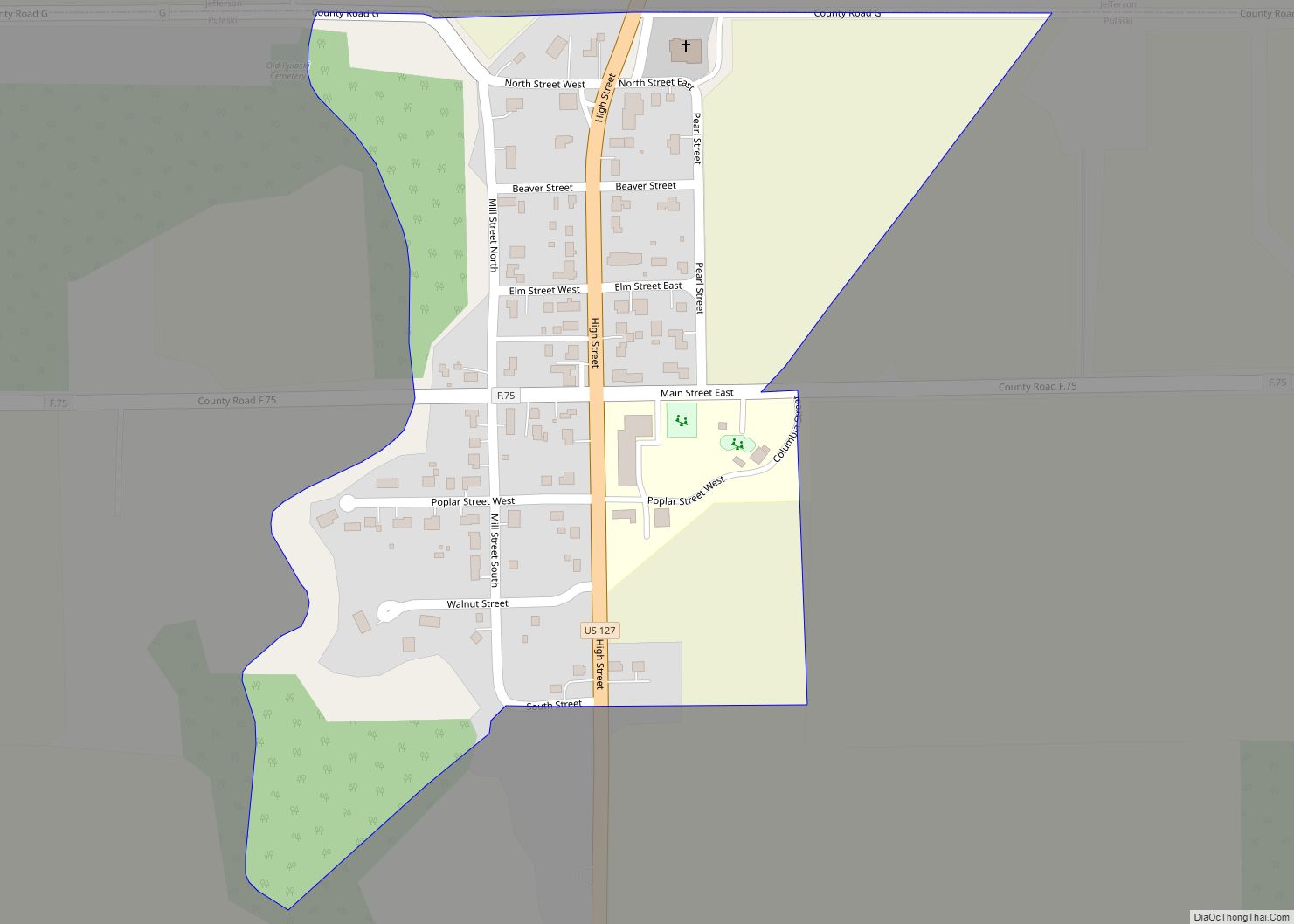
Polk is a village in Ashland County, Ohio, United States. The population was 310 at the 2020 census. Polk village overview: Name: Polk village LSAD Code: 47 LSAD Description: village (suffix) State: Ohio County: Ashland County Elevation: 1,270 ft (387 m) Total Area: 1.04 sq mi (2.68 km²) Land Area: 1.01 sq mi (2.62 km²) Water Area: 0.02 sq mi (0.06 km²) Total Population: 310 Population ... Read more
Map of Polk village, Ohio
Map of Pulaski CDP, Ohio
Pulaski is a census-designated place in Williams County, in the U.S. state of Ohio. Pulaski CDP overview: Name: Pulaski CDP LSAD Code: 57 LSAD Description: CDP (suffix) State: Ohio County: Williams County FIPS code: 3964906 Online Interactive Map Pulaski online map. Source: Basemap layers from Google Map, Open Street Map (OSM), Arcgisonline, Wmflabs. Boundary Data ... Read more
Map of Pulaski CDP, Ohio
Map of Prospect village, Ohio
Prospect is a village in Marion County, Ohio, United States. The population was 1,112 at the 2010 census. The village is served by Elgin Local School District. Prospect has a public library, a branch of Marion Public Library. Prospect village overview: Name: Prospect village LSAD Code: 47 LSAD Description: village (suffix) State: Ohio County: Marion ... Read more
Map of Prospect village, Ohio
Map of Proctorville village, Ohio
Proctorville is a village in Lawrence County, Ohio, United States, along the Ohio River. The population was 574 at the 2010 census. The East End Bridge connects Proctorville to Huntington, West Virginia across the Ohio River. Proctorville is a part of the Huntington–Ashland, WV–KY–OH, Metropolitan Statistical Area (MSA). As of the 2000 census, the MSA ... Read more
Map of Proctorville village, Ohio