Map of Prospect village, Ohio
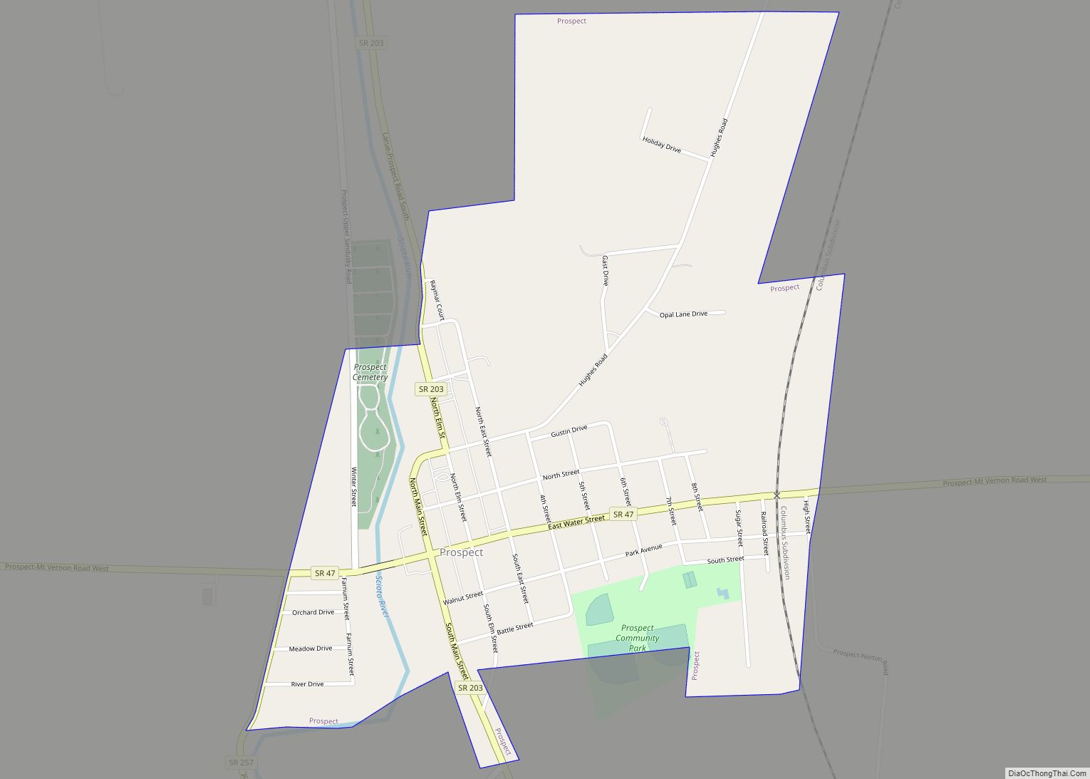
Prospect is a village in Marion County, Ohio, United States. The population was 1,112 at the 2010 census. The village is served by Elgin Local School District. Prospect has a public library, a branch of Marion Public Library. Prospect village overview: Name: Prospect village LSAD Code: 47 LSAD Description: village (suffix) State: Ohio County: Marion ... Read more
Map of Prospect village, Ohio
Map of Proctorville village, Ohio
Proctorville is a village in Lawrence County, Ohio, United States, along the Ohio River. The population was 574 at the 2010 census. The East End Bridge connects Proctorville to Huntington, West Virginia across the Ohio River. Proctorville is a part of the Huntington–Ashland, WV–KY–OH, Metropolitan Statistical Area (MSA). As of the 2000 census, the MSA ... Read more
Map of Proctorville village, Ohio
Map of Powhatan Point village
Powhatan Point is a village in southeastern Belmont County, Ohio, United States, along the Ohio River. The population was 1,461 at the 2020 census. It is part of the Wheeling metropolitan area. While “Powhatan” likely memorializes the Native-American tribe of the same name, the “Point” in the town’s name refers to the confluence between the ... Read more
Map of Powhatan Point village
Map of Powell city, Ohio
Powell is a city in the U.S. state of Ohio, located 14 miles (21.5 km) north of the state capital of Columbus. The city is located in Delaware County; a frequent placeholder on the List of highest-income counties in the United States, and 35th wealthiest county in the United States in 2020. Powell had an estimated ... Read more
Map of Powell city, Ohio
Map of Pottery Addition CDP
Pottery Addition is a census-designated place (CDP) in Jefferson County, Ohio, United States. Its population was 293 as of the 2010 census. The community is located along the Ohio River and is served by Ohio State Route 7. Pottery Addition CDP overview: Name: Pottery Addition CDP LSAD Code: 57 LSAD Description: CDP (suffix) State: Ohio ... Read more
Map of Pottery Addition CDP
Map of Potsdam village, Ohio
Potsdam is a village in Miami County, Ohio, United States. The population was 288 at the 2010 census. It is part of the Dayton Metropolitan Statistical Area. Potsdam village overview: Name: Potsdam village LSAD Code: 47 LSAD Description: village (suffix) State: Ohio County: Miami County Elevation: 1,010 ft (310 m) Total Area: 0.45 sq mi (1.15 km²) Land Area: 0.45 sq mi ... Read more
Map of Potsdam village, Ohio
Map of Portsmouth city, Ohio
Portsmouth is a city in and the county seat of Scioto County, Ohio, United States. Located in southern Ohio 41 miles (66 km) south of Chillicothe, it lies on the north bank of the Ohio River, across from Kentucky, just east of the mouth of the Scioto River. The population was 18,252 at the 2020 census. ... Read more
Map of Portsmouth city, Ohio
Map of Reminderville village
Reminderville is a city in northeastern Summit County, Ohio, United States. The population was 5,412 at the 2020 census. It is part of the Akron metropolitan area. Reminderville village overview: Name: Reminderville village LSAD Code: 47 LSAD Description: village (suffix) State: Ohio County: Summit County Elevation: 1,010 ft (308 m) Total Area: 2.22 sq mi (5.75 km²) Land Area: 2.18 sq mi ... Read more
Map of Reminderville village
Map of Reading city, Ohio
Reading (pronounced /ˈrɛdɪŋ/ RED-ing) is a city in Hamilton County, Ohio, United States. The population was 10,600 at the 2020 census. It is an inner suburb of Cincinnati and is included as part of the Cincinnati metropolitan area. Reading city overview: Name: Reading city LSAD Code: 25 LSAD Description: city (suffix) State: Ohio County: Hamilton ... Read more
Map of Reading city, Ohio
Map of Raymond CDP, Ohio
Raymond is a census-designated place in eastern Liberty Township, Union County, Ohio, United States. It has a post office with the ZIP code 43067. It is located at the intersection of State Routes 347 and 739. Raymond CDP overview: Name: Raymond CDP LSAD Code: 57 LSAD Description: CDP (suffix) State: Ohio County: Union County FIPS ... Read more
Map of Raymond CDP, Ohio
Map of Rayland village
Rayland is a village in southern Jefferson County, Ohio, United States, along the Ohio River. The population was 389 at the 2020 census. It is part of the Weirton–Steubenville metropolitan area. Rayland village overview: Name: Rayland village LSAD Code: 47 LSAD Description: village (suffix) State: Ohio County: Jefferson County Elevation: 679 ft (207 m) Total Area: 0.50 sq mi ... Read more
Map of Rayland village
Map of Rawson village
Rawson is a village in Hancock County, Ohio, United States. The population was 570 at the 2010 census. Rawson village overview: Name: Rawson village LSAD Code: 47 LSAD Description: village (suffix) State: Ohio County: Hancock County Elevation: 814 ft (248 m) Total Area: 0.38 sq mi (0.99 km²) Land Area: 0.38 sq mi (0.99 km²) Water Area: 0.00 sq mi (0.00 km²) Total Population: 567 Population ... Read more
Map of Rawson village