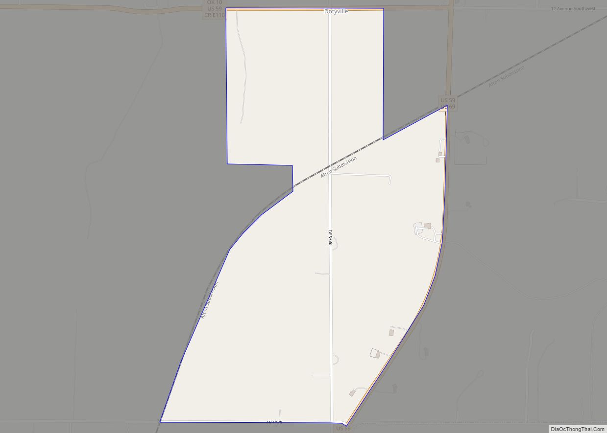
Map of Drummond town, Oklahoma

Map of Drummond town, Oklahoma

Drummond is a town in Garfield County, Oklahoma, United States. The population was 455 at the 2010 census, up from 405 in 2000. Drummond town overview: Name: Drummond town LSAD Code: 43 LSAD Description: town (suffix) State: Oklahoma County: Garfield County Elevation: 1,224 ft (373 m) Total Area: 0.27 sq mi (0.71 km²) Land Area: 0.27 sq mi (0.71 km²) Water Area: 0.00 sq mi … Read more

Map of Drowning Creek CDP

Map of Drowning Creek CDP

Drowning Creek is an unincorporated community and census-designated place (CDP) in Delaware County, Oklahoma, United States. The population was 155 at the 2010 census. Drowning Creek CDP overview: Name: Drowning Creek CDP LSAD Code: 57 LSAD Description: CDP (suffix) State: Oklahoma County: Delaware County Elevation: 756 ft (230 m) Total Area: 0.89 sq mi (2.30 km²) Land Area: 0.89 sq mi (2.30 km²) … Read more

Map of El Reno city

Map of El Reno city

El Reno is a city in and county seat of Canadian County, Oklahoma, United States. As of the 2020 census, the city population was 16,989, marking a change of 1.55% from 16,729, recorded in the 2010 census. The city was begun shortly after the 1889 land rush and named for the nearby Fort Reno. It … Read more

Map of East Duke town

Map of East Duke town

East Duke is a town in Jackson County, Oklahoma, United States. The population was 424 at the 2010 census. East Duke town overview: Name: East Duke town LSAD Code: 43 LSAD Description: town (suffix) State: Oklahoma County: Jackson County Elevation: 1,417 ft (432 m) Total Area: 0.43 sq mi (1.13 km²) Land Area: 0.43 sq mi (1.13 km²) Water Area: 0.00 sq mi (0.00 km²) Total … Read more

Map of Earlsboro town

Map of Earlsboro town

Earlsboro is a town in Pottawatomie County, Oklahoma, United States. The population was 628 at the 2010 census, a decline of 0.8 percent from the figure of 633 in 2000. It was once called “…the town that whisky built and oil broke.” Earlsboro town overview: Name: Earlsboro town LSAD Code: 43 LSAD Description: town (suffix) … Read more

Map of Eakly town

Map of Eakly town

Eakly is a town in Caddo County, Oklahoma, United States. The population was 338 at the 2010 census. Eakly town overview: Name: Eakly town LSAD Code: 43 LSAD Description: town (suffix) State: Oklahoma County: Caddo County Elevation: 1,496 ft (456 m) Total Area: 0.26 sq mi (0.68 km²) Land Area: 0.26 sq mi (0.68 km²) Water Area: 0.00 sq mi (0.00 km²) Total Population: 293 Population … Read more

Map of Eagletown CDP

Map of Eagletown CDP

Eagletown is an unincorporated community and census-designated place in McCurtain County, Oklahoma, United States. The population was 528 at the 2010 census. Located on Mountain Fork River, approximately 6 miles (9.7 km) from the Oklahoma-Arkansas border, it was the first permanent Choctaw settlement in the Indian Territory, who called it osi yamaha (“Eagle”). Eagletown was an … Read more

Map of Dwight Mission CDP

Map of Dwight Mission CDP

Dwight Mission is a census-designated place (CDP) in Sequoyah County, Oklahoma, United States. It is part of the Fort Smith, Arkansas-Oklahoma Metropolitan Statistical Area. The population was 55 at the 2010 census, a 71.9 percent gain over the figure of 32 recorded in 2000. It is currently the home of Dwight Mission Presbyterian Camp & … Read more

Map of Dustin town

Map of Dustin town

Dustin is a town in Hughes County, Oklahoma, United States. The population was 395 at the 2010 census, down from 452 in 2000. Dustin town overview: Name: Dustin town LSAD Code: 43 LSAD Description: town (suffix) State: Oklahoma County: Hughes County Elevation: 715 ft (218 m) Total Area: 0.70 sq mi (1.81 km²) Land Area: 0.65 sq mi (1.67 km²) Water Area: 0.05 sq mi … Read more

Map of Durant city, Oklahoma

Map of Durant city, Oklahoma

Durant (/duːrænt/) is a city in Bryan County, Oklahoma, United States that serves as the headquarters of the Choctaw Nation of Oklahoma. The population was 18,589 in the 2020 census. Durant is the principal city of the Durant Micropolitan Statistical Area, which had a population of 46,067 in 2020. The city is the largest in … Read more

Map of Duncan city, Oklahoma

Map of Duncan city, Oklahoma

Duncan is a city and county seat of Stephens County, Oklahoma, United States. Its population was 22,310 at the 2020 census. Its main claim to fame is as the birthplace of the Halliburton Corporation. Erle P. Halliburton established the New Method Oil Well Cementing Company in 1919. Halliburton maintains seven different complexes in Duncan plus … Read more

Map of Duchess Landing CDP

Map of Duchess Landing CDP

Duchess Landing is a census-designated place (CDP) in McIntosh County, Oklahoma, United States. The population was 95 at the 2000 census. Duchess Landing CDP overview: Name: Duchess Landing CDP LSAD Code: 57 LSAD Description: CDP (suffix) State: Oklahoma County: McIntosh County Total Area: 5.94 sq mi (15.38 km²) Land Area: 5.94 sq mi (15.38 km²) Water Area: 0.00 sq mi (0.00 km²) Total Population: … Read more