Map of Shady Point town
Shady Point, sometimes referred to as Shadypoint, is a town in Le Flore County, Oklahoma, United States. It is part of the Fort Smith, Arkansas-Oklahoma Metropolitan Statistical Area. The population was 1,026 at the 2010 census, a 21.0 percent increase over the figure of 848 recorded in 2000. Shady Point town overview: Name: Shady Point ... Read more
Map of Shady Point town
Map of Skedee town
Skedee is a town in Pawnee County, Oklahoma, United States. The population was 51 at the 2010 census, a 50 percent decline from the figure of 102 recorded in 2000. Skedee town overview: Name: Skedee town LSAD Code: 43 LSAD Description: town (suffix) State: Oklahoma County: Pawnee County Elevation: 850 ft (259 m) Total Area: 0.14 sq mi (0.35 km²) ... Read more
Map of Skedee town
Map of Simms CDP, Oklahoma
Simms is a census-designated place (CDP) in Muskogee County, Oklahoma, United States. The population was 295 at the 2000 census. Simms CDP overview: Name: Simms CDP LSAD Code: 57 LSAD Description: CDP (suffix) State: Oklahoma County: Muskogee County Total Area: 14.10 sq mi (36.51 km²) Land Area: 14.10 sq mi (36.51 km²) Water Area: 0.00 sq mi (0.00 km²) Total Population: 261 Population Density: ... Read more
Map of Simms CDP, Oklahoma
Map of Silo town
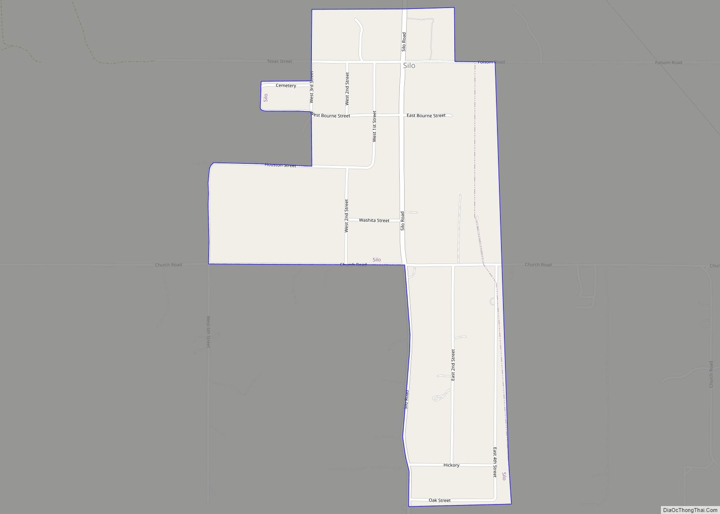
Silo is a town in Bryan County, Oklahoma, United States. The population was 331 at the 2010 census, an increase of 17.4 percent from the figure of 282 recorded in 2000. Silo town overview: Name: Silo town LSAD Code: 43 LSAD Description: town (suffix) State: Oklahoma County: Bryan County Elevation: 817 ft (249 m) Total Area: 0.52 sq mi ... Read more
Map of Silo town
Map of Short CDP
Short is a census-designated place (CDP) in Sequoyah County, Oklahoma, United States. It is part of the Fort Smith, Arkansas-Oklahoma Metropolitan Statistical Area. The population was 328 at the 2000 census. Short CDP overview: Name: Short CDP LSAD Code: 57 LSAD Description: CDP (suffix) State: Oklahoma County: Sequoyah County Elevation: 751 ft (229 m) Total Area: 10.92 sq mi ... Read more
Map of Short CDP
Map of Shidler city
Shidler is a city in Osage County, Oklahoma, United States. The population was 328 in the 2020 census, a decline from the figure of 441 recorded in 2010. Shidler city overview: Name: Shidler city LSAD Code: 25 LSAD Description: city (suffix) State: Oklahoma County: Osage County Elevation: 1,168 ft (356 m) Total Area: 0.75 sq mi (1.93 km²) Land Area: ... Read more
Map of Shidler city
Map of Shawnee city, Oklahoma
Shawnee (Meskwaki: Shânîheki) is a city in and the county seat of Pottawatomie County, Oklahoma, United States. The population was 29,857 in 2010, a 4.9 percent increase from the figure of 28,692 in 2000. The city is part of the Oklahoma City-Shawnee Combined Statistical Area and the principal city of the Shawnee Micropolitan Statistical Area. ... Read more
Map of Shawnee city, Oklahoma
Map of Shattuck town
Shattuck is a town in Ellis County, Oklahoma, United States. The population was 1,356 at the 2010 census. Shattuck town overview: Name: Shattuck town LSAD Code: 43 LSAD Description: town (suffix) State: Oklahoma County: Ellis County Elevation: 2,247 ft (685 m) Total Area: 2.20 sq mi (5.69 km²) Land Area: 2.20 sq mi (5.69 km²) Water Area: 0.00 sq mi (0.00 km²) Total Population: 1,249 Population ... Read more
Map of Shattuck town
Map of Sour John CDP
Sour John is a census-designated place (CDP) in Muskogee County, Oklahoma, United States. The population was 61 at the 2000 census. Sour John CDP overview: Name: Sour John CDP LSAD Code: 57 LSAD Description: CDP (suffix) State: Oklahoma County: Muskogee County Total Area: 5.68 sq mi (14.70 km²) Land Area: 5.68 sq mi (14.70 km²) Water Area: 0.00 sq mi (0.00 km²) Total Population: ... Read more
Map of Sour John CDP
Map of Soper town
Soper is a town in Choctaw County, Oklahoma, United States. The population was 261 at the 2010 census. The town was named for Pliny L. Soper, who was an attorney for the Arkansas and Choctaw Railway. Soper town overview: Name: Soper town LSAD Code: 43 LSAD Description: town (suffix) State: Oklahoma County: Choctaw County Elevation: ... Read more
Map of Soper town
Map of Snyder city, Oklahoma
Snyder is a city in Kiowa County, Oklahoma, United States. The population was 1,394 at the 2010 census. This figure represented a decline of 7.6 percent from 1,509 persons in 2000. Snyder city overview: Name: Snyder city LSAD Code: 25 LSAD Description: city (suffix) State: Oklahoma County: Kiowa County Elevation: 1,355 ft (413 m) Total Area: 1.21 sq mi ... Read more
Map of Snyder city, Oklahoma
Map of Snake Creek CDP
Snake Creek is a census-designated place (CDP) in Mayes County, Oklahoma, United States. The population was 255 at the 2020 census. Snake Creek CDP overview: Name: Snake Creek CDP LSAD Code: 57 LSAD Description: CDP (suffix) State: Oklahoma County: Mayes County Elevation: 932 ft (284 m) Total Area: 8.36 sq mi (21.64 km²) Land Area: 8.36 sq mi (21.64 km²) Water Area: 0.00 sq mi ... Read more
Map of Snake Creek CDP