Shady Point, sometimes referred to as Shadypoint, is a town in Le Flore County, Oklahoma, United States. It is part of the Fort Smith, Arkansas-Oklahoma Metropolitan Statistical Area. The population was 1,026 at the 2010 census, a 21.0 percent increase over the figure of 848 recorded in 2000.
| Name: | Shady Point town |
|---|---|
| LSAD Code: | 43 |
| LSAD Description: | town (suffix) |
| State: | Oklahoma |
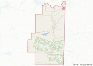
| County: | Le Flore County |
| Elevation: | 456 ft (139 m) |
| Total Area: | 2.56 sq mi (6.63 km²) |
| Land Area: | 2.56 sq mi (6.63 km²) |
| Water Area: | 0.00 sq mi (0.00 km²) |
| Total Population: | 972 |
| Population Density: | 379.69/sq mi (146.58/km²) |
| ZIP code: | 74956 |
| Area code: | 539/918 |
| FIPS code: | 4066550 |
| GNISfeature ID: | 1097947 |
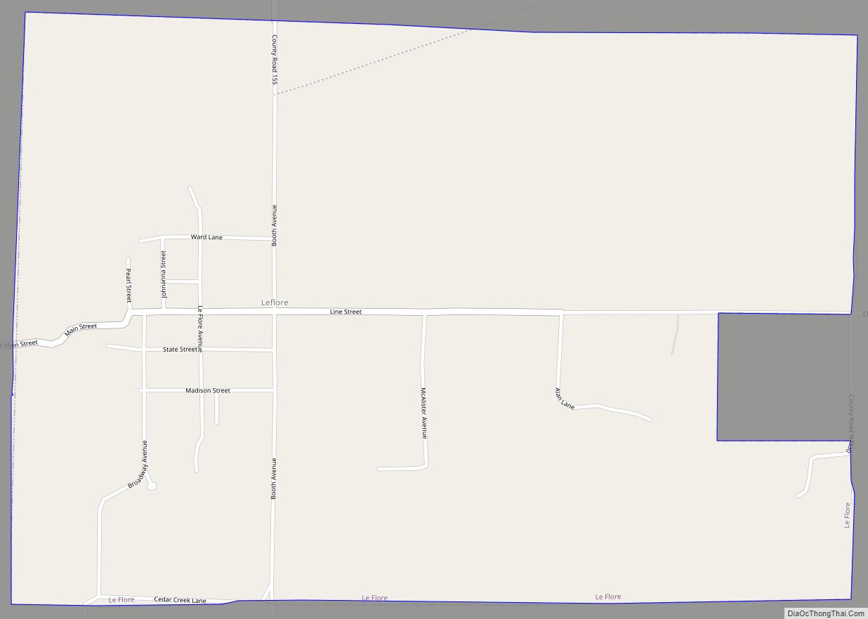
Online Interactive Map
Click on ![]() to view map in "full screen" mode.
to view map in "full screen" mode.
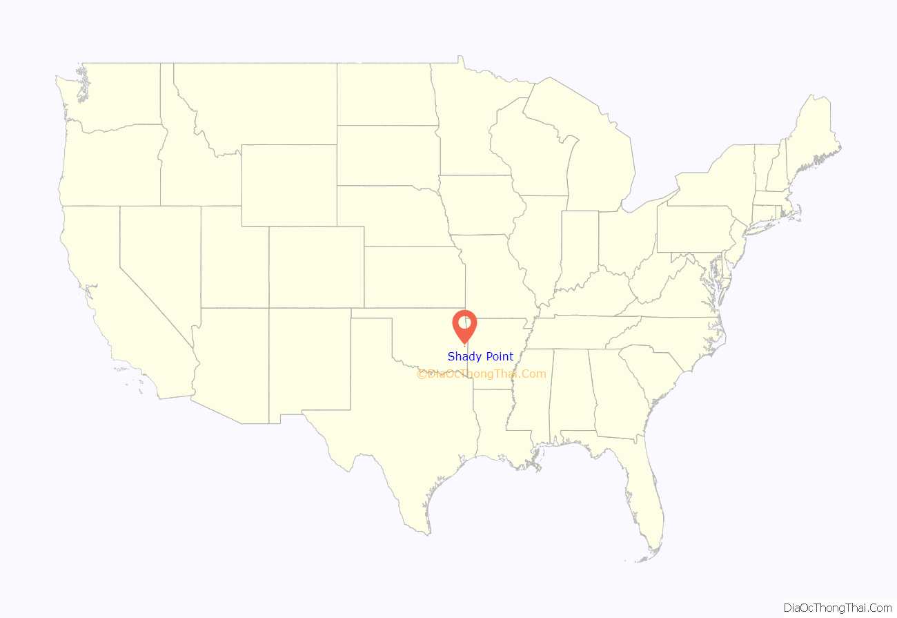
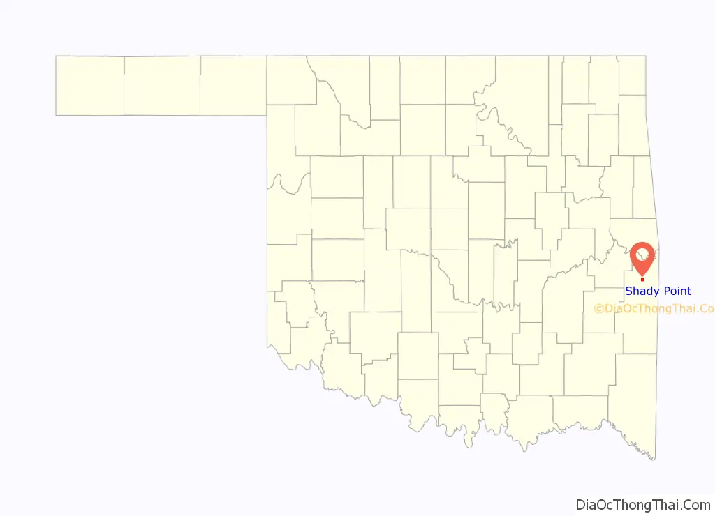
Shady Point location map. Where is Shady Point town?
History
A post office was established at Harrison, Indian Territory on September 17, 1891. It was named for William H. Harrison, an attorney and Choctaw leader. On December 11, 1894 its name was changed to Shady Point, Indian Territory. At the time of its founding the community was located in Sugar Loaf County, a part of the Moshulatubbee District of the Choctaw Nation.
In 1894, the settlement moved eastward to the proposed route of the Kansas City, Pittsburg and Gulf Railroad, which built a track through Indian Territory in 1895–96. In 1900, the Kansas City Southern Railway bought out the Kansas City, Pittsburg and Gulf Railroad. The population was estimated at 200 In 1901. In the same year, the Poteau Valley Railroad built tracks from Shady Point to the mines at Sutter (which was renamed Calhoun in 1914), bringing prosperity to Shady Point as a coal shipping point.
Agriculture became the basis for Shady Point’s economy during the Great Depression. The Evans Coal Company closed its deep-shaft coal mine in 1980, the same year the town incorporated. The population then was 235. Applied Energy Services built a power plant in 1991 that burned half of the coal produced in Oklahoma by the end of the twentieth century.
Shady Point Road Map
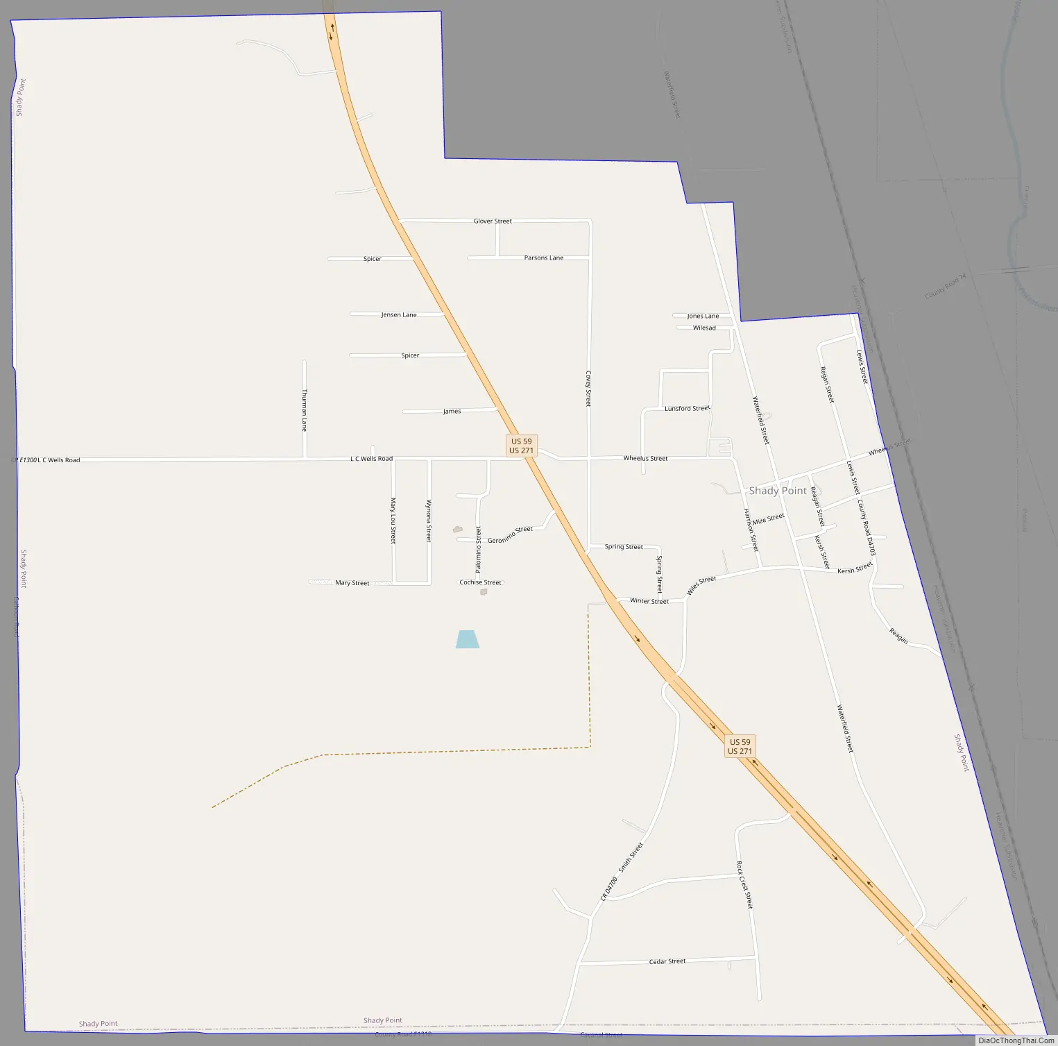
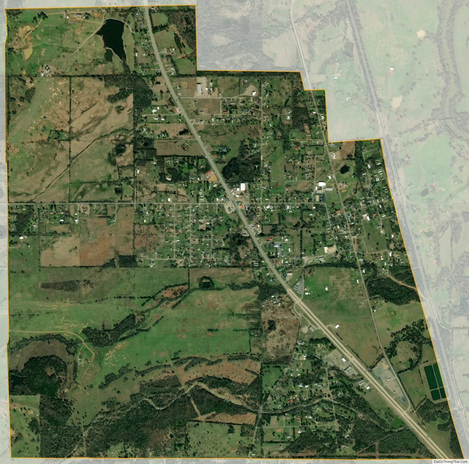
Shady Point city Satellite Map
Geography
Shady Point is located at 35°7′43″N 94°39′35″W / 35.12861°N 94.65972°W / 35.12861; -94.65972 (35.128571, -94.659726). It is 6 miles (9.7 km) north of Poteau.
According to the United States Census Bureau, the town has a total area of 2.5 square miles (6.5 km), all land.
See also
Map of Oklahoma State and its subdivision:- Adair
- Alfalfa
- Atoka
- Beaver
- Beckham
- Blaine
- Bryan
- Caddo
- Canadian
- Carter
- Cherokee
- Choctaw
- Cimarron
- Cleveland
- Coal
- Comanche
- Cotton
- Craig
- Creek
- Custer
- Delaware
- Dewey
- Ellis
- Garfield
- Garvin
- Grady
- Grant
- Greer
- Harmon
- Harper
- Haskell
- Hughes
- Jackson
- Jefferson
- Johnston
- Kay
- Kingfisher
- Kiowa
- Latimer
- Le Flore
- Lincoln
- Logan
- Love
- Major
- Marshall
- Mayes
- McClain
- McCurtain
- McIntosh
- Murray
- Muskogee
- Noble
- Nowata
- Okfuskee
- Oklahoma
- Okmulgee
- Osage
- Ottawa
- Pawnee
- Payne
- Pittsburg
- Pontotoc
- Pottawatomie
- Pushmataha
- Roger Mills
- Rogers
- Seminole
- Sequoyah
- Stephens
- Texas
- Tillman
- Tulsa
- Wagoner
- Washington
- Washita
- Woods
- Woodward
- Alabama
- Alaska
- Arizona
- Arkansas
- California
- Colorado
- Connecticut
- Delaware
- District of Columbia
- Florida
- Georgia
- Hawaii
- Idaho
- Illinois
- Indiana
- Iowa
- Kansas
- Kentucky
- Louisiana
- Maine
- Maryland
- Massachusetts
- Michigan
- Minnesota
- Mississippi
- Missouri
- Montana
- Nebraska
- Nevada
- New Hampshire
- New Jersey
- New Mexico
- New York
- North Carolina
- North Dakota
- Ohio
- Oklahoma
- Oregon
- Pennsylvania
- Rhode Island
- South Carolina
- South Dakota
- Tennessee
- Texas
- Utah
- Vermont
- Virginia
- Washington
- West Virginia
- Wisconsin
- Wyoming