Shattuck is a town in Ellis County, Oklahoma, United States. The population was 1,356 at the 2010 census.
| Name: | Shattuck town |
|---|---|
| LSAD Code: | 43 |
| LSAD Description: | town (suffix) |
| State: | Oklahoma |
| County: | Ellis County |
| Elevation: | 2,247 ft (685 m) |
| Total Area: | 2.20 sq mi (5.69 km²) |
| Land Area: | 2.20 sq mi (5.69 km²) |
| Water Area: | 0.00 sq mi (0.00 km²) |
| Total Population: | 1,249 |
| Population Density: | 568.76/sq mi (219.61/km²) |
| ZIP code: | 73858 |
| Area code: | 580 |
| FIPS code: | 4066750 |
| GNISfeature ID: | 1097962 |
| Website: | shattuckok.com |
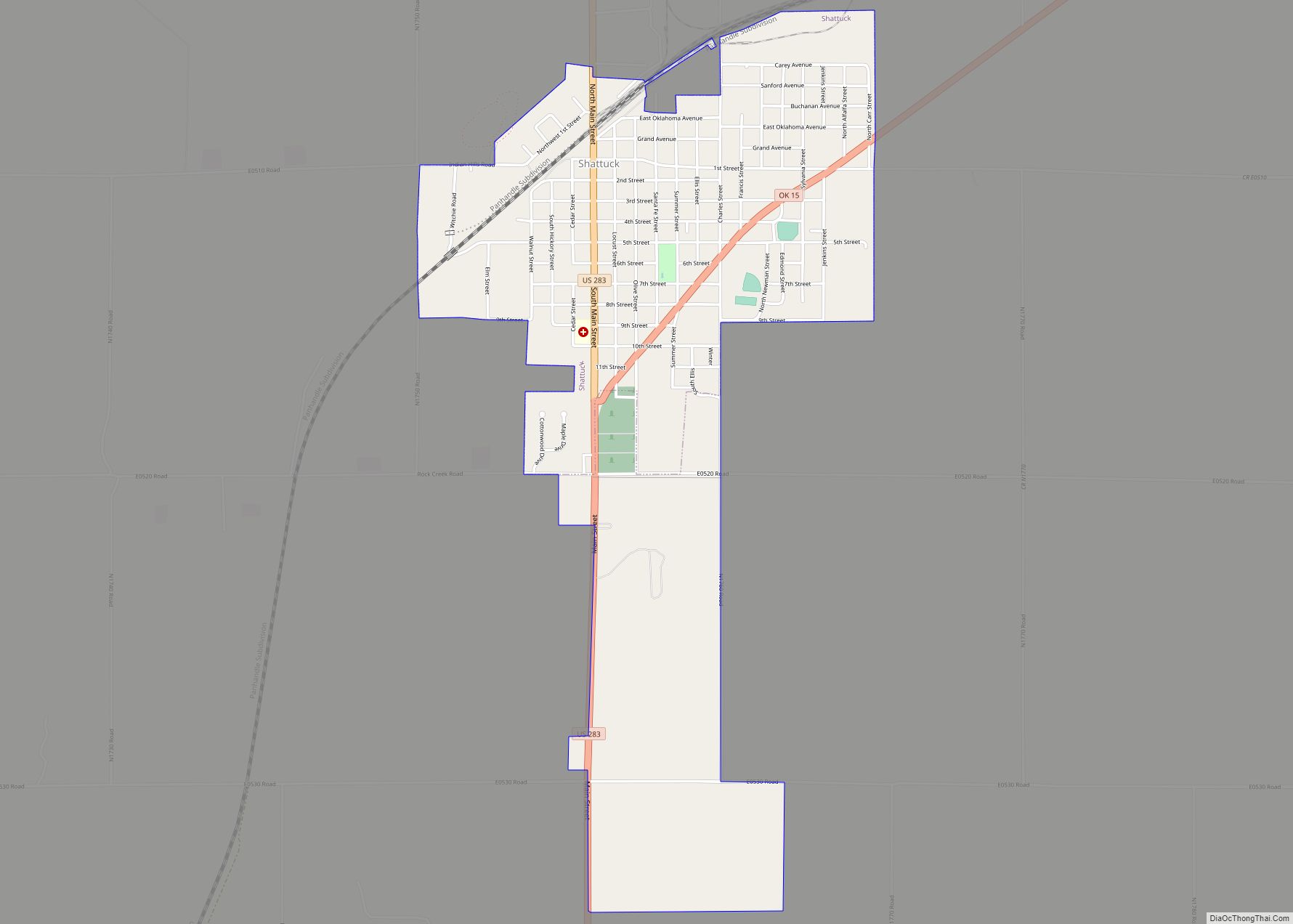
Online Interactive Map
Click on ![]() to view map in "full screen" mode.
to view map in "full screen" mode.
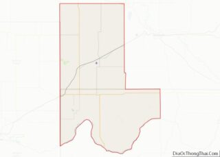
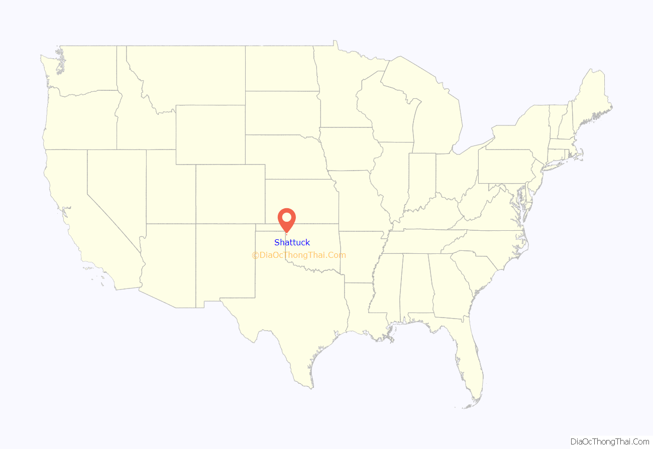
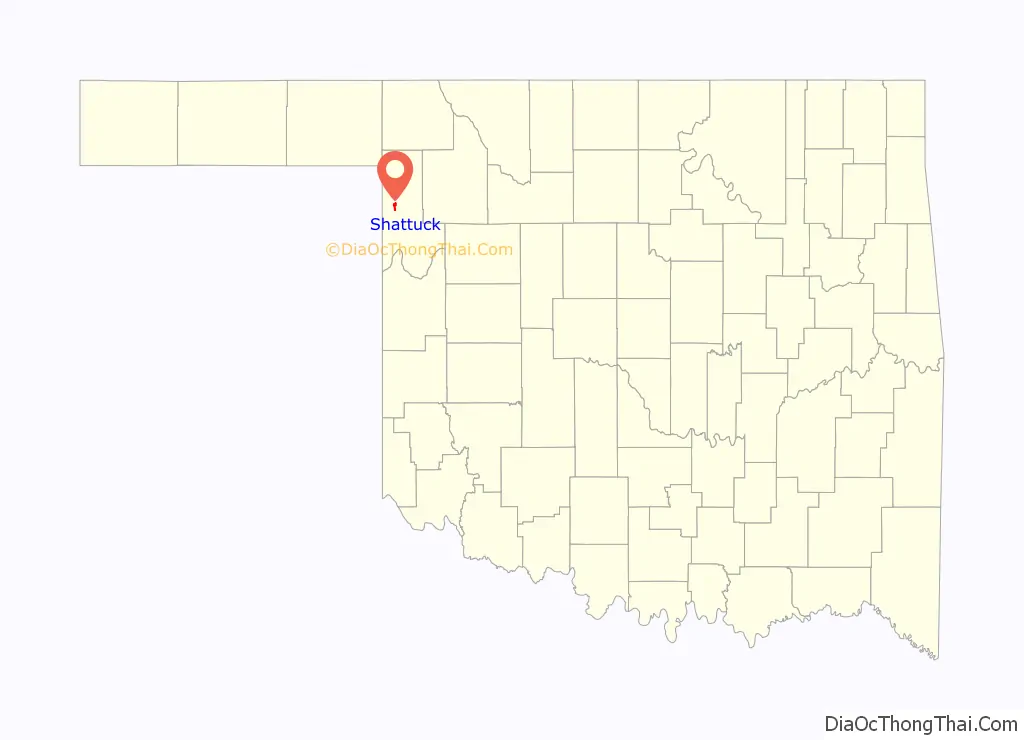
Shattuck location map. Where is Shattuck town?
History
Shattuck is located in what was once the Cherokee Outlet. The Southern Kansas Railway built a railroad through the area in 1887, and there was a railroad water station called “Norice” on the site that later became Shattuck. Non-Indian settlers first arrived in the Land Run of 1893. Around the railroad station, new businesses opened to support the farmers, including a blacksmith shop, a store, a school, and a post office. The post office, which was incorporated in November 1893, was named Shattuck after a Santa Fe Railroad director. The town site was plotted 1901, and the town was incorporated in 1906.
On May 25, 2021, an earthquake magnitude 4.1 on the Richter Scale occurred a few miles west of Shattuck, despite it not being an area known for earthquakes.
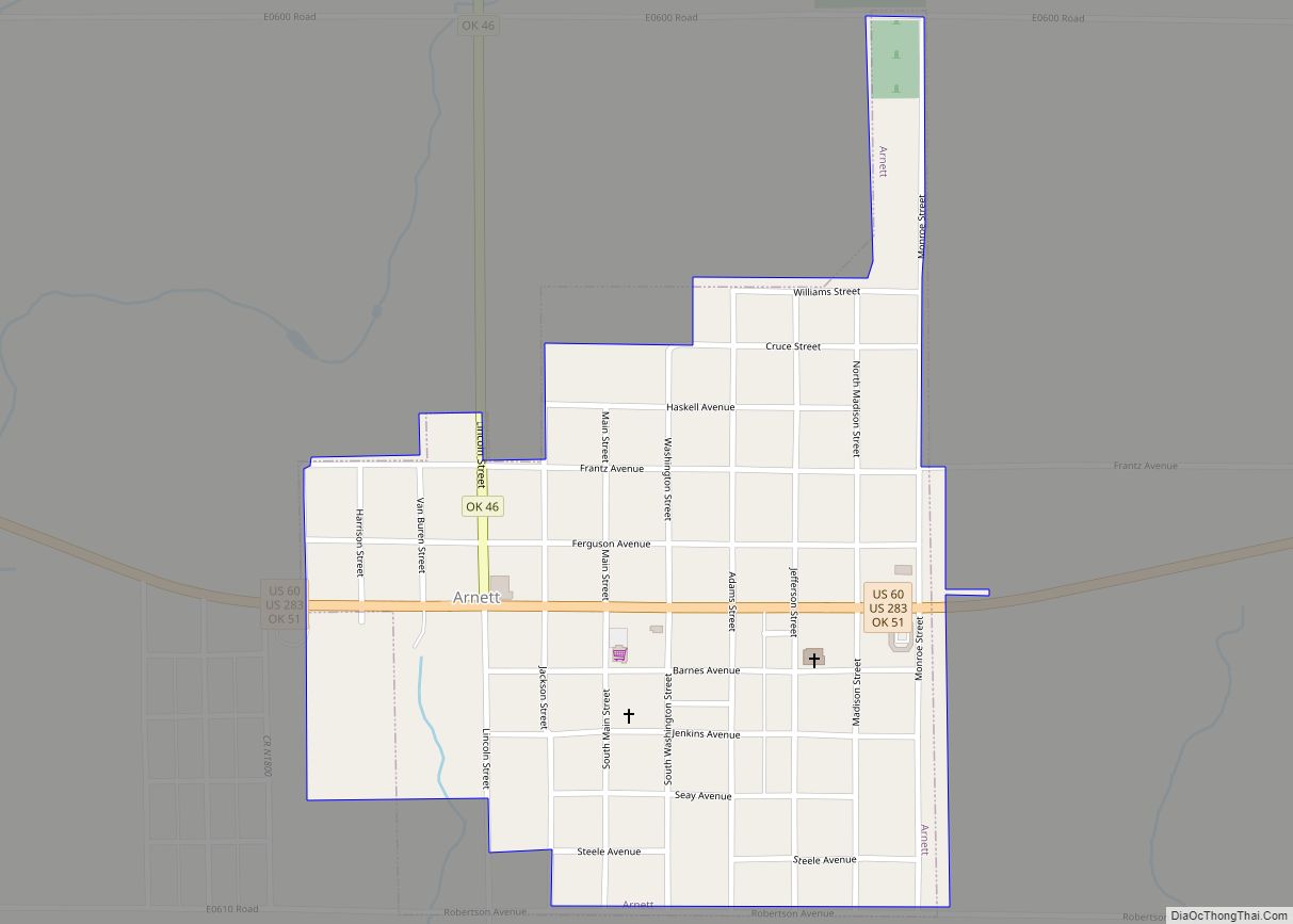
Shattuck Road Map
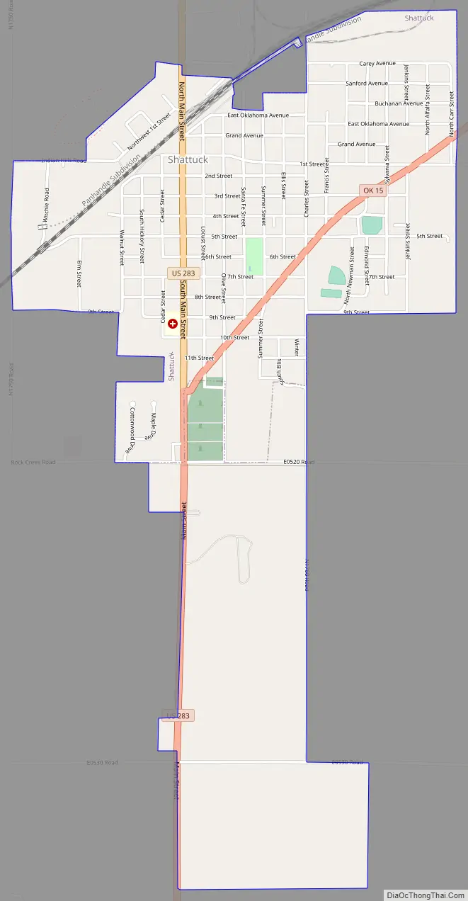
Shattuck city Satellite Map

Geography
Shattuck is located west of the center of Ellis County at 36°16′21″N 99°52′34″W / 36.27250°N 99.87611°W / 36.27250; -99.87611 (36.272596, -99.876217). U.S. Route 283 passes through the center of town, leading north 30 miles (48 km) to Laverne and south 15 miles (24 km) to Arnett, the Ellis county seat. Oklahoma State Highway 15 passes through the southeast part of Shattuck, leading northeast 30 miles (48 km) to Woodward. The Texas border is 7 miles (11 km) west of Shattuck.
According to the United States Census Bureau, the town has a total area of 2.2 square miles (5.8 km), all land.
See also
Map of Oklahoma State and its subdivision:- Adair
- Alfalfa
- Atoka
- Beaver
- Beckham
- Blaine
- Bryan
- Caddo
- Canadian
- Carter
- Cherokee
- Choctaw
- Cimarron
- Cleveland
- Coal
- Comanche
- Cotton
- Craig
- Creek
- Custer
- Delaware
- Dewey
- Ellis
- Garfield
- Garvin
- Grady
- Grant
- Greer
- Harmon
- Harper
- Haskell
- Hughes
- Jackson
- Jefferson
- Johnston
- Kay
- Kingfisher
- Kiowa
- Latimer
- Le Flore
- Lincoln
- Logan
- Love
- Major
- Marshall
- Mayes
- McClain
- McCurtain
- McIntosh
- Murray
- Muskogee
- Noble
- Nowata
- Okfuskee
- Oklahoma
- Okmulgee
- Osage
- Ottawa
- Pawnee
- Payne
- Pittsburg
- Pontotoc
- Pottawatomie
- Pushmataha
- Roger Mills
- Rogers
- Seminole
- Sequoyah
- Stephens
- Texas
- Tillman
- Tulsa
- Wagoner
- Washington
- Washita
- Woods
- Woodward
- Alabama
- Alaska
- Arizona
- Arkansas
- California
- Colorado
- Connecticut
- Delaware
- District of Columbia
- Florida
- Georgia
- Hawaii
- Idaho
- Illinois
- Indiana
- Iowa
- Kansas
- Kentucky
- Louisiana
- Maine
- Maryland
- Massachusetts
- Michigan
- Minnesota
- Mississippi
- Missouri
- Montana
- Nebraska
- Nevada
- New Hampshire
- New Jersey
- New Mexico
- New York
- North Carolina
- North Dakota
- Ohio
- Oklahoma
- Oregon
- Pennsylvania
- Rhode Island
- South Carolina
- South Dakota
- Tennessee
- Texas
- Utah
- Vermont
- Virginia
- Washington
- West Virginia
- Wisconsin
- Wyoming