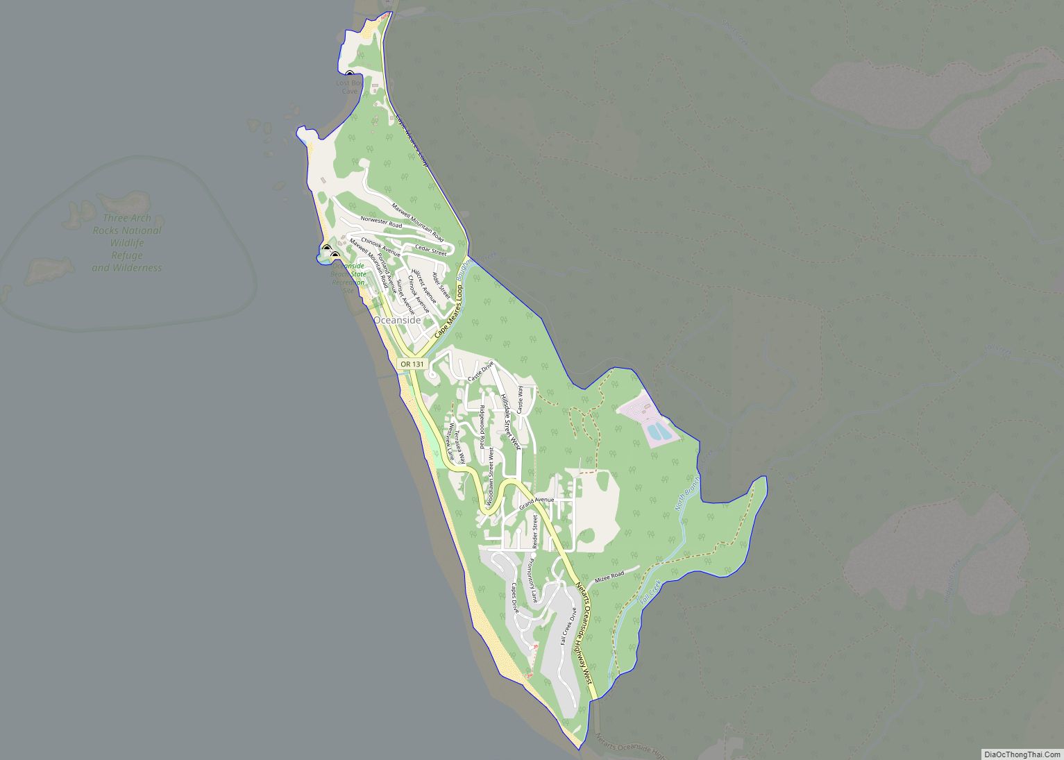
Map of Ontario city, Oregon

Map of Ontario city, Oregon

Ontario is the largest city in Malheur County, Oregon, United States. It lies along the Snake River at the Idaho border. The population was 11,366 at the 2010 census. The city is the largest community in the region of far eastern Oregon, also known as the Western Treasure Valley. Ontario is the principal city of … Read more

Map of Odell CDP, Oregon

Map of Odell CDP, Oregon

Odell is an unincorporated community and census-designated place (CDP) in Hood River County, Oregon, United States. Odell was named for an early pioneer, William Odell, a native of Tennessee by way of California, who settled in the area in 1861. The population was 2,255 as of the 2010 census. Odell CDP overview: Name: Odell CDP … Read more

Map of Plush CDP

Map of Plush CDP

Plush is an unincorporated rural community and census-designated place in the Warner Valley of Lake County, in the U.S. state of Oregon. As of the 2010 census it had a population of 57. The community is in an arid, sparsely populated part of the state 39 miles (63 km) by road northeast of Lakeview. The valley … Read more

Map of Pistol River CDP

Map of Pistol River CDP

Pistol River (Tolowa: chvt-ler’sh-chvn-dvn taa-ghii~-li~’ ) is an unincorporated community and census-designated place in Curry County, Oregon, United States. As of the 2010 census it had a population of 84. It is near the Pistol River and the Pistol River State Scenic Viewpoint, just to the east of U.S. Route 101. The community of Pistol … Read more

Map of Pine Hollow CDP

Map of Pine Hollow CDP

Pine Hollow is a census-designated place (CDP) and unincorporated community in Wasco County, Oregon, United States. It surrounds Pine Hollow Reservoir. The CDP population was 424 at the 2000 census. Pine Hollow CDP overview: Name: Pine Hollow CDP LSAD Code: 57 LSAD Description: CDP (suffix) State: Oregon County: Wasco County Elevation: 1,886 ft (575 m) Total Area: … Read more

Map of Pine Grove CDP, Oregon

Map of Pine Grove CDP, Oregon

Pine Grove is a census-designated place (CDP) and unincorporated community in Wasco County, Oregon, United States. The population was 162 at the 2000 census. Pine Grove CDP overview: Name: Pine Grove CDP LSAD Code: 57 LSAD Description: CDP (suffix) State: Oregon County: Wasco County Elevation: 2,228 ft (679 m) Total Area: 6.0 sq mi (16 km²) Total Population: 162 Population … Read more

Map of Pilot Rock city

Map of Pilot Rock city

Pilot Rock is a city in Umatilla County, Oregon, United States. The population was 1,502 at the 2010 census. It is part of the Pendleton–Hermiston Micropolitan Statistical Area. The main industries are timber and agriculture. Pilot Rock is home to the Boise Cascade /Kinzua Lumber lumber and pole mill as well as Pilot Rock High … Read more

Map of Phoenix city, Oregon

Map of Phoenix city, Oregon

Phoenix is a city in Jackson County, Oregon, United States. The population was 4,538 at the 2010 census. Phoenix is a part of the Medford Metropolitan Statistical Area, in the Rogue Valley, and is 3 miles (5 km) southeast of Medford on Interstate 5. Phoenix city overview: Name: Phoenix city LSAD Code: 25 LSAD Description: city … Read more

Map of Philomath city

Map of Philomath city

Philomath (/fɪˈloʊməθ/ fi-LOH-məth) is a city in Benton County, Oregon, United States. It was named for Philomath (Greek, “love of learning”) College. The population was 4,584 at the 2010 census and was most recently estimated in 2019 to have a population of 5,666. It is part of the Corvallis, Oregon, Metropolitan Statistical Area. Philomath city … Read more

Map of Peoria CDP, Oregon

Map of Peoria CDP, Oregon

Peoria is an unincorporated community and census-designated place (CDP) in Linn County, Oregon, United States. It is on the right bank of the Willamette River at river mile 141 between Eugene and Corvallis. Lacking stores and services, it is a cluster of houses plus a county park along Peoria Road, about 8 miles (13 km) south of … Read more

Map of Pendleton city, Oregon

Map of Pendleton city, Oregon

Pendleton is a city and the county seat of Umatilla County, Oregon. The population was 17,107 at the time of the 2020 census, which includes approximately 1,600 people who are incarcerated at Eastern Oregon Correctional Institution. Pendleton is the smaller of the two principal cities of the Hermiston–Pendleton Micropolitan Statistical Area. This micropolitan area covers … Read more

Map of Parkdale CDP, Oregon

Map of Parkdale CDP, Oregon

Parkdale is an unincorporated community and census-designated place (CDP) in Hood River County, Oregon, United States. As of the 2010 census, the population was 311, up from 266 at the 2000 census. Parkdale CDP overview: Name: Parkdale CDP LSAD Code: 57 LSAD Description: CDP (suffix) State: Oregon County: Hood River County Elevation: 1,726 ft (526 m) Total … Read more