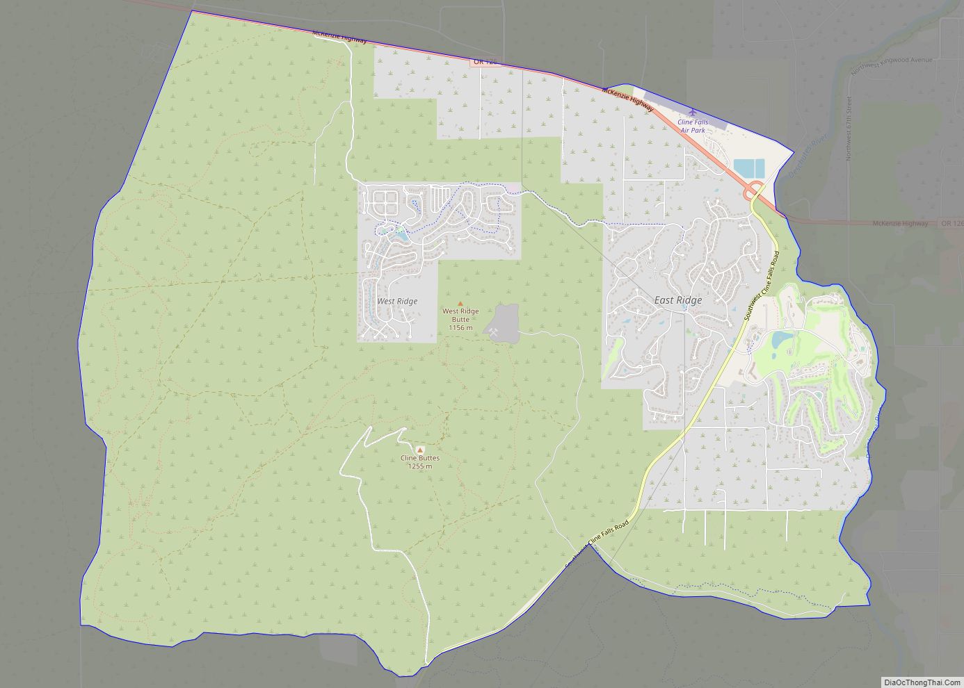
Map of Dunes City
Dunes City is a city in Lane County, Oregon, United States. The population was 1,303 at the 2010 census. Dunes City city overview: Name: Dunes City city LSAD Code: 25 LSAD Description: city (suffix) State: Oregon County: Lane County Incorporated: 1963 Elevation: 39 ft (11.9 m) Total Area: 3.45 sq mi (8.95 km²) Land Area: 2.69 sq mi (6.96 km²) Water Area: 0.77 sq mi ... Read more
Map of Dunes City
Map of Dundee city, Oregon
Dundee /ˈdʌndiː/ is a city in Yamhill County, Oregon, United States. The population was 3,238 at the 2020 census. Dundee city overview: Name: Dundee city LSAD Code: 25 LSAD Description: city (suffix) State: Oregon County: Yamhill County Incorporated: 1895 Elevation: 189 ft (57.6 m) Total Area: 1.36 sq mi (3.53 km²) Land Area: 1.34 sq mi (3.47 km²) Water Area: 0.02 sq mi (0.06 km²) Total ... Read more
Map of Dundee city, Oregon
Map of Dufur city
Dufur is a city in Wasco County, Oregon, United States. The population was 604 at the 2010 census. It is a farming community where wheat, tree fruit, and grapes are important crops. Dufur city overview: Name: Dufur city LSAD Code: 25 LSAD Description: city (suffix) State: Oregon County: Wasco County Incorporated: 1893 Elevation: 1,345 ft (410 m) ... Read more
Map of Dufur city
Map of Drain city
Drain is a city in Douglas County, Oregon, United States. The population was 1,151 at the 2010 census. Drain is named after town founder and politician Charles J. Drain, who donated 60 acres (24 ha) of nearby land to the Oregon and California Railroad in 1871. Drain city overview: Name: Drain city LSAD Code: 25 LSAD ... Read more
Map of Drain city
Map of Elkton city, Oregon
Elkton is a city in Douglas County, Oregon, United States. It is located on the lower Umpqua River, at the junction of Oregon Route 38 and Oregon Route 138, about 20 miles (32 km) west of Interstate 5 and about 14 miles (23 km) west of Drain. The population was 195 at the 2010 census, an increase ... Read more
Map of Elkton city, Oregon
Map of Elgin city, Oregon
Elgin is a city in Union County, Oregon, United States. The population was 1,711 at the 2010 census. The community is named after the Lady Elgin, a ship lost on Lake Michigan. The city is known for the Elgin Opera House, originally dedicated in 1912. Elgin city overview: Name: Elgin city LSAD Code: 25 LSAD ... Read more
Map of Elgin city, Oregon
Map of Echo city, Oregon
Echo is a city in Umatilla County, Oregon, United States. The population was 699 at the 2010 census. It is part of the Pendleton–Hermiston Micropolitan Statistical Area. Echo city overview: Name: Echo city LSAD Code: 25 LSAD Description: city (suffix) State: Oregon County: Umatilla County Incorporated: 1904 Elevation: 635 ft (194 m) Total Area: 0.58 sq mi (1.50 km²) Land ... Read more
Map of Echo city, Oregon
Map of Eagle Point city
Eagle Point is a city in Jackson County, Oregon, United States. The population was 8,469 at the 2010 census, up from 4,798 at the 2000 census. As of 2018, the estimated population was 9,408. Eagle Point city overview: Name: Eagle Point city LSAD Code: 25 LSAD Description: city (suffix) State: Oregon County: Jackson County Incorporated: ... Read more
Map of Eagle Point city
Map of Fort Hill CDP
Fort Hill is an unincorporated community in Polk and Yamhill counties in Oregon, United States. It is located about a mile east of Spirit Mountain Casino on Oregon Route 22 near the South Yamhill River. For statistical purposes, the United States Census Bureau has defined Fort Hill as a census-designated place (CDP). The census definition ... Read more
Map of Fort Hill CDP
Map of Forest Grove city
Forest Grove is a city in Washington County, Oregon, United States, 25 miles (40 km) west of Portland. Originally a small farm town, it is now primarily a commuter town in the Portland metro area. Settled in the 1840s, the town was platted in 1850, then incorporated in 1872, making it the first city in Washington ... Read more
Map of Forest Grove city
Map of Foots Creek CDP
Foots Creek is an unincorporated community and census-designated place (CDP) in Jackson County, in the U.S. state of Oregon. It lies along Oregon Route 99 near the mouth of Foots Creek, where it empties into the Rogue River. Interstate 5 and Valley of the Rogue State Park are on the side of the river opposite ... Read more
Map of Foots Creek CDP
Map of Florence city, Oregon
Florence is a coastal city in Lane County, in the U.S. state of Oregon. It lies at the mouth of the Siuslaw River on the Pacific Ocean and about midway between Newport and Coos Bay along U.S. Route 101. As of the 2020 census, the city had a total population of 8,921. Florence city overview: ... Read more
Map of Florence city, Oregon