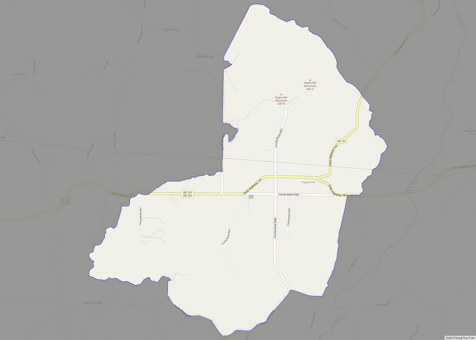
Map of Hackett city
Hackett is a city in Sebastian County, Arkansas, United States. It is part of the Fort Smith, Arkansas–Oklahoma Metropolitan Statistical Area. The population was 812 at the 2010 census. Hackett city overview: Name: Hackett city LSAD Code: 25 LSAD Description: city (suffix) State: Arkansas County: Sebastian County Elevation: 538 ft (164 m) Total Area: 1.46 sq mi (3.79 km²) Land ... Read more
Map of Hackett city
Map of Guy city
Guy is a city in Faulkner County, Arkansas, United States. The population was 708 at the 2010 census, up from 202 at the 2000 census. It is part of the Little Rock–North Little Rock–Conway Metropolitan Statistical Area. Guy city overview: Name: Guy city LSAD Code: 25 LSAD Description: city (suffix) State: Arkansas County: Faulkner County ... Read more
Map of Guy city
Map of Hardy city, Arkansas
Hardy is the 2nd oldest city in Sharp and Fulton counties in the U.S. state of Arkansas. The population was 765 in 2020. Hardy city overview: Name: Hardy city LSAD Code: 25 LSAD Description: city (suffix) State: Arkansas County: Fulton County, Sharp County Elevation: 440 ft (130 m) Total Area: 5.31 sq mi (13.76 km²) Land Area: 5.06 sq mi (13.09 km²) Water ... Read more
Map of Hardy city, Arkansas
Map of Hampton city, Arkansas
Hampton is a town in Calhoun County, Arkansas, United States. The population was 1,324 at the 2010 census. The town is the county seat of Calhoun County. Hampton is part of the Camden Micropolitan Statistical Area. Hampton city overview: Name: Hampton city LSAD Code: 25 LSAD Description: city (suffix) State: Arkansas County: Calhoun County Elevation: ... Read more
Map of Hampton city, Arkansas
Map of Hamburg city, Arkansas
Hamburg is a city and county seat of Ashley County, Arkansas, United States. The population was 2,857 at the 2010 census. It is best known for being the home town of NBA legend Scottie Pippen. Hamburg city overview: Name: Hamburg city LSAD Code: 25 LSAD Description: city (suffix) State: Arkansas County: Ashley County Elevation: 161 ft ... Read more
Map of Hamburg city, Arkansas
Map of Harrison city, Arkansas
Harrison is a city in and the county seat of Boone County, Arkansas, United States. It is named after Marcus LaRue Harrison, a surveyor who laid out the city along Crooked Creek at Stifler Springs. According to 2019 Census Bureau estimates, the population of the city was 13,069, up from 12,943 at the 2010 census ... Read more
Map of Harrison city, Arkansas
Map of Harrisburg city, Arkansas
Harrisburg is a city in Poinsett County, Arkansas, United States. The population was 2,288 at the 2010 census. It is included in the Jonesboro, Arkansas Metropolitan Statistical Area. The city is the county seat of Poinsett County. Harrisburg city overview: Name: Harrisburg city LSAD Code: 25 LSAD Description: city (suffix) State: Arkansas County: Poinsett County ... Read more
Map of Harrisburg city, Arkansas
Map of Harrell town
Harrell is a town in Calhoun County, Arkansas, United States. The population was 254 at the 2010 census. It is part of the Camden Micropolitan Statistical Area. Harrell town overview: Name: Harrell town LSAD Code: 43 LSAD Description: town (suffix) State: Arkansas County: Calhoun County Elevation: 203 ft (62 m) Total Area: 0.55 sq mi (1.43 km²) Land Area: 0.55 sq mi ... Read more
Map of Harrell town
Map of Haskell city, Arkansas
Haskell is a city in Saline County, Arkansas, United States. The population was 3,990 at the 2010 census. It is part of the Little Rock–North Little Rock–Conway Metropolitan Statistical Area. Haskell city overview: Name: Haskell city LSAD Code: 25 LSAD Description: city (suffix) State: Arkansas County: Saline County Elevation: 308 ft (94 m) Total Area: 4.91 sq mi (12.73 km²) ... Read more
Map of Haskell city, Arkansas
Map of Hartman city, Arkansas
Hartman is a city in Johnson County, Arkansas, United States. The population was 519 at the 2010 census. Hartman city overview: Name: Hartman city LSAD Code: 25 LSAD Description: city (suffix) State: Arkansas County: Johnson County Elevation: 492 ft (150 m) Total Area: 1.60 sq mi (4.15 km²) Land Area: 1.58 sq mi (4.09 km²) Water Area: 0.02 sq mi (0.06 km²) Total Population: 516 Population ... Read more
Map of Hartman city, Arkansas
Map of Hartford city, Arkansas
Hartford is a city in Sebastian County, Arkansas, United States. It is part of the Fort Smith, Arkansas–Oklahoma Metropolitan Statistical Area. The population was 642 at the 2010 census. Clergyman James T. Draper, Jr., president of the Southern Baptist Convention from 1982 to 1984, was born in Hartford in 1935, where his father, James Draper, ... Read more
Map of Hartford city, Arkansas
Map of Haynes town, Arkansas
Haynes is a town in Lee County, Arkansas, United States. The population was 150 at the 2010 census, down from 214 at the 2000 census. Haynes town overview: Name: Haynes town LSAD Code: 43 LSAD Description: town (suffix) State: Arkansas County: Lee County Elevation: 220 ft (70 m) Total Area: 0.35 sq mi (0.90 km²) Land Area: 0.35 sq mi (0.90 km²) Water ... Read more
Map of Haynes town, Arkansas