Map of Old Fort town, North Carolina
Old Fort is a town in McDowell County, North Carolina, United States. The population was 811 people in the 2020 U.S. census. Old Fort town overview: Name: Old Fort town LSAD Code: 43 LSAD Description: town (suffix) State: North Carolina County: McDowell County Elevation: 1,447 ft (440 m) Total Area: 1.23 sq mi (3.18 km²) Land Area: 1.22 sq mi (3.16 km²) Water ... Read more
Map of Old Fort town, North Carolina
Map of Ogden CDP, North Carolina
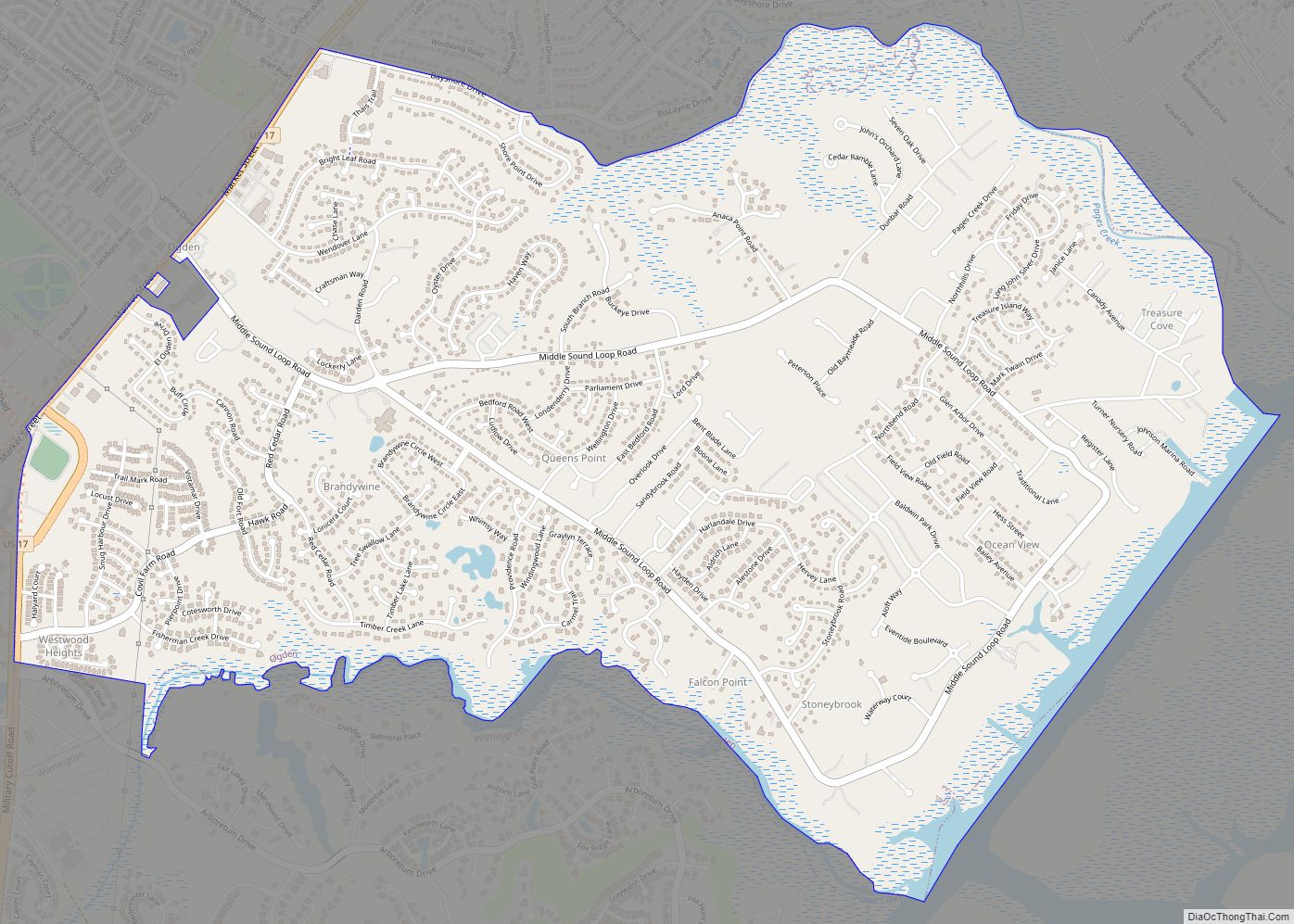
Ogden is a census-designated place (CDP) in New Hanover County, North Carolina, United States. It is both a suburb of the city of Wilmington and part of the Wilmington Metropolitan Statistical Area. The population was 6,766 at the 2010 census, up from 5,481 in 2000. Ogden CDP overview: Name: Ogden CDP LSAD Code: 57 LSAD ... Read more
Map of Ogden CDP, North Carolina
Map of Ocracoke CDP
Ocracoke /ˈoʊkrəkoʊk/ is a census-designated place (CDP) and unincorporated town located at the southern end of Ocracoke Island, located entirely within Hyde County, North Carolina, United States. The population was 948 as of the 2010 census. In the 2020 census, the population had dropped to 797 people. No bridges connect Ocracoke Island to the mainland, ... Read more
Map of Ocracoke CDP
Map of Pikeville town, North Carolina
Pikeville is a town in Wayne County, North Carolina, United States. The population was 678 at the 2010 census. It is included in the Goldsboro, North Carolina Metropolitan Statistical Area. It is notable for being the home of Collier Motors, an automobile sales and service business established in 1955 that has remained an American Motors ... Read more
Map of Pikeville town, North Carolina
Map of Pembroke town, North Carolina
Pembroke is a town in Robeson County, North Carolina, United States. It is about 90 miles inland and northwest from the Atlantic Coast. The population was 2,973, at the 2010 census. The town is the seat of the state-recognized Lumbee tribe of North Carolina, as well as the home of The University of North Carolina ... Read more
Map of Pembroke town, North Carolina
Map of Peletier town
Peletier is a town in Carteret County, North Carolina, United States. The population was 644 at the 2010 census. The town was named for the late-18th century Pelletier family. Peletier town overview: Name: Peletier town LSAD Code: 43 LSAD Description: town (suffix) State: North Carolina County: Carteret County Elevation: 30 ft (9 m) Total Area: 3.68 sq mi (9.53 km²) ... Read more
Map of Peletier town
Map of Peachland town
Peachland is a town in Anson County, North Carolina, United States. The population was 402 at the 2020 census. Peachland town overview: Name: Peachland town LSAD Code: 43 LSAD Description: town (suffix) State: North Carolina County: Anson County Incorporated: 1895 Elevation: 449 ft (137 m) Total Area: 1.01 sq mi (2.61 km²) Land Area: 1.01 sq mi (2.61 km²) Water Area: 0.00 sq mi (0.00 km²) ... Read more
Map of Peachland town
Map of Patterson Springs town
Patterson Springs is a town in Cleveland County, North Carolina, United States. The population was 622 at the 2010 census. Patterson Springs town overview: Name: Patterson Springs town LSAD Code: 43 LSAD Description: town (suffix) State: North Carolina County: Cleveland County Elevation: 919 ft (280 m) Total Area: 1.03 sq mi (2.66 km²) Land Area: 1.03 sq mi (2.66 km²) Water Area: 0.00 sq mi ... Read more
Map of Patterson Springs town
Map of Parmele town
Parmele is a town in Martin County, North Carolina, United States. The population was 278 at the 2010 census. Parmele town overview: Name: Parmele town LSAD Code: 43 LSAD Description: town (suffix) State: North Carolina County: Martin County Incorporated: February 14, 1893 Elevation: 75 ft (23 m) Total Area: 1.16 sq mi (3.00 km²) Land Area: 1.16 sq mi (3.00 km²) Water Area: ... Read more
Map of Parmele town
Map of Parkton town
Parkton is a town in Robeson County, North Carolina, Lumberton metro area, United States. The town was so named because it was a place where farmers tied up their horses while waiting for the train. As of the 2010 census, the town population was 436. Parkton town overview: Name: Parkton town LSAD Code: 43 LSAD ... Read more
Map of Parkton town
Map of Pantego town, North Carolina
Pantego is a town in Beaufort County, North Carolina, United States. The population was 179 at the 2010 Census. Pantego town overview: Name: Pantego town LSAD Code: 43 LSAD Description: town (suffix) State: North Carolina County: Beaufort County Elevation: 3 ft (1 m) Total Area: 0.80 sq mi (2.08 km²) Land Area: 0.80 sq mi (2.08 km²) Water Area: 0.00 sq mi (0.00 km²) Total Population: ... Read more
Map of Pantego town, North Carolina
Map of Oxford city, North Carolina
Oxford is a town in Granville County, North Carolina, United States, with a population of 8,628 as of the 2020 census. It is the county seat of Granville County. Oxford city overview: Name: Oxford city LSAD Code: 25 LSAD Description: city (suffix) State: North Carolina County: Granville County Elevation: 479 ft (146 m) Total Area: 6.24 sq mi (16.15 km²) ... Read more
Map of Oxford city, North Carolina