Map of Bantry city
Bantry city overview: Name: Bantry city LSAD Code: 25 LSAD Description: city (suffix) State: North Dakota County: McHenry County FIPS code: 3804740 Online Interactive Map Bantry online map. Source: Basemap layers from Google Map, Open Street Map (OSM), Arcgisonline, Wmflabs. Boundary Data from Database of Global Administrative Areas. Bantry location map. Where is Bantry city? ... Read more
Map of Bantry city
Map of Balta city
Balta is a city in Pierce County, North Dakota, United States. The population was 66 at the 2020 census. Balta was founded in 1912, and is known for its duck hunting. Old Mt. Carmel Cemetery, Wrought-Iron Cross Site, in or near Balta, is listed on the National Register of Historic Places. Balta city overview: Name: ... Read more
Map of Balta city
Map of Bergen city, North Dakota
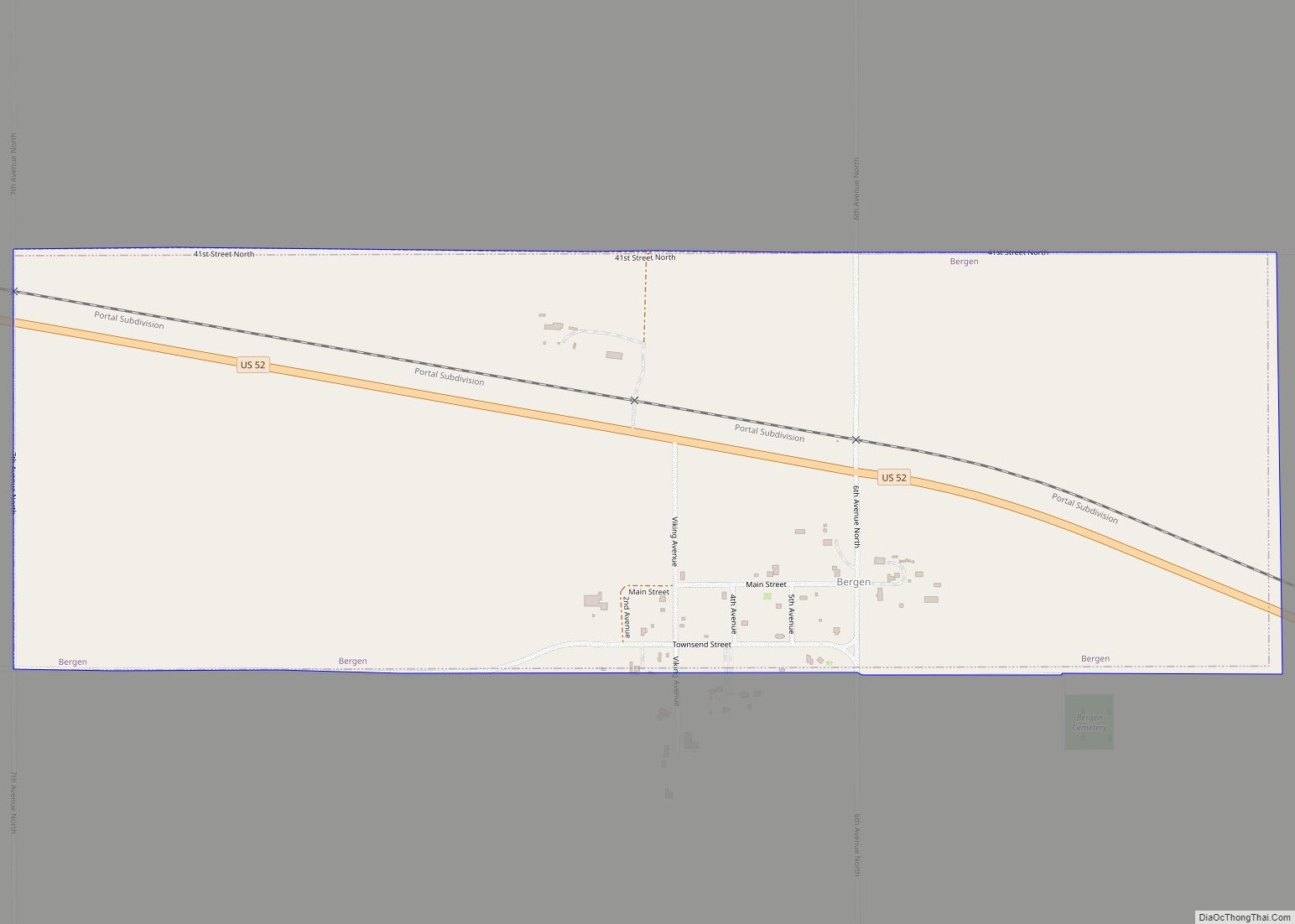
Bergen is a city in McHenry County, North Dakota, United States. The population was 10 at the 2020 census. It is part of the Minot Micropolitan Statistical Area. Bergen was founded in 1905 and named after Bergen, Norway. Bergen city overview: Name: Bergen city LSAD Code: 25 LSAD Description: city (suffix) State: North Dakota County: ... Read more
Map of Bergen city, North Dakota
Map of Benedict city, North Dakota
Benedict is a city in McLean County, North Dakota, United States. The population was 68 at the 2020 census. Benedict was founded in 1906. Benedict city overview: Name: Benedict city LSAD Code: 25 LSAD Description: city (suffix) State: North Dakota County: McLean County Founded: 1906 Elevation: 2,083 ft (635 m) Total Area: 0.25 sq mi (0.65 km²) Land Area: 0.25 sq mi ... Read more
Map of Benedict city, North Dakota
Map of Belfield city
Belfield is a city in Stark County, North Dakota, United States and only 15 minutes from Theodore Roosevelt National Park. Belfield’s population was 996 at the 2020 census. Belfield was founded in 1883, and has seen many boom and busts in this oil-rich part of North Dakota. It is part of the Dickinson Micropolitan Statistical ... Read more
Map of Belfield city
Map of Belcourt CDP
Belcourt is a census-designated place (CDP) in Rolette County, North Dakota, United States. It is within the Turtle Mountain Indian Reservation. The population was 1,510 at the 2020 census. The community is the seat of the Turtle Mountain Band of Chippewa Indians. Belcourt was originally known as Siipiising, which is Anishinaabe (Chippewa) for “creek that ... Read more
Map of Belcourt CDP
Map of Beach city
Beach is a city in and the county seat of Golden Valley County in the State of North Dakota. The population was 981 at the 2020 census. Beach was incorporated in 1909. Walter Losinski was elected mayor of Beach in June of 2022. . Beach city overview: Name: Beach city LSAD Code: 25 LSAD Description: ... Read more
Map of Beach city
Map of Bowman city, North Dakota
Bowman is a city and county seat of Bowman County, North Dakota, United States. The population was 1,470 at the 2020 census. Bowman city overview: Name: Bowman city LSAD Code: 25 LSAD Description: city (suffix) State: North Dakota County: Bowman County Founded: 1907 Elevation: 2,963 ft (903 m) Total Area: 1.86 sq mi (4.83 km²) Land Area: 1.86 sq mi (4.83 km²) Water ... Read more
Map of Bowman city, North Dakota
Map of Bowdon city, North Dakota
Bowdon is a city in Wells County, North Dakota, United States. The population was 137 at the 2020 census. Bowdon was founded in 1899 by Richard Sykes, a landowner from England who named it after Bowdon, near Manchester where he lived. Bowdon city overview: Name: Bowdon city LSAD Code: 25 LSAD Description: city (suffix) State: ... Read more
Map of Bowdon city, North Dakota
Map of Bowbells city
Bowbells is a city in and the county seat of Burke County, North Dakota, United States. The population was 301 at the 2020 census. Bowbells city overview: Name: Bowbells city LSAD Code: 25 LSAD Description: city (suffix) State: North Dakota County: Burke County Founded: 1898 Incorporated: 1906 Elevation: 1,962 ft (598 m) Total Area: 0.97 sq mi (2.52 km²) Land ... Read more
Map of Bowbells city
Map of Bottineau city
Bottineau is a city in Bottineau County, North Dakota, United States. It is the county seat of Bottineau County and is located just over ten miles (16 km) south of the Canada–United States border. The city’s population was 2,194 at the 2020 census. The city is home to Dakota College at Bottineau. Attractions in Bottineau include ... Read more
Map of Bottineau city
Map of Blanchard CDP, North Dakota
Blanchard is a census-designated place in Blanchard Township, Traill County, North Dakota, United States. The population was 26 at the 2010 census. Blanchard is near the North Dakota-Minnesota border, near the junction of state highways 18 and 200. The KVLY-TV mast, the tallest man-made structure in the Western Hemisphere, stands near Blanchard. The mast is ... Read more
Map of Blanchard CDP, North Dakota