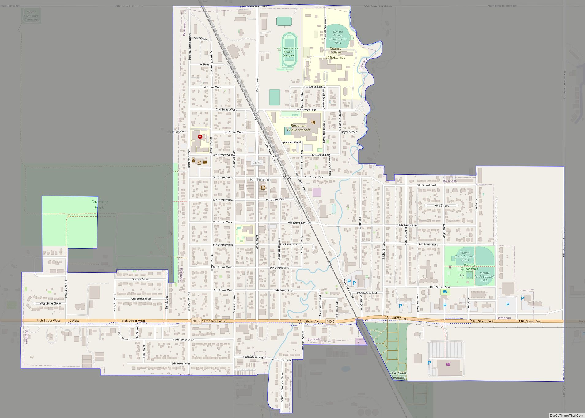
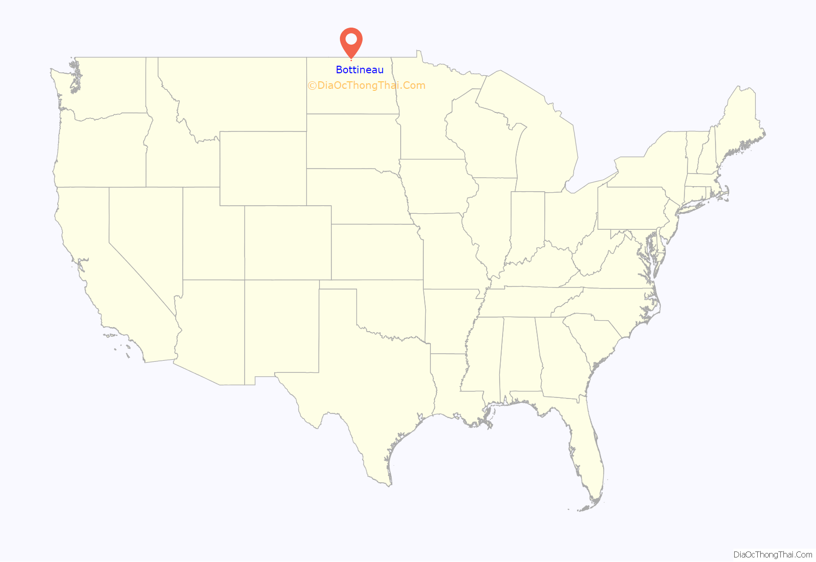
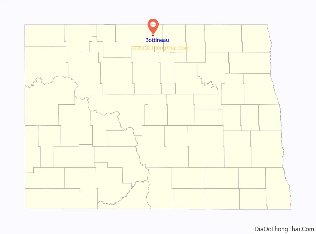
Bottineau is a city in Bottineau County, North Dakota, United States. It is the county seat of Bottineau County and is located just over ten miles (16 km) south of the Canada–United States border. The city’s population was 2,194 at the 2020 census.
The city is home to Dakota College at Bottineau. Attractions in Bottineau include the Bottineau Winter Park and “Tommy Turtle,” the world’s largest turtle, which has become a landmark for the city. Built in 1978 and thirty feet (9 m) in height, the fiberglass turtle is located in the eastern half of the city and was built as a symbol for the nearby Turtle Mountains. The International Peace Garden is nearby to the northeast.
Bottineau is also home to Programmer’s Broadcasting, which owns and operates KBTO, along with KTZU and KWGO in Minot.
| Name: | Bottineau city |
|---|---|
| LSAD Code: | 25 |
| LSAD Description: | city (suffix) |
| State: | North Dakota |
| County: | Bottineau County |
| Elevation: | 1,637 ft (499 m) |
| Total Area: | 1.32 sq mi (3.41 km²) |
| Land Area: | 1.32 sq mi (3.41 km²) |
| Water Area: | 0.00 sq mi (0.00 km²) |
| Total Population: | 2,194 |
| Population Density: | 1,667.17/sq mi (643.81/km²) |
| ZIP code: | 58318 |
| Area code: | 701 |
| FIPS code: | 3808460 |
| GNISfeature ID: | 1028083 |
| Website: | bottineau.govoffice.com |
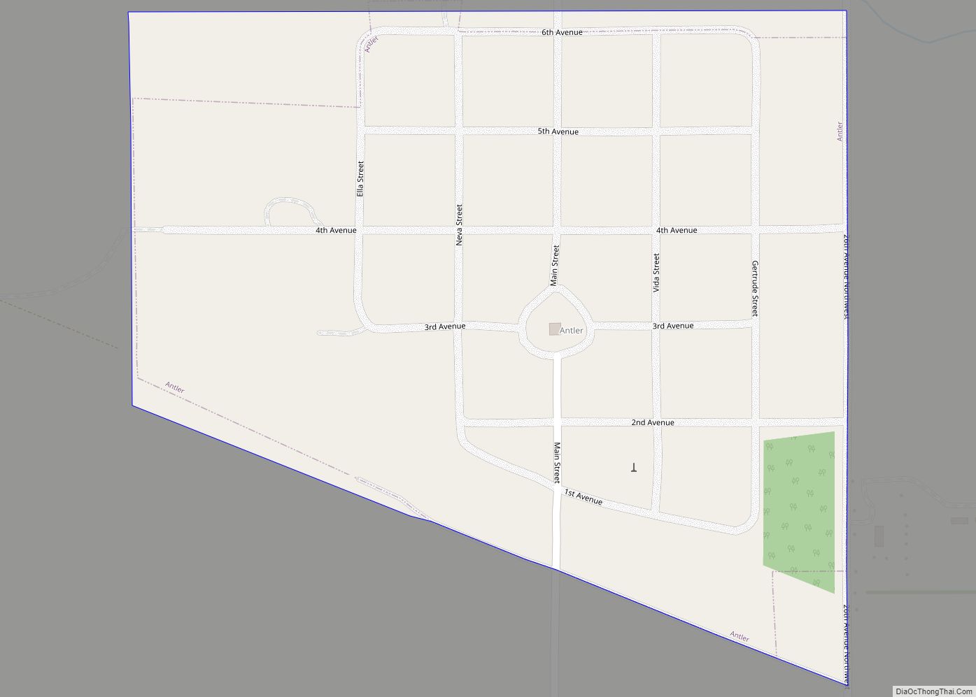
Online Interactive Map
Click on ![]() to view map in "full screen" mode.
to view map in "full screen" mode.
Bottineau location map. Where is Bottineau city?
History
Bottineau was founded in 1883 as Oak Creek as a customs station and an overnight stagecoach stop. The town name was changed to Bottineau in 1884 in honor of Pierre Bottineau (c. 1814–1895), a Métis pioneer, hunter, and trapper, who became a successful land speculator.
The town was originally located about 1½ miles (2½ km) north of its current location. The entire town was moved south in 1887 to where the Great Northern Railway was installing new tracks.
In 2012, a new chalet called Annie’s House was built in Bottineau Winter Park, ten miles (16 km) north. The facility was North Dakota’s first ski facility for handicapped children and wounded veterans. It was built to honor Ann Nicole Nelson, who was the only North Dakotan to die in the September 11 attacks on the World Trade Center in New York City.
Bottineau Road Map
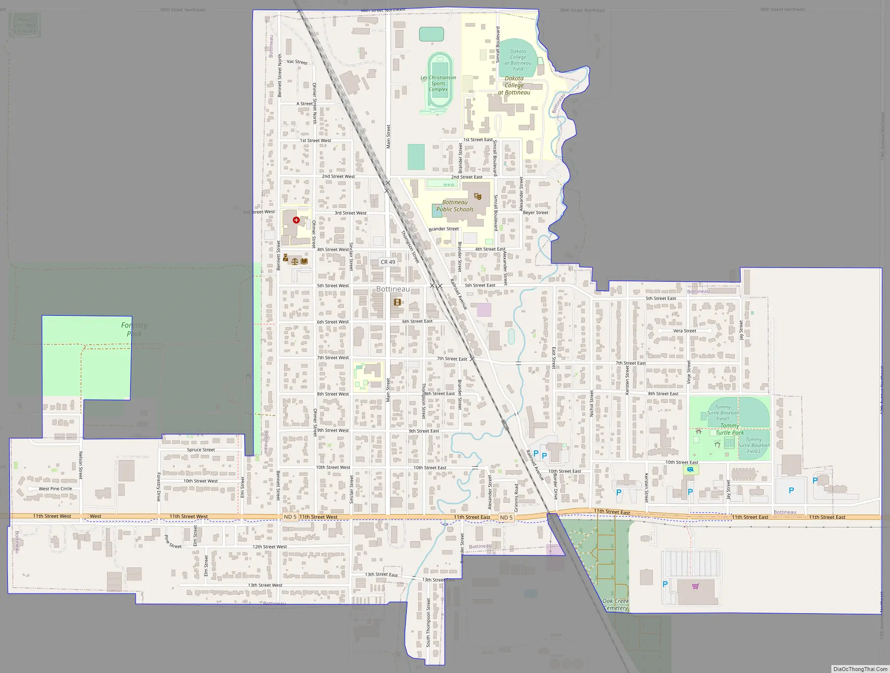
Bottineau city Satellite Map

Geography
According to the United States Census Bureau, the city has a total area of 1.09 square miles (2.82 km), all land. The elevation is 1,637 feet (499 m) above sea level.
Bottineau has a humid continental climate (Koppen: Dfb) with four seasons and huge differences in temperatures throughout the year. Summers tend to be warm, sometimes hot, and winters are severely cold. On February 13, 2021, the record low temperature of −51 °F (−46 °C) was registered.
See also
Map of North Dakota State and its subdivision:- Adams
- Barnes
- Benson
- Billings
- Bottineau
- Bowman
- Burke
- Burleigh
- Cass
- Cavalier
- Dickey
- Divide
- Dunn
- Eddy
- Emmons
- Foster
- Golden Valley
- Grand Forks
- Grant
- Griggs
- Hettinger
- Kidder
- Lamoure
- Logan
- McHenry
- McIntosh
- McKenzie
- McLean
- Mercer
- Morton
- Mountrail
- Nelson
- Oliver
- Pembina
- Pierce
- Ramsey
- Ransom
- Renville
- Richland
- Rolette
- Sargent
- Sheridan
- Sioux
- Slope
- Stark
- Steele
- Stutsman
- Towner
- Traill
- Walsh
- Ward
- Wells
- Williams
- Alabama
- Alaska
- Arizona
- Arkansas
- California
- Colorado
- Connecticut
- Delaware
- District of Columbia
- Florida
- Georgia
- Hawaii
- Idaho
- Illinois
- Indiana
- Iowa
- Kansas
- Kentucky
- Louisiana
- Maine
- Maryland
- Massachusetts
- Michigan
- Minnesota
- Mississippi
- Missouri
- Montana
- Nebraska
- Nevada
- New Hampshire
- New Jersey
- New Mexico
- New York
- North Carolina
- North Dakota
- Ohio
- Oklahoma
- Oregon
- Pennsylvania
- Rhode Island
- South Carolina
- South Dakota
- Tennessee
- Texas
- Utah
- Vermont
- Virginia
- Washington
- West Virginia
- Wisconsin
- Wyoming