Map of La Union CDP
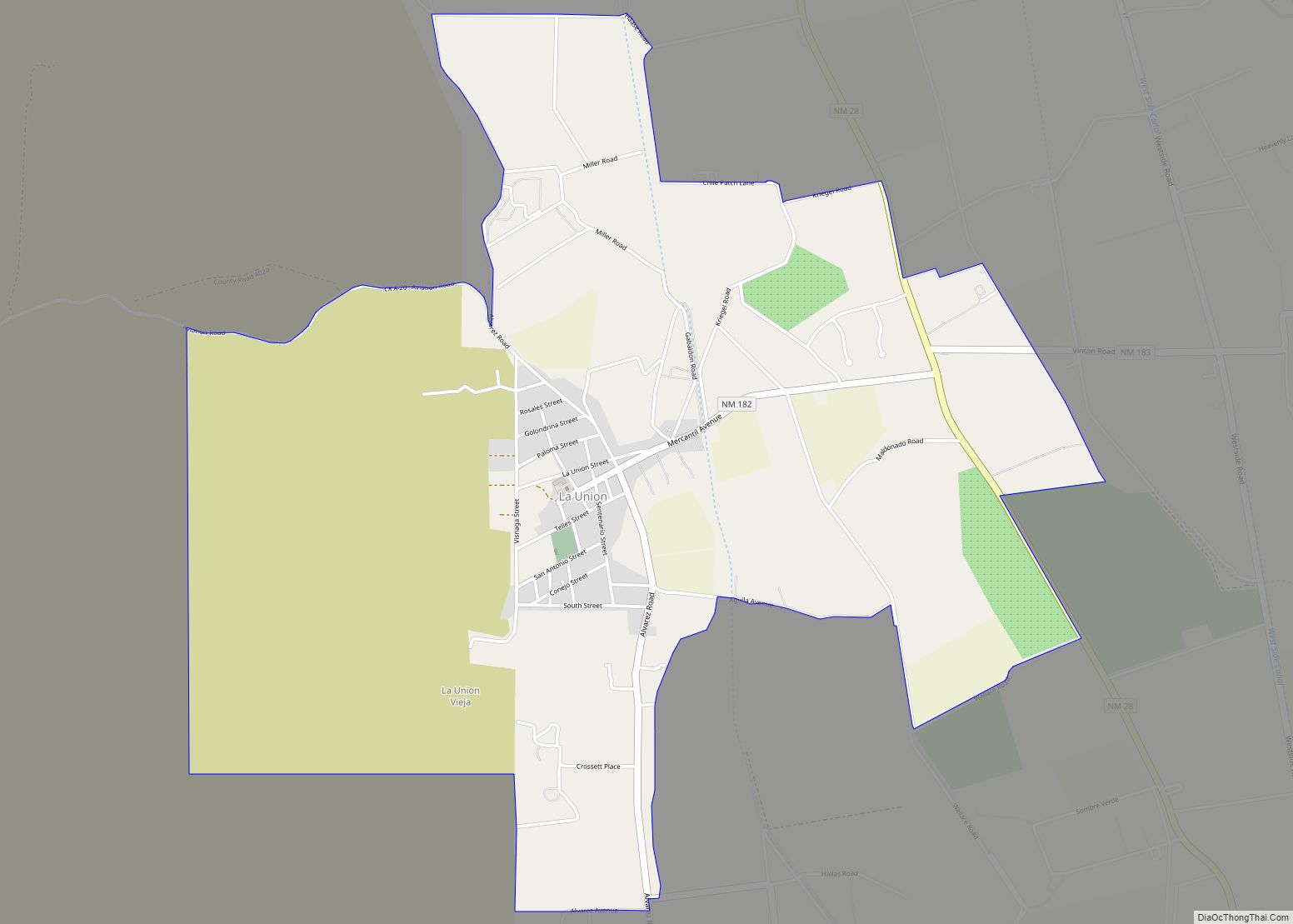
La Union is a census-designated place in Doña Ana County, New Mexico, United States. Its population was 1,106 as of the 2010 census. NM 182 connects the community to NM 28. La Union CDP overview: Name: La Union CDP LSAD Code: 57 LSAD Description: CDP (suffix) State: New Mexico County: Doña Ana County Elevation: 3,799 ft ... Read more
Map of La Union CDP
Map of La Puebla CDP
La Puebla is a census-designated place (CDP) in Santa Fe County, New Mexico, United States. It is part of the Santa Fe, New Mexico Metropolitan Statistical Area. The population was 1,296 at the 2000 census. La Puebla CDP overview: Name: La Puebla CDP LSAD Code: 57 LSAD Description: CDP (suffix) State: New Mexico County: Santa ... Read more
Map of La Puebla CDP
Map of La Plata CDP, New Mexico
La Plata is a census-designated place in San Juan County, New Mexico, United States. Its population was 612 as of the 2010 census. La Plata has a post office with ZIP code 87418. The community is located at the junction of state roads 170 and 574. La Plata CDP overview: Name: La Plata CDP LSAD ... Read more
Map of La Plata CDP, New Mexico
Map of La Mesilla CDP
La Mesilla is a census-designated place in Río Arriba County, New Mexico, United States. Its population was 1,772 as of the 2010 census. In 1870, a family from La Mesilla was ambushed and killed by Mexicans disguised as Native Americans. La Mesilla CDP overview: Name: La Mesilla CDP LSAD Code: 57 LSAD Description: CDP (suffix) ... Read more
Map of La Mesilla CDP
Map of Las Maravillas CDP
Las Maravillas is a census-designated place in Valencia County, New Mexico, United States. Its population was 1,628 as of the 2010 census. Las Maravillas CDP overview: Name: Las Maravillas CDP LSAD Code: 57 LSAD Description: CDP (suffix) State: New Mexico County: Valencia County Elevation: 5,023 ft (1,531 m) Total Area: 1.01 sq mi (2.62 km²) Land Area: 1.01 sq mi (2.61 km²) Water ... Read more
Map of Las Maravillas CDP
Map of Lamy CDP
Lamy is a census-designated place (CDP) in Santa Fe County, New Mexico, United States, 18 miles (29 km) south of the city of Santa Fe. The community was named for Archbishop Jean-Baptiste Lamy, and lies within the Bishop John Lamy Spanish Land Grant, which dates back to the eighteenth century. Lamy is part of the Santa ... Read more
Map of Lamy CDP
Map of Lake Valley CDP
Lake Valley is an unincorporated community and census-designated place in San Juan County, New Mexico, United States. Its population was 64 as of the 2010 census. Lake Valley CDP overview: Name: Lake Valley CDP LSAD Code: 57 LSAD Description: CDP (suffix) State: New Mexico County: San Juan County Elevation: 5,909 ft (1,801 m) Total Area: 8.347 sq mi (21.62 km²) ... Read more
Map of Lake Valley CDP
Map of Llano del Medio CDP
Llano del Medio is an unincorporated community and census-designated place in Guadalupe County, New Mexico, United States. Its population was 118 as of the 2010 census, of which 111 people were Hispanic in origin. New Mexico State Road 119 passes through the community. Llano del Medio CDP overview: Name: Llano del Medio CDP LSAD Code: ... Read more
Map of Llano del Medio CDP
Map of Livingston Wheeler CDP
Livingston Wheeler is an unincorporated community and census-designated place in Eddy County, New Mexico, United States. Its population was 609 as of the 2010 census. The community is located on the southeastern edge of Carlsbad along New Mexico State Road 216. Livingston Wheeler CDP overview: Name: Livingston Wheeler CDP LSAD Code: 57 LSAD Description: CDP ... Read more
Map of Livingston Wheeler CDP
Map of Lemitar CDP
Lemitar is a census-designated place in Socorro County, New Mexico, United States. Its population was 330 as of the 2010 census. Lemitar has a post office with ZIP code 87823. Exit 156 on Interstate 25 serves the community. Lemitar CDP overview: Name: Lemitar CDP LSAD Code: 57 LSAD Description: CDP (suffix) State: New Mexico County: ... Read more
Map of Lemitar CDP
Map of Lee Acres CDP
Lee Acres is a census-designated place in San Juan County, New Mexico, United States. Its population was 5,858 as of the 2010 census. It is located on U.S. Route 64 between Farmington and Bloomfield. Lee Acres CDP overview: Name: Lee Acres CDP LSAD Code: 57 LSAD Description: CDP (suffix) State: New Mexico County: San Juan ... Read more
Map of Lee Acres CDP
Map of Las Vegas city, New Mexico
Las Vegas is a city in and the county seat of San Miguel County, New Mexico, United States. Once two separate municipalities (one a city and the other a town), both were named Las Vegas—West Las Vegas (“Old Town”) and East Las Vegas (“New Town”); they are separated by the Gallinas River and retain distinct ... Read more
Map of Las Vegas city, New Mexico