Map of Yellville city
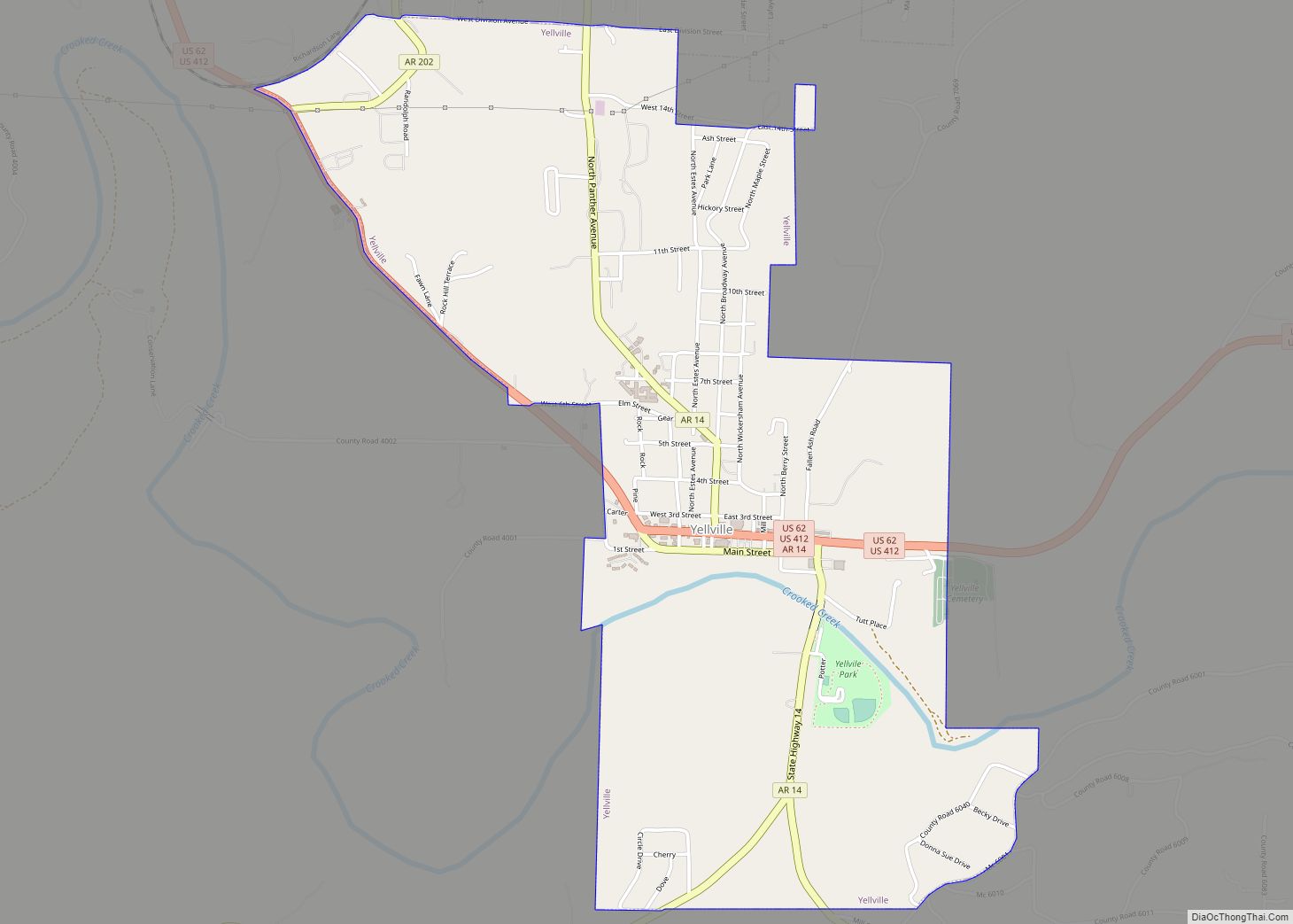
Yellville is a city and county seat in Marion County, Arkansas, United States. Yellville is located in the Ozark Mountains along the banks of Crooked Creek, and neighbors the small town of Summit to the north. The population was 1,178 at the 2020 census. The town’s original name is preserved in the Shawnee Town Branch, ... Read more
Map of Yellville city
Map of Yarborough Landing CDP
Yarborough Landing is a census-designated place in Little River County, Arkansas, United States. Per the 2020 census, the population was 457. Yarborough Landing CDP overview: Name: Yarborough Landing CDP LSAD Code: 57 LSAD Description: CDP (suffix) State: Arkansas County: Little River County Elevation: 308 ft (94 m) Total Area: 2.18 sq mi (5.64 km²) Land Area: 2.17 sq mi (5.61 km²) Water Area: ... Read more
Map of Yarborough Landing CDP
Map of Wynne city
Wynne is the county seat and largest city of Cross County, Arkansas, United States. The population was 8,314 at the 2020 Census. Nestled between the Arkansas Delta and Crowley’s Ridge, Wynne is the closest city to the second-largest state park in Arkansas, Village Creek State Park. Wynne city overview: Name: Wynne city LSAD Code: 25 ... Read more
Map of Wynne city
Map of Aasu village
Aasu village overview: Name: Aasu village LSAD Code: 47 LSAD Description: village (suffix) State: American Samoa FIPS code: 6000100 Online Interactive Map Aasu online map. Source: Basemap layers from Google Map, Open Street Map (OSM), Arcgisonline, Wmflabs. Boundary Data from Database of Global Administrative Areas. Aasu location map. Where is Aasu village? Aasu Road Map ... Read more
Map of Aasu village
Map of Zinc town
Zinc is a town near the east-central edge of Boone County, Arkansas, United States. The population was 92 at the 2020 census. It is part of the Harrison Micropolitan Statistical Area. A chapter of the Ku Klux Klan operates in Zinc. Zinc town overview: Name: Zinc town LSAD Code: 43 LSAD Description: town (suffix) State: ... Read more
Map of Zinc town
Map of Afao village
Afao village overview: Name: Afao village LSAD Code: 47 LSAD Description: village (suffix) State: American Samoa FIPS code: 6002500 Online Interactive Map Afao online map. Source: Basemap layers from Google Map, Open Street Map (OSM), Arcgisonline, Wmflabs. Boundary Data from Database of Global Administrative Areas. Afao location map. Where is Afao village? Afao Road Map ... Read more
Map of Afao village
Map of Agugulu village
Agugulu village overview: Name: Agugulu village LSAD Code: 47 LSAD Description: village (suffix) State: American Samoa FIPS code: 6004500 Online Interactive Map Agugulu online map. Source: Basemap layers from Google Map, Open Street Map (OSM), Arcgisonline, Wmflabs. Boundary Data from Database of Global Administrative Areas. Agugulu location map. Where is Agugulu village? Agugulu Road Map ... Read more
Map of Agugulu village
Map of Afono village
Afono village overview: Name: Afono village LSAD Code: 47 LSAD Description: village (suffix) State: American Samoa FIPS code: 6003300 Online Interactive Map Afono online map. Source: Basemap layers from Google Map, Open Street Map (OSM), Arcgisonline, Wmflabs. Boundary Data from Database of Global Administrative Areas. Afono location map. Where is Afono village? Afono Road Map ... Read more
Map of Afono village
Map of Alofau village
Alofau village overview: Name: Alofau village LSAD Code: 47 LSAD Description: village (suffix) State: American Samoa FIPS code: 6007300 Online Interactive Map Alofau online map. Source: Basemap layers from Google Map, Open Street Map (OSM), Arcgisonline, Wmflabs. Boundary Data from Database of Global Administrative Areas. Alofau location map. Where is Alofau village? Alofau Road Map ... Read more
Map of Alofau village
Map of Alega village
Alega village overview: Name: Alega village LSAD Code: 47 LSAD Description: village (suffix) State: American Samoa FIPS code: 6006500 Online Interactive Map Alega online map. Source: Basemap layers from Google Map, Open Street Map (OSM), Arcgisonline, Wmflabs. Boundary Data from Database of Global Administrative Areas. Alega location map. Where is Alega village? Alega Road Map ... Read more
Map of Alega village
Map of Alao village
Alao village overview: Name: Alao village LSAD Code: 47 LSAD Description: village (suffix) State: American Samoa FIPS code: 6004900 Online Interactive Map Alao online map. Source: Basemap layers from Google Map, Open Street Map (OSM), Arcgisonline, Wmflabs. Boundary Data from Database of Global Administrative Areas. Alao location map. Where is Alao village? Alao Road Map ... Read more
Map of Alao village
Map of Amaua village
Amaua village overview: Name: Amaua village LSAD Code: 47 LSAD Description: village (suffix) State: American Samoa FIPS code: 6009700 Online Interactive Map Amaua online map. Source: Basemap layers from Google Map, Open Street Map (OSM), Arcgisonline, Wmflabs. Boundary Data from Database of Global Administrative Areas. Amaua location map. Where is Amaua village? Amaua Road Map ... Read more
Map of Amaua village