Map of Gann (Brinkhaven) village
Brinkhaven, once known as Mount Holly and Gann, is a village in Knox County, Ohio, United States. The population was 125 at the 2010 census. Gann (Brinkhaven) village overview: Name: Gann (Brinkhaven) village LSAD Code: 47 LSAD Description: village (suffix) State: Ohio County: Knox County Total Area: 0.20 sq mi (0.51 km²) Land Area: 0.18 sq mi (0.48 km²) Water Area: ... Read more
Map of Gann (Brinkhaven) village
Map of Gambier village
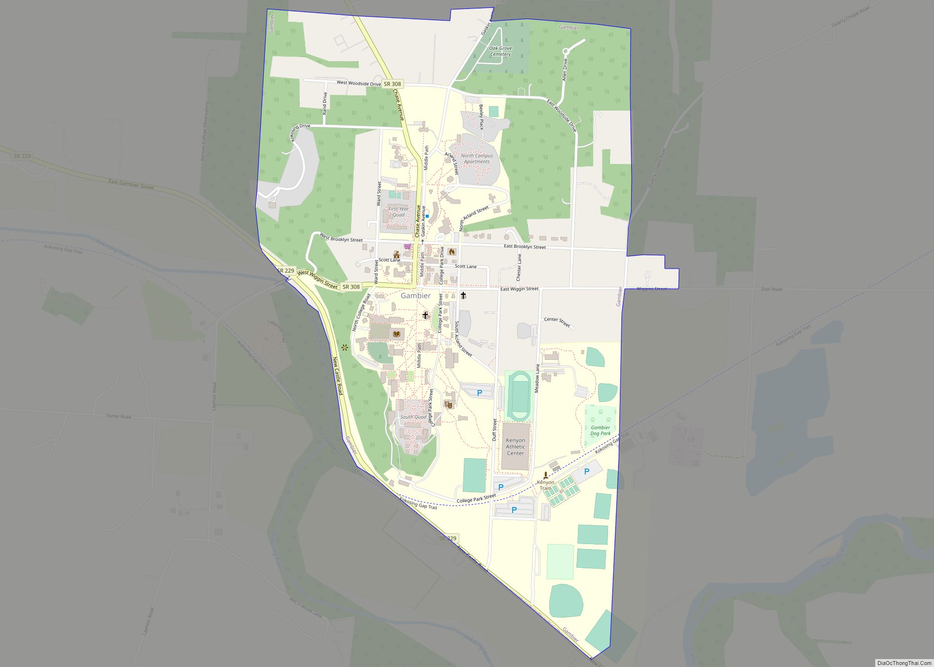
Gambier is a village in Knox County, Ohio, United States. The population was 2,391 at the 2010 census. Gambier is the home of Kenyon College. A major feature is a gravel path running the length of the village, referred to as “Middle Path”. This path has become a piece of Gambier’s history, as it is ... Read more
Map of Gambier village
Map of Gallipolis village
Gallipolis (/ˌɡæləpəˈliːs/ GAL-ə-pə-LEES) is a chartered village in and the county seat of Gallia County, Ohio, United States. The municipality is located in Southeast Ohio along the Ohio River about 55 miles southeast of Chillicothe and 44 miles northwest of Charleston, West Virginia. The population was 3,313 at the 2020 census. Gallipolis is the second-largest ... Read more
Map of Gallipolis village
Map of Galion city
Galion is a city in Crawford, Morrow, and Richland counties in the U.S. state of Ohio. The population was 10,453 at the 2020 census. Galion is the second-largest city in Crawford County after Bucyrus. The Crawford County portion of Galion is part of the Bucyrus Micropolitan Statistical Area. The small portion of the city that ... Read more
Map of Galion city
Map of Girard city, Ohio
Girard is a city in southern Trumbull County, Ohio, United States, along the Mahoning River. The population was 9,603 at the 2020 census. Located directly north of Youngstown, it is a suburb of the Youngstown–Warren metropolitan area. Girard city overview: Name: Girard city LSAD Code: 25 LSAD Description: city (suffix) State: Ohio County: Trumbull County ... Read more
Map of Girard city, Ohio
Map of Gilboa village
Gilboa is a village in Putnam County, Ohio, United States. The village is named after Mount Gilboa. The population was 184 at the 2010 census. Gilboa village overview: Name: Gilboa village LSAD Code: 47 LSAD Description: village (suffix) State: Ohio County: Putnam County Elevation: 748 ft (228 m) Total Area: 0.13 sq mi (0.34 km²) Land Area: 0.13 sq mi (0.34 km²) Water ... Read more
Map of Gilboa village
Map of Gibsonburg village
Gibsonburg is a village in Sandusky County, Ohio, United States, about 33 miles (53 km) southeast of Toledo. The population was 2,452 at the 2020 census. The National Arbor Day Foundation has designated Gibsonburg as a Tree City USA. Gibsonburg village overview: Name: Gibsonburg village LSAD Code: 47 LSAD Description: village (suffix) State: Ohio County: Sandusky ... Read more
Map of Gibsonburg village
Map of Gettysburg village, Ohio
Gettysburg is a village in Darke County, Ohio, United States. The population was 513 at the 2010 census. Gettysburg village overview: Name: Gettysburg village LSAD Code: 47 LSAD Description: village (suffix) State: Ohio County: Darke County Elevation: 991 ft (302 m) Total Area: 0.44 sq mi (1.14 km²) Land Area: 0.44 sq mi (1.13 km²) Water Area: 0.00 sq mi (0.00 km²) Total Population: 463 Population ... Read more
Map of Gettysburg village, Ohio
Map of Germantown city, Ohio
Germantown is a city in Montgomery County, Ohio, United States. The population was 5,796 at the 2020 census. A part of the Dayton metropolitan area, Germantown was founded by German Americans from Pennsylvania and was once home to a cigar industry. Germantown city overview: Name: Germantown city LSAD Code: 25 LSAD Description: city (suffix) State: ... Read more
Map of Germantown city, Ohio
Map of Georgetown village, Ohio
Georgetown is a village in Brown County, Ohio, United States located about 36 miles southeast of Cincinnati. The population was 4,331 at the 2010 census. It is the county seat of Brown County. Georgetown was the childhood home of Ulysses S. Grant. Georgetown village overview: Name: Georgetown village LSAD Code: 47 LSAD Description: village (suffix) ... Read more
Map of Georgetown village, Ohio
Map of Genoa village, Ohio
Genoa is a village in Ottawa County, Ohio, United States. The population was 2,336 at the 2010 census. Originally settled as Stony Ridge, it took its present name in 1856 and was incorporated as a village on December 10, 1868. Genoa village overview: Name: Genoa village LSAD Code: 47 LSAD Description: village (suffix) State: Ohio ... Read more
Map of Genoa village, Ohio
Map of Glendale village, Ohio
Glendale is a village in Hamilton County, Ohio, United States. The population was 2,298 at the 2020 census. It is a northern suburb of Cincinnati, and is the site of the Glendale Historic District. Glendale village overview: Name: Glendale village LSAD Code: 47 LSAD Description: village (suffix) State: Ohio County: Hamilton County Elevation: 630 ft (192 m) ... Read more
Map of Glendale village, Ohio