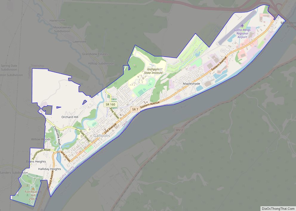
Gallipolis (/ˌɡæləpəˈliːs/ GAL-ə-pə-LEES) is a chartered village in and the county seat of Gallia County, Ohio, United States. The municipality is located in Southeast Ohio along the Ohio River about 55 miles southeast of Chillicothe and 44 miles northwest of Charleston, West Virginia. The population was 3,313 at the 2020 census. Gallipolis is the second-largest community in the rural Point Pleasant micropolitan area, which includes all of Gallia County, Ohio and Mason County, West Virginia.
| Name: | Gallipolis village |
|---|---|
| LSAD Code: | 47 |
| LSAD Description: | village (suffix) |
| State: | Ohio |
| County: | Gallia County |
| Founded: | October 17, 1790; 232 years ago (1790-10-17) |
| Elevation: | 574 ft (175 m) |
| Total Area: | 3.83 sq mi (9.91 km²) |
| Land Area: | 3.60 sq mi (9.32 km²) |
| Water Area: | 0.23 sq mi (0.59 km²) |
| Total Population: | 3,313 |
| Population Density: | 921.05/sq mi (355.57/km²) |
| ZIP code: | 45631 |
| Area code: | 740 |
| FIPS code: | 3929204 |
| GNISfeature ID: | 1077526 |
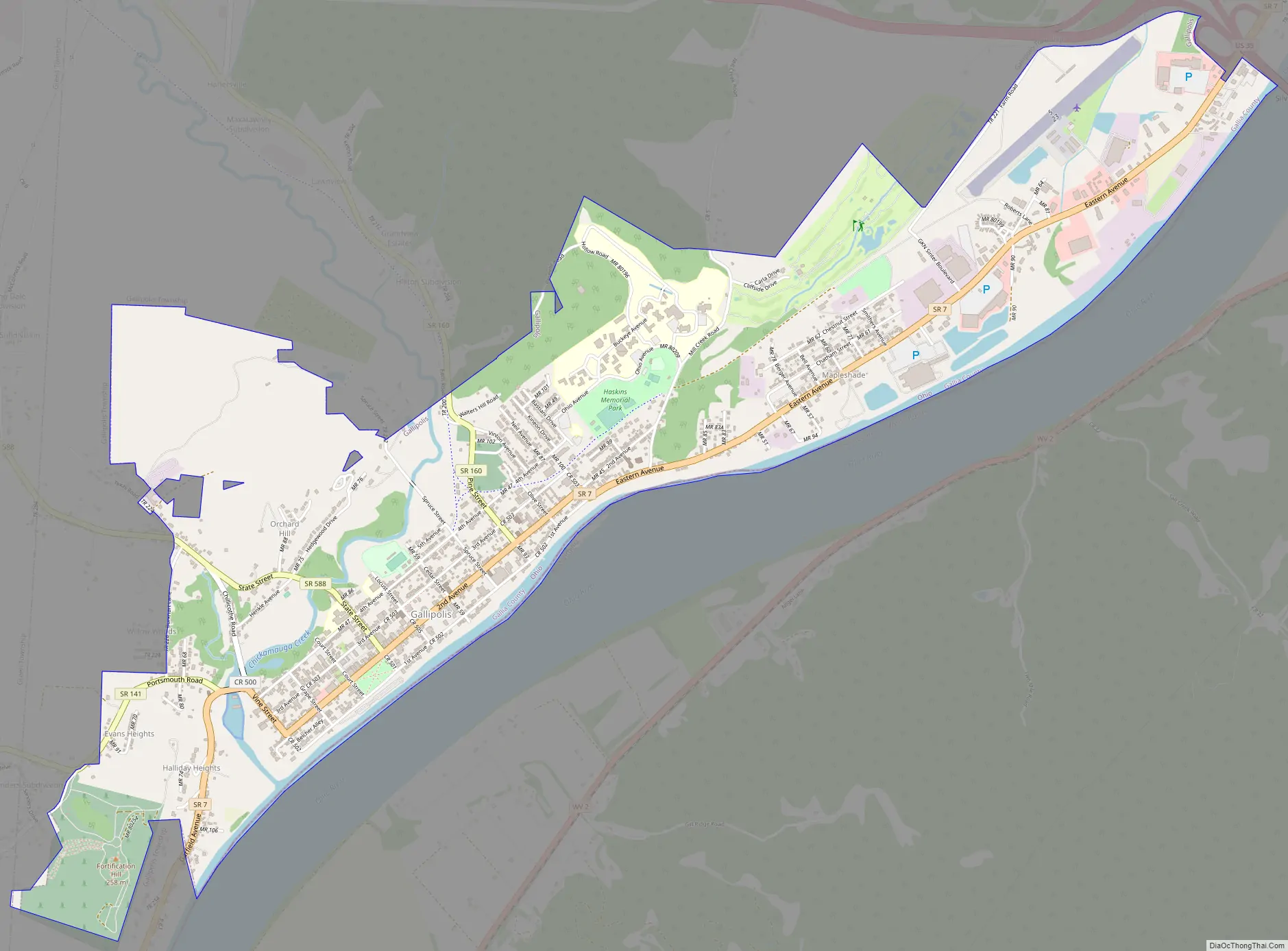
Online Interactive Map
Click on ![]() to view map in "full screen" mode.
to view map in "full screen" mode.
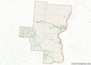
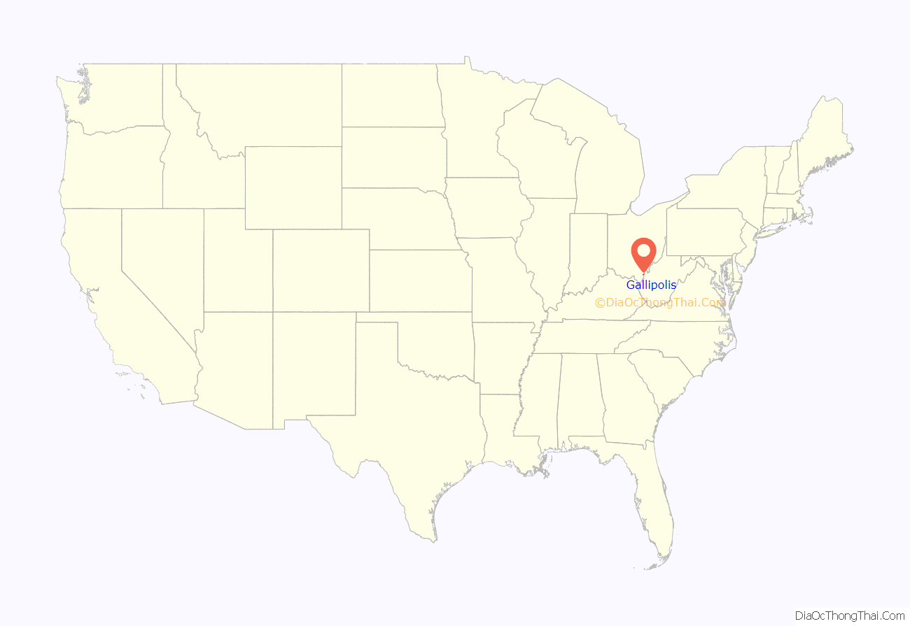
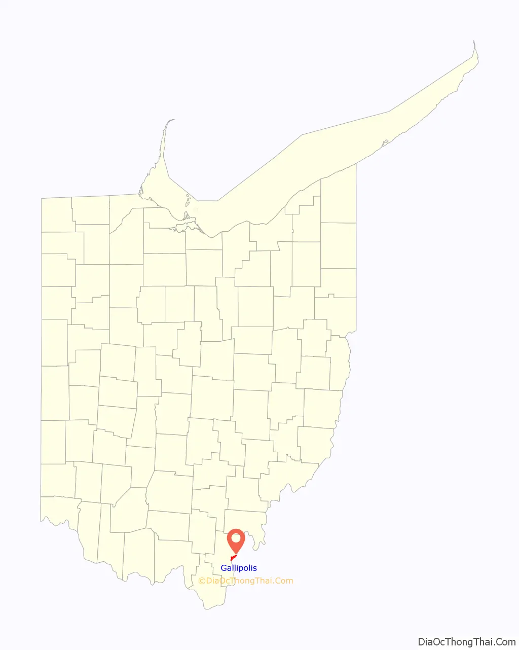
Gallipolis location map. Where is Gallipolis village?
History
Gallipolis was first settled by Europeans in 1790: “The French 500” were a group of French aristocrats, merchants, and artisans who were fleeing the violence and disruption of the French Revolution. They were led by Count Jean-Joseph de Barth, an Alsatian member of the French National Assembly. It is the second city to be founded in the newly organized Northwest Territory of the United States. It is known as “The Old French City” because of this beginning.
This was a time of rampant land speculation in the Northwest Territory, recently opened for settlement after it was organized following the Northwest Indian Wars. The French had worked with the Scioto Company, a purported land development company registered in Paris in 1789, paying its agents for land along the Ohio River. They sailed to the United States on several ships, most to Alexandria, Virginia, outside Washington, DC. From there they traveled over land and by the Ohio River to reach Gallipolis. The French were city people and were taken aback by the undeveloped frontier they encountered.
When they arrived at the Gallipolis area, they learned their deeds of land were worthless. The Scioto Company did not own the land, for which the Ohio Company had an option for development. They survived somehow, building cabins close together in what is now City Park, with a defensive palisade and bastions. In 1795 President George Washington’s administration granted the settlers free land in the French Grant in southwest present-day Scioto County, Ohio. Under the terms of this grant, settlers had to live on the land for 5 years and show cultivation to become owners. Settlers who chose to stay in Gallipolis had to pay again for their plots, this time to the Ohio Company. Most either sold their land in the French Grant or arranged to have tenants farm it.
The name Gallipolis is a construct of the Greek or Latin prefix “Galli-” and the Greek suffix “-polis”, meaning “city of the French”. A US post office called Gallipolis began operating there in 1794.
On November 30, 1893, the state-run Asylum for Epileptics and Epileptic Insane opened. Later it would become the Gallipolis Developmental Center, which is still operational today serving 52 patients with developmental disabilities in the Appalachian Ohio region.
On December 15, 1967, the Silver Bridge, connecting Gallipolis to Point Pleasant, West Virginia, across the Ohio River, collapsed under the weight of rush-hour traffic, resulting in the deaths of 46 people. It had been built in 1928, and analysis showed that the bridge was carrying much heavier loads than it had originally been designed for and had been poorly maintained. It was replaced by the Silver Memorial Bridge, completed in 1969. When the population dropped below 5,000, Gallipolis lost its city status and was classified as a village under state law. It continues to operate its government under its existing city charter.
Gallipolis Road Map
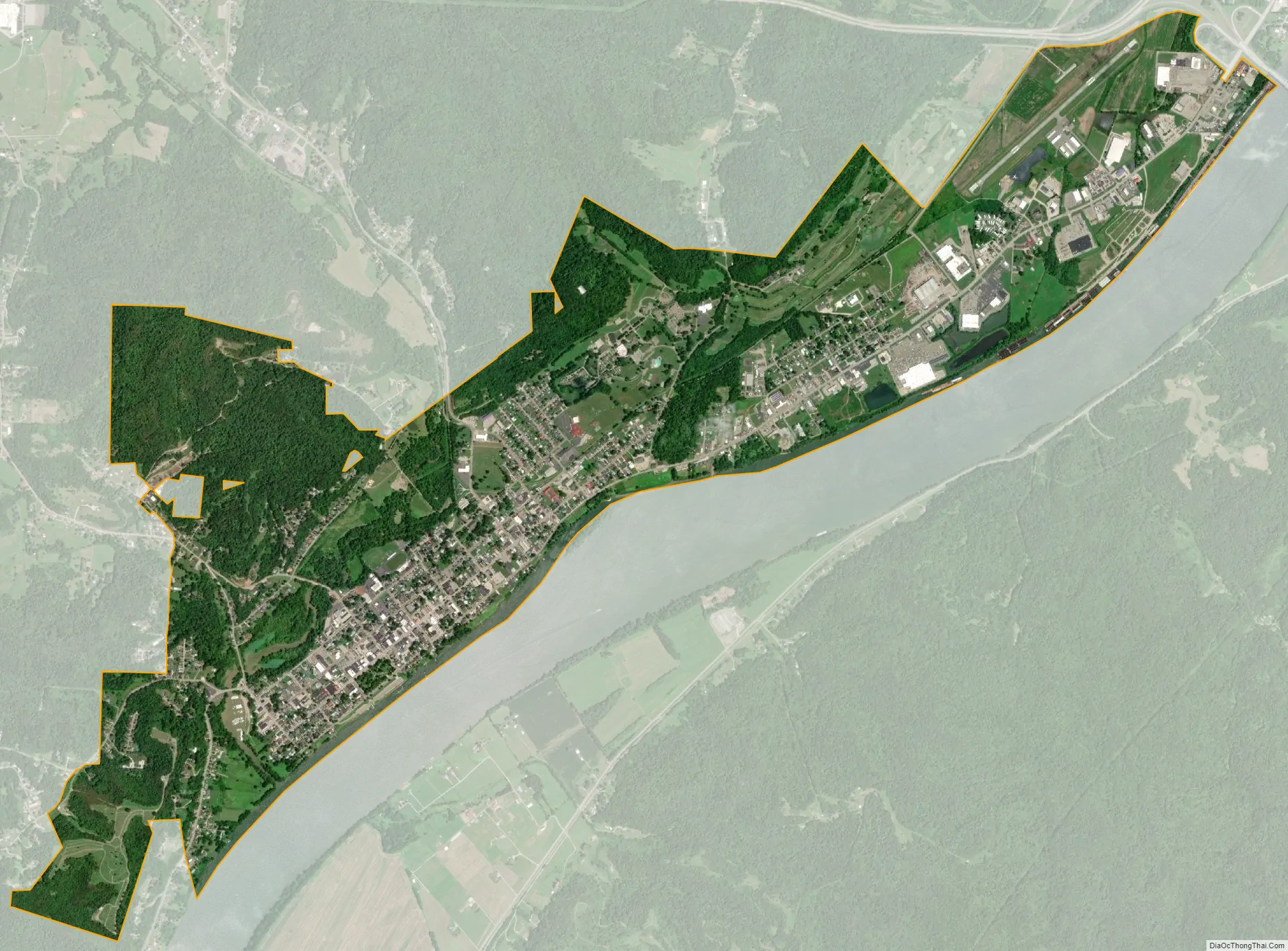
Gallipolis city Satellite Map
Geography
Gallipolis is located along the Ohio River in the Appalachia region.
According to the United States Census Bureau, the village has a total area of 3.83 square miles (9.92 km), of which 3.60 square miles (9.32 km) is land and 0.23 square miles (0.60 km) is water. Gallipolis is located in the unglaciated hills of southeastern Ohio.
Public lands
Gallipolis City Park is located centrally in the city and is the site of original settlement by 18th-century French refugees. Cassius M. Canaday Memorial Playground is in the village’s east end. Sports facilities include Memorial Field and Cliffside Golf Club. The waterworks facility on Chestnut Street also has green space and some ballfields. The park is known for “Gallipolis in Lights,” a Christmas light display that has received national recognition.
Haskins Memorial Park is contiguous with the golf club. The Elizabeth L. Evans Waterfowl and Bird Sanctuary are adjacent to Memorial Field, which also features a skate park. The Texas Road Wildlife Area is located close by.
The village owns and operates the Pine Street and Mound Hill cemeteries. Mound Hill Park has picnic tables and is adjacent to the cemetery; both have a long view over the Ohio River, the village of Gallipolis, and the opposite shore. At least two persons of the founding French 500 are said to have been buried in Mound Hill cemetery. It was officially established in 1880 but had been used for burials before that.
Climate
Gallipolis, like most of the state of Ohio, has a humid continental climate (Köppen Dfa) transitioning into the neighboring subtropical climate. The village experiences four distinct seasons, with hot, muggy summers, and cold, dry winters. The village is part of USDA Hardiness zone 6b. October is the driest month, with an average of 2.86 inches (73 mm) of precipitation.
Winters are cold, with an average January temperature of 34.3 °F (1.3 °C). Snowfall is generally very light, with a mean average snowfall of 10.9 inches (280 mm). The village does not experience by lake-effect snow, although the village’s weather can be influenced by the Great Lakes and regional topography. On average, there are 109 nights per year when the temperature drops to or below freezing, and only 14 days when the temperature fails to rise above freezing. Summers are hot and humid, with an average July temperature of 78.6 °F (25.9 °C). There are an average of 39 days per year with highs at or above 90 °F (32 °C).
Precipitation is generally heavier from the late spring to early summer (May through July), and on average Gallipolis receives 40.3 inches (1,020 mm) of precipitation annually; historically, annual precipitation has ranged from 27.28 inches (693 mm) in 1987 to 53.91 inches (1,369 mm) in 2004. Like many places in the Midwest, Gallipolis is subject to severe weather. During the spring and summer, severe thunderstorms may be accompanied by lightning, hail, flooding and tornadoes. Perhaps the most notable tornado event was the 1968 Wheelersburg tornado outbreak.
See also
Map of Ohio State and its subdivision:- Adams
- Allen
- Ashland
- Ashtabula
- Athens
- Auglaize
- Belmont
- Brown
- Butler
- Carroll
- Champaign
- Clark
- Clermont
- Clinton
- Columbiana
- Coshocton
- Crawford
- Cuyahoga
- Darke
- Defiance
- Delaware
- Erie
- Fairfield
- Fayette
- Franklin
- Fulton
- Gallia
- Geauga
- Greene
- Guernsey
- Hamilton
- Hancock
- Hardin
- Harrison
- Henry
- Highland
- Hocking
- Holmes
- Huron
- Jackson
- Jefferson
- Knox
- Lake
- Lake Erie
- Lawrence
- Licking
- Logan
- Lorain
- Lucas
- Madison
- Mahoning
- Marion
- Medina
- Meigs
- Mercer
- Miami
- Monroe
- Montgomery
- Morgan
- Morrow
- Muskingum
- Noble
- Ottawa
- Paulding
- Perry
- Pickaway
- Pike
- Portage
- Preble
- Putnam
- Richland
- Ross
- Sandusky
- Scioto
- Seneca
- Shelby
- Stark
- Summit
- Trumbull
- Tuscarawas
- Union
- Van Wert
- Vinton
- Warren
- Washington
- Wayne
- Williams
- Wood
- Wyandot
- Alabama
- Alaska
- Arizona
- Arkansas
- California
- Colorado
- Connecticut
- Delaware
- District of Columbia
- Florida
- Georgia
- Hawaii
- Idaho
- Illinois
- Indiana
- Iowa
- Kansas
- Kentucky
- Louisiana
- Maine
- Maryland
- Massachusetts
- Michigan
- Minnesota
- Mississippi
- Missouri
- Montana
- Nebraska
- Nevada
- New Hampshire
- New Jersey
- New Mexico
- New York
- North Carolina
- North Dakota
- Ohio
- Oklahoma
- Oregon
- Pennsylvania
- Rhode Island
- South Carolina
- South Dakota
- Tennessee
- Texas
- Utah
- Vermont
- Virginia
- Washington
- West Virginia
- Wisconsin
- Wyoming