Map of Friendship CDP, Ohio
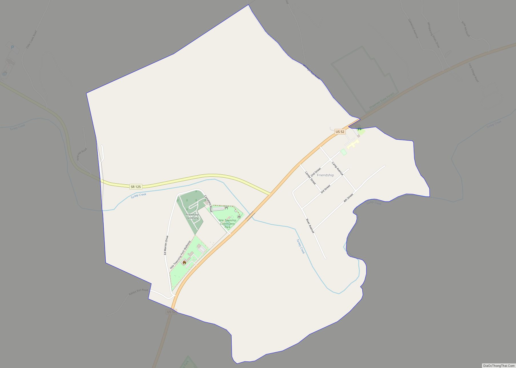
Friendship is a census-designated place in western Nile Township, Scioto County, Ohio, United States. As of the 2010 census it had a population of 351. It has a post office with the ZIP code 45630. It lies along U.S. Route 52. The citizens of Friendship are served by the Nile Township Volunteer Fire Department and ... Read more
Map of Friendship CDP, Ohio
Map of Fresno CDP, Ohio
Fresno is a census-designated place in eastern White Eyes Township, Coshocton County, Ohio, United States. As of the 2010 census it had a population of 140. It has a post office with the ZIP code 43824, gas station, White Eyes Carryout/Drive Thru and Pizza Shop. It lies along State Route 93 between West Lafayette and ... Read more
Map of Fresno CDP, Ohio
Map of Fremont city, Ohio
Fremont is a city in and the county seat of Sandusky County, Ohio, United States, located along the banks of the Sandusky River. It is about 35 miles (56 km) from Toledo and 25 miles (40 km) from Sandusky. It is part of the Toledo metropolitan area. The population was 15,930 at the 2020 census. The city ... Read more
Map of Fremont city, Ohio
Map of Freeport village, Ohio
Freeport is a village in southwestern Harrison County, Ohio, United States. The population was 321 at the 2020 census. Freeport village overview: Name: Freeport village LSAD Code: 47 LSAD Description: village (suffix) State: Ohio County: Harrison County Elevation: 997 ft (304 m) Total Area: 0.60 sq mi (1.55 km²) Land Area: 0.60 sq mi (1.55 km²) Water Area: 0.00 sq mi (0.00 km²) Total Population: 321 ... Read more
Map of Freeport village, Ohio
Map of Fredericktown village, Ohio
Fredericktown is a village in Knox County, Ohio, United States. The population was 2,493 at the 2010 census. Fredericktown village overview: Name: Fredericktown village LSAD Code: 47 LSAD Description: village (suffix) State: Ohio County: Knox County Elevation: 1,090 ft (332.2 m) Total Area: 2.08 sq mi (5.38 km²) Land Area: 1.98 sq mi (5.14 km²) Water Area: 0.09 sq mi (0.24 km²) Total Population: 2,648 Population ... Read more
Map of Fredericktown village, Ohio
Map of Fredericksburg village, Ohio
Fredericksburg is a village in Salt Creek Township, Wayne County, Ohio, United States. The population was 423 at the 2010 census. Fredericksburg was platted in 1824 by Jacob Frederick, and named for him. Fredericksburg village overview: Name: Fredericksburg village LSAD Code: 47 LSAD Description: village (suffix) State: Ohio County: Wayne County Elevation: 971 ft (296 m) Total ... Read more
Map of Fredericksburg village, Ohio
Map of Gambier village
Gambier is a village in Knox County, Ohio, United States. The population was 2,391 at the 2010 census. Gambier is the home of Kenyon College. A major feature is a gravel path running the length of the village, referred to as “Middle Path”. This path has become a piece of Gambier’s history, as it is ... Read more
Map of Gambier village
Map of Gallipolis village
Gallipolis (/ˌɡæləpəˈliːs/ GAL-ə-pə-LEES) is a chartered village in and the county seat of Gallia County, Ohio, United States. The municipality is located in Southeast Ohio along the Ohio River about 55 miles southeast of Chillicothe and 44 miles northwest of Charleston, West Virginia. The population was 3,313 at the 2020 census. Gallipolis is the second-largest ... Read more
Map of Gallipolis village
Map of Galion city
Galion is a city in Crawford, Morrow, and Richland counties in the U.S. state of Ohio. The population was 10,453 at the 2020 census. Galion is the second-largest city in Crawford County after Bucyrus. The Crawford County portion of Galion is part of the Bucyrus Micropolitan Statistical Area. The small portion of the city that ... Read more
Map of Galion city
Map of Galena village, Ohio
Galena is a village in Delaware County, Ohio, United States. The population was 653 at the 2010 United States Census. Galena village overview: Name: Galena village LSAD Code: 47 LSAD Description: village (suffix) State: Ohio County: Delaware County Elevation: 922 ft (281 m) Total Area: 1.83 sq mi (4.74 km²) Land Area: 1.73 sq mi (4.48 km²) Water Area: 0.10 sq mi (0.27 km²) Total Population: ... Read more
Map of Galena village, Ohio
Map of Geneva city, Ohio
Geneva is a city in northwestern Ashtabula County, Ohio, United States. The population was 5,924 at the 2020 census. It is part of the Ashtabula micropolitan area, 44 miles (71 km) northeast of Cleveland. The area which would become Geneva was originally settled in 1805, and was incorporated as a city in 1958. It is named ... Read more
Map of Geneva city, Ohio
Map of Geneva-on-the-Lake village
Geneva-on-the-Lake is a village in northwestern Ashtabula County, Ohio, United States, along the southern shore of Lake Erie. A small resort town, the population was 916 at the 2020 census. It is part of the Ashtabula micropolitan area, 46 miles (74 km) northeast of Cleveland. Geneva-on-the-Lake village overview: Name: Geneva-on-the-Lake village LSAD Code: 47 LSAD Description: ... Read more
Map of Geneva-on-the-Lake village