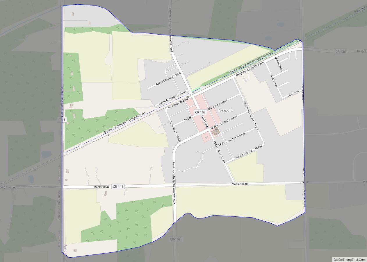
Neville is a village in Clermont County, Ohio, United States, along the Ohio River. The population was 87 at the 2020 census. Neville village overview: Name: Neville village LSAD Code: 47 LSAD Description: village (suffix) State: Ohio County: Clermont County Elevation: 499 ft (152 m) Total Area: 0.46 sq mi (1.18 km²) Land Area: 0.40 sq mi (1.02 km²) Water Area: 0.06 sq mi (0.16 km²) ... Read more
Map of US Cities and Places
Nevada (/nəˈveɪdə/ nə-VAY-də) is a village in Wyandot County, Ohio, United States. The population was 760 at the 2010 census. Nevada village overview: Name: Nevada village LSAD Code: 47 LSAD Description: village (suffix) State: Ohio County: Wyandot County Elevation: 928 ft (283 m) Total Area: 1.03 sq mi (2.66 km²) Land Area: 1.03 sq mi (2.66 km²) Water Area: 0.00 sq mi (0.00 km²) Total Population: ... Read more
Nettle Lake CDP overview: Name: Nettle Lake CDP LSAD Code: 57 LSAD Description: CDP (suffix) State: Ohio FIPS code: 3953914 Online Interactive Map Nettle Lake online map. Source: Basemap layers from Google Map, Open Street Map (OSM), Arcgisonline, Wmflabs. Boundary Data from Database of Global Administrative Areas. Nettle Lake location map. Where is Nettle Lake ... Read more
Nelsonville is a city in northwestern Athens County, Ohio, United States, located about 60 miles (97 km) southeast of Columbus. The population was 5,373 at the 2020 census. It is home to Hocking College as well as Rocky Brands. Nelsonville is surrounded by Ohio’s only national forest, the Wayne National Forest. Nelsonville city overview: Name: Nelsonville ... Read more
Nellie is a village in Coshocton County, Ohio, United States, along the Walhonding River. The population was 131 at the 2010 census. The 1930s-era Mohawk Dam, a dry dam built for flood control, is just to the north and west of the village. Nellie village overview: Name: Nellie village LSAD Code: 47 LSAD Description: village ... Read more
Negley is an unincorporated community and census-designated place in Middleton Township, Columbiana County, Ohio, United States. The population was 274 at the 2020 census. It is part of the Salem micropolitan area, 22 miles (35 km) south of Youngstown. Historically a mining community, Negley lies at the confluence of Bull Creek and the North Fork of ... Read more
New California is a census-designated place in central Jerome Township, Union County, Ohio, United States. It is located at 40°09′22″N 83°14′12″W / 40.15611°N 83.23667°W / 40.15611; -83.23667Coordinates: 40°09′22″N 83°14′12″W / 40.15611°N 83.23667°W / 40.15611; -83.23667, at the intersection of U.S. Route 42 and Industrial Parkway, just south of 42’s intersection with U.S. Route 33. New ... Read more
New Burlington is a census-designated place (CDP) in Springfield Township, Hamilton County, Ohio, United States. The population was 5,049 at the 2020 census. New Burlington CDP overview: Name: New Burlington CDP LSAD Code: 57 LSAD Description: CDP (suffix) State: Ohio County: Hamilton County Elevation: 820 ft (250 m) Total Area: 3.41 sq mi (8.84 km²) Land Area: 3.41 sq mi (8.83 km²) Water ... Read more
New Bremen (/ˈbriːmʌn/) is a village in Auglaize County, Ohio, United States. The population was 2,978 at the 2010 census. It is included in the Wapakoneta, Ohio Micropolitan Statistical Area. The village is adjacent to Minster to the south. The village was founded by German immigrants in 1832 and is named after Bremen. It is ... Read more
New Boston is a village in Scioto County, Ohio, United States, along the Ohio River. The population was 2,272 at the 2010 census. Apart from its southern boundary on the Ohio River, New Boston is entirely surrounded by the city of Portsmouth. New Boston is served by the Portsmouth Public Library and the New Boston ... Read more
New Bloomington is a village in Marion County, Ohio, United States. The population was 515 at the 2010 census. New Bloomington is served by Elgin Local School District. New Bloomington was originally named Carey Station, and under the latter name was laid out in 1856. New Bloomington village overview: Name: New Bloomington village LSAD Code: ... Read more
New Bavaria is a village in Henry County, Ohio, United States. The population was 86 at the 2020 census. New Bavaria village overview: Name: New Bavaria village LSAD Code: 47 LSAD Description: village (suffix) State: Ohio County: Henry County Elevation: 735 ft (224 m) Total Area: 0.07 sq mi (0.18 km²) Land Area: 0.07 sq mi (0.18 km²) Water Area: 0.00 sq mi (0.00 km²) Total ... Read more