New Bremen (/ˈbriːmʌn/) is a village in Auglaize County, Ohio, United States. The population was 2,978 at the 2010 census. It is included in the Wapakoneta, Ohio Micropolitan Statistical Area. The village is adjacent to Minster to the south.
The village was founded by German immigrants in 1832 and is named after Bremen. It is home to the Bicycle Museum of America. New Bremen is also the world headquarters of Crown Equipment Corporation.
| Name: | New Bremen village |
|---|---|
| LSAD Code: | 47 |
| LSAD Description: | village (suffix) |
| State: | Ohio |
| County: | Auglaize County |
| Elevation: | 945 ft (288 m) |
| Total Area: | 2.34 sq mi (6.06 km²) |
| Land Area: | 2.34 sq mi (6.06 km²) |
| Water Area: | 0.00 sq mi (0.00 km²) |
| Total Population: | 3,034 |
| Population Density: | 1,297.14/sq mi (500.73/km²) |
| ZIP code: | 45869 |
| Area code: | 419 |
| FIPS code: | 3954194 |
| GNISfeature ID: | 1065111 |
| Website: | http://www.newbremen.com/ |
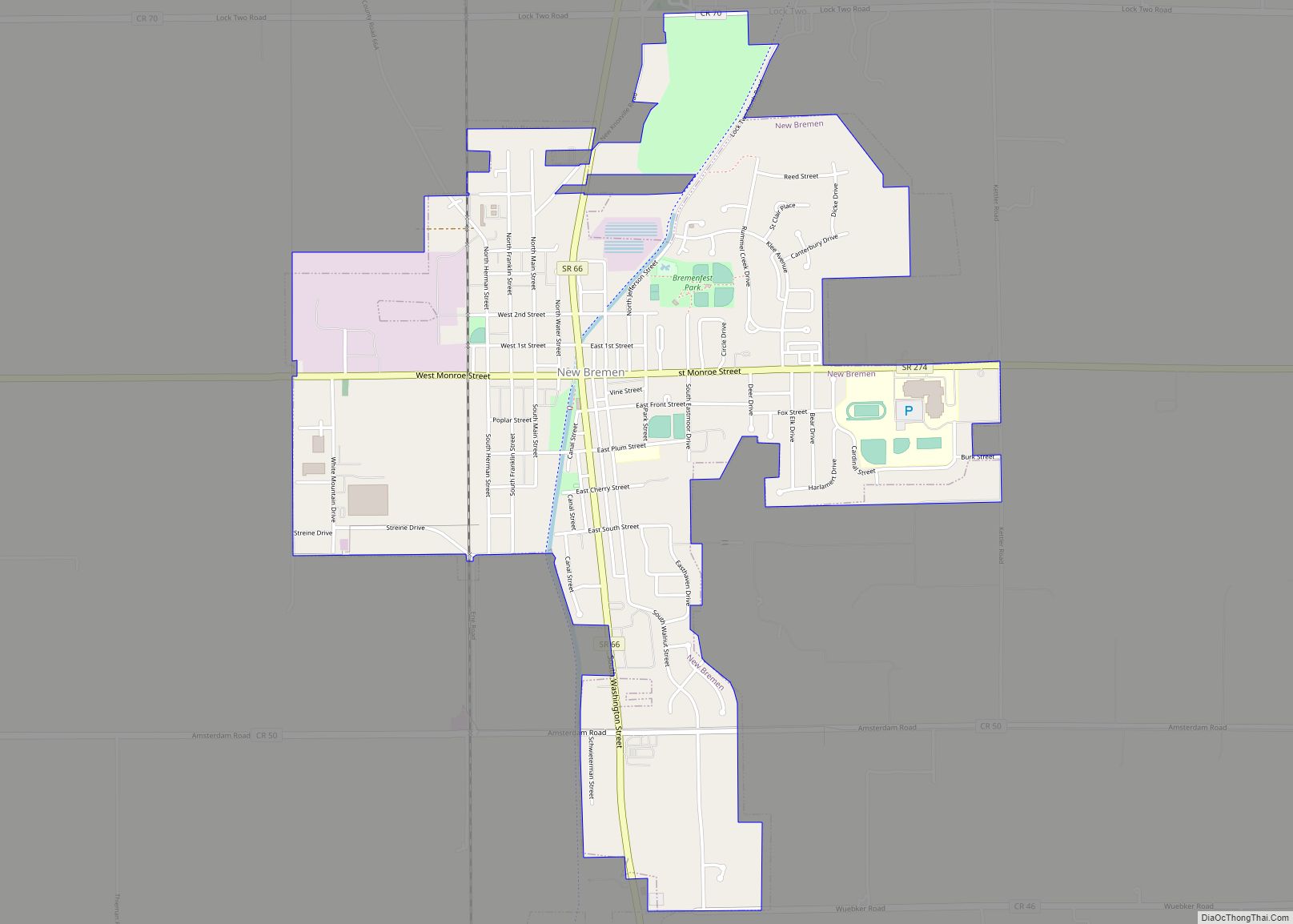
Online Interactive Map
Click on ![]() to view map in "full screen" mode.
to view map in "full screen" mode.
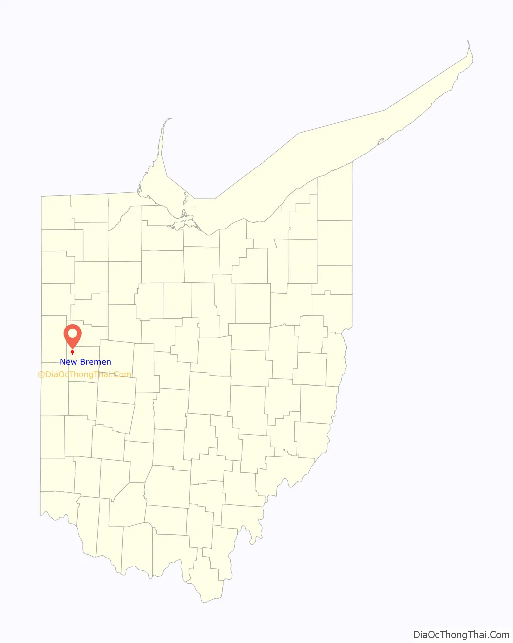
New Bremen location map. Where is New Bremen village?

History
The town was first a farming community started by Bavarians and Hanoverians, following a route from Bremen, Germany to America, through West Virginia and along the Ohio River to Cincinnati. Once Cincinnati was reached the founders formed a group called the City of Bremen Society, which drew up a charter among its 33 members. This charter authorized the purchase of 80 acres of Ohio land to build a town. Land within German Township was first established as a farming community in 1832, and by 1833 the plat of Bremen was recorded with 102 shares of land to be given away by lottery.
A village was established, but growth had been stunted by lack of accessible markets, and malaria. Transportation through swampy terrain was slow and expensive compared to other areas. This all would change with the completion of the Miami and Erie Canal. There were so few in the town that subcontractors had to rely on “jiggers” or 2oz bottles of whiskey to attract workers. The Canal was soon finished and opened. When opened, the Canal brought new markets to New Bremen, lowering transportation costs thus adding value to agricultural products that before the canal had little cash value. Increased potential profitability also lowered the risks of additional investments. The town became a busy place very quickly, with hundreds of freight boats moving frequently, along with dozens of passenger boats filled with people making the trip from Cincinnati. The locks from the Canal have been restored, along with the addition of a lock keeper’s house and can be seen in New Bremen’s downtown area.
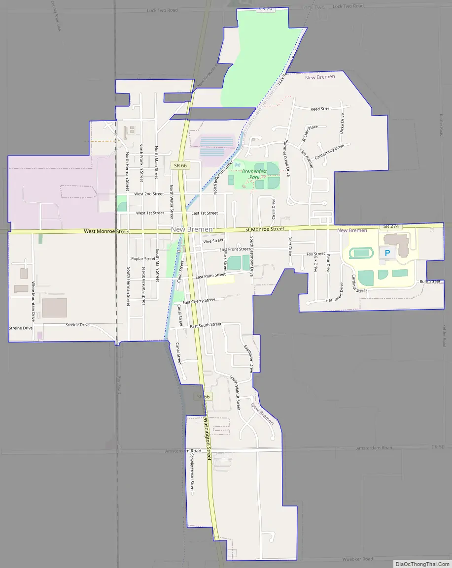
New Bremen Road Map
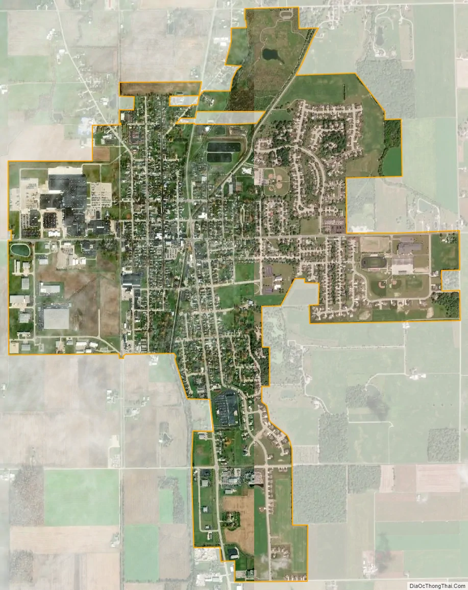
New Bremen city Satellite Map
Geography
New Bremen is located at 40°26′11″N 84°22′46″W / 40.43639°N 84.37944°W / 40.43639; -84.37944 (40.436301, -84.379542).
The southern edge of New Bremen is the most southern point of the St. Lawrence River Basin which covers an area of 519,000 sq. miles. This feat is achieved by being the headwaters of the St. Mary’s River, which is a tributary of the Maumee River. The Maumee River and basin (8316 sq miles) is the largest and most southern tributary of Lake Erie and any of the Great Lakes.
According to the United States Census Bureau, the village has a total area of 2.15 square miles (5.57 km), all land.
See also
Map of Ohio State and its subdivision:- Adams
- Allen
- Ashland
- Ashtabula
- Athens
- Auglaize
- Belmont
- Brown
- Butler
- Carroll
- Champaign
- Clark
- Clermont
- Clinton
- Columbiana
- Coshocton
- Crawford
- Cuyahoga
- Darke
- Defiance
- Delaware
- Erie
- Fairfield
- Fayette
- Franklin
- Fulton
- Gallia
- Geauga
- Greene
- Guernsey
- Hamilton
- Hancock
- Hardin
- Harrison
- Henry
- Highland
- Hocking
- Holmes
- Huron
- Jackson
- Jefferson
- Knox
- Lake
- Lake Erie
- Lawrence
- Licking
- Logan
- Lorain
- Lucas
- Madison
- Mahoning
- Marion
- Medina
- Meigs
- Mercer
- Miami
- Monroe
- Montgomery
- Morgan
- Morrow
- Muskingum
- Noble
- Ottawa
- Paulding
- Perry
- Pickaway
- Pike
- Portage
- Preble
- Putnam
- Richland
- Ross
- Sandusky
- Scioto
- Seneca
- Shelby
- Stark
- Summit
- Trumbull
- Tuscarawas
- Union
- Van Wert
- Vinton
- Warren
- Washington
- Wayne
- Williams
- Wood
- Wyandot
- Alabama
- Alaska
- Arizona
- Arkansas
- California
- Colorado
- Connecticut
- Delaware
- District of Columbia
- Florida
- Georgia
- Hawaii
- Idaho
- Illinois
- Indiana
- Iowa
- Kansas
- Kentucky
- Louisiana
- Maine
- Maryland
- Massachusetts
- Michigan
- Minnesota
- Mississippi
- Missouri
- Montana
- Nebraska
- Nevada
- New Hampshire
- New Jersey
- New Mexico
- New York
- North Carolina
- North Dakota
- Ohio
- Oklahoma
- Oregon
- Pennsylvania
- Rhode Island
- South Carolina
- South Dakota
- Tennessee
- Texas
- Utah
- Vermont
- Virginia
- Washington
- West Virginia
- Wisconsin
- Wyoming