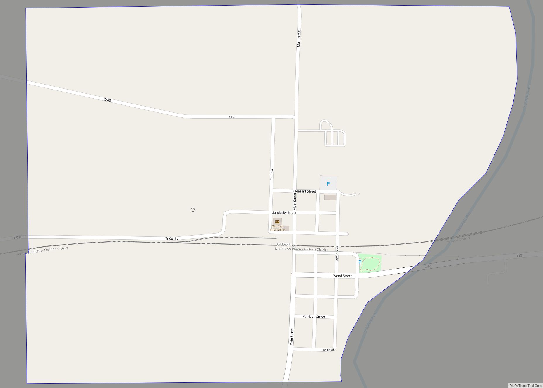
Map of Obetz village
Obetz is a village in Franklin County, Ohio, United States. The population was 5,489 at the 2020 census. Obetz village overview: Name: Obetz village LSAD Code: 47 LSAD Description: village (suffix) State: Ohio County: Franklin County Elevation: 800 ft (228 m) Total Area: 5.97 sq mi (15.47 km²) Land Area: 5.83 sq mi (15.09 km²) Water Area: 0.15 sq mi (0.39 km²) Total Population: 5,489 Population ... Read more
Map of Obetz village
Map of Oberlin city, Ohio
Oberlin is a city in Lorain County, Ohio, United States. It is located about 31 miles (50 km) southwest of Cleveland within the Cleveland metropolitan area. The population was 8,555 at the 2020 census. Oberlin is the home of Oberlin College, a liberal arts college and music conservatory with approximately 3,000 students. The town is the ... Read more
Map of Oberlin city, Ohio
Map of Orwell village
Orwell is a village in Ashtabula County, Ohio, United States. The population was 1,533 at the 2020 census. Orwell village overview: Name: Orwell village LSAD Code: 47 LSAD Description: village (suffix) State: Ohio County: Ashtabula County Elevation: 896 ft (273 m) Total Area: 1.98 sq mi (5.12 km²) Land Area: 1.98 sq mi (5.12 km²) Water Area: 0.00 sq mi (0.00 km²) Total Population: 1,533 Population ... Read more
Map of Orwell village
Map of Orrville city, Ohio
Orrville is a city in Wayne County, Ohio, United States. It is about 9 miles east of Wooster and 20 miles southwest of Akron. The population was 8,452 at the 2020 census. It is part of the Wooster micropolitan area. The J.M. Smucker Company, manufacturer of the Smucker’s food brand, is headquartered in Orrville. Orrville ... Read more
Map of Orrville city, Ohio
Map of Orient CDP, Ohio
Orient is a census-designated place and former village in Pickaway County, Ohio, United States. The population was 270 at the 2010 census. Orient is home to the Pickaway Correctional Institution and the Correctional Reception Center. Orient CDP overview: Name: Orient CDP LSAD Code: 57 LSAD Description: CDP (suffix) State: Ohio County: Pickaway County Elevation: 840 ft ... Read more
Map of Orient CDP, Ohio
Map of Oregon city, Ohio
Oregon is a city in Lucas County, Ohio. It is a lakefront suburb of Toledo, located on Lake Erie, just east of the city. Oregon is known for its scenic lakefront, bike trails, and Maumee Bay State Park. The population was 19,950 at the 2020 Census. There are also two refineries and the Bayshore Power ... Read more
Map of Oregon city, Ohio
Map of Orangeville village, Ohio
Orangeville is a village in eastern Trumbull County, Ohio, United States, along the state line with Pennsylvania. The population was 174 at the 2020 census. It is part of the Youngstown–Warren metropolitan area. Orangeville village overview: Name: Orangeville village LSAD Code: 47 LSAD Description: village (suffix) State: Ohio County: Trumbull County Elevation: 919 ft (280 m) Total ... Read more
Map of Orangeville village, Ohio
Map of Orange village, Ohio
Orange is a village in eastern Cuyahoga County, Ohio, United States. The population was 3,421 at the 2020 census. An eastern suburb of Cleveland, it is part of the Cleveland metropolitan area. Orange village overview: Name: Orange village LSAD Code: 47 LSAD Description: village (suffix) State: Ohio County: Cuyahoga County Elevation: 1,158 ft (353 m) Total Area: ... Read more
Map of Orange village, Ohio
Map of Ontario city, Ohio
Ontario is a city in Richland County in the U.S. state of Ohio. It was founded in 1834 on the western edge of the Allegheny Plateau, just west of the city of Mansfield. After being incorporated in 1958, Ontario became a heavy manufacturing center because of the Erie Railroad line, and its proximity to Mansfield. ... Read more
Map of Ontario city, Ohio
Map of Olmsted Falls city
Olmsted Falls is a city in Cuyahoga County, Ohio, United States, and a southwestern suburb of Cleveland. The population was 9,024 at the 2010 census. The city’s main business district is located at the corners of Bagley and Columbia Roads, and contains the Grand Pacific Junction, an historic district. Olmsted Falls city overview: Name: Olmsted ... Read more
Map of Olmsted Falls city
Map of Olde West Chester CDP
Olde West Chester is a census-designated place (CDP) in West Chester Township, Butler County, Ohio, United States. The population was 240 at the 2010 census. Olde West Chester CDP overview: Name: Olde West Chester CDP LSAD Code: 57 LSAD Description: CDP (suffix) State: Ohio County: Butler County Elevation: 669 ft (204 m) Total Area: 0.36 sq mi (0.93 km²) Land ... Read more
Map of Olde West Chester CDP
Map of Osgood village, Ohio
Osgood is a village in Darke County, Ohio, United States. The population was 302 at the 2010 census. Osgood village overview: Name: Osgood village LSAD Code: 47 LSAD Description: village (suffix) State: Ohio County: Darke County Elevation: 961 ft (293 m) Total Area: 0.35 sq mi (0.91 km²) Land Area: 0.35 sq mi (0.91 km²) Water Area: 0.00 sq mi (0.00 km²) Total Population: 306 Population ... Read more
Map of Osgood village, Ohio