Ontario is a city in Richland County in the U.S. state of Ohio. It was founded in 1834 on the western edge of the Allegheny Plateau, just west of the city of Mansfield. After being incorporated in 1958, Ontario became a heavy manufacturing center because of the Erie Railroad line, and its proximity to Mansfield. However, its status in that regard began to decline in the late 20th century, when much of the Erie Railroad that once ran through the city was abandoned; and shifts in the manufacturing industry led to the relocation or repositioning of many factories. The city’s industry has since diversified into the service economy, including education, finance and healthcare. The city is also a major regional retail hub serving the entire North-Central Ohio area, with a shopping population of over 150,000.
As of the 2020 Census, the city had a population of 6,656. It is part of the Mansfield, Ohio Metropolitan Statistical Area.
| Name: | Ontario city |
|---|---|
| LSAD Code: | 25 |
| LSAD Description: | city (suffix) |
| State: | Ohio |
| County: | Richland County |
| Founded: | 1834 |
| Incorporated: | 1958 (village) |
| Elevation: | 1,358 ft (414 m) |
| Total Area: | 11.09 sq mi (28.72 km²) |
| Land Area: | 11.07 sq mi (28.66 km²) |
| Water Area: | 0.02 sq mi (0.06 km²) |
| Total Population: | 6,656 |
| Population Density: | 601.48/sq mi (232.23/km²) |
| ZIP code: | 44906 |
| Area code: | 419 |
| FIPS code: | 3958520 |
| GNISfeature ID: | 1057901 |
| Website: | http://www.ontarioohio.org/ |
Online Interactive Map
Click on ![]() to view map in "full screen" mode.
to view map in "full screen" mode.
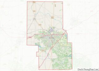
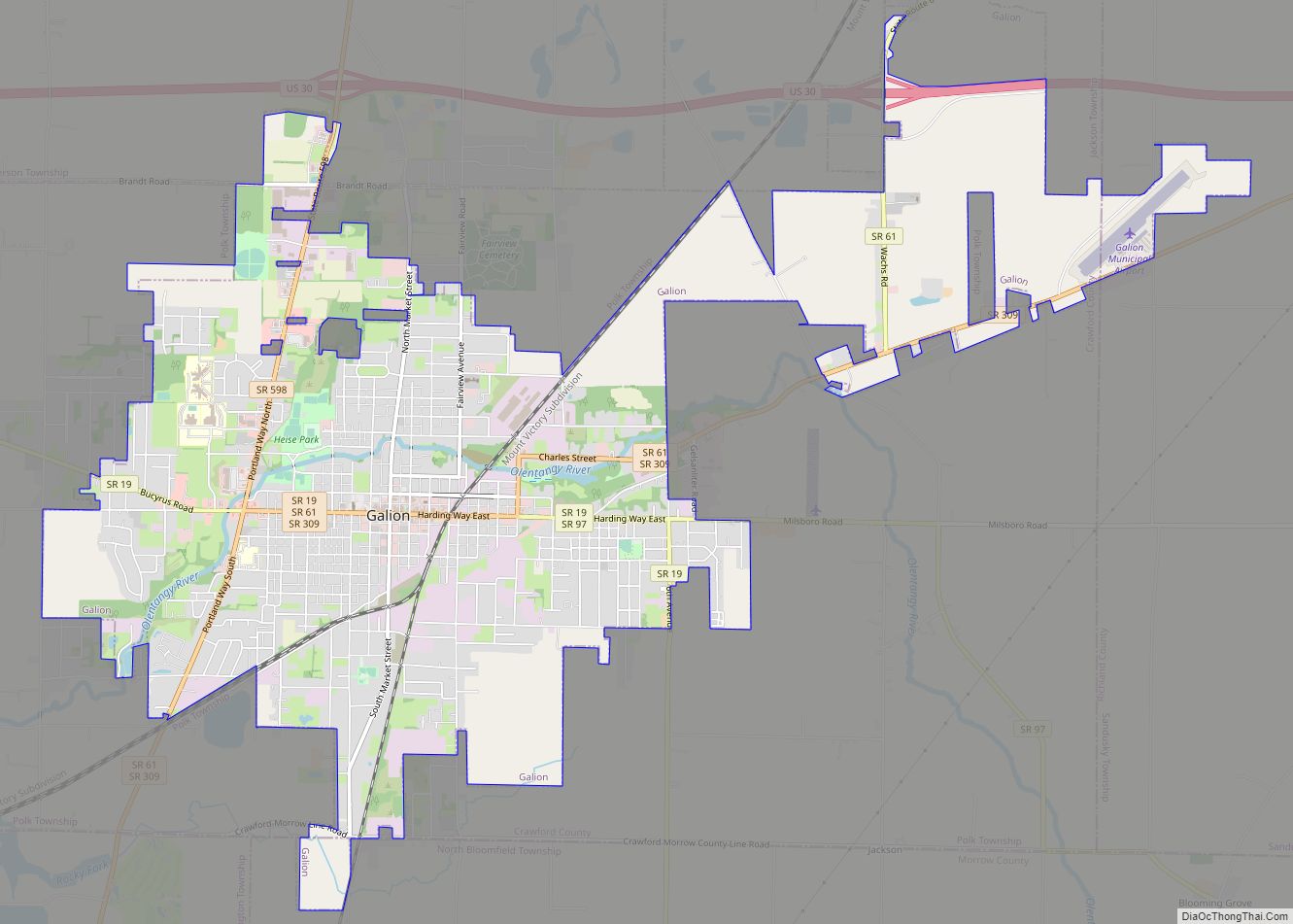
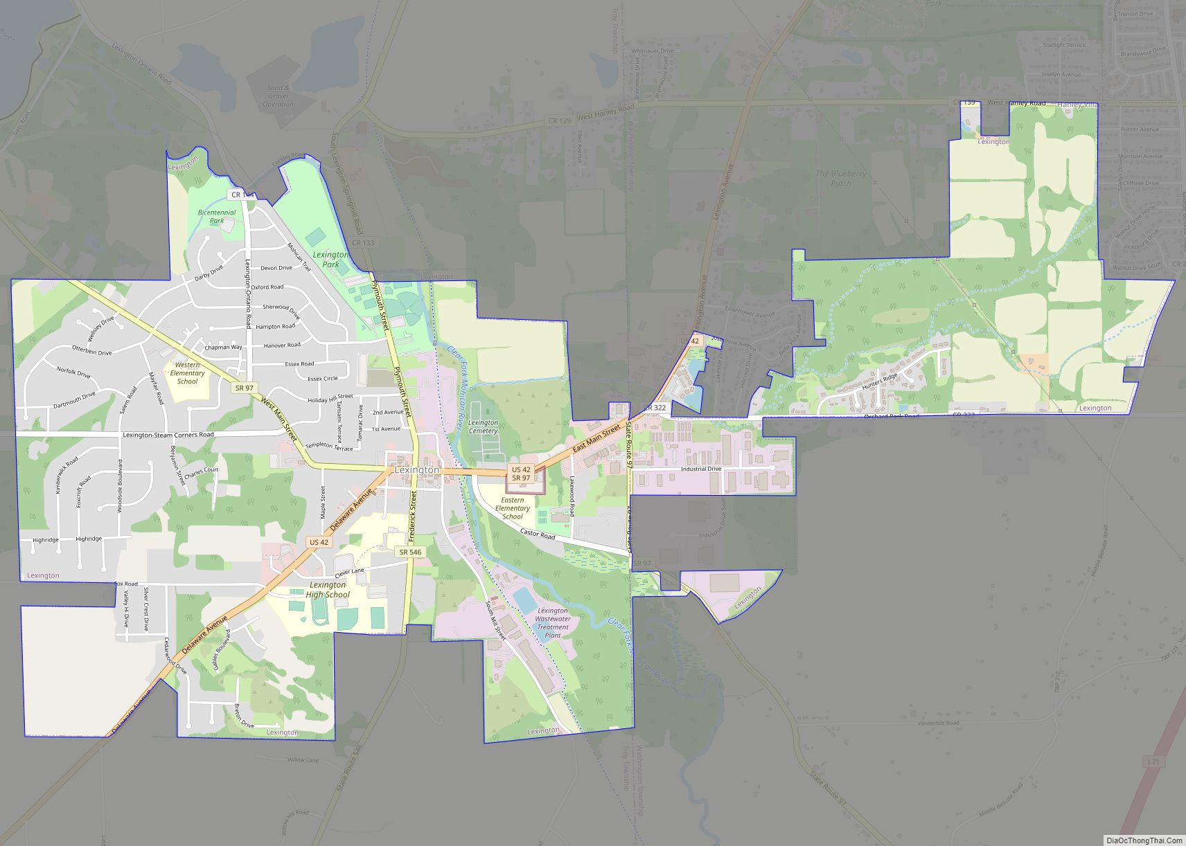
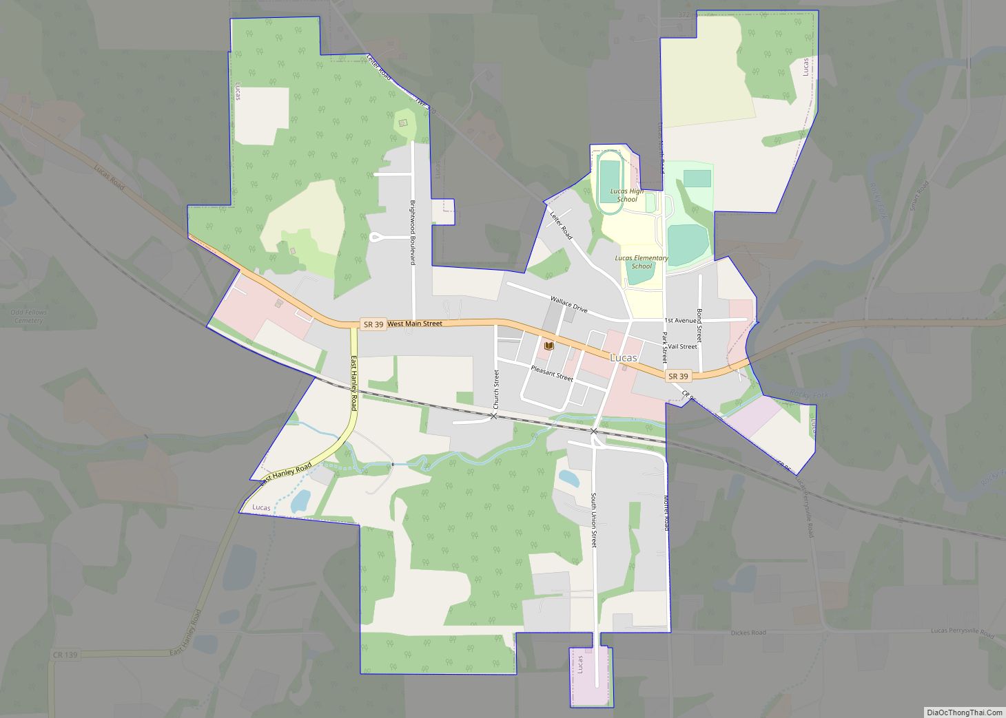
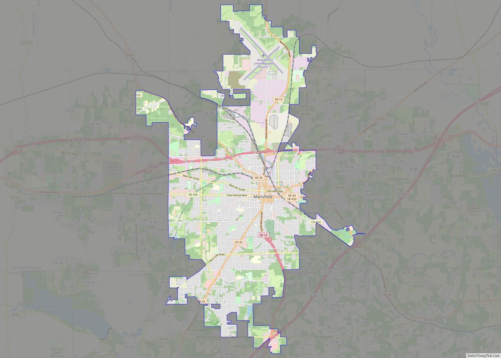
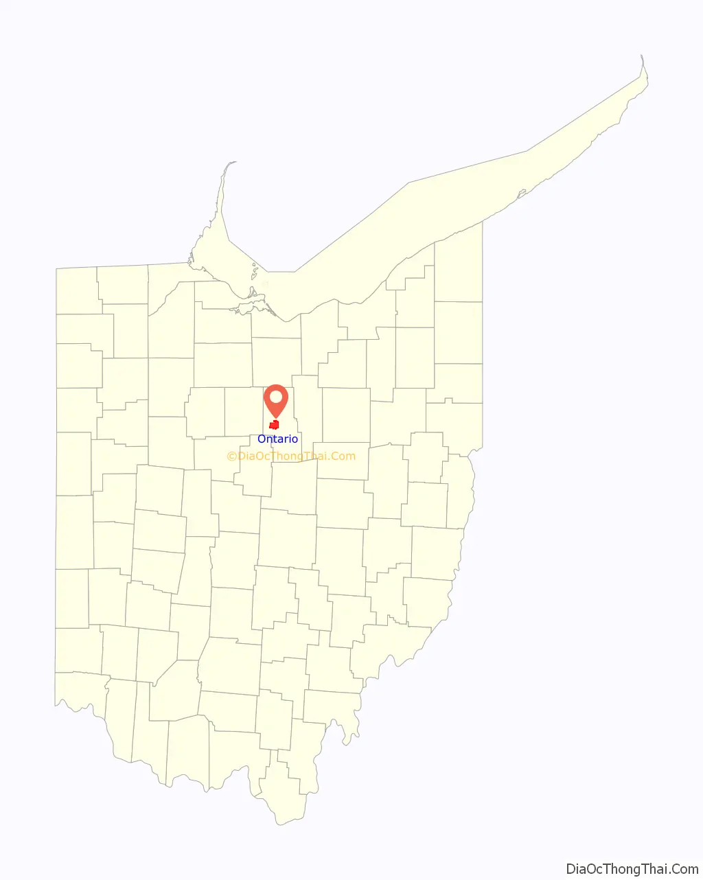
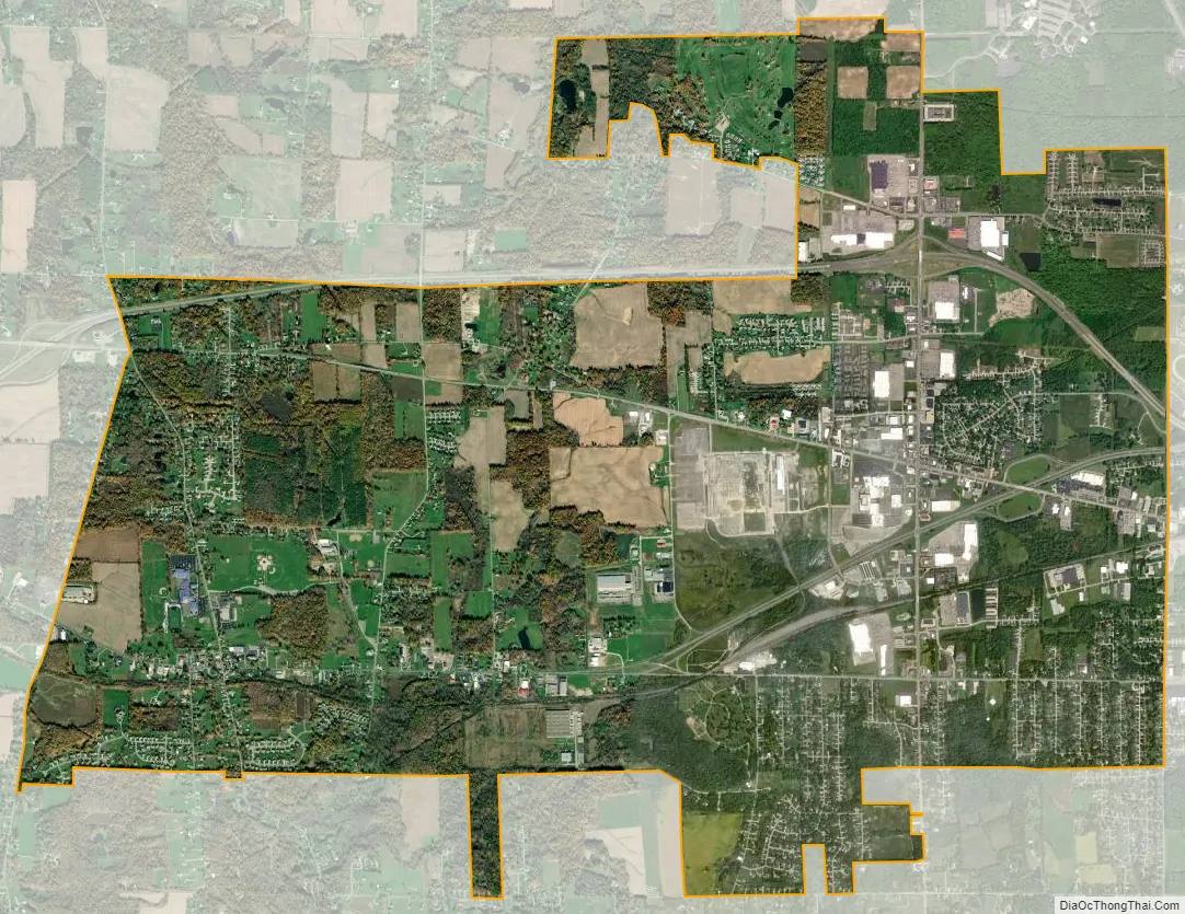
Ontario location map. Where is Ontario city?

History
Ontario was founded by Hiram Cook, and was platted in December 1834 as a settlement in Springfield Township near Mansfield. During that same month thereafter, the original settlement of Ontario merged with New Castle, another small settlement that was originally located just to the west of the Ontario settlement along the Mansfield and Bucyrus route (known today as State Route 309) that had just been laid out and platted. New Castle was named for Henry Cassell, while others stated that it was named in honor of Newcastle upon Tyne, a city in England. Ontario was named after Ontario County, New York, the native place of the founder of the town. In 1863, the Atlantic and Great Western Railroad (later Erie Railroad mainline) reached Ontario and a train station was built, but was later demolished after much of the railway was abandoned in the late 20th century.
The arrival of the Lincoln Highway to Ontario in 1913 was a major influence on the development of the town. Upon the advent of the federal numbered highway system in 1928, the Lincoln Highway through Ontario became U.S. Route 30.
In 1956, General Motors built a large Fisher Body stamping plant in Springfield Township and on June 25, 1958, the residents voted to incorporate Ontario into a village to bring the new General Motors plant into Ontario. In 1960, the new Ontario High School was built, complete with an indoor swimming pool, a theatre, 3 shops, and numerous high-tech classrooms and labs for college-preparatory studies. New school construction and renovation has continued over the years, and today the Ontario School District is the main district.
The arrival of both General Motors and the Richland Mall to Ontario was the beginning of the eventual shift of commerce and industry from the adjacent rust belt city of Mansfield to the new suburb-satellite town of Ontario. On June 1, 2009, General Motors filed for Chapter 11 bankruptcy protection and announced that its Ontario stamping plant (Mansfield-Ontario Metal Center) will close in June 2010. Several annexations have been made to Ontario since its incorporation and millions of dollars have been spent on public infrastructure including streets, water and sewer facilities, parks, schools, and new civic buildings for Administrative offices, Public Safety Departments and the Water Department. The city administration offices have been housed in several different locations including the “Old Library” which is now being used as a Senior Center. In 1986, the city’s offices were moved to the newly constructed Charles K. Hellinger Municipal Building. On April 30, 2001, Ontario became a city with a population over 5,300.
Since the 1960s, Ontario has been a location of choice for residential development, due in part to its civic administration, its school system, and significant commercial and industrial development.
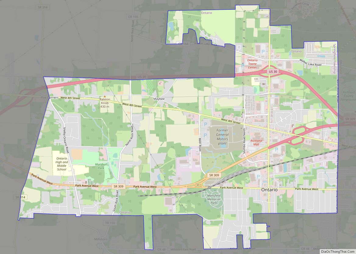
Ontario Road Map
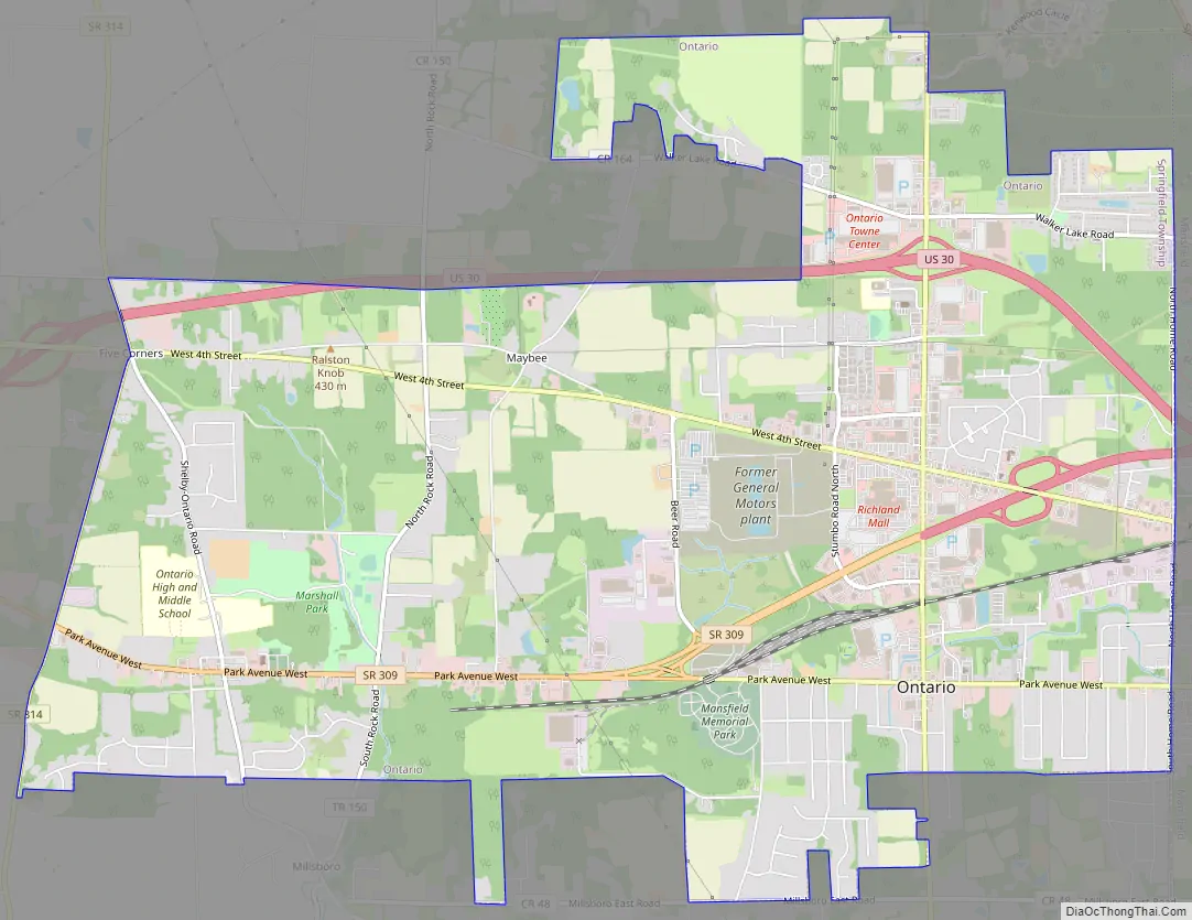
Ontario city Satellite Map
Geography
Ontario is located at 40°46′08″N 82°36′11″W / 40.768906°N 82.603066°W / 40.768906; -82.603066 (40.768906, -82.603066).
According to the United States Census Bureau, the city has a total area of 11.10 square miles (28.75 km), of which 11.08 square miles (28.70 km) is land and 0.02 square miles (0.05 km) is water.
See also
Map of Ohio State and its subdivision:- Adams
- Allen
- Ashland
- Ashtabula
- Athens
- Auglaize
- Belmont
- Brown
- Butler
- Carroll
- Champaign
- Clark
- Clermont
- Clinton
- Columbiana
- Coshocton
- Crawford
- Cuyahoga
- Darke
- Defiance
- Delaware
- Erie
- Fairfield
- Fayette
- Franklin
- Fulton
- Gallia
- Geauga
- Greene
- Guernsey
- Hamilton
- Hancock
- Hardin
- Harrison
- Henry
- Highland
- Hocking
- Holmes
- Huron
- Jackson
- Jefferson
- Knox
- Lake
- Lake Erie
- Lawrence
- Licking
- Logan
- Lorain
- Lucas
- Madison
- Mahoning
- Marion
- Medina
- Meigs
- Mercer
- Miami
- Monroe
- Montgomery
- Morgan
- Morrow
- Muskingum
- Noble
- Ottawa
- Paulding
- Perry
- Pickaway
- Pike
- Portage
- Preble
- Putnam
- Richland
- Ross
- Sandusky
- Scioto
- Seneca
- Shelby
- Stark
- Summit
- Trumbull
- Tuscarawas
- Union
- Van Wert
- Vinton
- Warren
- Washington
- Wayne
- Williams
- Wood
- Wyandot
- Alabama
- Alaska
- Arizona
- Arkansas
- California
- Colorado
- Connecticut
- Delaware
- District of Columbia
- Florida
- Georgia
- Hawaii
- Idaho
- Illinois
- Indiana
- Iowa
- Kansas
- Kentucky
- Louisiana
- Maine
- Maryland
- Massachusetts
- Michigan
- Minnesota
- Mississippi
- Missouri
- Montana
- Nebraska
- Nevada
- New Hampshire
- New Jersey
- New Mexico
- New York
- North Carolina
- North Dakota
- Ohio
- Oklahoma
- Oregon
- Pennsylvania
- Rhode Island
- South Carolina
- South Dakota
- Tennessee
- Texas
- Utah
- Vermont
- Virginia
- Washington
- West Virginia
- Wisconsin
- Wyoming