Map of Westerville city, Ohio
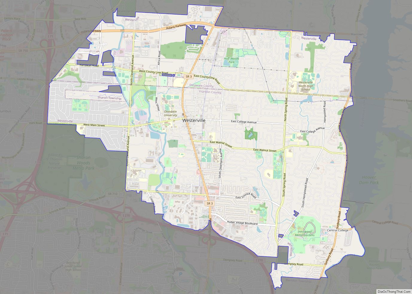
Westerville is a city in Franklin and Delaware counties in the U.S. state of Ohio. A northeastern suburb of Columbus, the population was 39,190 at the 2020 census. Westerville is the home of Otterbein University. Westerville was once known as “The Dry Capital of the World” for its strict laws prohibiting sales of alcohol and ... Read more
Map of Westerville city, Ohio
Map of West Unity village
West Unity is a village in Williams County, Ohio, United States. The population was 1,763 at the 2020 census. West Unity village overview: Name: West Unity village LSAD Code: 47 LSAD Description: village (suffix) State: Ohio County: Williams County Elevation: 787 ft (240 m) Total Area: 1.54 sq mi (3.99 km²) Land Area: 1.54 sq mi (3.99 km²) Water Area: 0.00 sq mi (0.00 km²) Total ... Read more
Map of West Unity village
Map of West Union village, Ohio
West Union is a village in Adams County, Ohio, United States, about 55 miles (89 km) southeast of Cincinnati. The population was 3,004 at the 2020 census. It is the county seat of Adams County. West Union is served by West Union High School, the Adams County/Ohio Valley School District, and the West Union Public Library, ... Read more
Map of West Union village, Ohio
Map of West Salem village, Ohio
West Salem is a village in Wayne County, Ohio. The population was 1,464 at the time of the 2010 census. West Salem is served by a branch of the Wayne County Public Library. The noted drag racing track Dragway 42 is located nearby. West Salem village overview: Name: West Salem village LSAD Code: 47 LSAD ... Read more
Map of West Salem village, Ohio
Map of West Rushville village
West Rushville is a village in Fairfield County, Ohio, United States. The population was 134 at the 2010 census. West Rushville village overview: Name: West Rushville village LSAD Code: 47 LSAD Description: village (suffix) State: Ohio County: Fairfield County Total Area: 0.07 sq mi (0.17 km²) Land Area: 0.07 sq mi (0.17 km²) Water Area: 0.00 sq mi (0.00 km²) Total Population: 166 Population ... Read more
Map of West Rushville village
Map of West Portsmouth CDP
West Portsmouth is a census-designated place (CDP) in Scioto County, Ohio, United States. The population was 3,149 in accordance with the 2010 census. The citizens of West Portsmouth are served by the Washington-Nile Local School District (Portsmouth West High School). West Portsmouth CDP overview: Name: West Portsmouth CDP LSAD Code: 57 LSAD Description: CDP (suffix) ... Read more
Map of West Portsmouth CDP
Map of White Oak CDP, Ohio
White Oak is a census-designated place (CDP) in Hamilton County, Ohio, United States. It is seven miles northwest of Cincinnati. The population was 19,541 at the 2020 census. White Oak is situated in both Green Township and Colerain Township. White Oak CDP overview: Name: White Oak CDP LSAD Code: 57 LSAD Description: CDP (suffix) State: ... Read more
Map of White Oak CDP, Ohio
Map of Wheelersburg CDP
Wheelersburg is a census-designated place (CDP) in Scioto County, Ohio, United States. It lies along the northern banks of the Ohio River in southern Ohio. Wheelersburg is approximately 7 miles (11 km) east of Portsmouth and 14 miles (23 km) west of Ironton. It is in Porter Township. The population was 6,437 at the 2010 census. Wheelersburg ... Read more
Map of Wheelersburg CDP
Map of Wharton village, Ohio
Wharton is a village in Wyandot County, Ohio, United States. The population was 358 at the 2010 census. Wharton village overview: Name: Wharton village LSAD Code: 47 LSAD Description: village (suffix) State: Ohio County: Wyandot County Total Area: 1.26 sq mi (3.25 km²) Land Area: 1.26 sq mi (3.25 km²) Water Area: 0.00 sq mi (0.00 km²) Total Population: 328 Population Density: 260.94/sq mi (100.78/km²) ... Read more
Map of Wharton village, Ohio
Map of Wetherington CDP
Wetherington is a census-designated place (CDP) in West Chester Township, Butler County, Ohio, United States. The population was 1,302 at the 2010 census. Wetherington CDP overview: Name: Wetherington CDP LSAD Code: 57 LSAD Description: CDP (suffix) State: Ohio County: Butler County Elevation: 860 ft (262 m) Total Area: 0.91 sq mi (2.35 km²) Land Area: 0.91 sq mi (2.35 km²) Water Area: 0.00 sq mi ... Read more
Map of Wetherington CDP
Map of Wilberforce CDP
Wilberforce is a census-designated place (CDP) in Greene County, Ohio, United States. The population was 2,271 at the 2010 census, up from 1,579 at the 2000 census. Wilberforce CDP overview: Name: Wilberforce CDP LSAD Code: 57 LSAD Description: CDP (suffix) State: Ohio County: Greene County Elevation: 1,007 ft (307 m) Total Area: 3.10 sq mi (8.04 km²) Land Area: 3.08 sq mi ... Read more
Map of Wilberforce CDP
Map of Wightmans Grove CDP
Wightmans Grove is a census-designated place in Sandusky County, in the U.S. state of Ohio. Its population was 72 as of the 2010 census. Wightmans Grove CDP overview: Name: Wightmans Grove CDP LSAD Code: 57 LSAD Description: CDP (suffix) State: Ohio County: Sandusky County Elevation: 574 ft (175 m) Total Area: 0.17 sq mi (0.45 km²) Land Area: 0.14 sq mi (0.37 km²) ... Read more
Map of Wightmans Grove CDP