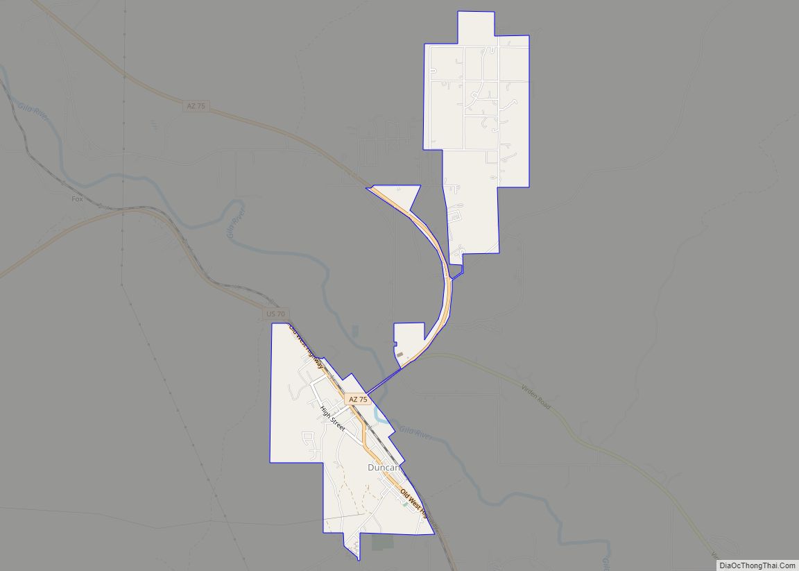
Duncan is a town in Greenlee County, Arizona, United States. As of the 2010 census, the population of the town was 696. In 2018 the estimated population was 789. Duncan is in the Gila River valley, four miles (6 km) west of the Arizona–New Mexico border. The town limits are on both sides of the Gila, ... Read more
Map of US Cities and Places
Dudleyville is a census-designated place (CDP) in Pinal County, Arizona, United States. The population was 959 at the 2010 census. Dudleyville CDP overview: Name: Dudleyville CDP LSAD Code: 57 LSAD Description: CDP (suffix) State: Arizona County: Pinal County Elevation: 1,946 ft (593 m) Total Area: 6.71 sq mi (17.37 km²) Land Area: 6.71 sq mi (17.37 km²) Water Area: 0.00 sq mi (0.00 km²) Total Population: ... Read more
East Verde Estates is a census-designated place in Gila County in the U.S. state of Arizona. East Verde Estates is located approximately six miles north of the town of Payson, off Arizona State Route 87. The population as of the 2010 U.S. Census was 170. East Verde Estates CDP overview: Name: East Verde Estates CDP ... Read more
East Globe is a census-designated place in Gila County, Arizona, United States. As of the 2010 census it had a population of 226. The racial and ethnic makeup of the population is 78.3% non-Hispanic Native Americans, 12.9% Hispanic Native Americans, 3.5% non-Hispanic whites, 0.4% Asian, 2.2% reporting two or more races and 2.6% non-Native American ... Read more
East Fork (Western Apache: Hawúʼishįįhé) is a census-designated place (CDP) in Navajo County, Arizona, United States, on the Fort Apache Indian Reservation. The population was 699 at the 2010 census. East Fork CDP overview: Name: East Fork CDP LSAD Code: 57 LSAD Description: CDP (suffix) State: Arizona County: Navajo County Elevation: 5,253 ft (1,601 m) Total Area: ... Read more
El Mirage is a city in Maricopa County, Arizona, United States. As of the 2020 census, the population of the city was 35,805, up from 31,797 in 2010. El Mirage city overview: Name: El Mirage city LSAD Code: 25 LSAD Description: city (suffix) State: Arizona County: Maricopa County Elevation: 1,283 ft (391 m) Total Area: 9.95 sq mi (25.78 km²) ... Read more
El Capitan is a census-designated place in Gila County in the U.S. state of Arizona. El Capitan is located approximately 13 miles (21 km) south of the city of Globe. The population as of the 2010 U.S. Census was 37. El Capitan CDP overview: Name: El Capitan CDP LSAD Code: 57 LSAD Description: CDP (suffix) State: ... Read more
Ehrenberg, also historically spelled “Ehrenburg”, is an unincorporated community and census-designated place (CDP) in La Paz County, Arizona, United States. The population was 1,470 at the 2010 census. Ehrenberg is named for its founder, Herman Ehrenberg. Ehrenberg is located on the Colorado River, which forms the border with Riverside County, California, near the city of ... Read more
Elfrida is a census-designated place in Cochise County, Arizona, United States. As of the 2010 census it had a population of 459. Elfrida CDP overview: Name: Elfrida CDP LSAD Code: 57 LSAD Description: CDP (suffix) State: Arizona County: Cochise County Total Area: 6.06 sq mi (15.71 km²) Land Area: 6.06 sq mi (15.71 km²) Water Area: 0.00 sq mi (0.00 km²) Total Population: 421 ... Read more
Elephant Head is a census-designated place (CDP) in Pima County, Arizona, United States. The population was 612 at the 2010 census. Elephant Head CDP overview: Name: Elephant Head CDP LSAD Code: 57 LSAD Description: CDP (suffix) State: Arizona County: Pima County Elevation: 3,104 ft (946 m) Total Area: 7.25 sq mi (18.78 km²) Land Area: 7.25 sq mi (18.78 km²) Water Area: 0.00 sq mi ... Read more
El Prado Estates is a census-designated place (CDP) in Yuma County, Arizona, United States. The population was 504 at the 2010 census. El Prado Estates CDP overview: Name: El Prado Estates CDP LSAD Code: 57 LSAD Description: CDP (suffix) State: Arizona County: Yuma County Elevation: 148 ft (45 m) Land Area: 0.97 sq mi (2.51 km²) Water Area: 0.00 sq mi (0.00 km²) ... Read more
First Mesa (Hopi: Wàlpi) is a census-designated place (CDP) in Navajo County, Arizona, United States, on the Hopi Reservation. As of the 2010 census, the CDP population was 1,555, spread among three Hopi villages atop the 5,700-foot (1,740 m) mesa: Hano (or Tegua, Arizona), Sitsomovi (or Sichomovi), and Waalpi (or Walpi). First Mesa CDP overview: ... Read more