Map of Lefors town
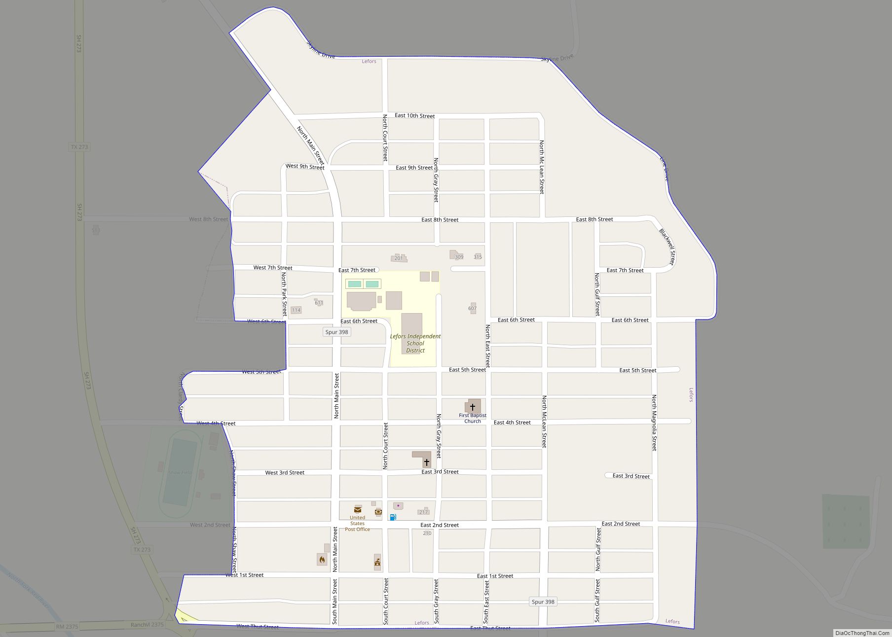
Lefors (/ləˈfɔːrz/ lə-FORZ) is a town in Gray County, Texas, United States. It is part of the Pampa, Texas micropolitan statistical area. Its population was 497 at the 2010 census. Lefors town overview: Name: Lefors town LSAD Code: 43 LSAD Description: town (suffix) State: Texas County: Gray County Elevation: 2,805 ft (855 m) Total Area: 0.39 sq mi (1.01 km²) ... Read more
Map of Lefors town
Map of Liberty Hill city
Liberty Hill is a city in Williamson County, Texas, United States. The population was 3,646 at the 2020 census. Liberty Hill is part of the Greater Austin metropolitan area. Liberty Hill city overview: Name: Liberty Hill city LSAD Code: 25 LSAD Description: city (suffix) State: Texas County: Williamson County Elevation: 1,024 ft (312 m) Total Area: 4.64 sq mi ... Read more
Map of Liberty Hill city
Map of Liberty City CDP
Liberty City is a census-designated place (CDP) in Gregg County, Texas, United States. The population was 2,721 at the 2020 census, up from 2,351 at the 2010 census. Liberty City CDP overview: Name: Liberty City CDP LSAD Code: 57 LSAD Description: CDP (suffix) State: Texas County: Gregg County Elevation: 390 ft (119 m) Total Area: 6.10 sq mi (15.80 km²) ... Read more
Map of Liberty City CDP
Map of Lexington town, Texas
Lexington is a town in Lee County, Texas, United States. Its population was 1,217 at the 2020 census. Lexington, a cattle trading town, is about 40 miles (64 km) west of Bryan. Lexington town overview: Name: Lexington town LSAD Code: 43 LSAD Description: town (suffix) State: Texas County: Lee County Elevation: 456 ft (139 m) Total Area: 1.24 sq mi ... Read more
Map of Lexington town, Texas
Map of Levelland city
Levelland is a city in Hockley County, Texas, in the United States. As of the 2020 census, the city population was 12,652, down from 13,542 at the 2010 census. It is the county seat of Hockley County. It is located on the Llano Estacado, 30 miles (48 km) west of Lubbock. Major industries include cotton farming ... Read more
Map of Levelland city
Map of Leroy city, Texas
Leroy is a city in McLennan County, Texas, United States. The population was 310 at the 2010 census. It is part of the Waco Metropolitan Statistical Area. Leroy city overview: Name: Leroy city LSAD Code: 25 LSAD Description: city (suffix) State: Texas County: McLennan County Elevation: 495 ft (151 m) Total Area: 1.89 sq mi (4.89 km²) Land Area: 1.88 sq mi ... Read more
Map of Leroy city, Texas
Map of Leonard city, Texas
Leonard is a city in Fannin County, Texas, United States. The population was 1,990 at the 2010 census. Leonard city overview: Name: Leonard city LSAD Code: 25 LSAD Description: city (suffix) State: Texas County: Fannin County Elevation: 719 ft (219 m) Total Area: 2.29 sq mi (5.94 km²) Land Area: 2.29 sq mi (5.94 km²) Water Area: 0.00 sq mi (0.00 km²) Total Population: 1,990 Population ... Read more
Map of Leonard city, Texas
Map of Leona city, Texas
Leona is a city in Leon County, Texas, United States. The population was 175 at the 2010 census. Leona city overview: Name: Leona city LSAD Code: 25 LSAD Description: city (suffix) State: Texas County: Leon County Elevation: 341 ft (104 m) Total Area: 2.22 sq mi (5.76 km²) Land Area: 2.22 sq mi (5.76 km²) Water Area: 0.00 sq mi (0.00 km²) Total Population: 175 Population ... Read more
Map of Leona city, Texas
Map of Little Elm city
Little Elm is a city in Denton County, Texas, United States, and a part of the Dallas–Fort Worth metroplex. It is an extended suburb of Denton; its population was 46,453 as of the 2020 census. In 2000, the census population was at 3,646. By the 2010 census, the city total had jumped to 25,898, making ... Read more
Map of Little Elm city
Map of Lipscomb CDP, Texas
Lipscomb (/ˈlɪpskəm/ LIP-skəm) is an unincorporated community and census-designated place (CDP) in Lipscomb County, Texas, United States. It is the Lipscomb county seat. The population was 37 at the 2010 census. Lipscomb CDP overview: Name: Lipscomb CDP LSAD Code: 57 LSAD Description: CDP (suffix) State: Texas County: Lipscomb County Elevation: 2,392 ft (729 m) Total Area: 3.75 sq mi ... Read more
Map of Lipscomb CDP, Texas
Map of Lipan city
Lipan (/ˈlaɪpæn/ LY-pan) is a city in northwest Hood County, Texas, United States. The population was 430 at the 2010 census. It is part of the Granbury, Texas Micropolitan Statistical Area. Lipan city overview: Name: Lipan city LSAD Code: 25 LSAD Description: city (suffix) State: Texas County: Hood County Elevation: 919 ft (280 m) Total Area: 1.06 sq mi ... Read more
Map of Lipan city
Map of Linn CDP, Texas
Linn, formerly San Manuel-Linn, is an unincorporated area and census-designated place (CDP) in Hidalgo County, Texas, United States. The population was 801 at the 2010 census, down from 958 at the 2000 census. It is part of the McAllen–Edinburg–Mission Metropolitan Statistical Area. Linn CDP overview: Name: Linn CDP LSAD Code: 57 LSAD Description: CDP (suffix) ... Read more
Map of Linn CDP, Texas