Little Elm is a city in Denton County, Texas, United States, and a part of the Dallas–Fort Worth metroplex. It is an extended suburb of Denton; its population was 46,453 as of the 2020 census. In 2000, the census population was at 3,646. By the 2010 census, the city total had jumped to 25,898, making Little Elm one of the fastest-growing municipalities by percentage in Texas since 2000. The July 1, 2021 census estimates Little Elm’s population as 51,042.
| Name: | Little Elm city |
|---|---|
| LSAD Code: | 25 |
| LSAD Description: | city (suffix) |
| State: | Texas |
| County: | Denton County |
| Elevation: | 515 ft (157 m) |
| Total Area: | 22.09 sq mi (57.22 km²) |
| Land Area: | 17.99 sq mi (46.60 km²) |
| Water Area: | 4.10 sq mi (10.62 km²) |
| Total Population: | 46,453 |
| Population Density: | 2,102.89/sq mi (811.83/km²) |
| ZIP code: | 75068 |
| Area code: | 214, 469, 945, 972 |
| FIPS code: | 4843012 |
| GNISfeature ID: | 2410843 |
| Website: | www.littleelm.org |
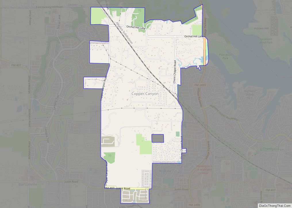
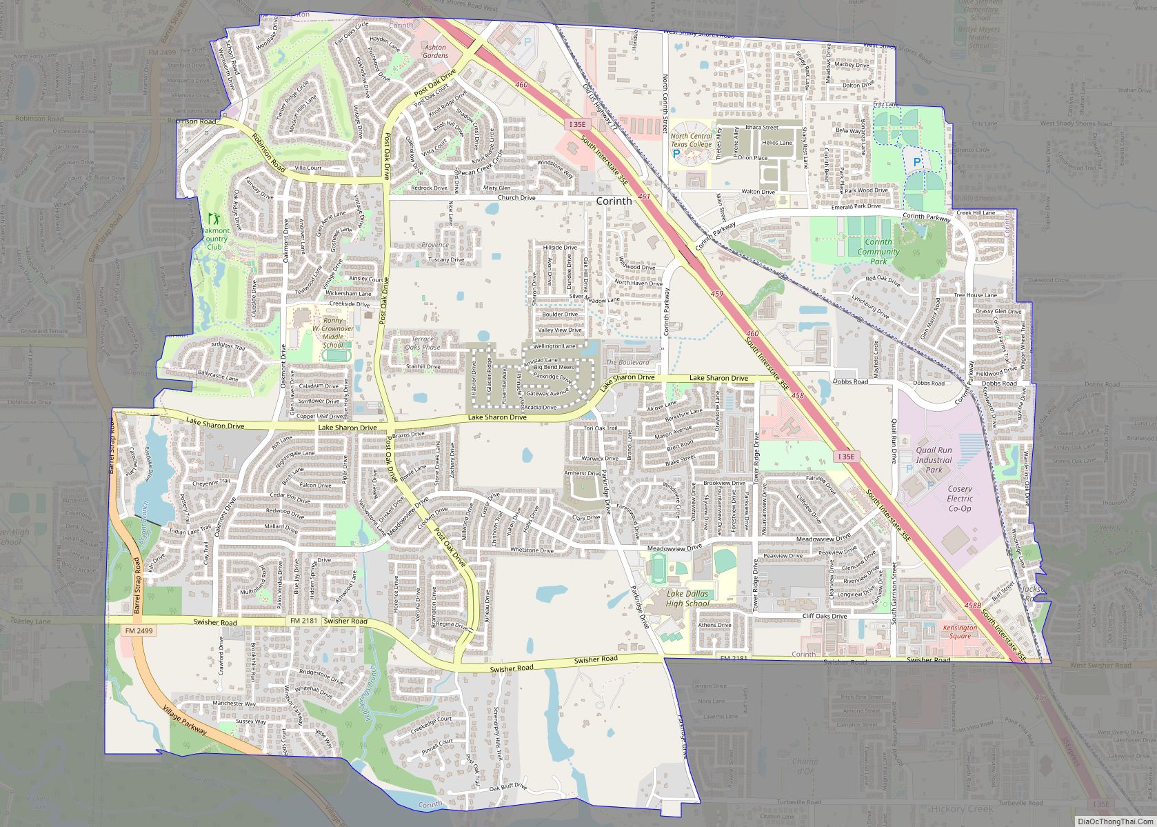
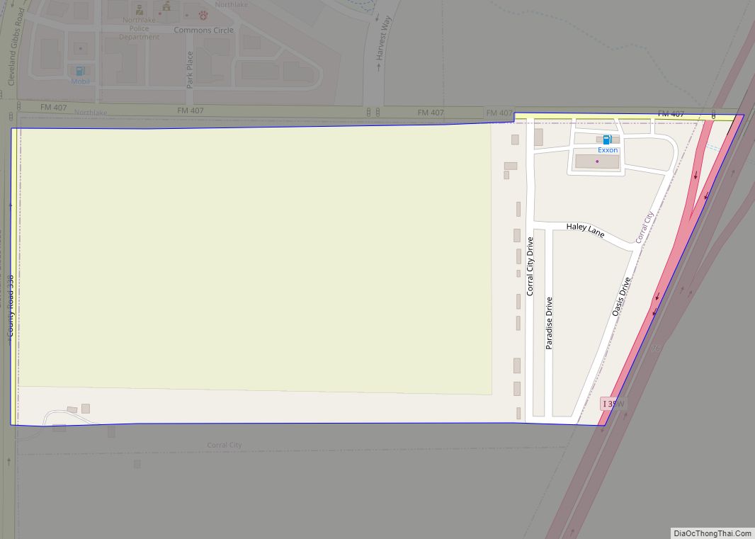
Online Interactive Map
Click on ![]() to view map in "full screen" mode.
to view map in "full screen" mode.
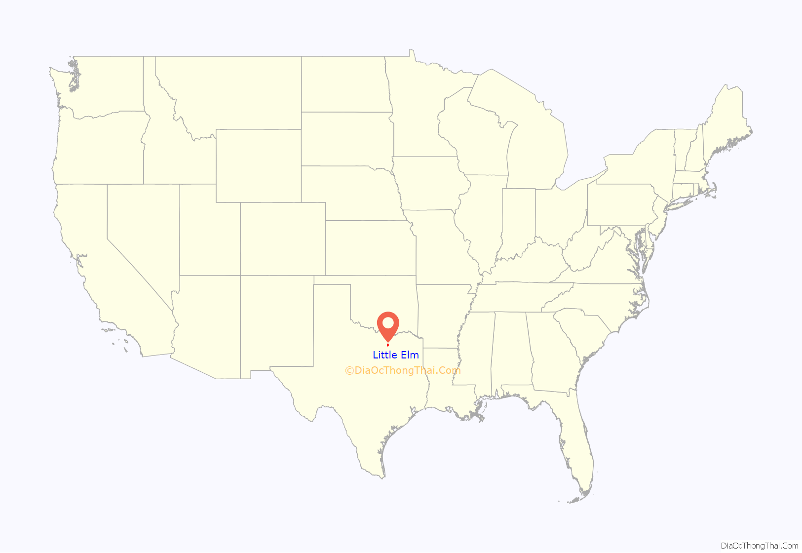
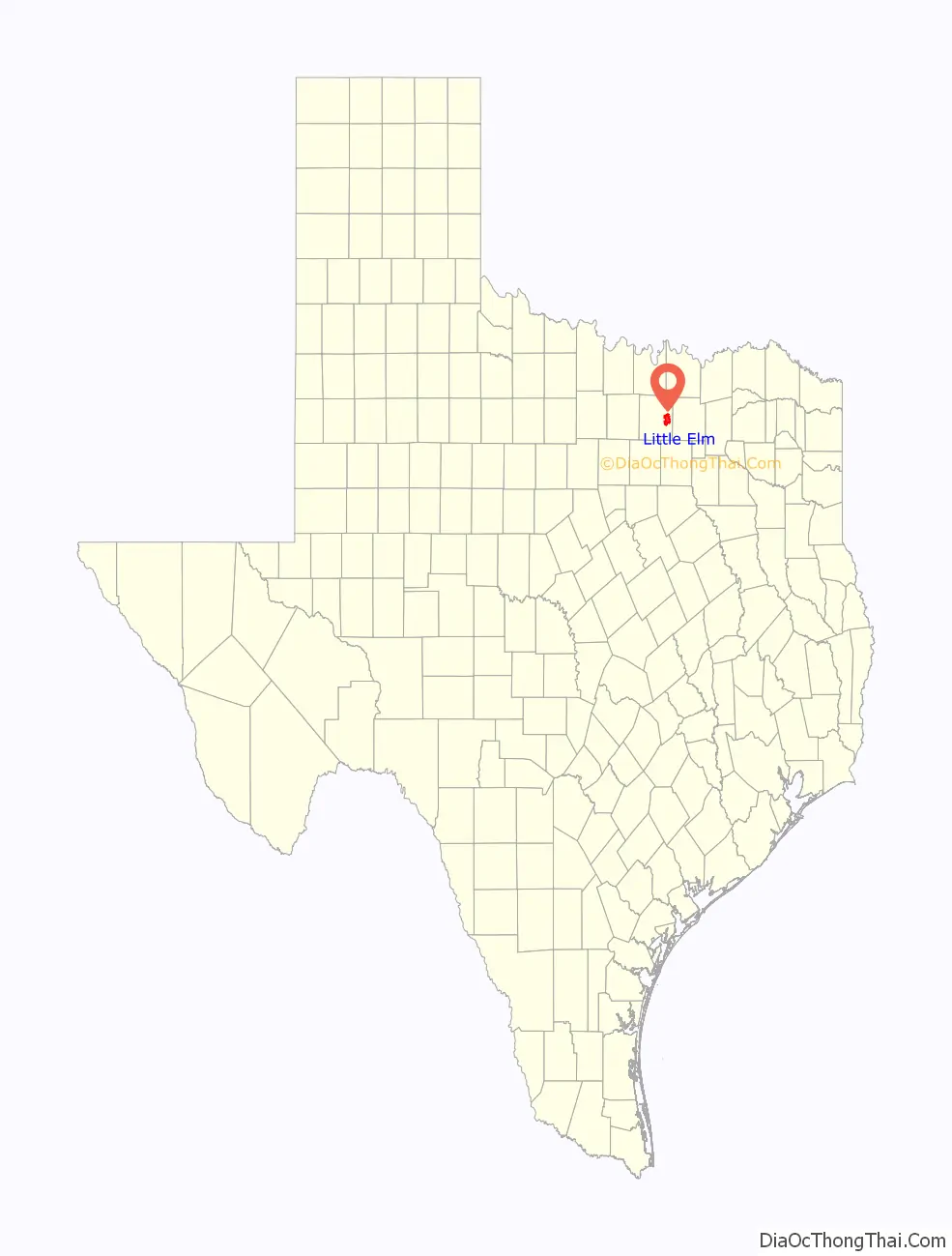
Little Elm location map. Where is Little Elm city?
History
Little Elm was established along Lewisville Lake by C.C. “Kit” King, son of John and Delilah King, in 1844. King named the community after the creek banks where it was located. King helped organize mail service for the area and in 1852 was named the postmaster of Denton County’s first post office. The population was very low throughout the first half of the 20th century but in 1966 was able to officially incorporate. The first official census for the town came in 1970 which recorded 363 persons.
On the second of March 2023, a very powerful storm came through north Texas. It caused damages across the area but most notably, a supermarket’s facade was completely torn off covering several automobiles parked in the parking lot.
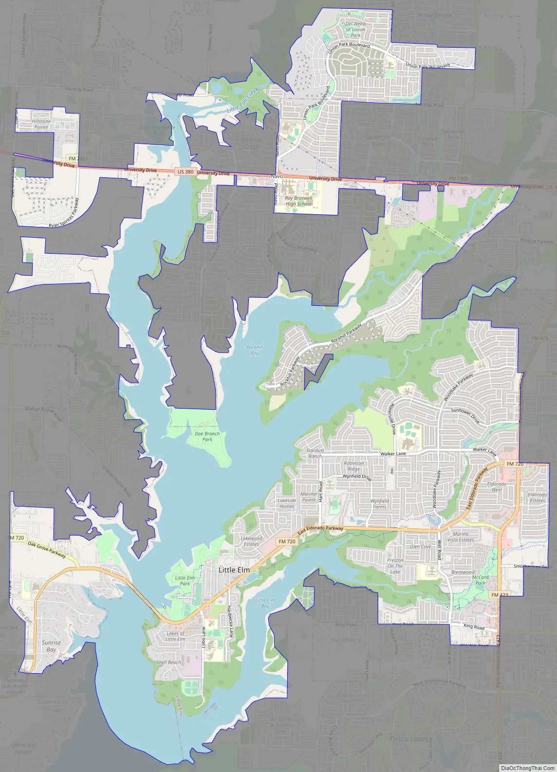
Little Elm Road Map
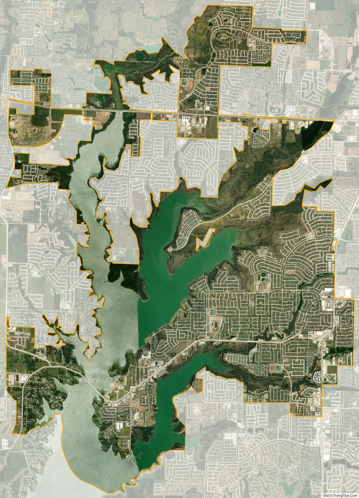
Little Elm city Satellite Map
Geography
Little Elm is generally located along the northern and eastern shores of Lewisville Lake at the crossroads of Eldorado Parkway, FM 720, and FM 423, and includes stretches of U.S. Highway 380. Its neighbors include Frisco to the east, The Colony and Hackberry to the south, Prosper, Aubrey, Savannah, and Providence to the north, and Oak Point, Cross Roads, Hickory Creek, Lake Dallas, and Lakewood Village to the west.
The city is about 33 miles north of the City of Dallas, 53 miles north of the City of Fort Worth, 23 miles north of Dallas/Fort Worth International Airport, and 20 miles east of the City of Denton, the county seat of Denton County.
Little Elm is located at 33°9′50″N 96°55′49″W / 33.16389°N 96.93028°W / 33.16389; -96.93028 (33.163955, –96.930281). According to the U.S. Census Bureau, it has a total area of 18.6 square miles (48.3 km), of which 14.6 square miles (37.7 km) is land and 4.1 square miles (10.5 km), or 21.83%, is covered by water. Little Elm has an average elevation of 545 feet above sea level.
See also
Map of Texas State and its subdivision:- Anderson
- Andrews
- Angelina
- Aransas
- Archer
- Armstrong
- Atascosa
- Austin
- Bailey
- Bandera
- Bastrop
- Baylor
- Bee
- Bell
- Bexar
- Blanco
- Borden
- Bosque
- Bowie
- Brazoria
- Brazos
- Brewster
- Briscoe
- Brooks
- Brown
- Burleson
- Burnet
- Caldwell
- Calhoun
- Callahan
- Cameron
- Camp
- Carson
- Cass
- Castro
- Chambers
- Cherokee
- Childress
- Clay
- Cochran
- Coke
- Coleman
- Collin
- Collingsworth
- Colorado
- Comal
- Comanche
- Concho
- Cooke
- Coryell
- Cottle
- Crane
- Crockett
- Crosby
- Culberson
- Dallam
- Dallas
- Dawson
- Deaf Smith
- Delta
- Denton
- Dewitt
- Dickens
- Dimmit
- Donley
- Duval
- Eastland
- Ector
- Edwards
- El Paso
- Ellis
- Erath
- Falls
- Fannin
- Fayette
- Fisher
- Floyd
- Foard
- Fort Bend
- Franklin
- Freestone
- Frio
- Gaines
- Galveston
- Garza
- Gillespie
- Glasscock
- Goliad
- Gonzales
- Gray
- Grayson
- Gregg
- Grimes
- Guadalupe
- Hale
- Hall
- Hamilton
- Hansford
- Hardeman
- Hardin
- Harris
- Harrison
- Hartley
- Haskell
- Hays
- Hemphill
- Henderson
- Hidalgo
- Hill
- Hockley
- Hood
- Hopkins
- Houston
- Howard
- Hudspeth
- Hunt
- Hutchinson
- Irion
- Jack
- Jackson
- Jasper
- Jeff Davis
- Jefferson
- Jim Hogg
- Jim Wells
- Johnson
- Jones
- Karnes
- Kaufman
- Kendall
- Kenedy
- Kent
- Kerr
- Kimble
- King
- Kinney
- Kleberg
- Knox
- La Salle
- Lamar
- Lamb
- Lampasas
- Lavaca
- Lee
- Leon
- Liberty
- Limestone
- Lipscomb
- Live Oak
- Llano
- Loving
- Lubbock
- Lynn
- Madison
- Marion
- Martin
- Mason
- Matagorda
- Maverick
- McCulloch
- McLennan
- McMullen
- Medina
- Menard
- Midland
- Milam
- Mills
- Mitchell
- Montague
- Montgomery
- Moore
- Morris
- Motley
- Nacogdoches
- Navarro
- Newton
- Nolan
- Nueces
- Ochiltree
- Oldham
- Orange
- Palo Pinto
- Panola
- Parker
- Parmer
- Pecos
- Polk
- Potter
- Presidio
- Rains
- Randall
- Reagan
- Real
- Red River
- Reeves
- Refugio
- Roberts
- Robertson
- Rockwall
- Runnels
- Rusk
- Sabine
- San Augustine
- San Jacinto
- San Patricio
- San Saba
- Schleicher
- Scurry
- Shackelford
- Shelby
- Sherman
- Smith
- Somervell
- Starr
- Stephens
- Sterling
- Stonewall
- Sutton
- Swisher
- Tarrant
- Taylor
- Terrell
- Terry
- Throckmorton
- Titus
- Tom Green
- Travis
- Trinity
- Tyler
- Upshur
- Upton
- Uvalde
- Val Verde
- Van Zandt
- Victoria
- Walker
- Waller
- Ward
- Washington
- Webb
- Wharton
- Wheeler
- Wichita
- Wilbarger
- Willacy
- Williamson
- Wilson
- Winkler
- Wise
- Wood
- Yoakum
- Young
- Zapata
- Zavala
- Alabama
- Alaska
- Arizona
- Arkansas
- California
- Colorado
- Connecticut
- Delaware
- District of Columbia
- Florida
- Georgia
- Hawaii
- Idaho
- Illinois
- Indiana
- Iowa
- Kansas
- Kentucky
- Louisiana
- Maine
- Maryland
- Massachusetts
- Michigan
- Minnesota
- Mississippi
- Missouri
- Montana
- Nebraska
- Nevada
- New Hampshire
- New Jersey
- New Mexico
- New York
- North Carolina
- North Dakota
- Ohio
- Oklahoma
- Oregon
- Pennsylvania
- Rhode Island
- South Carolina
- South Dakota
- Tennessee
- Texas
- Utah
- Vermont
- Virginia
- Washington
- West Virginia
- Wisconsin
- Wyoming