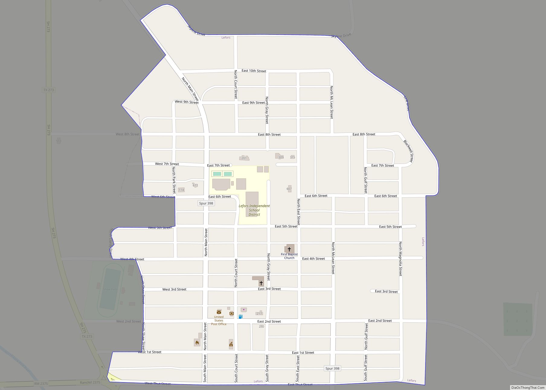
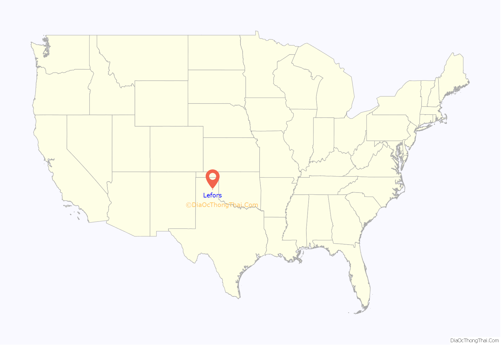
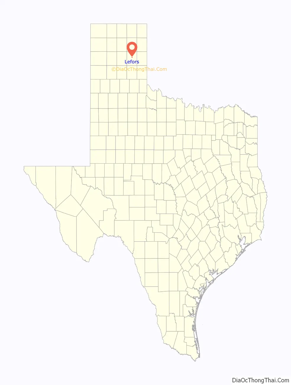
Lefors (/ləˈfɔːrz/ lə-FORZ) is a town in Gray County, Texas, United States. It is part of the Pampa, Texas micropolitan statistical area. Its population was 497 at the 2010 census.
| Name: | Lefors town |
|---|---|
| LSAD Code: | 43 |
| LSAD Description: | town (suffix) |
| State: | Texas |
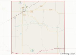
| County: | Gray County |
| Elevation: | 2,805 ft (855 m) |
| Total Area: | 0.39 sq mi (1.01 km²) |
| Land Area: | 0.39 sq mi (1.01 km²) |
| Water Area: | 0.00 sq mi (0.00 km²) |
| Total Population: | 497 |
| Population Density: | 1,230.77/sq mi (475.67/km²) |
| ZIP code: | 79054 |
| Area code: | 806 |
| FIPS code: | 4842148 |
| GNISfeature ID: | 1361049 |
Online Interactive Map
Click on ![]() to view map in "full screen" mode.
to view map in "full screen" mode.
Lefors location map. Where is Lefors town?
History
The area around modern Lefors was near the heart of Comancheria and a common village site for the nomadic tribes of Comanche.
Randolph Marcy’s 1852 expedition passed this way. The Battle of the North Fork of the Red River, between the U.S. Army under the command of Ranald Slidell Mackenzie and the Comanche, was fought near here on September 29, 1872. Cheyenne chief Grey Beard’s band was attacked near here in 1874 by the U.S. Army.
Lefors was founded in 1888 by Travis Leach, Perry LeFors, Henry Thut, and Henry B. Lovett. The town was named for Perry LeFors, who traveled with his father to the Panhandle in 1878 and later became foreman of the Diamond F Ranch, a part of the Francklyn Land and Cattle Company, which became insolvent in 1886 and became the White Deer Lands Trust Company, of which Timothy Dwight Hobart was the agent.
In 1882, the first homestead on the future townsite was laid by Travis Leach, a rancher and surveyor, whose log cabin served as a stagecoach stop on the mail route from Fort Elliott and Mobeetie to Tascosa. Henry B. Lovett, a former buffalo hunter, and Henry Thut, a Swiss immigrant whose sister-in-law, Emma Lang, married LeFors, also settled in the vicinity during the 1880s. George Henry Saunders had a ranch camp headquarters nearby.
Other settlers soon moved into the area, and in 1892, a post office was opened at Lefors with Thut as postmaster. (Postal officials required that the F be lower-cased.) Four years later, a combination school and church building was built. When Gray County was organized on May 27, 1902, Lefors was named the county seat. A two-story frame courthouse was built for less than $2,500, and Thut, who became the first county treasurer, erected a hotel. Perry LeFors served as the town’s first constable. The population reached 150 in 1910, and despite its small size and the lack of a railroad, the town managed for a time to remain the county seat.
When the oil boom hit the county during the 1920s, three oil pools were discovered in the vicinity. Lefors profited from the boom, especially in real estate; the boom resulted in the establishment of an independent school district and the bringing of electricity and other modern utilities to the town.
By 1931, Lefors had incorporated, and in 1932, the town finally obtained a railroad, when the Fort Worth and Denver extended its line from Pampa. The population increased to 809 by 1940. Several Protestant denominations established churches in the community.
Eight people died when an early spring snowstorm stranded about 100 people in around 55 automobiles on the road between Pampa and Lefors on April 7–8, 1938. After between 10 and 12 inches of snow fell in the Panhandle, with 50-mile-an-hour winds creating drifts 5-25 tall, men with farm tractors and heavy oilfield equipment had to come to the rescue of the snowed-in travelers, which included two school buses rescued by the army.
The town suffered a flood in 1961, unemployment from the closure of several area carbon black plants in 1964, and a tornado in 1975.
Lefors Road Map

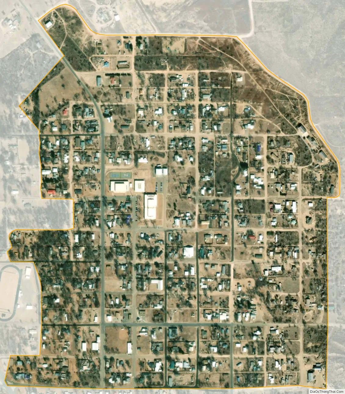
Lefors city Satellite Map
Geography
Lefors is located at 35°26′20″N 100°48′13″W / 35.43889°N 100.80361°W / 35.43889; -100.80361 (35.438787, –100.803721).
According to the United States Census Bureau, the town has a total area of 0.4 square miles (1.0 km), all of it land.
Lefors is on the North Fork of the Red River and State Highway 273, 12 miles southeast of Pampa in central Gray County
See also
Map of Texas State and its subdivision:- Anderson
- Andrews
- Angelina
- Aransas
- Archer
- Armstrong
- Atascosa
- Austin
- Bailey
- Bandera
- Bastrop
- Baylor
- Bee
- Bell
- Bexar
- Blanco
- Borden
- Bosque
- Bowie
- Brazoria
- Brazos
- Brewster
- Briscoe
- Brooks
- Brown
- Burleson
- Burnet
- Caldwell
- Calhoun
- Callahan
- Cameron
- Camp
- Carson
- Cass
- Castro
- Chambers
- Cherokee
- Childress
- Clay
- Cochran
- Coke
- Coleman
- Collin
- Collingsworth
- Colorado
- Comal
- Comanche
- Concho
- Cooke
- Coryell
- Cottle
- Crane
- Crockett
- Crosby
- Culberson
- Dallam
- Dallas
- Dawson
- Deaf Smith
- Delta
- Denton
- Dewitt
- Dickens
- Dimmit
- Donley
- Duval
- Eastland
- Ector
- Edwards
- El Paso
- Ellis
- Erath
- Falls
- Fannin
- Fayette
- Fisher
- Floyd
- Foard
- Fort Bend
- Franklin
- Freestone
- Frio
- Gaines
- Galveston
- Garza
- Gillespie
- Glasscock
- Goliad
- Gonzales
- Gray
- Grayson
- Gregg
- Grimes
- Guadalupe
- Hale
- Hall
- Hamilton
- Hansford
- Hardeman
- Hardin
- Harris
- Harrison
- Hartley
- Haskell
- Hays
- Hemphill
- Henderson
- Hidalgo
- Hill
- Hockley
- Hood
- Hopkins
- Houston
- Howard
- Hudspeth
- Hunt
- Hutchinson
- Irion
- Jack
- Jackson
- Jasper
- Jeff Davis
- Jefferson
- Jim Hogg
- Jim Wells
- Johnson
- Jones
- Karnes
- Kaufman
- Kendall
- Kenedy
- Kent
- Kerr
- Kimble
- King
- Kinney
- Kleberg
- Knox
- La Salle
- Lamar
- Lamb
- Lampasas
- Lavaca
- Lee
- Leon
- Liberty
- Limestone
- Lipscomb
- Live Oak
- Llano
- Loving
- Lubbock
- Lynn
- Madison
- Marion
- Martin
- Mason
- Matagorda
- Maverick
- McCulloch
- McLennan
- McMullen
- Medina
- Menard
- Midland
- Milam
- Mills
- Mitchell
- Montague
- Montgomery
- Moore
- Morris
- Motley
- Nacogdoches
- Navarro
- Newton
- Nolan
- Nueces
- Ochiltree
- Oldham
- Orange
- Palo Pinto
- Panola
- Parker
- Parmer
- Pecos
- Polk
- Potter
- Presidio
- Rains
- Randall
- Reagan
- Real
- Red River
- Reeves
- Refugio
- Roberts
- Robertson
- Rockwall
- Runnels
- Rusk
- Sabine
- San Augustine
- San Jacinto
- San Patricio
- San Saba
- Schleicher
- Scurry
- Shackelford
- Shelby
- Sherman
- Smith
- Somervell
- Starr
- Stephens
- Sterling
- Stonewall
- Sutton
- Swisher
- Tarrant
- Taylor
- Terrell
- Terry
- Throckmorton
- Titus
- Tom Green
- Travis
- Trinity
- Tyler
- Upshur
- Upton
- Uvalde
- Val Verde
- Van Zandt
- Victoria
- Walker
- Waller
- Ward
- Washington
- Webb
- Wharton
- Wheeler
- Wichita
- Wilbarger
- Willacy
- Williamson
- Wilson
- Winkler
- Wise
- Wood
- Yoakum
- Young
- Zapata
- Zavala
- Alabama
- Alaska
- Arizona
- Arkansas
- California
- Colorado
- Connecticut
- Delaware
- District of Columbia
- Florida
- Georgia
- Hawaii
- Idaho
- Illinois
- Indiana
- Iowa
- Kansas
- Kentucky
- Louisiana
- Maine
- Maryland
- Massachusetts
- Michigan
- Minnesota
- Mississippi
- Missouri
- Montana
- Nebraska
- Nevada
- New Hampshire
- New Jersey
- New Mexico
- New York
- North Carolina
- North Dakota
- Ohio
- Oklahoma
- Oregon
- Pennsylvania
- Rhode Island
- South Carolina
- South Dakota
- Tennessee
- Texas
- Utah
- Vermont
- Virginia
- Washington
- West Virginia
- Wisconsin
- Wyoming