Map of San Isidro CDP, Texas
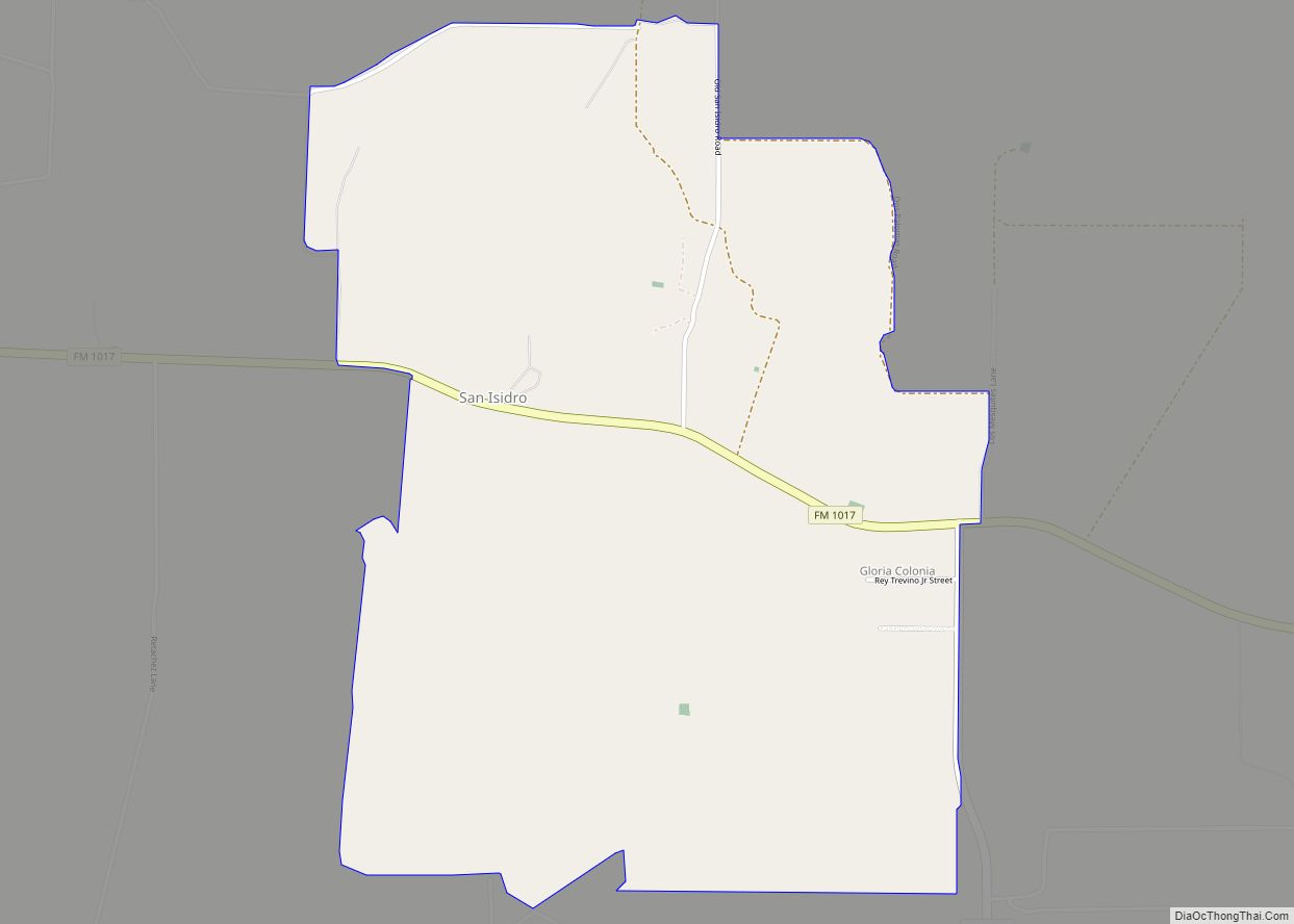
San Isidro is a census-designated place (CDP) in Starr County, Texas, United States. The population was 240 at the 2010 census. The town is named for St. Isidore the Laborer, the patron saint of farmers. A large Southwestern Barrel Cactus growing just east of town is said to be the largest in Texas. San Isidro ... Read more
Map of San Isidro CDP, Texas
Map of San Fernando CDP, Texas
San Fernando is a census-designated place (CDP) in Starr County, Texas, United States. The United States Census Bureau estimate the city has a population of 4 in 2019. San Fernando CDP overview: Name: San Fernando CDP LSAD Code: 57 LSAD Description: CDP (suffix) State: Texas County: Starr County Total Area: 4 FIPS code: 4865378 Online ... Read more
Map of San Fernando CDP, Texas
Map of San Felipe town
San Felipe (/ˌsæn fɪˈliːp/ SAN fi-LEEP), also known as San Felipe de Austin, is a town in Austin County, Texas, United States. The town was the social, economic, and political center of the early Stephen F. Austin colony. The population was 747 at the 2010 census. San Felipe town overview: Name: San Felipe town LSAD ... Read more
Map of San Felipe town
Map of San Elizario city
San Elizario is a city in El Paso County, Texas, United States. Its population was 13,603 at the 2010 census. It is part of the El Paso metropolitan statistical area. It lies on the Rio Grande, which forms the border between the United States and Mexico. The city of Socorro adjoins it on the west ... Read more
Map of San Elizario city
Map of Sand Springs CDP, Texas
Sand Springs is an unincorporated community and census-designated place in Howard County, Texas, United States. Its population was 835 at the 2010 census. Interstate 20 passes through the community. Sand Springs CDP overview: Name: Sand Springs CDP LSAD Code: 57 LSAD Description: CDP (suffix) State: Texas County: Howard County Elevation: 2,431 ft (741 m) Total Area: 2.570 sq mi ... Read more
Map of Sand Springs CDP, Texas
Map of Sanctuary town
Sanctuary is a town in Parker County, Texas, United States. The population was 329 at the 2010 census, and was incorporated in the early 1980s. Sanctuary town overview: Name: Sanctuary town LSAD Code: 43 LSAD Description: town (suffix) State: Texas County: Parker County Elevation: 768 ft (234 m) Total Area: 0.86 sq mi (2.22 km²) Land Area: 0.86 sq mi (2.22 km²) Water ... Read more
Map of Sanctuary town
Map of San Ygnacio CDP
San Ygnacio is a census-designated place (CDP) in Zapata County, Texas, in the United States. As of the 2010 census, the CDP population was 667. It is named for the prominent Spanish saint, Ignatius of Loyola. The portion of the community between the Rio Grande and U.S. Highway 83 is listed on the National Register ... Read more
Map of San Ygnacio CDP
Map of San Saba city
San Saba is a city located in, and the county seat of, San Saba County, Texas, United States. It was settled in 1854 and named for its location on the San Saba River. Its population was 3,099 at the 2010 census. San Saba city overview: Name: San Saba city LSAD Code: 25 LSAD Description: city ... Read more
Map of San Saba city
Map of San Perlita city
San Perlita (Santa Perlita) is a city in Willacy County, Texas, United States. The population was 573 at the 2010 census. It may be included as part of the Brownsville–Harlingen–Raymondville and the Matamoros–Brownsville metropolitan areas. San Perlita city overview: Name: San Perlita city LSAD Code: 25 LSAD Description: city (suffix) State: Texas County: Willacy County ... Read more
Map of San Perlita city
Map of Sandy Oaks city
Sandy Oaks is a city in Bexar County, Texas, United States. The community voted to incorporate in an election held on May 14, 2014. A total of 128 votes were cast in the election, 96 (75%) in favor of incorporation and 32 (25%) against. Sandy Oaks city overview: Name: Sandy Oaks city LSAD Code: 25 ... Read more
Map of Sandy Oaks city
Map of Sandy Hollow-Escondidas CDP
Sandy Hollow-Escondidas is a census-designated place (CDP) in Nueces County, Texas, United States. The population was 296 at the 2010 census, down from 433 at the 2000 census. Sandy Hollow-Escondidas CDP overview: Name: Sandy Hollow-Escondidas CDP LSAD Code: 57 LSAD Description: CDP (suffix) State: Texas County: Nueces County Total Area: 8.2 sq mi (21.2 km²) Land Area: 8.0 sq mi ... Read more
Map of Sandy Hollow-Escondidas CDP
Map of Sandoval CDP, Texas
Sandoval is a census-designated place (CDP) in Starr County, Texas, United States. It is a new CDP formed from part of the Fronton CDP prior to the 2010 census with a population of 32. Sandoval CDP overview: Name: Sandoval CDP LSAD Code: 57 LSAD Description: CDP (suffix) State: Texas County: Starr County Total Area: 32 ... Read more
Map of Sandoval CDP, Texas