San Felipe (/ˌsæn fɪˈliːp/ SAN fi-LEEP), also known as San Felipe de Austin, is a town in Austin County, Texas, United States. The town was the social, economic, and political center of the early Stephen F. Austin colony. The population was 747 at the 2010 census.
| Name: | San Felipe town |
|---|---|
| LSAD Code: | 43 |
| LSAD Description: | town (suffix) |
| State: | Texas |
| County: | Austin County |
| Incorporated: | November 18, 1837 |
| Elevation: | 154 ft (47 m) |
| Total Area: | 8.82 sq mi (22.42 km²) |
| Land Area: | 8.52 sq mi (21.65 km²) |
| Water Area: | 0.30 sq mi (0.77 km²) |
| Total Population: | 1,108 |
| Population Density: | 98.68/sq mi (38.10/km²) |
| ZIP code: | 77473 |
| Area code: | 979 |
| FIPS code: | 4865372 |
| GNISfeature ID: | 1346329 |
| Website: | townofsanfelipe.net |
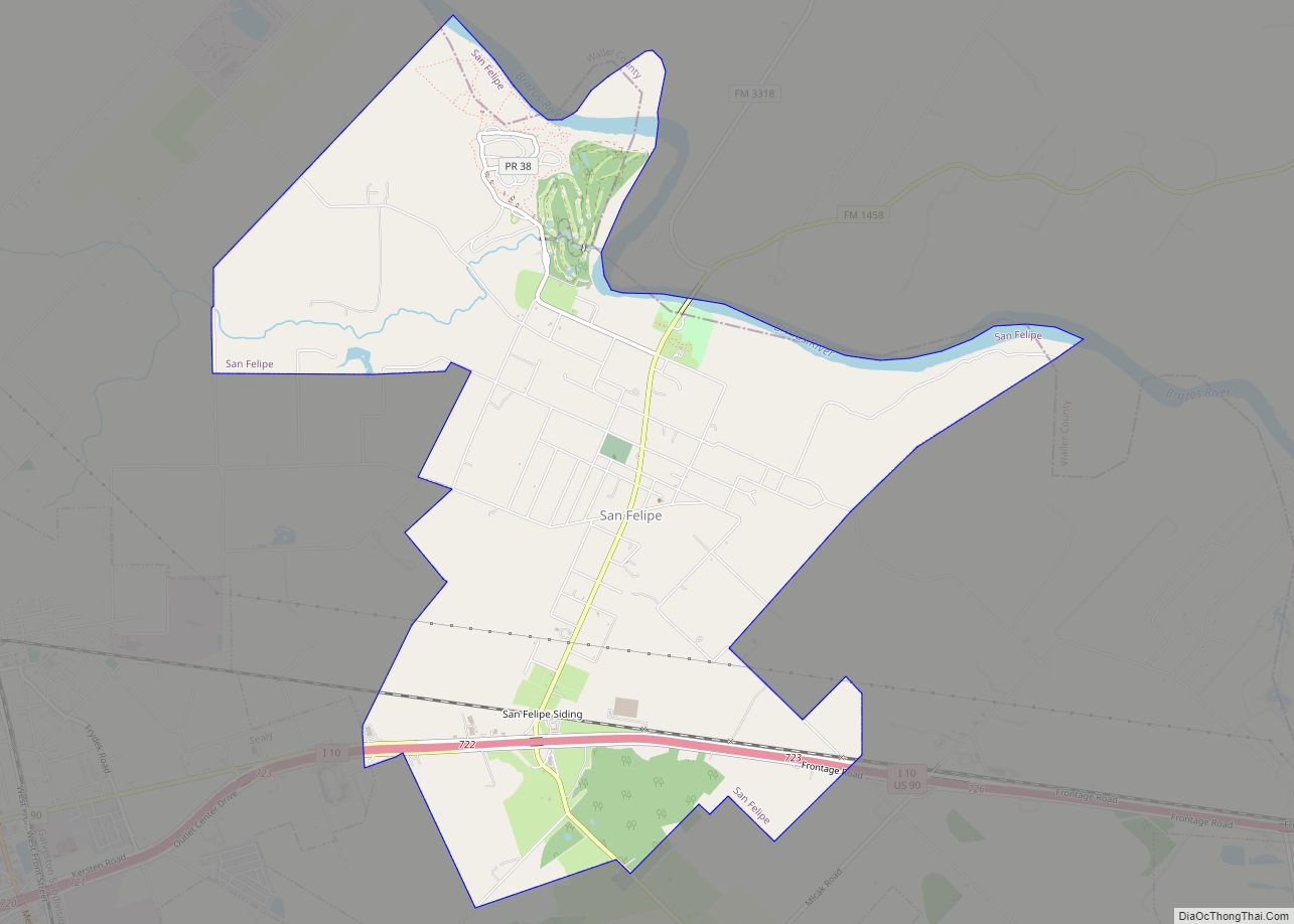
Online Interactive Map
Click on ![]() to view map in "full screen" mode.
to view map in "full screen" mode.
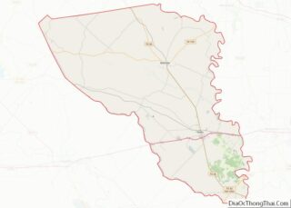
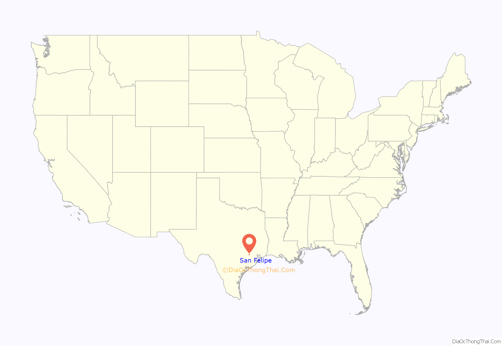
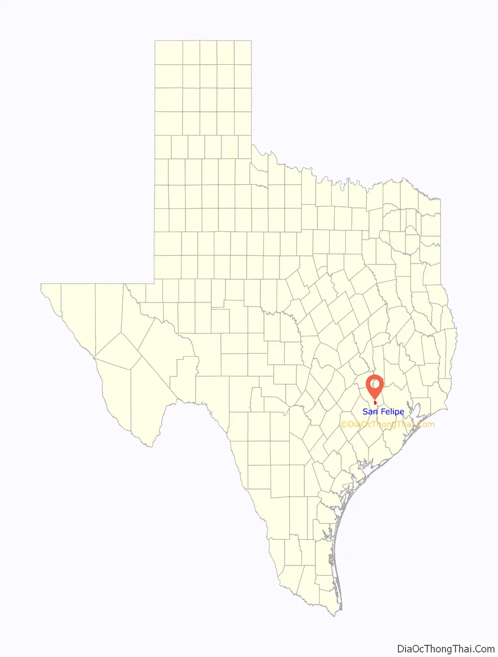
San Felipe location map. Where is San Felipe town?
History
In 1823, John McFarland operated a ferry on the Brazos River near this location. In the fall of the same year, the site was chosen by Stephen F. Austin, with the help of Felipe Enrique Neri, Baron de Bastrop, to be the main site in Texas for American colonization. Founded in 1824 as San Felipe de Austin, the town served as the capital of Stephen F. Austin’s first colony and the founding site of the Texas Rangers.
By 1828, San Felipe had been surveyed, with Calle Commercio laid out as the main commercial street. Austin and his secretary, Samuel May Williams, both resided in log cabins on the square. There were about 30 buildings, and at least one of these was a wood-framed structure. Also on the square was the tavern of Jonathan Peyton. Starting in 1830, James (Jack) Cummins operated a nearby lumber mill and grist mill, and about the same time, settlers raised livestock in the area.
By 1835, the town’s population had increased to around 600.
It was home to the first post office and one of the earliest newspapers and land offices in Texas. San Felipe was second only to San Antonio as a commercial center of Texas.
The Texas conventions of 1832 and 1833 and the Consultation of November 3, 1835, were held here. San Felipe acted as the capital for the provisional government of Texas until the Convention of 1836. The town was burned in 1836 to prevent the Mexican army from capturing it, and rebuilt a few years later, but never regained its popularity. The oldest post office in Texas is located here (ZIP code 77473).
Local residents dedicated the original townsite as a commemorative site in 1928. In 1940, the town of San Felipe donated most of the original townsite property to the state, which is now the San Felipe de Austin State Historic Site.
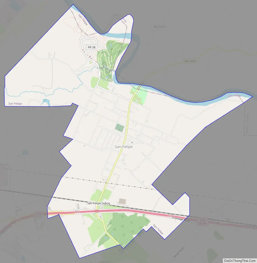
San Felipe Road Map
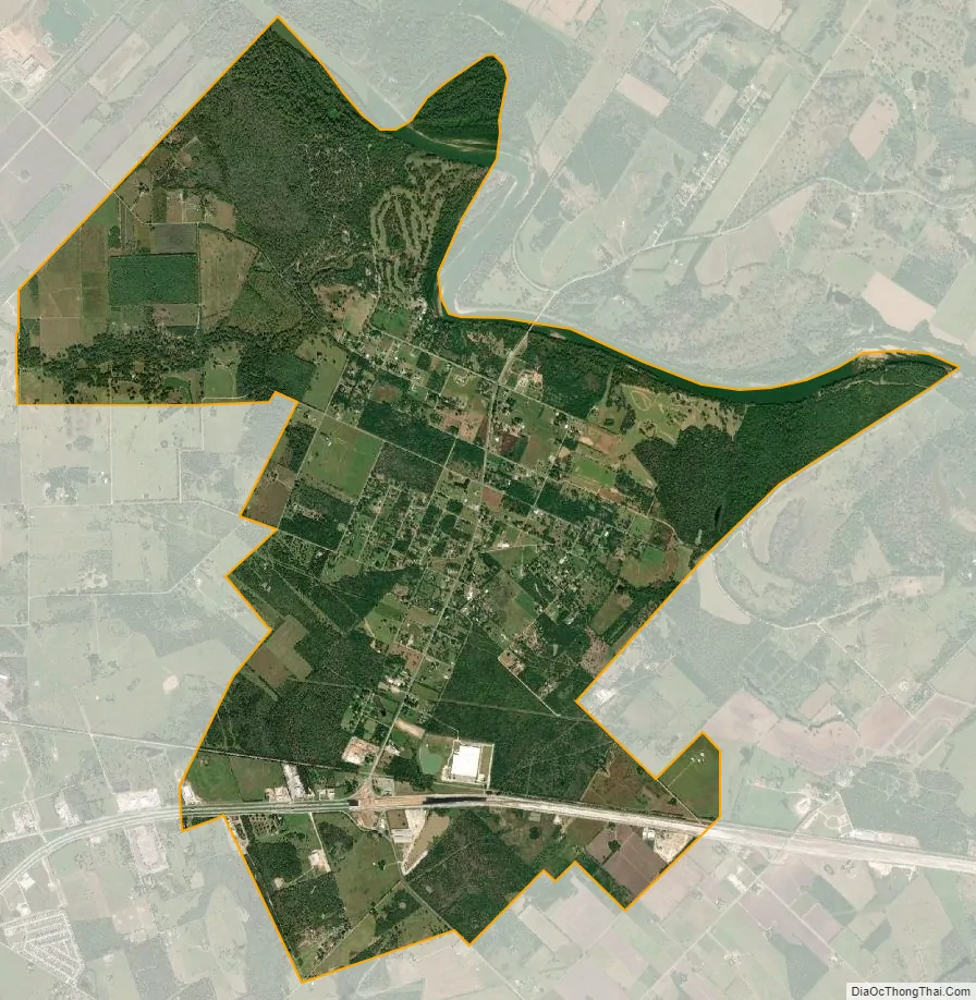
San Felipe city Satellite Map
Geography
San Felipe is located in eastern Austin County at 29°47′40″N 96°6′17″W / 29.79444°N 96.10472°W / 29.79444; -96.10472, along the west bank of the Brazos River. The town limits extend south below Interstate 10, with access at Exit 723. Sealy is 3 miles (5 km) to the west, and downtown Houston is 46 miles (74 km) to the east. Stephen F. Austin State Park is located in the northern part of the town.
According to the United States Census Bureau, the town has a total area of 8.7 square miles (23 km), of which, 8.5 square miles (22 km) of it is land and 0.3 square miles (0.78 km) is covered by water.
Climate
The climate in this area is characterized by hot, humid summers and generally mild to cool winters. According to the Köppen climate classification system, San Felipe has a humid subtropical climate, Cfa on climate maps.
See also
Map of Texas State and its subdivision:- Anderson
- Andrews
- Angelina
- Aransas
- Archer
- Armstrong
- Atascosa
- Austin
- Bailey
- Bandera
- Bastrop
- Baylor
- Bee
- Bell
- Bexar
- Blanco
- Borden
- Bosque
- Bowie
- Brazoria
- Brazos
- Brewster
- Briscoe
- Brooks
- Brown
- Burleson
- Burnet
- Caldwell
- Calhoun
- Callahan
- Cameron
- Camp
- Carson
- Cass
- Castro
- Chambers
- Cherokee
- Childress
- Clay
- Cochran
- Coke
- Coleman
- Collin
- Collingsworth
- Colorado
- Comal
- Comanche
- Concho
- Cooke
- Coryell
- Cottle
- Crane
- Crockett
- Crosby
- Culberson
- Dallam
- Dallas
- Dawson
- Deaf Smith
- Delta
- Denton
- Dewitt
- Dickens
- Dimmit
- Donley
- Duval
- Eastland
- Ector
- Edwards
- El Paso
- Ellis
- Erath
- Falls
- Fannin
- Fayette
- Fisher
- Floyd
- Foard
- Fort Bend
- Franklin
- Freestone
- Frio
- Gaines
- Galveston
- Garza
- Gillespie
- Glasscock
- Goliad
- Gonzales
- Gray
- Grayson
- Gregg
- Grimes
- Guadalupe
- Hale
- Hall
- Hamilton
- Hansford
- Hardeman
- Hardin
- Harris
- Harrison
- Hartley
- Haskell
- Hays
- Hemphill
- Henderson
- Hidalgo
- Hill
- Hockley
- Hood
- Hopkins
- Houston
- Howard
- Hudspeth
- Hunt
- Hutchinson
- Irion
- Jack
- Jackson
- Jasper
- Jeff Davis
- Jefferson
- Jim Hogg
- Jim Wells
- Johnson
- Jones
- Karnes
- Kaufman
- Kendall
- Kenedy
- Kent
- Kerr
- Kimble
- King
- Kinney
- Kleberg
- Knox
- La Salle
- Lamar
- Lamb
- Lampasas
- Lavaca
- Lee
- Leon
- Liberty
- Limestone
- Lipscomb
- Live Oak
- Llano
- Loving
- Lubbock
- Lynn
- Madison
- Marion
- Martin
- Mason
- Matagorda
- Maverick
- McCulloch
- McLennan
- McMullen
- Medina
- Menard
- Midland
- Milam
- Mills
- Mitchell
- Montague
- Montgomery
- Moore
- Morris
- Motley
- Nacogdoches
- Navarro
- Newton
- Nolan
- Nueces
- Ochiltree
- Oldham
- Orange
- Palo Pinto
- Panola
- Parker
- Parmer
- Pecos
- Polk
- Potter
- Presidio
- Rains
- Randall
- Reagan
- Real
- Red River
- Reeves
- Refugio
- Roberts
- Robertson
- Rockwall
- Runnels
- Rusk
- Sabine
- San Augustine
- San Jacinto
- San Patricio
- San Saba
- Schleicher
- Scurry
- Shackelford
- Shelby
- Sherman
- Smith
- Somervell
- Starr
- Stephens
- Sterling
- Stonewall
- Sutton
- Swisher
- Tarrant
- Taylor
- Terrell
- Terry
- Throckmorton
- Titus
- Tom Green
- Travis
- Trinity
- Tyler
- Upshur
- Upton
- Uvalde
- Val Verde
- Van Zandt
- Victoria
- Walker
- Waller
- Ward
- Washington
- Webb
- Wharton
- Wheeler
- Wichita
- Wilbarger
- Willacy
- Williamson
- Wilson
- Winkler
- Wise
- Wood
- Yoakum
- Young
- Zapata
- Zavala
- Alabama
- Alaska
- Arizona
- Arkansas
- California
- Colorado
- Connecticut
- Delaware
- District of Columbia
- Florida
- Georgia
- Hawaii
- Idaho
- Illinois
- Indiana
- Iowa
- Kansas
- Kentucky
- Louisiana
- Maine
- Maryland
- Massachusetts
- Michigan
- Minnesota
- Mississippi
- Missouri
- Montana
- Nebraska
- Nevada
- New Hampshire
- New Jersey
- New Mexico
- New York
- North Carolina
- North Dakota
- Ohio
- Oklahoma
- Oregon
- Pennsylvania
- Rhode Island
- South Carolina
- South Dakota
- Tennessee
- Texas
- Utah
- Vermont
- Virginia
- Washington
- West Virginia
- Wisconsin
- Wyoming