Map of Seagoville city
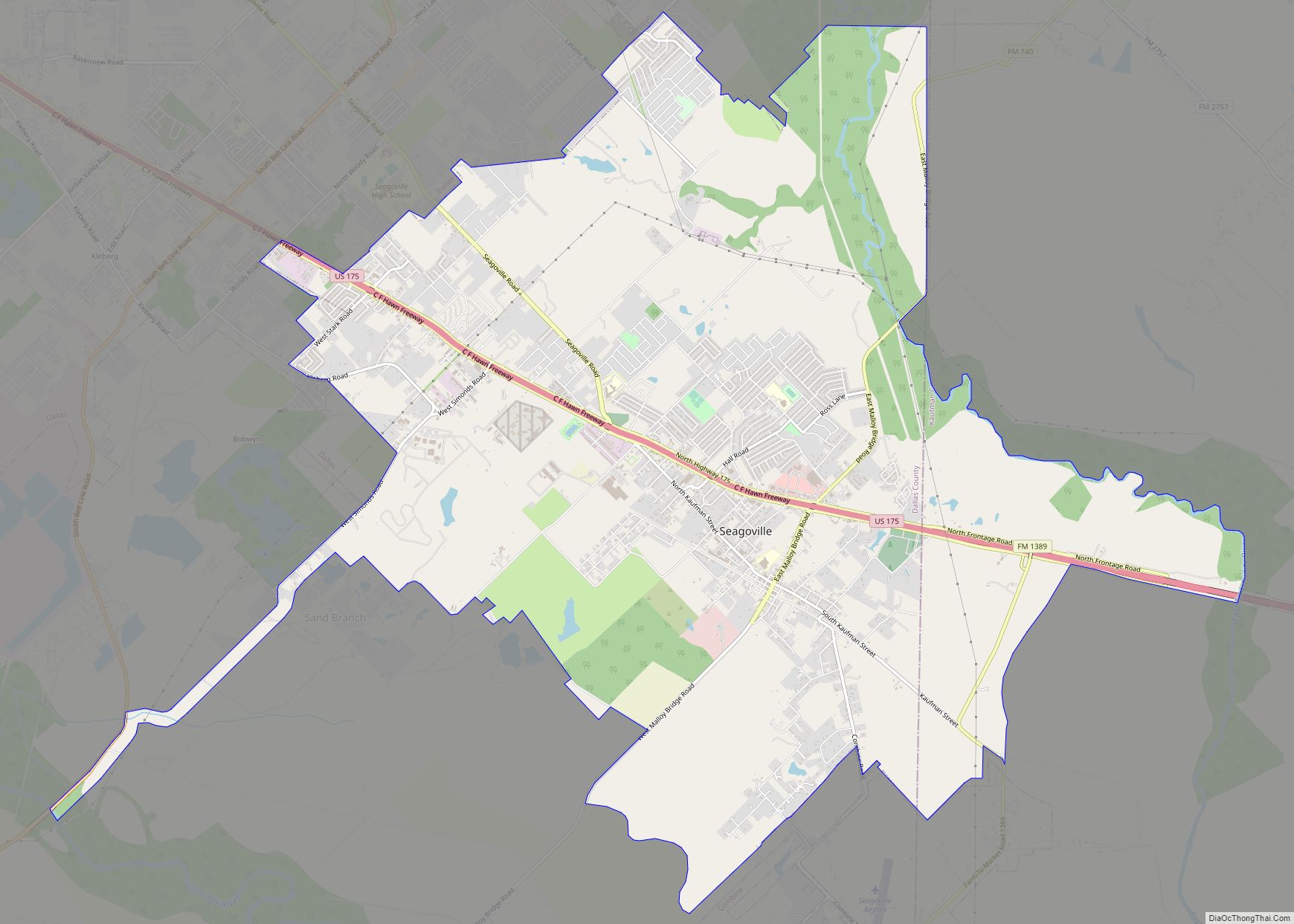
Seagoville (/ˈsiːɡoʊvɪl/ SEE-goh-vil) is a city in Dallas County, Texas, United States, and a suburb of Dallas. A small portion of Seagoville extends into Kaufman County. The population was 18,446 at the 2020 census. The city is located along U.S. Highway 175, 10 miles (16 km) from downtown Mesquite. Seagoville city overview: Name: Seagoville city LSAD ... Read more
Map of Seagoville city
Map of Seadrift city
Seadrift is a city in Calhoun County, Texas, United States. The population was 1,364 at the 2010 census. It is a part of the Victoria, Texas Metropolitan Statistical Area. Seadrift city overview: Name: Seadrift city LSAD Code: 25 LSAD Description: city (suffix) State: Texas County: Calhoun County Elevation: 10 ft (3 m) Total Area: 1.53 sq mi (3.95 km²) Land ... Read more
Map of Seadrift city
Map of Seabrook city, Texas
Seabrook is a city in Harris County in the U.S. state of Texas, with some water surface area located within Chambers County. The population was 11,952 at the 2010 U.S. census, and 14,149 in 2019. Several fish markets line the city’s waterfront, while antique shops and bed and breakfast establishments are found in the city’s ... Read more
Map of Seabrook city, Texas
Map of Scurry town
Scurry is a town in Kaufman County, Texas, United States. It was incorporated in 2003. As of the 2010 census, it had a population of 681. Scurry is named after Scurry Dean. The arrival of the Texas and Pacific Railway in the 1870s established the settlement as a shipment point for area farmers. When local ... Read more
Map of Scurry town
Map of Scottsville city, Texas
Scottsville is a city in Harrison County, Texas, United States. The population was 376 at the 2010 census, up from 263 at the 2000 census. Scottsville’s population in 2020 decreased to 334. Scottsville city overview: Name: Scottsville city LSAD Code: 25 LSAD Description: city (suffix) State: Texas County: Harrison County Elevation: 410 ft (125 m) Total Area: ... Read more
Map of Scottsville city, Texas
Map of Seguin city
Seguin (/sɪˈɡiːn/ sih-GEEN) is a city in and the county seat of Guadalupe County, Texas, United States; as of the 2020 census, its population was 29,433. Its economy is primarily supported by a regional hospital, as well as the Schertz-Seguin Local Government Corporation water-utility, that supplies the surrounding Greater San Antonio areas from nearby aquifers ... Read more
Map of Seguin city
Map of Seco Mines CDP
Seco Mines is an unincorporated community and census-designated place in Maverick County, Texas, United States. Its population was 560 as of the 2010 census. U.S. Route 277 passes through the community. Seco Mines CDP overview: Name: Seco Mines CDP LSAD Code: 57 LSAD Description: CDP (suffix) State: Texas County: Maverick County Elevation: 735 ft (224 m) Total ... Read more
Map of Seco Mines CDP
Map of Sebastian CDP, Texas
Sebastian is a census-designated place (CDP) in Willacy County, Texas, United States. The population was 1,917 at the 2010 census. Sebastian CDP overview: Name: Sebastian CDP LSAD Code: 57 LSAD Description: CDP (suffix) State: Texas County: Willacy County Elevation: 39 ft (12 m) Total Area: 1.7 sq mi (4.3 km²) Land Area: 1.7 sq mi (4.3 km²) Water Area: 0.0 sq mi (0.0 km²) Total Population: ... Read more
Map of Sebastian CDP, Texas
Map of Shadybrook CDP
Shadybrook is a census-designated place (CDP) in Cherokee County, Texas, United States. The population was 1,967 at the 2010 census. It is located in the northwestern corner of the county adjacent to Lake Palestine, and takes its name from a gated community located on either side of Farm to Market Road 346. It is 16 ... Read more
Map of Shadybrook CDP
Map of Shady Shores town
Shady Shores is a town in Denton County, Texas, United States. The population was 2,612 at the 2010 census. It is also one of four communities in the Lake Cities. Shady Shores town overview: Name: Shady Shores town LSAD Code: 43 LSAD Description: town (suffix) State: Texas County: Denton County Elevation: 538 ft (164 m) Total Area: ... Read more
Map of Shady Shores town
Map of Shady Hollow CDP
Shady Hollow is a census-designated place (CDP) in southwestern Travis County, Texas, United States, and is partially in the City of Austin. It is located ten miles (16 km) southwest of Downtown Austin, near the Travis/Hays county line. The population was 5,004 at the 2010 census. Shady Hollow CDP overview: Name: Shady Hollow CDP LSAD Code: ... Read more
Map of Shady Hollow CDP
Map of Seymour city, Texas
Seymour is a city in and the county seat of Baylor County, Texas, United States. Its population was 2,575 as of the 2020 Census. Seymour city overview: Name: Seymour city LSAD Code: 25 LSAD Description: city (suffix) State: Texas County: Baylor County Elevation: 1,289 ft (393 m) Total Area: 2.93 sq mi (7.59 km²) Land Area: 2.92 sq mi (7.57 km²) Water Area: ... Read more
Map of Seymour city, Texas